

An Caisteal
Good walks are even better shared.
Overview
An Caisteal: The Castle in the Highlands
Nestled in the heart of the Scottish Highlands, An Caisteal stands tall at 995 meters, offering both a challenge and a feast for the eyes to those who venture to its summit.
Geology
An Caisteal's rugged charm can be attributed to its ancient volcanic origins. Its predominant basalt composition, coupled with the surrounding schist and granite formations, create a diverse geological tapestry that tells tales of the prehistoric forces that shaped this majestic land.
Routes
The Standard Route
Starting from the A82, this well-trodden path leads you through enchanting landscapes, blending challenge and beauty. Expect a moderate hike that will leave you breathless not just from the climb but from the views!Alternative Route via Beinn a' Chroin
For the adventurous spirit, this extended route allows you to conquer both An Caisteal and its neighbour Beinn a' Chroin. Prepare yourself for a full day of exploration, stunning vistas, and possibly questionable snack choices!
Summit Features
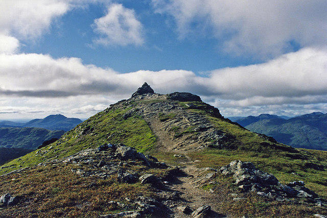
At the summit, you can find a robust stone cairn, a nod to the countless souls who have reached this lofty goal. The expansive views from here can leave you a little weak at the knees, so ensure you have a snack handy to regain your strength.
Terrain Type
Expect a rugged and rocky terrain as you make your way up, with some grassy areas sprinkled about for relief—perfect for a quick sit-down if you need a breather.
Views
The breathtaking panorama from the top includes remarkable sights like Ben More and Ben Vorlich, along with the captivating Loch Lomond below. The best views are typically found during the spring and early autumn, where the mix of weather and light produce dramatic skies.
Hazards
Like a good Scottish story, nothing is straightforward! The terrain can feature loose rocks, and weather can change in a heartbeat, so prepare accordingly. A comprehensive kit is your best friend!
Nearby Summits
- Beinn a' Chroin (942 meters)
- Ben More (1174 meters)
These nearby giants tempt further exploration, and if you’re feeling lucky, you might just conquer both in a single outing!
Access
The nearest car park is conveniently located near Crianlarich on the A82, providing ample space for your steed. If you prefer the iron horse, trains from Glasgow and Edinburgh frequent this charming little town.
Facilities
Crianlarich offers a few basic amenities like a café, a shop for your hiking needs, and public toilets for when nature calls.
History
The name 'An Caisteal' cleverly evokes images of a fortress, and rightly so; its lofty perch has defended secrets and stories throughout generations. A mountain that has stood sentinel through the annals of time, it's a symbol of heritage and natural beauty.
So dust off your hiking boots and prepare for an adventure that marries challenge with stunning beauty—just a walk in the park, if your park had a height of nearly 1000 meters!
Happy hiking, keep your wits about you, and may your sandwiches always be fresh!
Explore routes near An Caisteal
Walks starting near this hill. Open a route to check its map, distance and full itinerary.
West Highland Way: Tyndrum to Bridge of Orchy
View route
The Cobbler from Succoth Carpark
View route
Beinn Ime from Succoth
View route
Loch Katrine: Trossachs Pier to Stronachlachar
View route
Route planning notes
These notes describe possible approaches. Check a route's map and access information when planning your walk.
Standard Route via Sron Gharbh
This is the most popular and straightforward route to summit An Caisteal. Starting from the layby on the A82 near Crianlarich, cross the bridge over River Falloch and follow the path up through Coire Earb. Ascend Sron Gharbh before continuing along the ridge to the summit of An Caisteal. The route involves some minor scrambling near the summit but is otherwise a well-trodden path.
An Caisteal and Beinn a' Chroin Circuit
This circular route combines An Caisteal with its neighbouring Munro, Beinn a' Chroin. Starting from the same layby on the A82, follow the path to ascend An Caisteal first. From the summit, descend to the bealach and climb the steep and rocky ridge to Beinn a' Chroin. From here, descend back to the Coire Earb path and return to the starting point.
Approach via Twistin Hill
This scenic route takes you up An Caisteal via the ridge known as Twistin Hill. Begin from the same starting point on the A82 and follow the Coire Earb path. Branch off to ascend the undulating ridge of Twistin Hill, which leads directly to the summit of An Caisteal, offering spectacular views along the way. Descend via the same route.
Winter Ascent via Sron Gharbh
A winter-specific variation of the standard route, this ascent requires proper winter equipment and experience in navigating snow-covered terrain. The route follows the same path via Sron Gharbh but will take longer due to snow and ice. The ridge to the summit can be more challenging in winter, but it provides a rewarding experience for seasoned walkers.
An Caisteal from Inverlochlarig
Starting from the car park at Inverlochlarig, this less-travelled route approaches An Caisteal from the south. The path ascends through Gleann Sron a’ Chlachain to reach the ridge leading to An Caisteal. This quieter alternative provides a different perspective of the mountain and avoids the busier northern approach.
Make a day of it, together
Find someone to share the walk with, or organise a day out along a route you like.
Photo Gallery
View all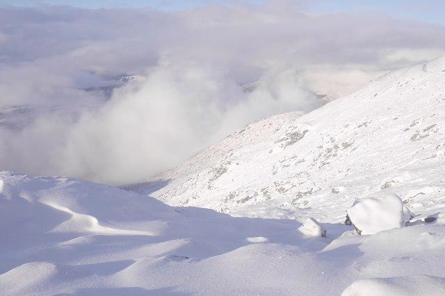 Photo could not load
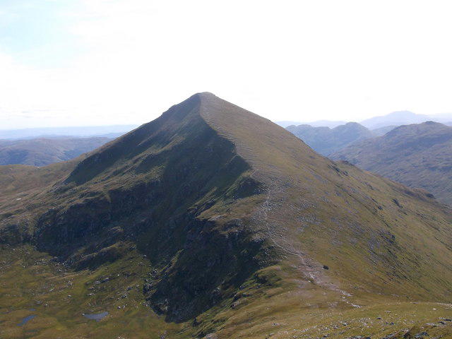
NN3719 : West side of An Caisteal
Richard Webb
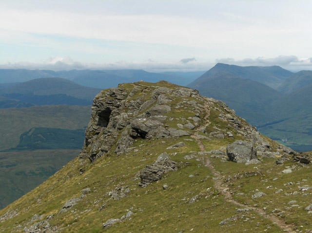 Photo could not load
NN3719 : North peak, An Caisteal
Andrew Smith
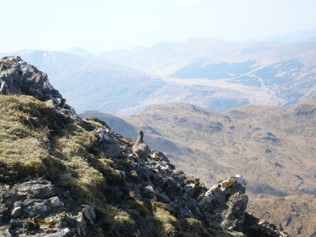 Photo could not load
NN3719 : Ptarmigan blending in to the terrain
Alan O'Dowd
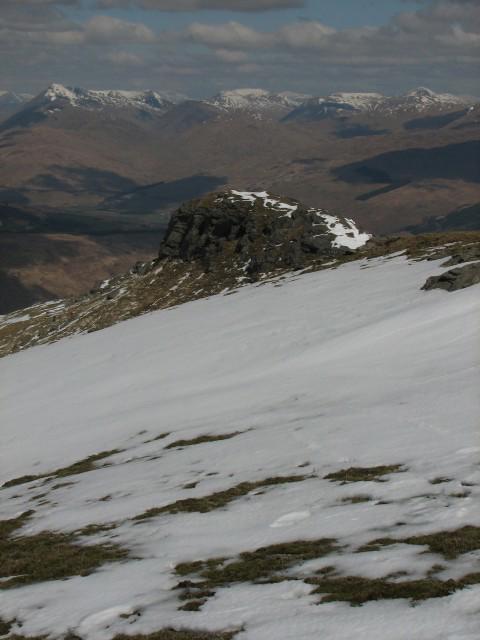 Photo could not load
NN3719 : An Caisteal's northern top
Callum Black
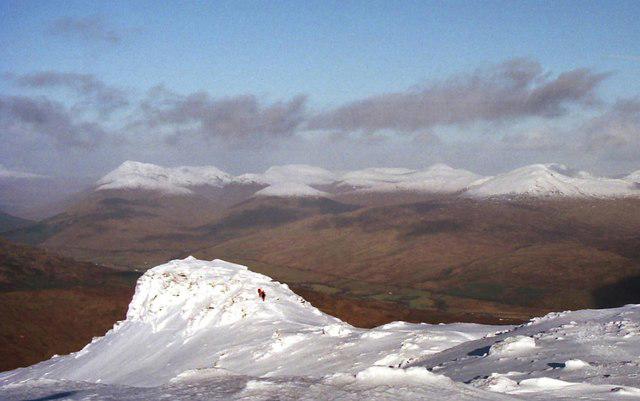 Photo could not load
NN3719 : North Top of An Caisteal
Russel Wills
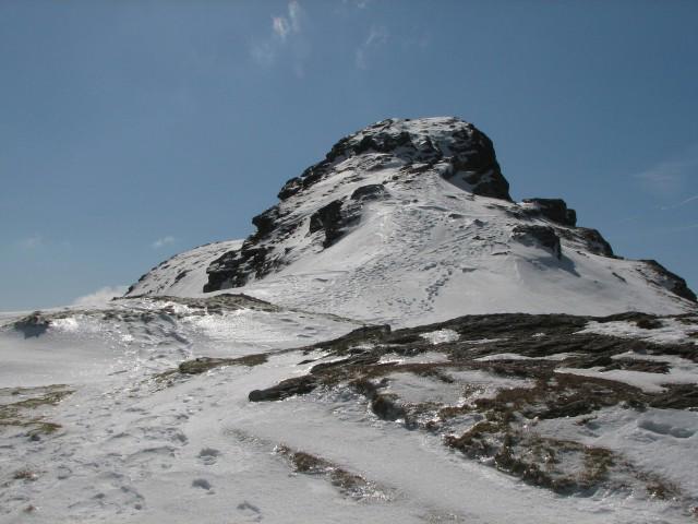 Photo could not load
NN3719 : An Caisteal
Callum Black
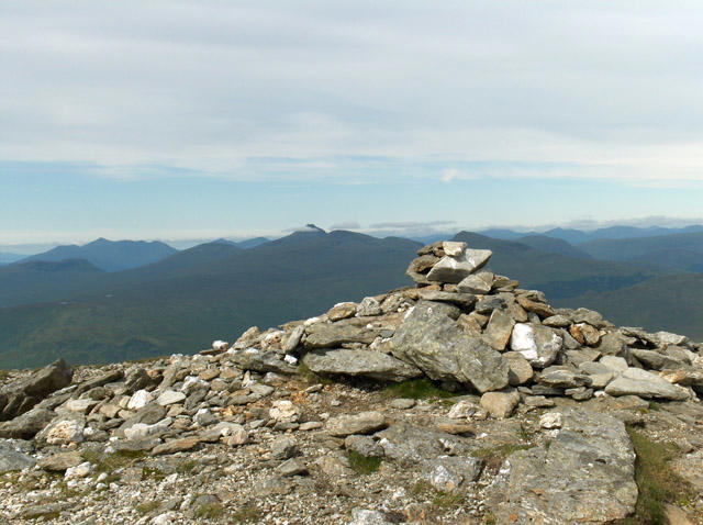 Photo could not load
NN3719 : An Caisteal
Andrew Smith
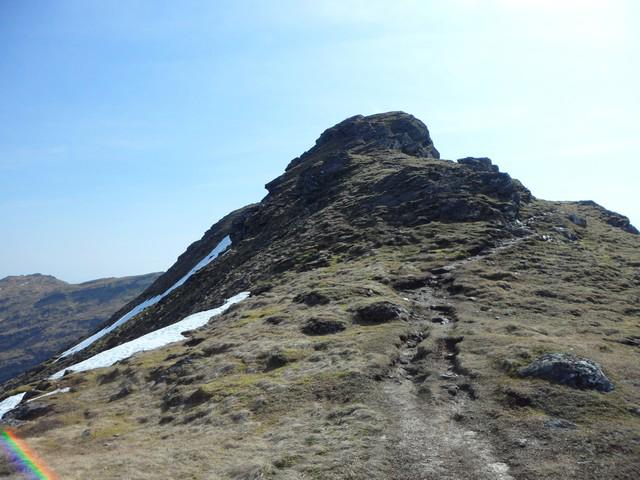 Photo could not load
NN3719 : Approaching the summit of An Caisteal
Stephen Sweeney
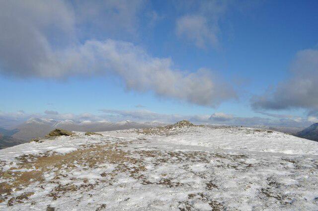 Photo could not load
NN3719 : An Caisteal Summit
Robert Struthers
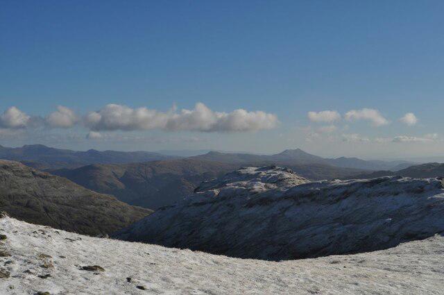
NN3719 : Beinn a' Chroin from An Caisteal
Robert Struthers
Hill facts and local notes
Classifications
Elevation
996m
3,267 ft
Prominence
474m
Coordinates
56.3386, -4.6244
NN378193
OS Map
50 56
Explorer: OL39N 364N
At the Summit
The summit boasts a stone cairn and offers a panoramic view of the surrounding peaks, making it a perfect spot for a well-deserved break (don't forget the snacks!).
Terrain & Geology
An Caisteal is primarily composed of ancient volcanic rock known as basalt, which provides a rugged and impressive terrain. The surrounding area features a mix of schist and granite, lending to an interesting geological story woven into the landscape.
Views & Scenery
On a clear day, one can enjoy views of Ben More, Ben Vorlich, and the sprawling beauty of Loch Lomond and the Trossachs National Park.
History & Heritage
Name Origin
The name 'An Caisteal' translates to 'The Castle' in Scots Gaelic, likely due to its imposing stature which resembles a fortress.
Historical Significance
An Caisteal is not only a beacon for hillwalkers but also holds cultural significance in local folklore and stories from the Highland clans.
Getting There & Facilities
Parking
There is a designated car park on the A82 near Crianlarich, which serves as a convenient starting point for the ascent.
Public Transport
Crianlarich has train services from both Glasgow and Edinburgh, making it accessible for those relying on public transport.
Nearby Facilities
There are limited facilities in Crianlarich including a café, a small shop, and public toilets available.
Safety Information
Known Hazards
- Loose rocks and sudden weather changes can occur, so it's wise to come prepared and keep an eye on the sky!
General Safety Tips
- Check weather conditions before setting out
- Carry appropriate clothing and equipment
- Let someone know your planned route
- Take a map, compass, and GPS device
- Carry emergency supplies: food, water, first aid kit, torch
Hills
Some common questions about the hills answered
Are there group walks up An Caisteal?
Many walkers use Walkmates to join or organise walks with others. You can check for group walks around An Caisteal through the maps
Are there other walkers around An Caisteal?
Activity varies by location and time, but Walkmates lets you see whether others have shared walks or shown interest in this area. Find other people through the walking friends search walking friends for An Caisteal search or of course create your own walk for An Caisteal
Can I organise a walk to An Caisteal?
Yes. If there aren’t any walks listed already, you can create a walk and make it available for others to join.
If you're signed up to Walkmates, you can create a walk to An Caisteal.
How do I find a walk up this hill?
There are often multiple ways to walk this hill, depending on experience and route preference. Walkmates helps you explore walks and routes that others have shared.
Can I suggest a new route up An Caisteal?
Yes. You can suggest or create routes to share with others. Walkmates focuses on the social side of walking, so routes are used to help people organise walks and explore areas together, rather than as detailed navigation tools or route libraries.
Other uses really appreciate knowledgeable walkers sharing their routes. Share your favourite route to An Caisteal here
The is an error or something incorrect about this hill. How do I let you know?
We always strive to keep the information on Walkmates as accurate as possible. If you find an error, please let us know through the contact form and we'll aim to correct it as quickly as possible
Community Discussion
Comments
Location
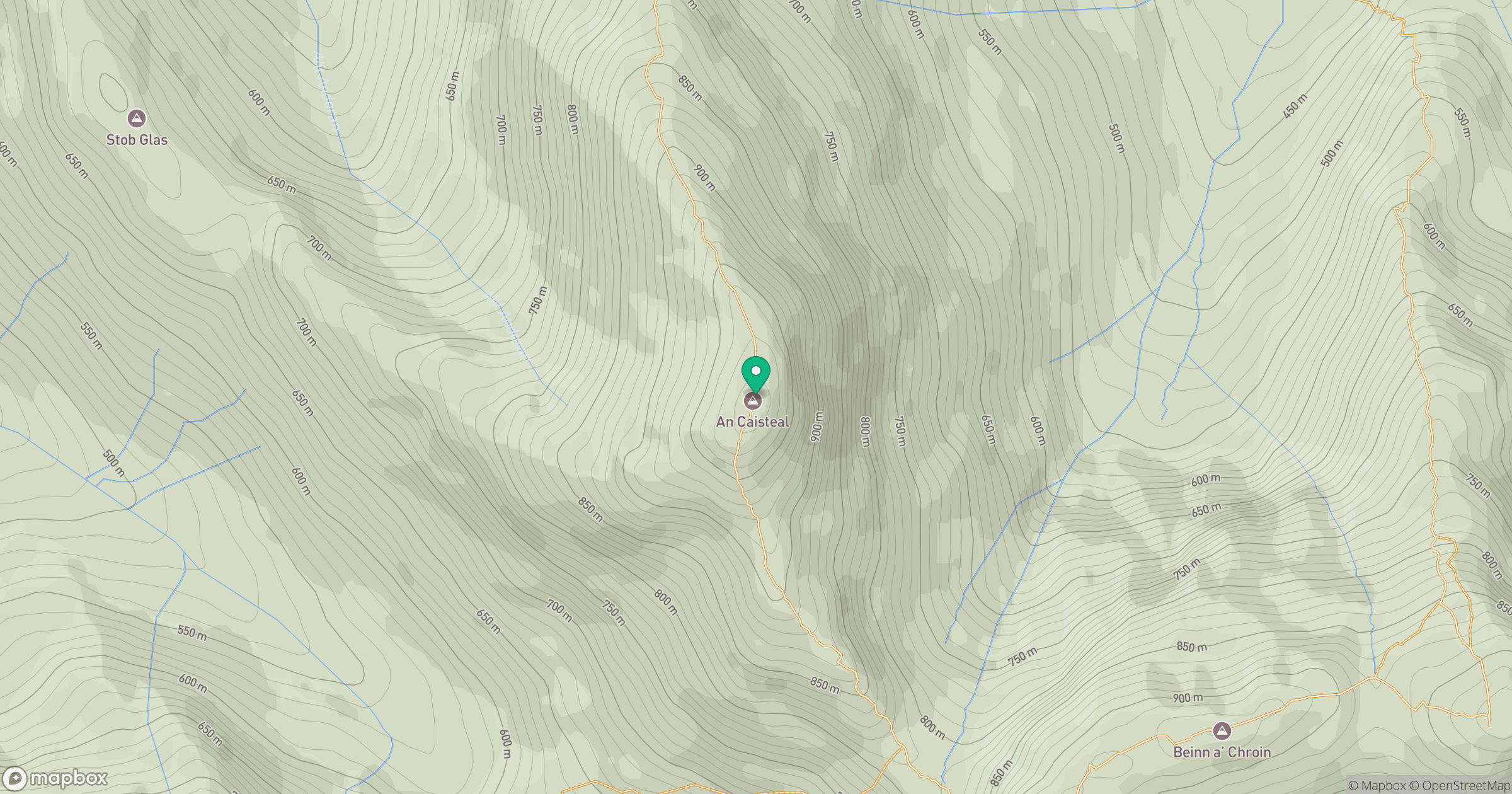
Grid reference: NN378193
View on OpenStreetMapOpens a map in a new tab, centred on the hill.
No comments yet. Be the first.