

Meall nan Tarmachan East Top
Good walks are even better shared.
NN5839 : The Summit of Meall nan Tarmachan 1044m
Iain Lees Photo source
Overview
Meall nan Tarmachan East Top
Overview
Meall nan Tarmachan East Top is nestled in the stunning Scottish Highlands, rising to an altitude of 908 meters. As one of the prominent peaks in the region, it beckons outdoor enthusiasts with its spectacular views and challenging routes.
Geology
This mountain is composed mainly of ancient volcanic rock, featuring a combination of granite and basalt. The rugged landscape serves as a reminder of Scotland's fiery geological past, shaped dramatically by glacial activity.
Routes
North Ridge Route
Starting from the Ben Lawers National Nature Reserve car park, this popular route provides a relatively straightforward ascent. The path is well-marked, leading you through breathtaking scenery and vibrant flora.
Loop from Ben Lawers Visitor Centre
For those looking for a bit more adventure, consider tackling this loop. You'll gain not just the East Top, but also the West Top, adding to your trekking glory!
Summit Features
Here, you'll be greeted by a modest cairn, perfect for capturing memories with your pals and snapping some enviable summit selfies.
Terrain Type
Expect a mix of rocky outcrops and grassy sections. Be mindful—some stretches can be quite boggy, particularly after rainfall. Waterproof boots are your best friend!
Views
The summit offers sweeping views of Loch Tay, Ben Lawers, and the rolling hills of the Highlands. On a clear day, the panoramas are simply unbeatable, showcasing the stunning beauty of this magical region.
Hazards
Always check the weather before you head out! Sudden changes can catch hikers off guard. Also, loose rocks can make footing tricky—keep your eyes peeled!
Access
Nearest Parking
The Ben Lawers National Nature Reserve car park is nearby, providing ample parking for visitors. Be sure to arrive early during peak seasons!
Public Transport
Public transport options are somewhat limited, so having a car is ideal for reaching this majestic mountain.
Nearest Town
Killin is your best bet for nearby amenities. Enjoy a hearty meal post-hike—trust me, your stomach will thank you!
Facilities
While facilities are sparse at the summit, the Ben Lawers Visitor Centre has basics like toilets and some informative displays about the local flora and fauna. For a more substantial feed, head into Killin.
History
The name translates to 'hill of the grouse', which is indicative of the rich wildlife in the area. The mountain's historical significance is intertwined with local clans, making it a site of cultural importance.
Conclusion
Meall nan Tarmachan East Top is not just another notch on your hiking belt—it's an experience! With picturesque views, diverse terrain, and a touch of Scottish culture, it's a must-visit for any hiking enthusiast.
Happy trekking and don’t forget your camera!
Explore routes near Meall nan Tarmachan East Top
Walks starting near this hill. Open a route to check its map, distance and full itinerary.
Killin: Falls of Dochart, Finlarig and Moirlanich Longhouse
View route
Kenmore: Drummond Hill Black Rock Trail above Loch Tay
View route
Aberfeldy: Glassie Woodland and River Tay Circular
View route
Loch Lubnaig: West Shore Railway Path from Ben Ledi Car Park
View route
Route planning notes
These notes describe possible approaches. Check a route's map and access information when planning your walk.
North Ridge Route
A scenic hike starting from the car park at Ben Lawers National Nature Reserve that takes you along a well-defined path up the north ridge.
Loop from Ben Lawers Visitor Centre
An enjoyable loop that includes both Meall nan Tarmachan East and West Tops, taking in stunning views along the way.
Make a day of it, together
Find someone to share the walk with, or organise a day out along a route you like.
Photo Gallery
View all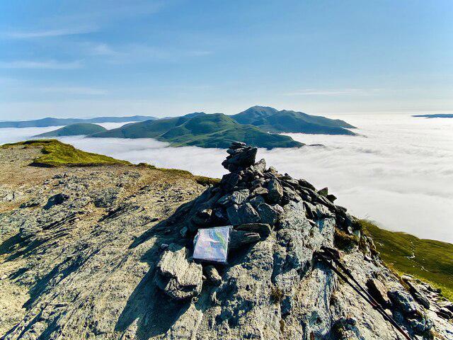 Photo could not load
NN5839 : The Summit of Meall nan Tarmachan 1044m
Iain Lees
Hill facts and local notes
Classifications
Elevation
865m
2,839 ft
Prominence
27m
Coordinates
56.5231, -4.2934
NN590391
OS Map
51
Explorer: OL48E 378E
At the Summit
The summit is marked by a small, unassuming cairn offering a perfect spot for a well-deserved rest and lunch. The views, however, are anything but ordinary.
Terrain & Geology
The mountain features ancient volcanic rock formations, primarily composed of basalt and granite, giving it a rugged and weather-beaten appearance. This area showcases the geological history of Scotland, with glacial formations from the last Ice Age leaving their mark.
Views & Scenery
From the summit, you'll gaze upon stunning vistas that include the Loch Tay and the surrounding peaks, such as Ben Lawers and Meall nan Tarmachan West Top. On a clear day, the views stretch far into the distance, making it a photographer's paradise.
History & Heritage
Name Origin
The name 'Meall nan Tarmachan' translates roughly to 'hill of the grouse', reflecting the region's wildlife.
Historical Significance
Historically, this area was important for local clans and has witnessed centuries of natural and human history, including ancient settlement sites.
Getting There & Facilities
Parking
Ben Lawers National Nature Reserve car park, located at the foot of the mountain with spaces for about 30 vehicles. Please park considerately.
Public Transport
Limited public transport options are available; a bus service operates from Aberfeldy to the nearby village of Lawers. It's recommended to check the current bus schedules.
Nearby Facilities
While there are no facilities directly on the mountain, visitors can find toilets and picnic areas at Ben Lawers Visitor Centre. The village of Killin has several cafes and shops to refuel after your hike.
Safety Information
Known Hazards
- Be aware of sudden changes in weather as conditions can shift rapidly in the Highlands. Some areas may be prone to loose rocks, so watch your footing!
General Safety Tips
- Check weather conditions before setting out
- Carry appropriate clothing and equipment
- Let someone know your planned route
- Take a map, compass, and GPS device
- Carry emergency supplies: food, water, first aid kit, torch
Hills
Some common questions about the hills answered
Are there group walks up Meall nan Tarmachan East Top?
Many walkers use Walkmates to join or organise walks with others. You can check for group walks around Meall nan Tarmachan East Top through the maps
Are there other walkers around Meall nan Tarmachan East Top?
Activity varies by location and time, but Walkmates lets you see whether others have shared walks or shown interest in this area. Find other people through the walking friends search walking friends for Meall nan Tarmachan East Top search or of course create your own walk for Meall nan Tarmachan East Top
Can I organise a walk to Meall nan Tarmachan East Top?
Yes. If there aren’t any walks listed already, you can create a walk and make it available for others to join.
If you're signed up to Walkmates, you can create a walk to Meall nan Tarmachan East Top.
How do I find a walk up this hill?
There are often multiple ways to walk this hill, depending on experience and route preference. Walkmates helps you explore walks and routes that others have shared.
Can I suggest a new route up Meall nan Tarmachan East Top?
Yes. You can suggest or create routes to share with others. Walkmates focuses on the social side of walking, so routes are used to help people organise walks and explore areas together, rather than as detailed navigation tools or route libraries.
Other uses really appreciate knowledgeable walkers sharing their routes. Share your favourite route to Meall nan Tarmachan East Top here
The is an error or something incorrect about this hill. How do I let you know?
We always strive to keep the information on Walkmates as accurate as possible. If you find an error, please let us know through the contact form and we'll aim to correct it as quickly as possible
Community Discussion
Comments
Location
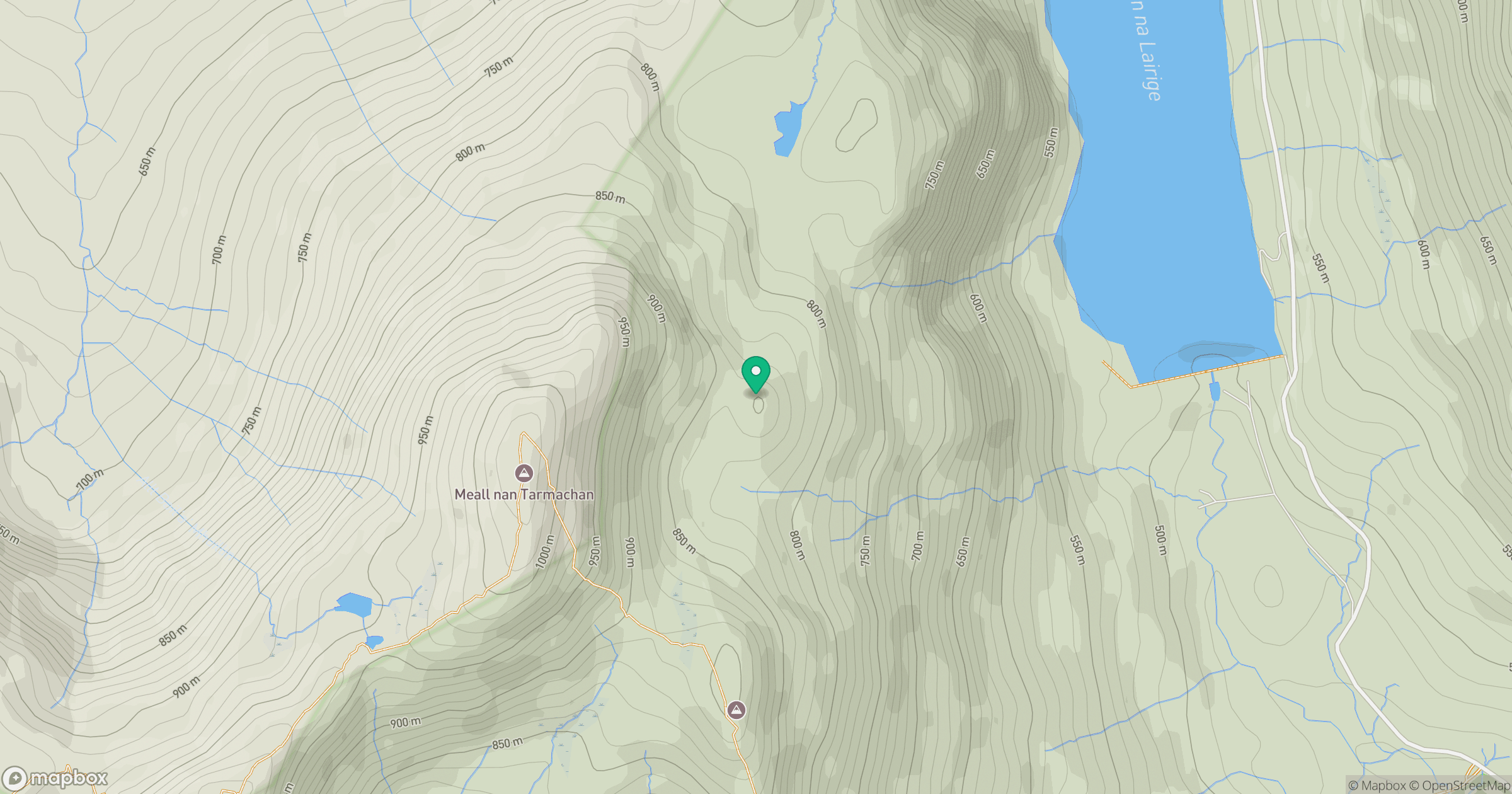
Grid reference: NN590391
View on OpenStreetMapOpens a map in a new tab, centred on the hill.


No comments yet. Be the first.