
Garbh Mheall
Good walks are even better shared.
Overview
Garbh Mheall: A Highland Gem
Nestled within the breathtaking embrace of the Scottish Highlands, Garbh Mheall stands tall with an elevation of 780 meters. This Munro not only offers hikers a rewarding challenge but also an opportunity to connect with nature amidst stunning scenery.
Geology
Garbh Mheall's composition is largely characterised by schist, a metamorphic rock born from the heat and pressure that nature can muster. The whispers of ancient glaciers are still felt, as the landscape showcases the formidable power of erosion over countless years.
The Routes
The most popular route starts from Glen Falloch, where hikers can meander through heather-laden slopes towards the rugged summit. The path boasts rocky outcrops that intersperse more gentle stretches, making it a perfect hike for those seeking adventure without the extreme technical challenges. It’s about 10 km long and typically takes around 4.5 hours to conquer.
Summit Features
Upon reaching the top, a sturdy stone cairn marks your success! It’s the perfect spot to pause, catch your breath, and maybe snap a few victory photos. Most importantly, don't forget to reflect on just how small you are in comparison to the vast beauty that surrounds you.
Terrain and Views
Expect a mix of rocky and grassy terrain – just enough diversity to keep things interesting. The summit rewards your effort with panoramic views of the surrounding landscape, including Ben More and the serene Loch Awe. The best time to appreciate these vistas is during the golden hours of late spring through autumn.
Hazards
While the trek is rewarding, it’s not without its risks. With rocky paths and sudden weather changes, keeping an eye on the conditions is prudent. Remember: a wet rock is a slippery rock!
Nearby Summits
If you’re feeling particularly ambitious, consider tackling nearby peaks such as Ben More or Stob Binnein, both of which offer their own enchanting vistas.
Access and Facilities
Access to Garbh Mheall is fairly straightforward, with a parking area located at the trailhead in Glen Falloch. The nearest town, Crianlarich, is not far and provides essential amenities – from a hearty meal at a local café to basic accommodation options.
Conclusion
Garbh Mheall is a magnificent mountain that beckons to walkers and adventurers. Whether you’re in it for the challenge, the views, or possibly a spot of sunshine, Garbh Mheall has something for everyone. Just don’t forget your camera – the Instagram likes will be worth it!
Explore routes near Garbh Mheall
Walks starting near this hill. Open a route to check its map, distance and full itinerary.
Killin: Falls of Dochart, Finlarig and Moirlanich Longhouse
View route
Kenmore: Drummond Hill Black Rock Trail above Loch Tay
View route
Aberfeldy: Glassie Woodland and River Tay Circular
View route
Loch Lubnaig: West Shore Railway Path from Ben Ledi Car Park
View route
Route planning notes
These notes describe possible approaches. Check a route's map and access information when planning your walk.
Western Approach from Glen Falloch
This route features a gradual ascent through heather and rocky outcrops, leading up to the summit with stunning views to reward your efforts.
Make a day of it, together
Find someone to share the walk with, or organise a day out along a route you like.
Hill facts and local notes
Classifications
Elevation
913m
2,996 ft
Prominence
50m
Coordinates
56.6229, -4.4457
NN500505
OS Map
42 51
Explorer: 385E
At the Summit
The summit of Garbh Mheall is marked by a small but sturdy cairn, offering a great spot for contemplative selfies or a bite to eat while looking across the rugged landscape.
Terrain & Geology
Garbh Mheall predominantly consists of schist, a metamorphic rock that has been uplifted and sculpted by glacial activity. The surrounding area's dramatic topography is a clear testament to the forces of nature at work, carved out by ice and time.
Views & Scenery
From the summit, you can catch sight of the iconic Ben More, Loch Awe, and the expansive landscape of the Highlands stretching far and wide.
History & Heritage
Name Origin
Garbh Mheall translates from Gaelic to mean ‘Rough Hill’, a fitting name given its rugged terrain.
Historical Significance
Historically, this area was part of ancient hunting grounds, and later became significant in the cultural narrative of the Highland clans.
Getting There & Facilities
Parking
There is a small car park at the start of the trail in Glen Falloch. It can accommodate around 5-10 cars.
Public Transport
The nearest train station is in Crianlarich, approximately 10 km away. Local buses connect Crianlarich to Glasgow and other key locations.
Nearby Facilities
Crianlarich has a small café and some accommodation options, as well as public toilets. For a good meal, the nearby hotels are a welcoming stop-off.
Safety Information
Known Hazards
- Rocky terrain can be treacherous, particularly when wet. Watch your footing! Visibility can drop rapidly, so be prepared for sudden changes in weather.
General Safety Tips
- Check weather conditions before setting out
- Carry appropriate clothing and equipment
- Let someone know your planned route
- Take a map, compass, and GPS device
- Carry emergency supplies: food, water, first aid kit, torch
Hills
Some common questions about the hills answered
Are there group walks up Garbh Mheall?
Many walkers use Walkmates to join or organise walks with others. You can check for group walks around Garbh Mheall through the maps
Are there other walkers around Garbh Mheall?
Activity varies by location and time, but Walkmates lets you see whether others have shared walks or shown interest in this area. Find other people through the walking friends search walking friends for Garbh Mheall search or of course create your own walk for Garbh Mheall
Can I organise a walk to Garbh Mheall?
Yes. If there aren’t any walks listed already, you can create a walk and make it available for others to join.
If you're signed up to Walkmates, you can create a walk to Garbh Mheall.
How do I find a walk up this hill?
There are often multiple ways to walk this hill, depending on experience and route preference. Walkmates helps you explore walks and routes that others have shared.
Can I suggest a new route up Garbh Mheall?
Yes. You can suggest or create routes to share with others. Walkmates focuses on the social side of walking, so routes are used to help people organise walks and explore areas together, rather than as detailed navigation tools or route libraries.
Other uses really appreciate knowledgeable walkers sharing their routes. Share your favourite route to Garbh Mheall here
The is an error or something incorrect about this hill. How do I let you know?
We always strive to keep the information on Walkmates as accurate as possible. If you find an error, please let us know through the contact form and we'll aim to correct it as quickly as possible
Community Discussion
Comments
Location
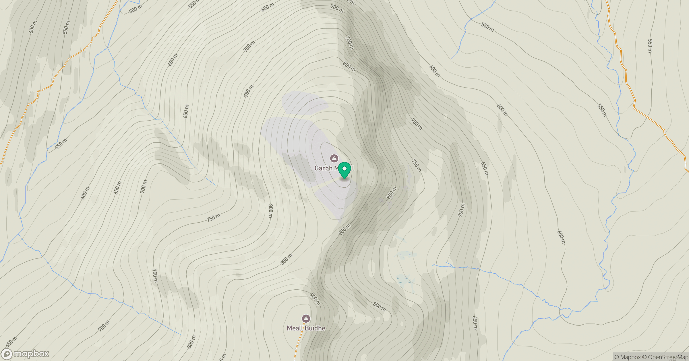
Grid reference: NN500505
View on OpenStreetMapOpens a map in a new tab, centred on the hill.
No comments yet. Be the first.