

Buachaille Etive Mor - Stob Dearg
Good walks are even better shared.
NN2254 : Stob Dearg from A82
Liam Drew Photo source
Overview
Stob Dearg is the 1,021.4-metre highest summit of Buachaille Etive Mòr, overlooking Rannoch Moor at the eastern end of Glen Coe. The Stob Dearg-only return, two-Munro circuit and technical Curved Ridge climb are different undertakings. Steep ground, exposed rock and serious winter avalanche terrain require careful route choice.
Buachaille Etive Mòr: Stob Dearg
Stob Dearg is the 1,021.4-metre highest summit of Buachaille Etive Mòr, the mountain overlooking Rannoch Moor at the eastern end of Glen Coe. This page concerns Stob Dearg; climbing it alone is a shorter outing than completing both Munros of the massif. Its measured prominence is 532 metres. DoBIH · National Trust for Scotland
Choose the right outing
The Stob Dearg-only return starts at Altnafeadh and uses Coire na Tulaich to reach the bealach and summit ridge, returning the same way. Walking Britain estimates 6.5 km and 4 hours 20 minutes for this defined itinerary. Its steep, rocky descent still needs care. This summer estimate does not apply to winter conditions. Stob Dearg return
The longer two-Munro circuit continues over Stob na Doire and Stob Coire Altruim to Stob na Bròige, then returns to the Coire Altruim descent and exits through Lairig Gartain. Walkhighlands gives 13 km and 7–9 hours. The separate “full traverse” card describes this same outing, not another verified route. Lairig Eilde is not an interchangeable descent from this ridge. Circuit · Independent route description
Curved Ridge is a Grade 3 scramble / Moderate rock climb in dry summer conditions. It requires technical route-finding, confidence on exposed rock and the skills to use climbing equipment appropriately; consider a qualified guide if these are outside your experience. Plan the descent and possible retreat before committing. These overview cards are not climbing instructions. BMC · Mountaineering Scotland
Summit, landscape and neighbouring tops
DoBIH identifies the high point as an outcrop near a cairn on the path. The prominent main cairn is about 115 metres north-east, on slightly lower ground. Do not assume that standing at a cairn places you at the precise mapped summit when navigating a descent. Nearby ridge tops are Stob na Doire (1,010.5 m), Stob Coire Altruim (938.8 m) and the other Munro, Stob na Bròige (953.4 m). DoBIH
Clear-weather views span Rannoch Moor and the Glen Coe mountains. Stob Dearg exposes volcanic rocks of the ancient Glencoe caldera, notably rhyolitic ignimbrites and tuffs; describing it simply as a quartzite mountain is misleading. Walkhighlands hill profile · British Geological Survey
Stob Dearg means “red peak”; Buachaille Etive Mòr is the “big herdsman of Etive”. Lagangarbh, the white cottage near the approach, has been maintained by the Scottish Mountaineering Club since 1946. It is a booked club hut, not a public walk-in refuge. Edinburgh Geological Society · NTS · SMC
Access and descent planning
Altnafeadh's A82 parking areas are around NN221563. Park responsibly and keep access clear. Walkhighlands identifies Kingshouse as the nearest coach stop; confirm current services and arrange a safe connection to the start. The longer circuit also involves a busy-road return section, a burn crossing and rocky steps in Coire Altruim. Navigation around Stob na Doire needs particular care in cloud. Access and circuit cautions
Bring food, water, suitable clothing, a headtorch and reliable navigation. The Glencoe Visitor Centre has a café and toilets, with public toilets also in Glencoe village; these facilities are away from the Altnafeadh start. Check opening times. NTS visitor information
Winter and other hazards
Coire na Tulaich is an avalanche terrain trap with a history of fatal accidents. Avalanches can reach well below the headwall. Its summer path must not be treated as a default winter ascent or descent, and the adjacent ridge is not automatically safe either. A safer decision may be a different objective or retreat before entering threatened terrain. Mountaineering Scotland · SAIS avalanche example · Glencoe Mountain Rescue
Snow, ice, cornices, wind and poor visibility require winter mountaineering judgement as well as suitable equipment and competent ice-axe and crampon use. Check mountain weather and the date and coverage of available SAIS forecasts. An old or absent seasonal bulletin is not an assessment of today's conditions. Allow time to turn back; no route card guarantees a safe descent. Winter skills · SAIS Glencoe
Explore routes near Buachaille Etive Mor - Stob Dearg
Walks starting near this hill. Open a route to check its map, distance and full itinerary.
Ben Nevis via Mountain Path
View route
Banavie to Glen Loy Aqueduct: Neptune’s Staircase Canal Towpath
View route
Killin: Falls of Dochart, Finlarig and Moirlanich Longhouse
View route
Coire Ardair lochan from Aberarder and back
View route
Route planning notes
These notes describe possible approaches. Check a route's map and access information when planning your walk.
Stob Dearg via Coire na Tulaich (return)
Stob Dearg-only return from Altnafeadh via Coire na Tulaich and the bealach, descending the same way. Walking Britain estimates 6.5 km and 4 h 20 min; allow more for conditions and your party. The corrie is steep and rocky. Snow or ice changes the undertaking: Coire na Tulaich is a serious avalanche terrain trap, not a default winter route.
Curved Ridge (technical scramble/climb)
A Grade 3 scramble / Moderate rock climb in dry summer conditions. Exposed steps and route-finding require appropriate climbing skills and equipment; use a qualified guide if needed. Plan the approach, descent and retreat before committing, as a wrong line can lead onto harder terrain. Coire na Tulaich is not automatically a safe descent under snow. This is an overview, not climbing instructions.
Two-Munro circuit via Coire Altruim and Lairig Gartain
From Altnafeadh, ascend Coire na Tulaich to Stob Dearg, continue over Stob na Doire and Stob Coire Altruim to Stob na Bròige, then return to the Coire Altruim descent and Lairig Gartain. Walkhighlands gives 13 km and 7–9 h; the time field shows the upper estimate, not a limit. Rocky descent steps, a burn crossing and the A82 return need care. Plan navigation and daylight; winter requires a separate assessment.
Buachaille Etive Mòr ridge traverse (same circuit)
The previously listed full traverse duplicates the two-Munro circuit above. Its supported return is via Coire Altruim and Lairig Gartain; Lairig Eilde is not an interchangeable descent from this ridge. No separate 14 km / 8 h itinerary has been verified. Use the defined circuit and plan the descent before setting out; do not improvise a descent into unfamiliar gullies.
Winter Coire na Tulaich (avalanche warning)
Coire na Tulaich is a serious avalanche terrain trap with fatal-accident history, including danger well below the headwall. Do not treat the summer path as a default winter ascent or descent. Winter route selection needs current weather/snow assessment, avalanche knowledge and competent ice-axe/crampon use. Nearby ribs are not automatically safe. Choose another objective when appropriate.
Make a day of it, together
Find someone to share the walk with, or organise a day out along a route you like.
Photo Gallery
View all Photo could not load
NN2254 : Stob Dearg from A82
Liam Drew
 Photo could not load
NN2254 : From the top of Stob Dearg looking south-west
Steven Brown
 Photo could not load
NN2254 : Buachaille Etive Mor
Iain Russell
 Photo could not load
NN2254 : Stob Dearg
wfmillar
 Photo could not load
NN2254 : Stob Dearg from the A82
Walter Baxter
 Photo could not load
NN2254 : Stob Dearg
Norrie Adamson
 Photo could not load
NN2254 : Stob Dearg
Simon McElroy
 Photo could not load
NN2254 : Stob Dearg
Richard Sutcliffe
 Photo could not load
NN2254 : Buachaille Etive Mor
Erik Piek

NN2254 : Stob Dearg, Buachaille Etive Mòr, from above!
Phillip Gamble
Hill facts and local notes
Classifications
Elevation
1,021m
3,351 ft
Prominence
532m
Coordinates
56.6462, -4.9004
NN222542
OS Map
41
Explorer: 384
At the Summit
DoBIH identifies the summit as an outcrop near a cairn on the path at NN 22266 54245. Embedded rock beside the prominent main cairn, about 115 m north-east at NN 22364 54312, is recorded as 0.2 m lower. The main cairn is therefore not the precise surveyed high point.
Terrain & Geology
Stob Dearg exposes volcanic rocks of the Glencoe caldera, notably Etive rhyolitic ignimbrites and associated tuffs. Older Dalradian rocks, including quartzite, occur beneath the volcanic sequence; the mountain should not be described as primarily quartzite. Its present relief also reflects later erosion.
Views & Scenery
In clear weather, views extend over Rannoch Moor, Glen Etive and the Glen Coe mountains. Visibility may be limited by cloud; keep well back from exposed edges.
Best Seasons
Clear conditions can reveal the ridge and surrounding glens in any season. Snow cover changes the appearance and seriousness of the mountain; there is no guaranteed best season for visibility.
History & Heritage
Name Origin
Stob Dearg means “red peak” in Scottish Gaelic. Buachaille Etive Mòr is commonly translated as “big” or “great herdsman of Etive”; Mòr qualifies the herdsman/mountain, not the size of the River Etive.
Historical Significance
Lagangarbh, the white cottage near the usual approach, is owned by the National Trust for Scotland and has been occupied and maintained by the Scottish Mountaineering Club since 1946. This is documented mountaineering history; no specific folklore claim is established here.
Getting There & Facilities
Parking
A82 parking areas at Altnafeadh, around NN221563, are the usual start. Space can be busy: use lawful marked areas, keep access clear and plan another option if full. No current capacity or fee is verified here. Take care around traffic.
Public Transport
The published route guide identifies Kingshouse as the nearest A82 coach stop, rather than Altnafeadh. Check current Scottish Citylink stops and times, and arrange a safe onward connection; do not assume a straightforward roadside walk to the start.
Nearby Facilities
Bring your own food and water. Lagangarbh is a booked Scottish Mountaineering Club hut, not a public walk-in refuge. Café and toilet facilities are available at Glencoe Visitor Centre, away from Altnafeadh, subject to opening hours; public toilets are also in Glencoe village.
Safety Information
Known Hazards
- Steep rocky ground, loose stones and exposed cliff edges: a slip can have serious consequences, especially in wet or icy conditions.
- Navigation needs care on the summit ridge and around Stob na Doire. The prominent main cairn is not the precise surveyed summit; do not improvise descents into gullies.
- Curved Ridge is a Grade 3 scramble / Moderate rock climb in dry summer conditions. Technical route-finding, suitable equipment and competent ropework or guiding may be needed.
- The full circuit includes rocky steps in Coire Altruim, a burn crossing and a return beside the busy A82. Assess water levels and plan a safe return.
- Wind, cold and poor visibility can make progress or retreat difficult. Carry suitable mountain equipment and allow enough daylight.
Seasonal Hazards
Coire na Tulaich is a serious avalanche terrain trap with fatal-accident history. Avalanches can threaten the lower corrie as well as its headwall, and neighbouring ribs are not automatically safe. Snow, ice and cornices require winter skills, appropriate ice axe/crampons and conditions-based route selection. Check weather and dated SAIS Glencoe information; an old or absent seasonal forecast does not mean safe conditions. Summer timings do not apply reliably in winter.
General Safety Tips
- Check weather conditions before setting out
- Carry appropriate clothing and equipment
- Let someone know your planned route
- Take a map, compass, and GPS device
- Carry emergency supplies: food, water, first aid kit, torch
Hills
Some common questions about the hills answered
Are there group walks up Buachaille Etive Mor - Stob Dearg?
Many walkers use Walkmates to join or organise walks with others. You can check for group walks around Buachaille Etive Mor - Stob Dearg through the maps
Are there other walkers around Buachaille Etive Mor - Stob Dearg?
Activity varies by location and time, but Walkmates lets you see whether others have shared walks or shown interest in this area. Find other people through the walking friends search walking friends for Buachaille Etive Mor - Stob Dearg search or of course create your own walk for Buachaille Etive Mor - Stob Dearg
Can I organise a walk to Buachaille Etive Mor - Stob Dearg?
Yes. If there aren’t any walks listed already, you can create a walk and make it available for others to join.
If you're signed up to Walkmates, you can create a walk to Buachaille Etive Mor - Stob Dearg.
How do I find a walk up this hill?
There are often multiple ways to walk this hill, depending on experience and route preference. Walkmates helps you explore walks and routes that others have shared.
Can I suggest a new route up Buachaille Etive Mor - Stob Dearg?
Yes. You can suggest or create routes to share with others. Walkmates focuses on the social side of walking, so routes are used to help people organise walks and explore areas together, rather than as detailed navigation tools or route libraries.
Other uses really appreciate knowledgeable walkers sharing their routes. Share your favourite route to Buachaille Etive Mor - Stob Dearg here
The is an error or something incorrect about this hill. How do I let you know?
We always strive to keep the information on Walkmates as accurate as possible. If you find an error, please let us know through the contact form and we'll aim to correct it as quickly as possible
Community Discussion
Comments
Location
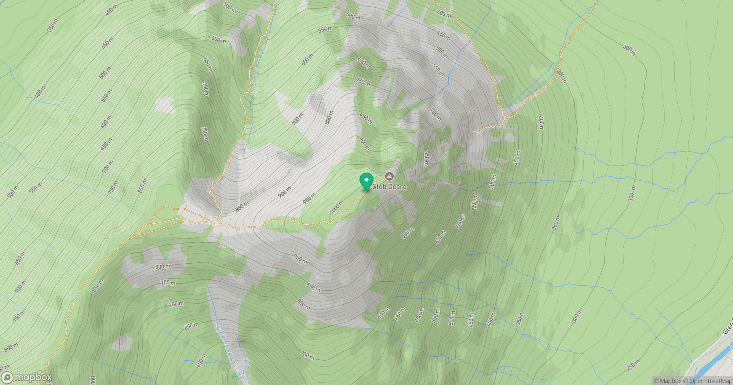
Grid reference: NN222542
View on OpenStreetMapOpens a map in a new tab, centred on the hill.
Nearby Hills
Creise
1,100m
Buachaille Etive Beag - Stob Coire Raineach
924m
Buachaille Etive Mor - Stob na Broige
953m
Buachaille Etive Beag - Stob Dubh
957m
Stob Ghabhar
1,089m
No comments yet. Be the first.