

Ben Alder
Good walks are even better shared.
NN4971 : View west across Ben Alder plateau
Russel Wills Photo source
Overview
Ben Alder
Ben Alder, standing tall at 1130 meters, is a majestic Munro that draws in adventurers eager to take on its challenges. Situated in the heart of the Scottish Highlands, this mountain offers a taste of the rugged beauty that Scotland is famous for.
Geology
The geology of Ben Alder is fascinating, predominantly featuring granite and schist. This unique composition has resulted in spectacular cliffs and dramatic landforms that showcase the area's ancient geological history.
Access
Getting to Ben Alder is part of the adventure. The nearest parking is conveniently located at Loch Pattack, approximately 2 miles from the trailhead. Current conditions may lead to a small charge, and it’s advisable to check parking restrictions before your trip. For those coming from further afield, Dalwhinnie is the closest town where you can catch a train and hopefully snag a bus to Loch Pattack.
Trails and Routes
Ben Alder offers several routes to the summit:
- Route from the Loch Pattack: This challenging 16km path leads you through picturesque forests before tackling the steep ascent. Estimated time: about 6 hours.
- Route from Dalwhinnie: A slightly longer 18.5km trek that gradually ascends, perfect for those wanting to soak in the surroundings. A 7-hour timeframe will be needed.
Summit Features
Once you reach the top, prepare to be greeted by a substantial cairn and a trig point that make for fantastic photographic opportunities. Whether standing triumphantly at the peak or simply enjoying the scenery, the summit is definitely Instagram-worthy.
Views
The views from Ben Alder are nothing short of breathtaking. On a clear day, you can see across Loch Ericht and take in the expansive glens of the Central Highlands. Late spring and early autumn offer the best visibility and vibrant colours that make your journey all the more rewarding.
Safety Considerations
However, do approach with caution! This mountain has its share of hazards including uneven and slippery terrain, so sturdy footwear is non-negotiable. Weather conditions can change in a blink, and it’s advisable to keep a watchful eye—for both the weather and the wildlife (yes, the deer can be quite cheeky)!
In Summary
Ben Alder is an unforgettable experience for any hiker worth their salt! Make sure to come well-prepared and be ready to take in one of the best views Scotland has to offer. With the right spirit and a pair of trusty boots, you're bound to create memories that will tickle your heart for years to come.
Explore routes near Ben Alder
Walks starting near this hill. Open a route to check its map, distance and full itinerary.
Ben Nevis via Mountain Path
View route
Kenmore: Drummond Hill Black Rock Trail above Loch Tay
View route
Banavie to Glen Loy Aqueduct: Neptune’s Staircase Canal Towpath
View route
Fort Augustus to Kytra Lock: Caledonian Canal Towpath
View route
Route planning notes
These notes describe possible approaches. Check a route's map and access information when planning your walk.
Ben Alder via the Loch Ericht Approach
This classic route begins at Dalwhinnie Railway Station and follows the track along the northwest shore of Loch Ericht. From Culra Bothy, ascend via the Long Leachas ridge, which provides an enjoyable scramble with stunning views. Descend via the Short Leachas ridge back to the Culra Bothy area and retrace the path along Loch Ericht to Dalwhinnie.
Ben Alder via Culra Bothy and Bealach Dubh
This route begins at the car park near Loch Rannoch, heading through the woods to reach the shores of Loch Ericht. From Culra Bothy, head south through Bealach Dubh, looping around to ascend Ben Alder from its southern slopes. Descend via the Beinn Bheoil ridge for a scenic return to Culra Bothy, then back to the starting point.
Ben Alder East Circuit
This variation starts from the parking area near Loch Pattack and follows the path to Culra Bothy. From here, take the Long Leachas ridge to summit Ben Alder. Descend via the Beinn Bheoil ridge, circling around and rejoining the path near Culra Bothy for the return to the starting point.
Ben Alder via the Sron Bealach Beithe
Starting at Dalwhinnie, take the shore path along Loch Ericht to Culra Bothy. Ascend Ben Alder via the Sron Bealach Beithe ridge, which offers an alternative, quieter ascent. Descend via the Long Leachas ridge and return to Dalwhinnie along the same track.
Ben Alder and Beinn Bheoil Horseshoe
This circular route begins at Culra Bothy, accessed either from Dalwhinnie or Loch Pattack. Ascend Ben Alder via the Long Leachas ridge, then continue to Beinn Bheoil for a fantastic ridge walk. Descend the southern slopes of Beinn Bheoil to rejoin the Loch Ericht track and return to the starting point.
Make a day of it, together
Find someone to share the walk with, or organise a day out along a route you like.
Photo Gallery
View all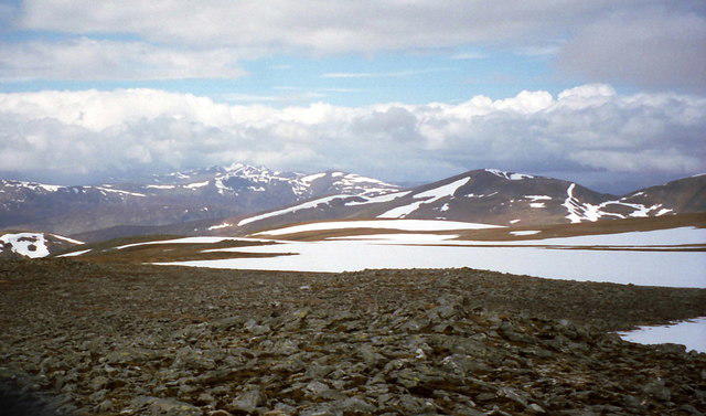 Photo could not load
NN4971 : View west across Ben Alder plateau
Russel Wills
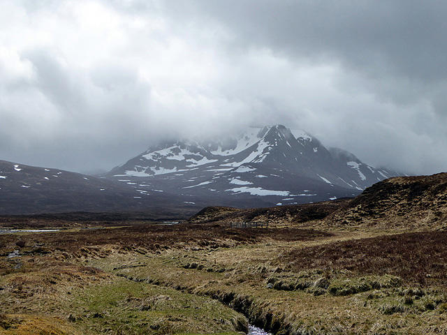 Photo could not load
NN4972 : The Ben Alder massif
John Lucas
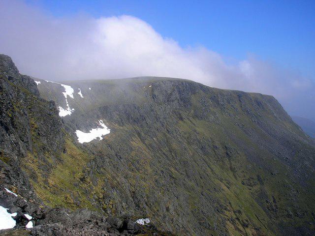 Photo could not load
NN4971 : Ben alder
Iain Lees
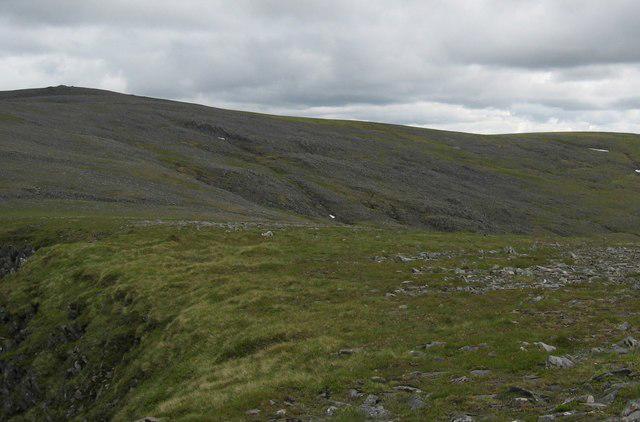 Photo could not load
NN4972 : Ben Alder
Hill Walker
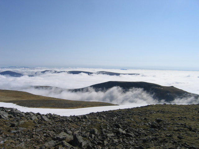 Photo could not load
NN4971 : Looking towards Beinn Bheoil from Ben Alder summit
Ali Ogden
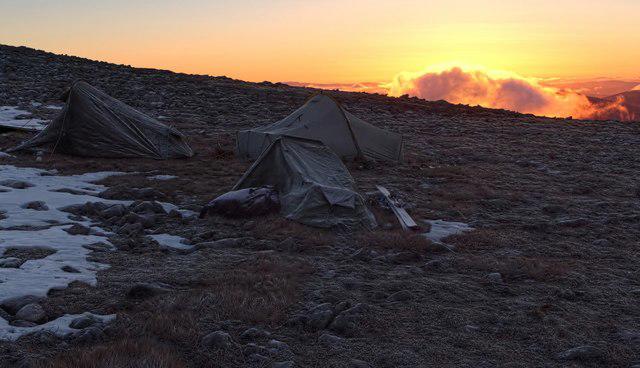 Photo could not load
NN4971 : Ben Alder summit camp
Ross
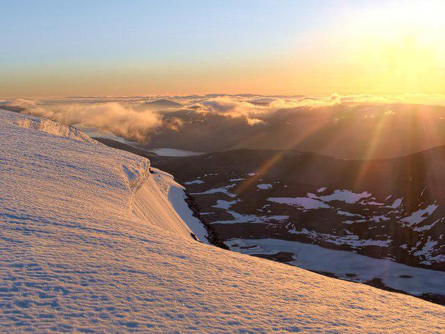 Photo could not load
NN4971 : View ENE from near Ben Alder summit at dawn
Ross
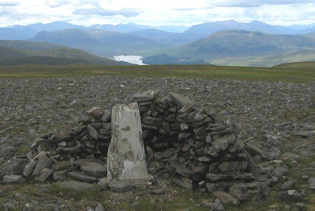 Photo could not load
NN4971 : Ben Alder Trig Point
Hill Walker
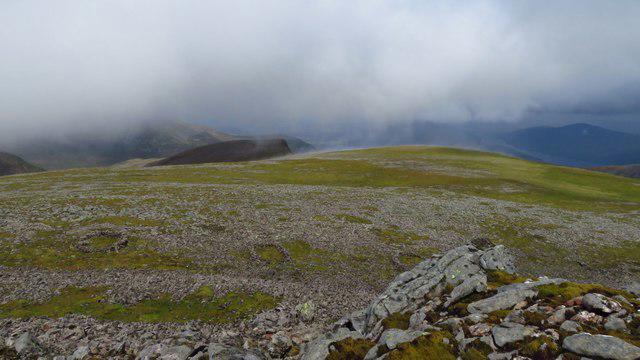 Photo could not load
NN4971 : Building outlines below Ben Alder summit
Colin Park
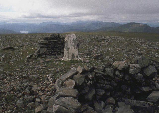
NN4971 : Summit trig point , Ben Alder
Alan Reid
Hill facts and local notes
Classifications
Elevation
1,148m
3,766 ft
Prominence
783m
Coordinates
56.8138, -4.4651
NN496718
OS Map
42
Explorer: OL50 385E 393
At the Summit
The summit boasts a large, impressive cairn and a trig point, both of which offer a perfect backdrop for those all-important summit selfies.
Terrain & Geology
Ben Alder is primarily composed of granite and schist, making for a rugged yet breathtaking landscape. Its geology reflects the complex tectonic processes that have shaped the Highlands over millions of years, giving rise to stunning cliffs and striking glacial features.
Views & Scenery
Spectacular views of the surrounding mountains including the expansive vistas over Loch Ericht and the glens of the Central Highlands.
History & Heritage
Name Origin
The name 'Ben Alder' likely derives from the Gaelic 'Beinn Alder', meaning 'the mountain of the alders', referencing the trees that can be found in the area.
Historical Significance
Ben Alder is not just a peak; it has been a landmark for generations of hikers and has significant appeal for its remote beauty and the challenge it presents to climbers.
Getting There & Facilities
Parking
Parking is available at Loch Pattack, about 2 miles from the start of the trail. Be prepared for a small charge, and check for any seasonal restrictions.
Public Transport
The nearest train station is Dalwhinnie, from where local buses may operate to Loch Pattack. Always double-check the current schedule.
Nearby Facilities
There are no facilities directly on the mountain, but Dalwhinnie offers a few cafes, shops, and restrooms.
Safety Information
Known Hazards
- Uneven and potentially slippery ground, sudden weather changes, and wildlife crossings—keep an eye out for the occasional deer!
General Safety Tips
- Check weather conditions before setting out
- Carry appropriate clothing and equipment
- Let someone know your planned route
- Take a map, compass, and GPS device
- Carry emergency supplies: food, water, first aid kit, torch
Hills
Some common questions about the hills answered
Are there group walks up Ben Alder?
Many walkers use Walkmates to join or organise walks with others. You can check for group walks around Ben Alder through the maps
Are there other walkers around Ben Alder?
Activity varies by location and time, but Walkmates lets you see whether others have shared walks or shown interest in this area. Find other people through the walking friends search walking friends for Ben Alder search or of course create your own walk for Ben Alder
Can I organise a walk to Ben Alder?
Yes. If there aren’t any walks listed already, you can create a walk and make it available for others to join.
If you're signed up to Walkmates, you can create a walk to Ben Alder.
How do I find a walk up this hill?
There are often multiple ways to walk this hill, depending on experience and route preference. Walkmates helps you explore walks and routes that others have shared.
Can I suggest a new route up Ben Alder?
Yes. You can suggest or create routes to share with others. Walkmates focuses on the social side of walking, so routes are used to help people organise walks and explore areas together, rather than as detailed navigation tools or route libraries.
Other uses really appreciate knowledgeable walkers sharing their routes. Share your favourite route to Ben Alder here
The is an error or something incorrect about this hill. How do I let you know?
We always strive to keep the information on Walkmates as accurate as possible. If you find an error, please let us know through the contact form and we'll aim to correct it as quickly as possible
Community Discussion
Comments
Location
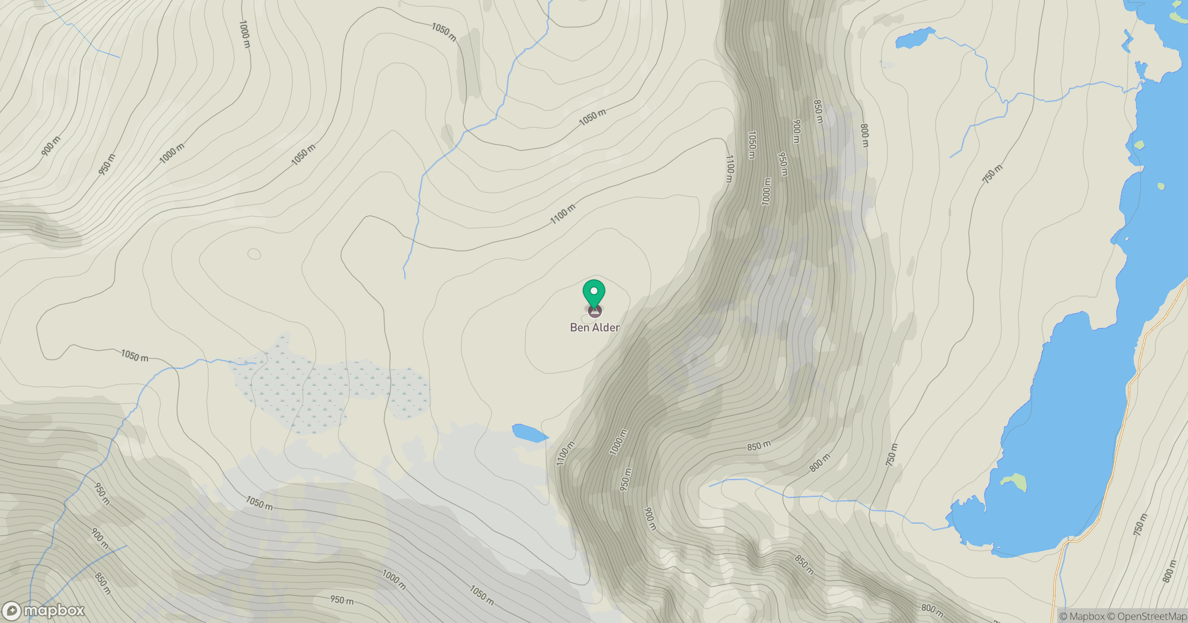
Grid reference: NN496718
View on OpenStreetMapOpens a map in a new tab, centred on the hill.
No comments yet. Be the first.