

Stob Ghabhar
Good walks are even better shared.
NN2345 : Stob Ghabhar from Coirein Lochain
Alan Murray Walsh Photo source
Overview
Exploring Stob Ghabhar
Introduction
Nestled in the Scottish Highlands, Stob Ghabhar rises majestically as a Munro with an elevation of 1,059 meters. Known as the 'Peak of the Outlaw', it beckons hikers and nature lovers with its dramatic scenery and challenging routes.
Geology
Stob Ghabhar's geological makeup is largely volcanic, revealing a past laden with fiery eruptions and sweeping glacial activity. The striking crags and ancient glacial valleys offer a glimpse into the earth's dynamic history. A geologist’s playground!
Routes
Two popular routes lead up this majestic peak:
- Glencoe Route: Starting from the A82 road, this route veers into stunning glens and steep ridges, making it a favourite amongst seasoned hikers.
- Coire na Ciste Route: For a quieter trek, this alternative offers less foot traffic and lovely views through Coire na Ciste, perfect for those looking to escape the crowds.
Summit Features
The summit of Stob Ghabhar features a rugged rocky outcrop adorned with a stone cairn—ideal for those Insta-snaps or a quick rest before the descent!
Terrain
Expect a rocky and often steep ascent, with sections of grass and scree that provide variety and a bit of an agility test. Be mindful of potential boggy areas, especially post rainfall!
Views
From the top, the views are nothing short of spectacular. Not only can you admire the splendid Ben Nevis and the Mamores, but there's also a sweeping vista over Loch Etive. Bring your binoculars; you'll want to spot everything!
Hazards
While Stob Ghabhar is an exhilarating venture, be cautious of steep ascents and loose rocks. Weather conditions can change quicker than you can say 'brollies and wellies', so be prepared.
Access
Getting to Stob Ghabhar is relatively easy. With a car park located near the A82, it’s a handy starting point. Ballachulish is close by for any supplies needed before a day on the hill.
Facilities
Though facilities at the trailhead are limited, nearby Ballachulish offers cafes and toilets. Perfect for grabbing a hot cuppa post-hike!
History
The mountain's name adds a dash of intrigue, translating to 'Peak of the Outlaw'. This title hints at the rich folklore that envelops Stob Ghabhar, echoing tales of yore that hikers might discover along their trek.
Conclusion
Stob Ghabhar is a splendid choice for any hiking enthusiast, offering both a physical challenge and unparalleled beauty in the heart of the Scottish Highlands. Whether you're a seasoned Munro bagger or just dipping your toes into hill walking, this peak promises a memorable adventure.
Happy hiking!
Explore routes near Stob Ghabhar
Walks starting near this hill. Open a route to check its map, distance and full itinerary.
Ben Nevis via Mountain Path
View route
Banavie to Glen Loy Aqueduct: Neptune’s Staircase Canal Towpath
View route
Killin: Falls of Dochart, Finlarig and Moirlanich Longhouse
View route
Beinn Ime from Succoth
View route
Route planning notes
These notes describe possible approaches. Check a route's map and access information when planning your walk.
Classic Coirein Lochain Route
This is the most popular ascent of Stob Ghabhar, starting from the car park at Victoria Bridge. The route follows the path through the woodland to Clashgour Farm before heading up the Allt Toaig, climbing steeply into Coirein Lochain. From the lochan, the path continues up the ridge towards the summit, providing dramatic views of the surrounding peaks and the lochan below.
Stob Ghabhar via the Aonach Eagach Ridge
This thrilling route ascends Stob Ghabhar via the Aonach Eagach ridge, a high, narrow ridgeline providing an exhilarating experience for experienced walkers. Starting from Victoria Bridge, the route heads up to the col between Stob a' Choire Odhair and Stob Ghabhar, before tackling the steep ascent onto the ridge and onwards to the summit.
Circular Route via Stob a' Choire Odhair
This route combines Stob Ghabhar with its neighbouring Munro, Stob a' Choire Odhair, for a rewarding circular hike. Starting from Victoria Bridge, the path climbs steadily to Stob a' Choire Odhair. From there, the route descends slightly before ascending Stob Ghabhar via the ridge. The return follows the descent along the Allt Toaig.
West Ridge Approach
This lesser-used route starts from the car park near the Inveroran Hotel and follows a more direct approach to Stob Ghabhar's west ridge. The terrain is steep and pathless in places, requiring good navigation skills. The summit rewards walkers with expansive views across Rannoch Moor and Glen Etive.
Winter Ascent via Coirein Lochain
For those seeking a challenge, this winter route ascends Stob Ghabhar via Coirein Lochain. Starting at Victoria Bridge, the route requires crampons and an ice axe, with sections of steep snow and ice. The winter scenery is breathtaking, with snow-covered ridges and frozen lochans providing a magical experience.
Make a day of it, together
Find someone to share the walk with, or organise a day out along a route you like.
Photo Gallery
View all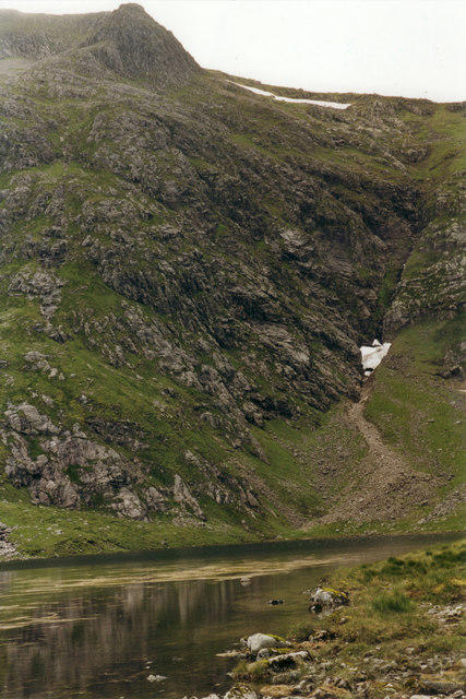 Photo could not load
NN2345 : Stob Ghabhar from Coirein Lochain
Alan Murray Walsh
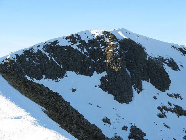 Photo could not load
NN2345 : Stob Ghabhar
Richard Webb
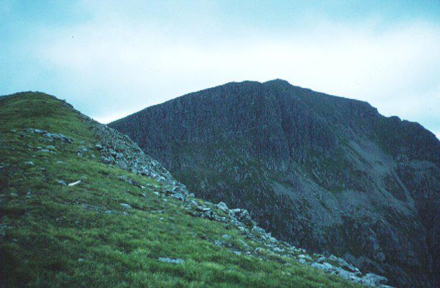 Photo could not load
NN2345 : Stob Ghabhar
Richard Webb
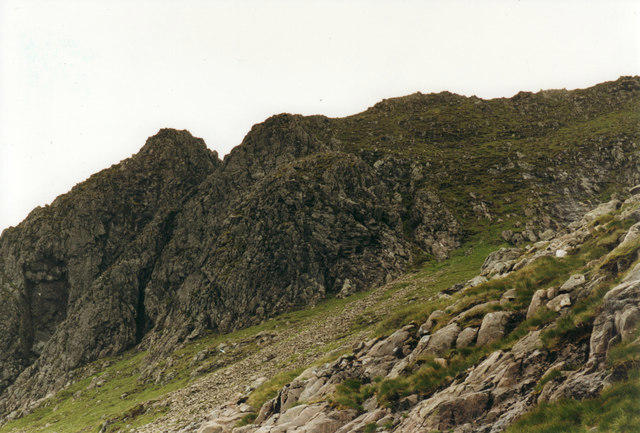 Photo could not load
NN2345 : Stob Ghabhar-1090m/3576ft
Alan Murray Walsh
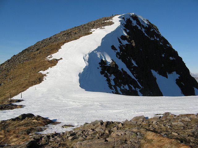 Photo could not load
NN2345 : Stob Ghabhar
Richard Webb
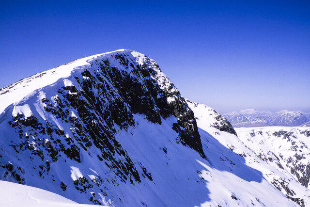 Photo could not load
NN2345 : Stob Ghabhar, east face
Trevor Littlewood
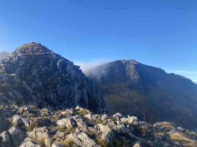 Photo could not load
NN2345 : On the Aonach Eagach of Stob Ghabhar
Iain Lees
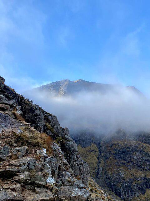 Photo could not load
NN2345 : Stob Ghabhar emerging from the mist
Iain Lees
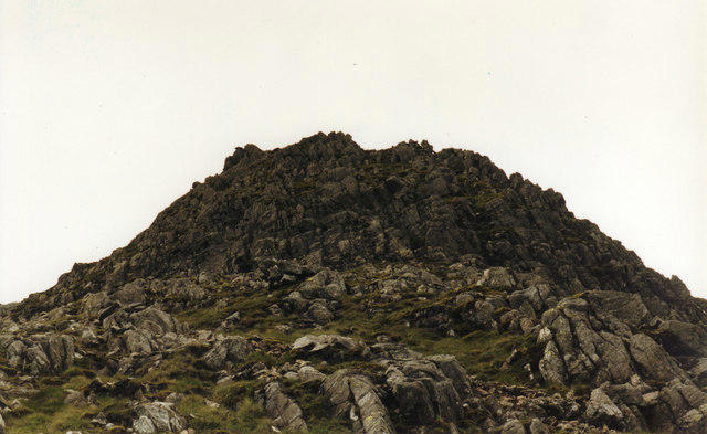 Photo could not load
NN2345 : Stob Ghabhar from the cliffs directly underneath the summit
Alan Murray Walsh
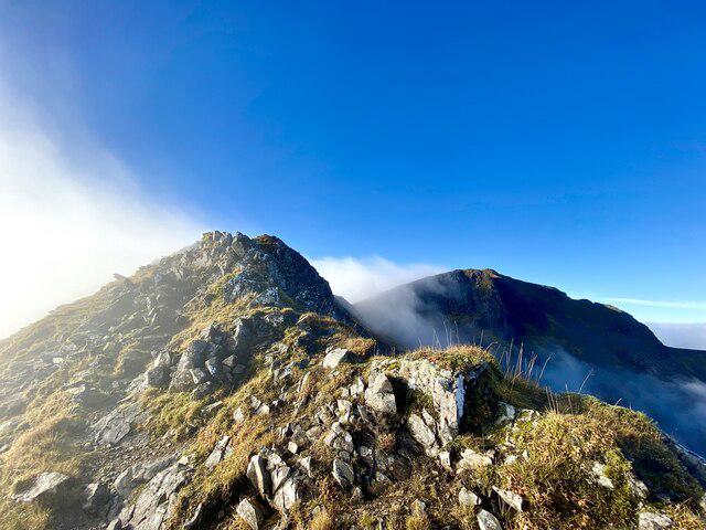
NN2345 : Looking to the Summit of Stob Ghabhar
Iain Lees
Hill facts and local notes
Classifications
Elevation
1,089m
3,573 ft
Prominence
392m
Coordinates
56.5681, -4.8821
NN230455
OS Map
50
Explorer: 377E 384
At the Summit
The summit features a prominent rocky outcrop and a stone cairn, providing a perfect spot for hikers to catch their breath and snap a few photos.
Terrain & Geology
Stob Ghabhar is primarily composed of volcanic rock, which gives rise to its rugged terrain. The mountain showcases a stunning array of geological features, including crags and glacial valleys that tell the tale of a tumultuous past.
Views & Scenery
From the summit, you can see the iconic peaks of the surrounding area including Ben Nevis and the Mamores, as well as breathtaking vistas of Loch Etive.
History & Heritage
Name Origin
The name 'Stob Ghabhar' translates from Gaelic to 'Peak of the Outlaw', which adds a hint of mystery and allure to the mountain.
Historical Significance
Stob Ghabhar is steeped in Scottish folklore and plays a significant role in the local landscape, often featured in walking and hiking guides.
Getting There & Facilities
Parking
The nearest parking area is at the car park near the A82 road at the entrance to Glencoe, which provides easy access to the trailhead.
Public Transport
Several bus services run from nearby towns such as Fort William and Oban, but check local timetables for the latest information.
Nearby Facilities
There are limited facilities at the trailhead, but Ballachulish has cafes, toilets, and shops for last-minute supplies.
Safety Information
Known Hazards
- Steep ascents and descents, loose rocks, and unpredictable weather conditions. The terrain can become slippery in wet weather, so sturdy footwear is recommended.
General Safety Tips
- Check weather conditions before setting out
- Carry appropriate clothing and equipment
- Let someone know your planned route
- Take a map, compass, and GPS device
- Carry emergency supplies: food, water, first aid kit, torch
Hills
Some common questions about the hills answered
Are there group walks up Stob Ghabhar?
Many walkers use Walkmates to join or organise walks with others. You can check for group walks around Stob Ghabhar through the maps
Are there other walkers around Stob Ghabhar?
Activity varies by location and time, but Walkmates lets you see whether others have shared walks or shown interest in this area. Find other people through the walking friends search walking friends for Stob Ghabhar search or of course create your own walk for Stob Ghabhar
Can I organise a walk to Stob Ghabhar?
Yes. If there aren’t any walks listed already, you can create a walk and make it available for others to join.
If you're signed up to Walkmates, you can create a walk to Stob Ghabhar.
How do I find a walk up this hill?
There are often multiple ways to walk this hill, depending on experience and route preference. Walkmates helps you explore walks and routes that others have shared.
Can I suggest a new route up Stob Ghabhar?
Yes. You can suggest or create routes to share with others. Walkmates focuses on the social side of walking, so routes are used to help people organise walks and explore areas together, rather than as detailed navigation tools or route libraries.
Other uses really appreciate knowledgeable walkers sharing their routes. Share your favourite route to Stob Ghabhar here
The is an error or something incorrect about this hill. How do I let you know?
We always strive to keep the information on Walkmates as accurate as possible. If you find an error, please let us know through the contact form and we'll aim to correct it as quickly as possible
Community Discussion
Comments
Location
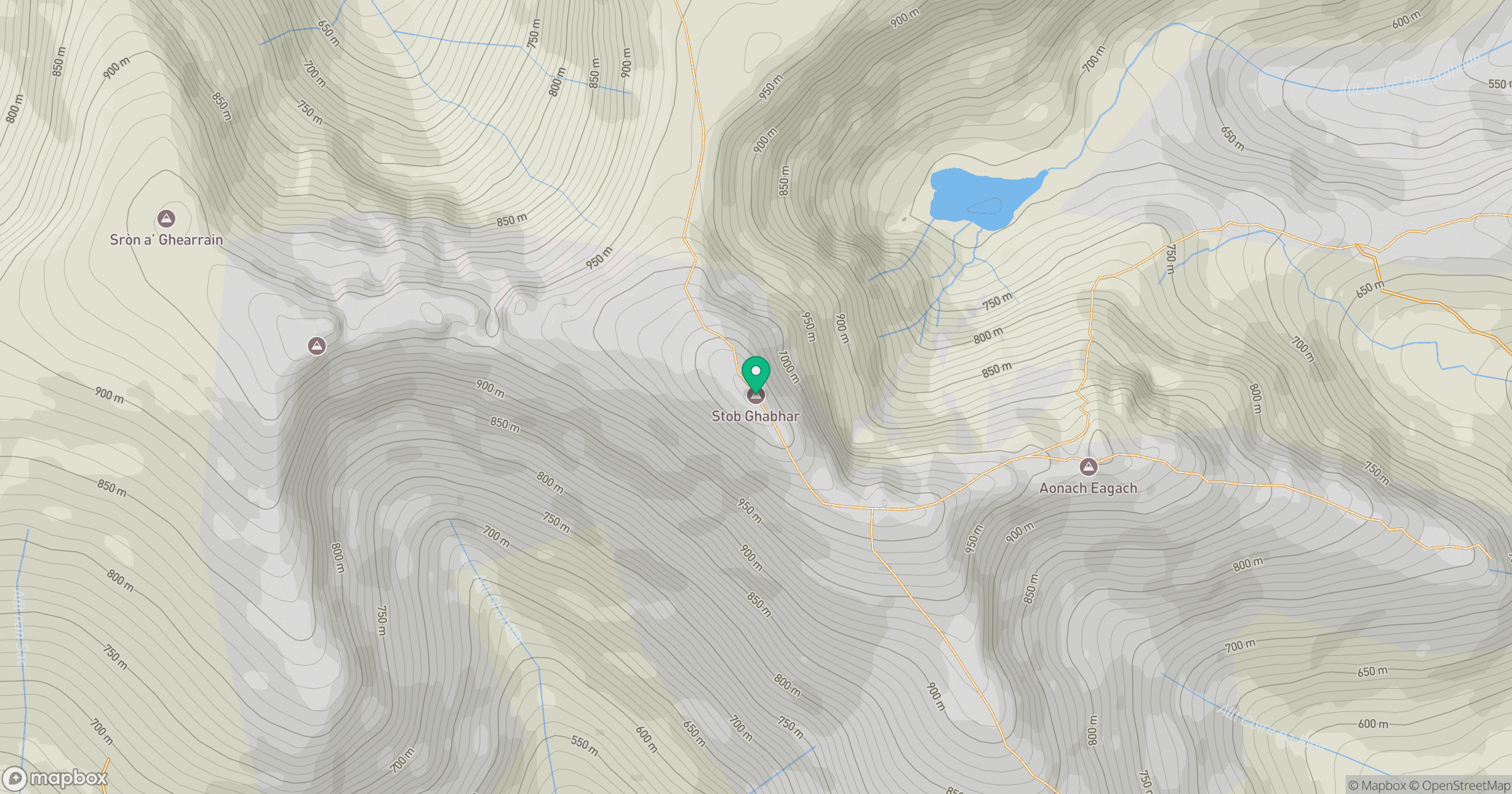
Grid reference: NN230455
View on OpenStreetMapOpens a map in a new tab, centred on the hill.
No comments yet. Be the first.