

Fan Frynych
Good walks are even better shared.
SN9522 : Not the summit of Fan Frynych
Gordon Hatton Photo source
Overview
Fan Frynych: A Hiker's Delight
Nestled within the stunning Brecon Beacons National Park, Fan Frynych stands as a Marilyn, offering both beauty and a sense of adventure. With its elevation of 752 meters, this hill is a beloved destination for day hikers and nature enthusiasts.
Geology
As a prominent feature in the landscape, Fan Frynych is primarily composed of sandstone, shaped over millions of years through weathering and erosion. The unique geological formations can give curious hikers something to ponder as they navigate the paths.
Routes
The main route to the summit is well-marked and easily navigable, taking approximately 2.5 hours to complete at a moderate pace. Its length of 5.2 km provides a satisfying trek without being overly strenuous. Be sure to take your time soaking in the beautiful surroundings!
Summit Features
On reaching the summit, you'll encounter a quaint stone cairn, perfect for capturing those all-important summit selfies. Prepare to be blown away by the view - it's easy to see why this mountain attracts so many lovers of the outdoors!
Terrain Type
The terrain is predominantly grassy, dotted with rocky outcrops that provide ample opportunities for exploration. It’s a delightful mix that keeps things interesting underfoot.
Views
The views from Fan Frynych are nothing short of breathtaking. On clear days, the majestic peaks of the Brecon Beacons, including Pen y Fan and Cribyn, stand proudly in the distance. Spring and autumn are particularly stunning, offering colourful displays that enchant the senses.
Hazards
As always, hikers must stay vigilant. The weather can change in a heartbeat, leaving paths slick with mud and rocks. Novice navigators should remain cautious in misty conditions, as visibility can drop dramatically.
Access
The nearest parking is conveniently located at the public car park in Libanus. It's a popular spot, so early birds might just catch the worm. Buses from Brecon will take you close to this hiking gem as well.
Facilities
Once you’ve conquered the mountain, treat yourself at one of Brecon’s welcoming cafes, where you can delight in a hot drink and perhaps indulge in a slice of cake - you’ve earned it!
History
The name 'Fan Frynych', meaning 'the hill of the sparrows', hints at the wildlife that flourishes in the area. Over the years, this area has grown into a favourite among hikers, rooted in both natural beauty and local lore.
So grab your walking shoes and prepare for a delightful adventure at Fan Frynych. Remember, it’s not just about reaching the summit, but enjoying the journey along the way!
Explore routes near Fan Frynych
Walks starting near this hill. Open a route to check its map, distance and full itinerary.
Pen y Fan via Corn Du from Storey Arms
View route
Brecon Basin to Brynich Aqueduct: Canal Towpath Walk
View route
Aircraft Crash Site - Wellington Bomber and Vampire Jet (Black Mountain range)
View route
Usk Reservoir: Glasfynydd Forest and Dam Circuit
View route
Route planning notes
These notes describe possible approaches. Check a route's map and access information when planning your walk.
Main Summit Route
A well-trodden path that ascends from the south, providing a steady incline and stunning views along the way.
Make a day of it, together
Find someone to share the walk with, or organise a day out along a route you like.
Photo Gallery
View all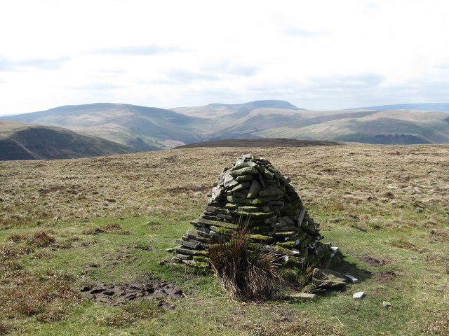 Photo could not load
SN9522 : Not the summit of Fan Frynych
Gordon Hatton
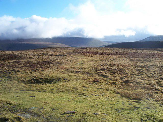 Photo could not load
SN9522 : View from Fan Frynych
John Light
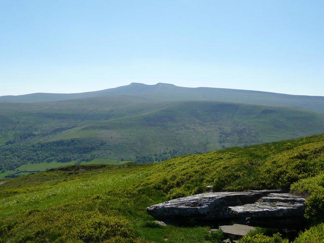 Photo could not load
SN9522 : The Beacons from Fan Frynych
Jeremy Bolwell
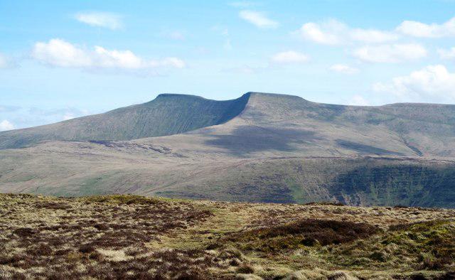 Photo could not load
SN9522 : East from Fan Frynych
Gordon Hatton
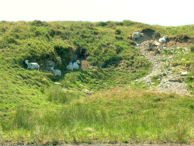 Photo could not load
SN9522 : No room at the hag
Nigel Davies
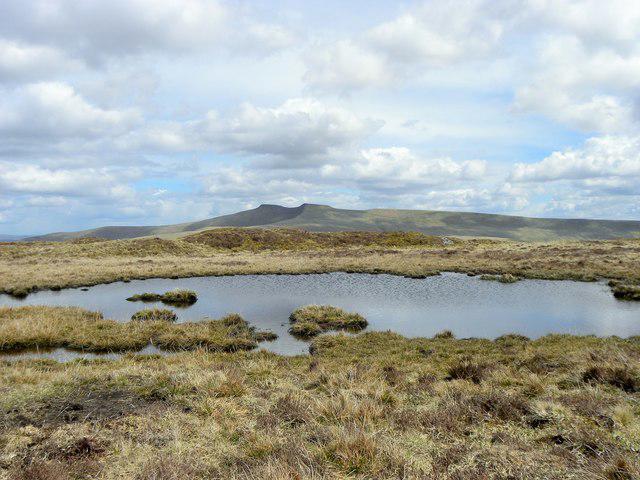 Photo could not load
SN9522 : Pond near Fan Frynych
Colin Bews
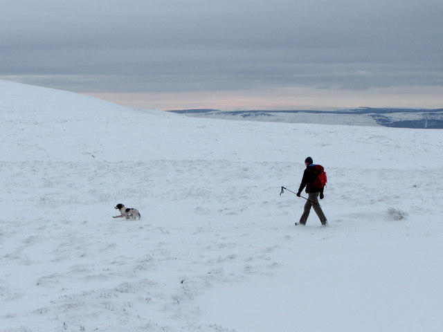 Photo could not load
SN9522 : One man and his dog near the summit of Fan Frynych
Gareth James
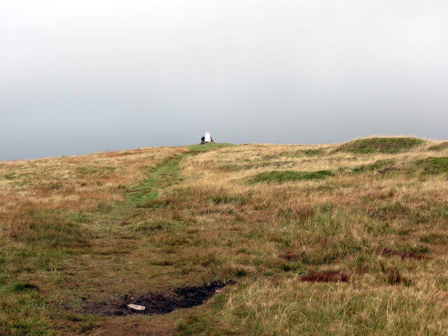 Photo could not load
SN9522 : Tuag at Fan Frynych / Towards Fan Frynych
Alan Richards
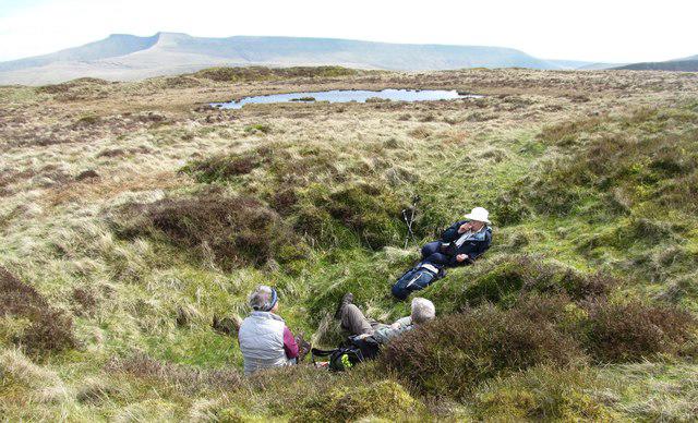 Photo could not load
SN9522 : In the pits
Gordon Hatton
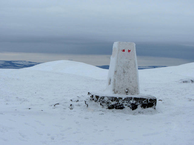
SN9522 : Summit of Fan Frynych
Gareth James
Hill facts and local notes
Classifications
Elevation
628m
2,061 ft
Prominence
46m
Coordinates
51.8939, -3.5158
SN957227
OS Map
160
Explorer: OL12E
At the Summit
At the summit, you'll find a stone cairn that serves as a landmark for adventurers. The panoramic views will have you feeling on top of the world!
Terrain & Geology
Primarily composed of sandstone, Fan Frynych is a testament to the ancient geological processes that shaped the Brecon Beacons. The striations and weathering can lead to fascinating rock formations along the trails.
Views & Scenery
From the summit, gaze upon the majestic peaks of the Brecon Beacons, including Pen y Fan and Cribyn. On clear days, you can even spot the distant Severn Estuary.
History & Heritage
Name Origin
The name 'Fan Frynych' translates to 'the hill of the sparrows,' which befits its gentle slopes and abundance of wildlife.
Historical Significance
This mountain has been a popular spot among hikers for decades, offering a serene escape into nature while also being deeply entwined with local folklore.
Getting There & Facilities
Parking
Parking is available at the nearest public car park near the village of Libanus. It’s a popular spot, so arrive early to nab a space.
Public Transport
Buses to Libanus operate from nearby towns such as Brecon. Check the local transport schedules for updated timings.
Nearby Facilities
There are a few cafes and shops in Brecon where you can refuel after your hike, complete with essential amenities and a cup of tea to warm you up.
Safety Information
Known Hazards
- Variable weather conditions can make paths slippery, so keep an eye out for mud and rocks on wet days. Additionally, some areas may be prone to mist, so navigation skills are key.
General Safety Tips
- Check weather conditions before setting out
- Carry appropriate clothing and equipment
- Let someone know your planned route
- Take a map, compass, and GPS device
- Carry emergency supplies: food, water, first aid kit, torch
Hills
Some common questions about the hills answered
Are there group walks up Fan Frynych?
Many walkers use Walkmates to join or organise walks with others. You can check for group walks around Fan Frynych through the maps
Are there other walkers around Fan Frynych?
Activity varies by location and time, but Walkmates lets you see whether others have shared walks or shown interest in this area. Find other people through the walking friends search walking friends for Fan Frynych search or of course create your own walk for Fan Frynych
Can I organise a walk to Fan Frynych?
Yes. If there aren’t any walks listed already, you can create a walk and make it available for others to join.
If you're signed up to Walkmates, you can create a walk to Fan Frynych.
How do I find a walk up this hill?
There are often multiple ways to walk this hill, depending on experience and route preference. Walkmates helps you explore walks and routes that others have shared.
Can I suggest a new route up Fan Frynych?
Yes. You can suggest or create routes to share with others. Walkmates focuses on the social side of walking, so routes are used to help people organise walks and explore areas together, rather than as detailed navigation tools or route libraries.
Other uses really appreciate knowledgeable walkers sharing their routes. Share your favourite route to Fan Frynych here
The is an error or something incorrect about this hill. How do I let you know?
We always strive to keep the information on Walkmates as accurate as possible. If you find an error, please let us know through the contact form and we'll aim to correct it as quickly as possible
Community Discussion
Comments
Location
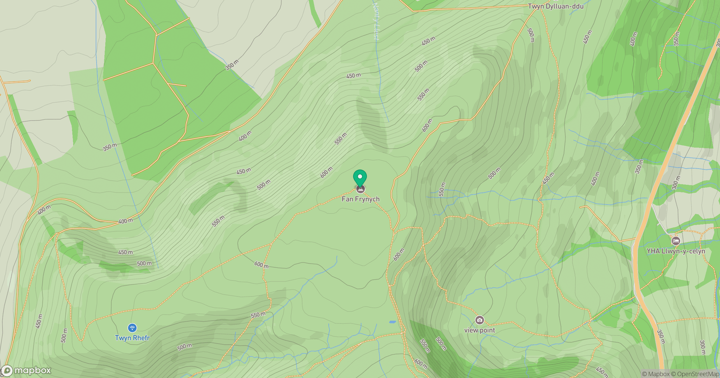
Grid reference: SN957227
View on OpenStreetMapOpens a map in a new tab, centred on the hill.


No comments yet. Be the first.