

Fan Nedd
Good walks are even better shared.
SN9118 : Lone walker taking in the views west of Fan Nedd
Gareth James Photo source
Overview
Fan Nedd: A Jewel of the Brecon Beacons
Fan Nedd, standing at 734 meters, is a true gem in the Brecon Beacons National Park. Whether you're a seasoned hiker or a beginner looking to lace up your boots, this mountain promises a delightful experience.
Geology
Fan Nedd primarily consists of sandstone and mudstone, which shape the rugged yet accessible terrain. The geological transitions from ancient seabed to present-day landscapes are evident as you navigate the slopes.
Access and Facilities
To reach Fan Nedd, consider parking at the Storey Arms Centre. Not only does it offer access to various hiking paths, but it's also a beacon of refreshment, with toilets and a café serving scrumptious fare. It’s wise to secure a spot early, especially on weekends, as the car park tends to get busier than a fishmonger on a Friday!
Routes
Heol Senni Route
This moderate trek spans about 8 km and typically takes around 3.5 hours, perfect for those wanting a leisurely pace without missing out on the views.
Storey Arms Route
For a gentler incline, the Storey Arms Route offers a scenic walk of 7.5 km, taking about 3.0 hours. This path is great for families and those seeking a less strenuous hike.
Terrain
Prepare yourself for a mixed bag of terrain! Grassy slopes, rock outcrops, and the occasional bog can provide some surprises. Proper boots are a must—trust us, your socks will thank you.
Summit Features
Upon reaching the summit, you're greeted by a lovely stone cairn and a trig point. It's the perfect spot to catch your breath and snap that all-important summit selfie—mind the wind!
Views
The views from Fan Nedd are simply breathtaking. On particularly clear days, the expansive panorama includes the Black Mountains and beyond. Spring and early autumn are ideal for visiting, with clearer skies and less chance of a drenched picnic.
Hazards
As with all mountain adventures, come prepared. Weather conditions can shift more swiftly than you can say 'cancellation on the hills', so dress in layers and pack waterproof gear. Muddy patches can also be quite slippery, so tread carefully!
Nearby Summits
Consider extending your adventure by visiting nearby Fan Fawr and Fan Llia. Each offers unique scenery and challenges, allowing you to indulge in a full day of exploration.
In summary, Fan Nedd is an inviting peak that encapsulates the beauty and rugged charm of the Brecon Beacons. Its varied terrain, combined with the splendid views and rich history, makes it a must-visit for outdoor lovers!
Happy hiking!
Explore routes near Fan Nedd
Walks starting near this hill. Open a route to check its map, distance and full itinerary.
Aircraft Crash Site - Wellington Bomber and Vampire Jet (Black Mountain range)
View route
Pen y Fan via Corn Du from Storey Arms
View route
Usk Reservoir: Glasfynydd Forest and Dam Circuit
View route
Brecon Basin to Brynich Aqueduct: Canal Towpath Walk
View route
Route planning notes
These notes describe possible approaches. Check a route's map and access information when planning your walk.
Heol Senni to Fan Nedd
A delightful walk starting from the village of Heol Senni, winding through lush pastures before ascending to the summit.
Storey Arms Route
Starting from the Storey Arms Centre, this route gently weaves through picturesque scenery with well-defined paths.
Make a day of it, together
Find someone to share the walk with, or organise a day out along a route you like.
Photo Gallery
View all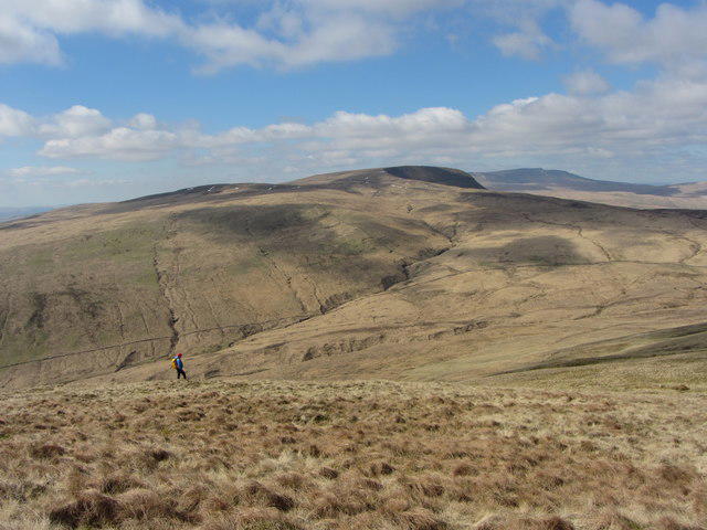 Photo could not load
SN9118 : Lone walker taking in the views west of Fan Nedd
Gareth James
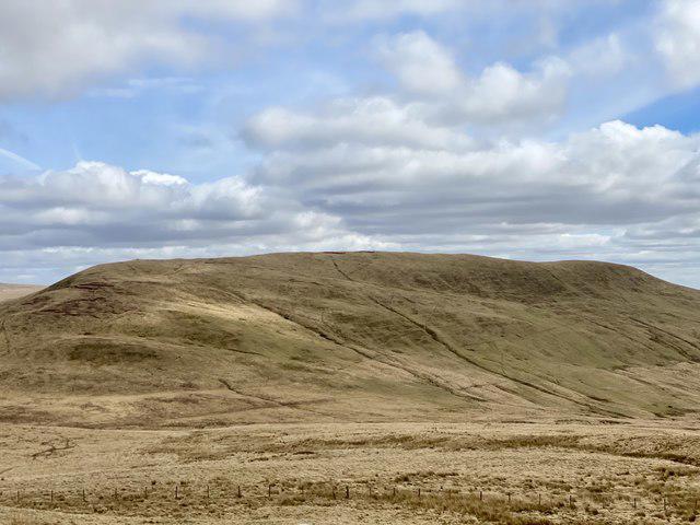 Photo could not load
SN9118 : Fan Nedd
Alan Hughes
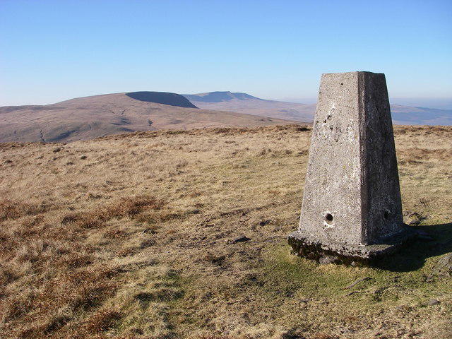 Photo could not load
SN9118 : Trig point on Fan Nedd
Alan Bowring
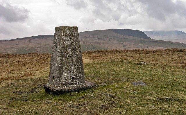 Photo could not load
SN9118 : Summit area of Fan Nedd
Trevor Littlewood
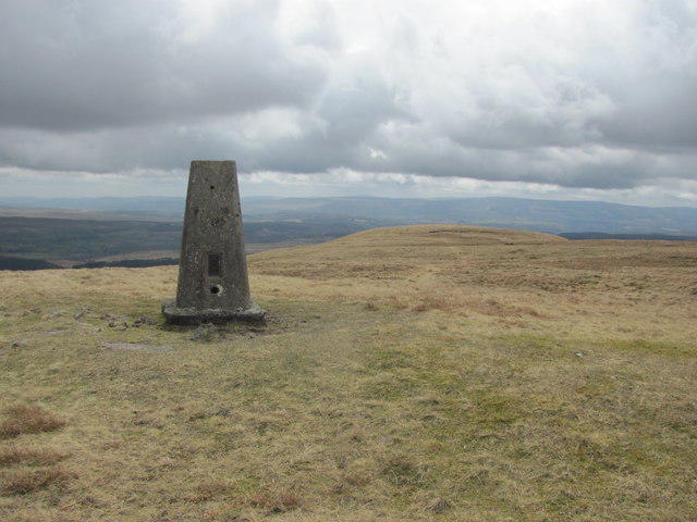 Photo could not load
SN9118 : View south from Fan Nedd trig point
John Light
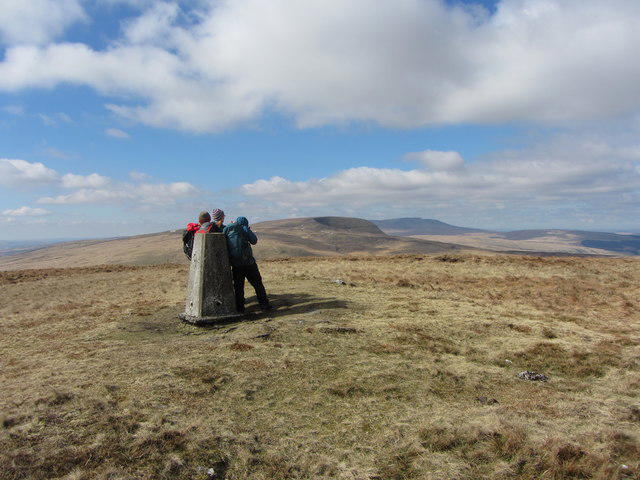 Photo could not load
SN9118 : Trig point on the summit of Fan Nedd
Gareth James
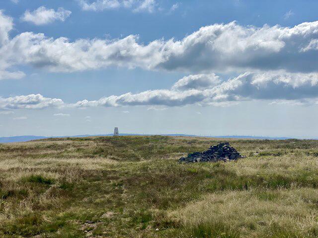 Photo could not load
SN9118 : Cairn and trig point on Fan Nedd
Alan Hughes
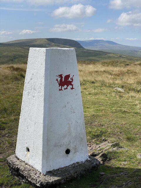 Photo could not load
SN9118 : Fan Nedd trig point
Alan Hughes
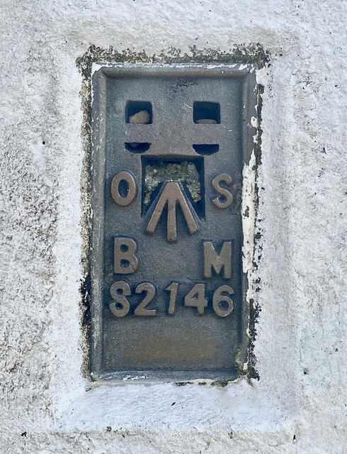 Photo could not load
SN9118 : Trig point identification plate - Fan Nedd
Alan Hughes
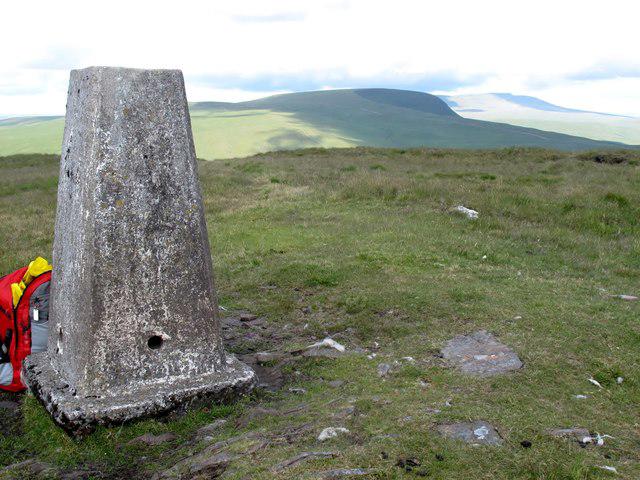
SN9118 : Fan Nedd
Rude Health
Hill facts and local notes
Classifications
Elevation
663m
2,175 ft
Prominence
174m
Coordinates
51.8537, -3.5792
SN913184
OS Map
160
Explorer: OL12E
At the Summit
At the summit, you'll find a modest stone cairn, often adorned with offerings from fellow climbers and a delightful trig point that challenges your selfie skills.
Terrain & Geology
Fan Nedd is primarily composed of sandstone and mudstone, which provides a solid footing yet can be slippery when wet. The layers of sedimentary rock tell tales of ancient seas that once covered this area.
Views & Scenery
On a clear day, expect sweeping views of the Black Mountains, the historic landscape of the Brecon Beacons, and even a glimpse of the Severn Estuary in the distance.
History & Heritage
Name Origin
The name 'Nedd' is thought to derive from the Welsh word for 'hairy', perhaps in reference to the area's lush, wild vegetation.
Historical Significance
Fan Nedd is part of the rich cultural landscape of the Brecon Beacons, often revered in Welsh folklore.
Getting There & Facilities
Parking
A small car park is available at the Storey Arms Centre, which fills up quickly on weekends, so get there early!
Public Transport
Regular bus services run from Brecon to the Storey Arms, particularly on weekends.
Nearby Facilities
The Storey Arms Centre provides toilets, and there's a charming café where you can recharge your energy with a cup of tea and a scone!
Safety Information
Known Hazards
- Be wary of the weather as it can change rapidly. Muddy paths can be deceptive, so take care of your footing.
General Safety Tips
- Check weather conditions before setting out
- Carry appropriate clothing and equipment
- Let someone know your planned route
- Take a map, compass, and GPS device
- Carry emergency supplies: food, water, first aid kit, torch
Hills
Some common questions about the hills answered
Are there group walks up Fan Nedd?
Many walkers use Walkmates to join or organise walks with others. You can check for group walks around Fan Nedd through the maps
Are there other walkers around Fan Nedd?
Activity varies by location and time, but Walkmates lets you see whether others have shared walks or shown interest in this area. Find other people through the walking friends search walking friends for Fan Nedd search or of course create your own walk for Fan Nedd
Can I organise a walk to Fan Nedd?
Yes. If there aren’t any walks listed already, you can create a walk and make it available for others to join.
If you're signed up to Walkmates, you can create a walk to Fan Nedd.
How do I find a walk up this hill?
There are often multiple ways to walk this hill, depending on experience and route preference. Walkmates helps you explore walks and routes that others have shared.
Can I suggest a new route up Fan Nedd?
Yes. You can suggest or create routes to share with others. Walkmates focuses on the social side of walking, so routes are used to help people organise walks and explore areas together, rather than as detailed navigation tools or route libraries.
Other uses really appreciate knowledgeable walkers sharing their routes. Share your favourite route to Fan Nedd here
The is an error or something incorrect about this hill. How do I let you know?
We always strive to keep the information on Walkmates as accurate as possible. If you find an error, please let us know through the contact form and we'll aim to correct it as quickly as possible
Community Discussion
Comments
Location
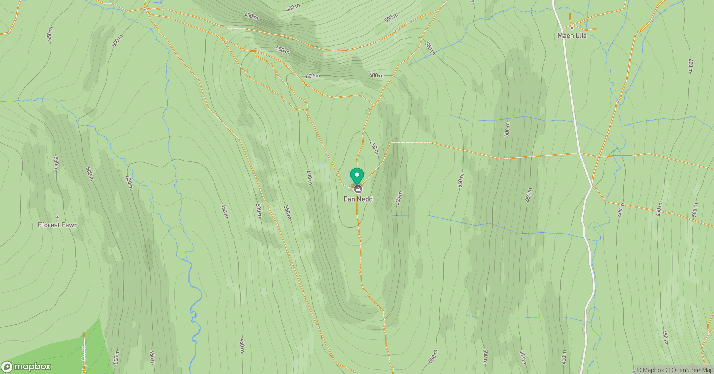
Grid reference: SN913184
View on OpenStreetMapOpens a map in a new tab, centred on the hill.


No comments yet. Be the first.