

Creag Sgiathan
Good walks are even better shared.
Overview
Creag Sgiathan
Nestled within the picturesque Scottish Highlands, Creag Sgiathan stands at an impressive 642 meters. A true gem for hikers and outdoor aficionados, it presents an engaging climb that rewards adventurers with stunning vistas.
Geology
The mountain boasts a fascinating combination of granite and schist, showcasing the natural artistry of the Earth’s crust. As you traverse its slopes, take a moment to admire the unique rock formations, and perhaps even spot an agile hare who thinks it’s the star of the show.
Routes
One of the most popular routes to the summit is the Southwest Ridge Route. This route is well-trodden and leads you through beautiful scenery, continuously ramping up the anticipation of the views that await at the top. The 5 km of trails can typically be conquered in around 2.5 hours, making it a manageable excursion for most fitness levels.
Summit Features
Upon reaching the summit, you’ll be greeted by a grand cairn—a traditional marker that many weary hikers have added a stone to in homage to their conquest. It’s an Instagrammable moment for sure!
Terrain Type
Expect a mix of rocky outcrops and grassy patches as you climb. The varying terrain keeps things interesting, but do wear solid boots to avoid mishaps on the rocky bits.
Views
The views from the summit are nothing short of spectacular. You’ll see a panorama that includes distant mountains like Ben Nevis and sparkling Loch Ness. Best seasons for these views are definitely spring and autumn, when the landscape is adorned with rich colours.
Hazards
While the challenges of the hike are rewarding, be mindful of the changing weather conditions. Scottish weather can be as unpredictable as a cat choosing to ignore you, so dress appropriately and be cautious of the tricky terrain.
Access
Finding your way up is relatively easy. The nearest parking can be found at the end of the B862 road, but be sure to arrive early during the busy months to claim a good spot. If you prefer letting someone else navigate, there are public transport options from Inverness to Fort Augustus, the nearest town, which is brimming with post-hike amenities.
Facilities
After your exertions, there’s nothing quite like indulging in some local sustenance at one of the cafes or pubs in Fort Augustus. Don’t forget to check out their cake selection; it’s as much a part of the experience as the hike itself!
History
The name Creag Sgiathan translates to the 'Crag of the Wings' and reflects the area’s rich avian wildlife. Historically, it has been a favoured spot for generations, enticing climbers with its challenges and breathtaking scenery.
In conclusion, whether you’re a seasoned climber or just out for a gentle walk, Creag Sgiathan offers a delightful outing amidst nature's finest. Just remember to bring your camera, because the views will have you grinning from ear to ear! Enjoy your adventure!
Explore routes near Creag Sgiathan
Public walks starting within 80 km of this hill. Nearby does not mean a route reaches the summit; check its map and access before setting out.
Beinn Eighe Lancaster Wreckage at Coire Mhic Fhearchair
View route
Glen Affric: Coire Loch Woodland Trail
View route
Loch Affric full circuit from River Affric
View route
Fairy Lochs Liberator Wreckage Circuit
View route
Route planning notes
These notes describe possible approaches, not verified navigable routes or permission to cross land. Check current paths, local access rules and conditions before setting out.
Southwest Ridge Route
This is the most popular ascent, following a well-worn path that meanders up the southwest ridge, offering stunning views right from the start.
Make a day of it, together
Find someone to share the walk with, or organise a day out along a route you like.
Photo Gallery
View all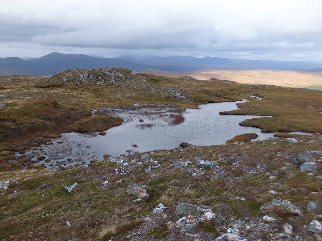 Photo could not load
NH1650 : Lochan to south of Creag Coir' a' Bhuic
Alpin Stewart
Hill facts and local notes
Classifications
Elevation
699m
2,294 ft
Prominence
131m
Coordinates
57.5109, -5.0585
NH168508
OS Map
25
Explorer: 430
At the Summit
The summit is marked by a large cairn, which, if it could talk, would probably tell tales of numerous hikers who have conquered this peak.
Terrain & Geology
Primarily composed of granite and schist, the mountain's layered geology is testimony to millennia of geological processes. Expect to see some striking rock formations and the occasional bunny hopping over the outcrops, unaware of its scenic background.
Views & Scenery
From the summit, enjoy breathtaking views of the surrounding peaks, including Ben Nevis and the shimmering waters of Loch Ness. On a clear day, you might even see as far as the Inverness skyline.
History & Heritage
Name Origin
Creag Sgiathan translates to 'the Crag of the Wings' in Scots Gaelic, hinting at the birdlife that nests on its crags.
Historical Significance
This mountain has been a popular climbing destination for generations, often providing a sense of adventure and a wonderful day out, along with potentially meeting like-minded souls along the way.
Getting There & Facilities
Check current local access restrictions, parking rules and transport timetables before travelling. These notes do not confirm public access to the summit.
Parking
The nearest parking is located at the end of the B862 road near the Loch Tarff area. Arrive early during peak season to secure a spot. It's popular for a reason!
Public Transport
Regular bus services operate from Inverness to Fort Augustus, with stops near Loch Tarff, though check local schedules for the latest information.
Nearby Facilities
Nearby, the charming village of Fort Augustus offers cafes, pubs, and public toilets. Enjoy a slice of cake and a hot cup of tea before or after your hike—it’s practically the law here!
Safety Information
Known Hazards
- Watch out for sudden weather changes. Also, the rocky terrain can be tricky, so sturdy boots are a must—nobody wants a twisted ankle trying to conquer nature!
General Safety Tips
- Check weather conditions before setting out
- Carry appropriate clothing and equipment
- Let someone know your planned route
- Take a map, compass, and GPS device
- Carry emergency supplies: food, water, first aid kit, torch
Hills
Some common questions about the hills answered
Are there group walks up Creag Sgiathan?
Many walkers use Walkmates to join or organise walks with others. You can check for group walks around Creag Sgiathan through the maps
Are there other walkers around Creag Sgiathan?
Activity varies by location and time, but Walkmates lets you see whether others have shared walks or shown interest in this area. Find other people through the walking friends search walking friends for Creag Sgiathan search or of course create your own walk for Creag Sgiathan
Can I organise a walk to Creag Sgiathan?
Yes. If there aren’t any walks listed already, you can create a walk and make it available for others to join.
If you're signed up to Walkmates, you can create a walk to Creag Sgiathan.
How do I find a walk up this hill?
There are often multiple ways to walk this hill, depending on experience and route preference. Walkmates helps you explore walks and routes that others have shared.
Can I suggest a new route up Creag Sgiathan?
Yes. You can suggest or create routes to share with others. Walkmates focuses on the social side of walking, so routes are used to help people organise walks and explore areas together, rather than as detailed navigation tools or route libraries.
Other uses really appreciate knowledgeable walkers sharing their routes. Share your favourite route to Creag Sgiathan here
The is an error or something incorrect about this hill. How do I let you know?
We always strive to keep the information on Walkmates as accurate as possible. If you find an error, please let us know through the contact form and we'll aim to correct it as quickly as possible
Community Discussion
Comments
Location
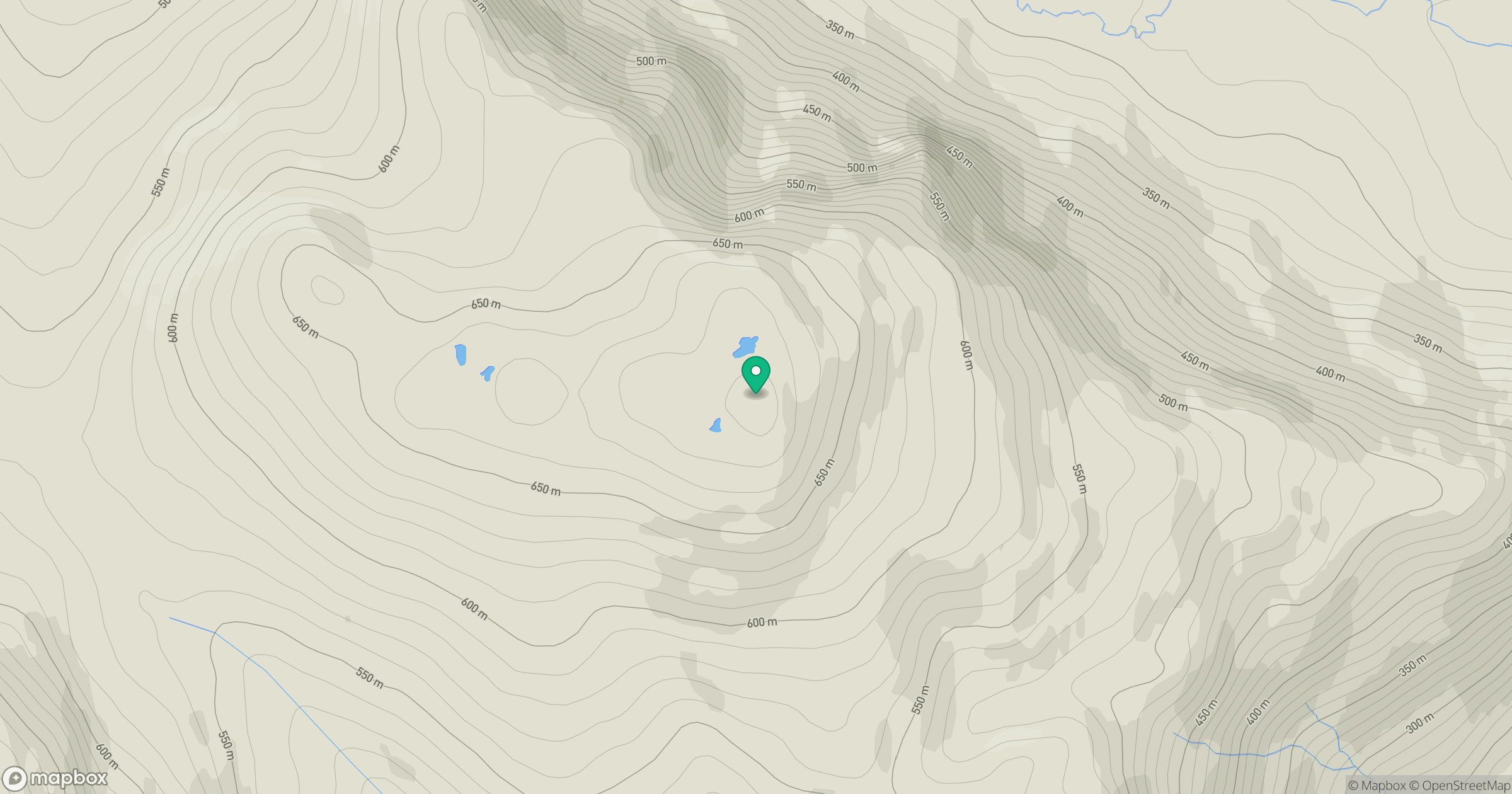
Grid reference: NH168508
View on OpenStreetMapOpens a map in a new tab, centred on the hill.
Hills within 30 km
Straight-line distance, not a walking route or confirmation of access.
No comments yet. Be the first.