

Cauldon Lowe
Good walks are even better shared.
SK0747 : Cauldon Limestone quarry
Hazel Mills Photo source
Overview
Introduction
Cauldon Lowe, sitting majestically at 522 meters, is one of the lesser-known gems of the Peak District. A Marilyn in classification, it boasts not only stunning views but also an adventurous spirit beckoning hikers.
Geology
This mountain is primarily formed of limestone which has weathered into fascinating karst features. Expect rugged scenery dotted with limestone pavements, and remember: the rock isn’t there just to show off its rugged good looks – it's got historical value as well!
Routes
There are a couple of popular routes to reach the summit:
The Cauldon Lowe Loop (8.5 km, Moderate): This scenic route takes you around lush valleys and moorland. Perfect for those who love a bit of a circuit, and who doesn’t enjoy a good loop?
From Wetton to Cauldon Lowe (4.0 km, Easy): For a more straightforward ascent, take the path from Wetton. This route is accessible and gives you a gentle introduction to the heights of Cauldon Lowe.
Summit Features
Once you reach the top, you’ll be greeted by a delightful cairn and a trig point, absolutely perfect for your Instagram snaps. Don’t forget to take a moment to enjoy the sweeping vistas—seriously, they’re Instagram gold!
Terrain
The terrain can be rocky, especially in places, with grassy patches snuggling in between. Muddy spots can surprise the best of us after a rain, so watch your step!
Views
From the summit, on a crystal-clear day, you’ll witness sweeping views of the southern Pennines. Best seasons for views from Cauldon Lowe are late spring and early autumn when colours are richest and visibility is unmatched.
Hazards
However, be cautious—weather changes can be as unpredictable as a squirrel’s mood. Appropriate hiking gear is recommended to navigate the rocky patches safely.
Access
Parking is available in the village of Cauldon, where the locals are always welcoming. If you prefer public transport, bus services from Ashbourne are available, although a bit limited.
Facilities
There’s a local shop and a pub in Wetton for your post-hike refreshments. Toilets can usually be found around the pub area, just in case you need to make a quick pit stop before heading back out on the trail.
History
The name 'Cauldon' means 'the cold valley' in Old English, a fitting title considering the brisk winds that can sweep through. Historically, this area has been significant for limestone quarrying, shaping both the landscape and local economy.
Conclusion
So lace up those hiking boots and grab your walking sticks! Cauldon Lowe not only offers a wonderful adventure but also plenty of opportunities for splendid views and a bit of fresh air—just remember, the cardigans stay at the bottom!
Explore routes near Cauldon Lowe
Walks starting near this hill. Open a route to check its map, distance and full itinerary.
Tissington Trail: Ashbourne, Thorpe Station and Tissington return
View route
Deep Hayes Country Park: Cumberledge Pool and woodland circuit
View route
Park Hall: pine woods, heathland and meadow circuit
View route
Tittesworth Reservoir
View route
Route planning notes
These notes describe possible approaches. Check a route's map and access information when planning your walk.
The Cauldon Lowe Loop
A scenic loop starting from the village of Cauldon, encompassing lush valleys and open moorland.
From Wetton to Cauldon Lowe
A direct path that offers the chance to take in the views of the surrounding Peak District.
Make a day of it, together
Find someone to share the walk with, or organise a day out along a route you like.
Photo Gallery
View all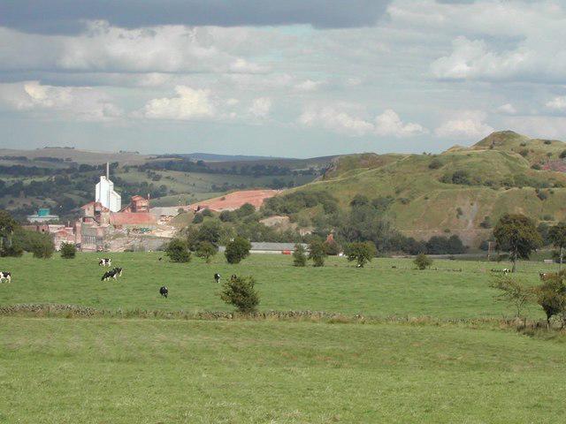 Photo could not load
SK0747 : Cauldon Limestone quarry
Hazel Mills
Hill facts and local notes
Classifications
Elevation
363m
1,192 ft
Prominence
30m
Coordinates
53.0272, -1.8877
SK076477
OS Map
119 128
Explorer: 259W
At the Summit
The summit features a prominent cairn and a trig point, providing a fantastic photo opportunity amidst the dramatic backdrop.
Terrain & Geology
Cauldon Lowe is primarily composed of limestone, known for its rugged scenery and karst topography, featuring some fascinating limestone pavements.
Views & Scenery
On a clear day, you can spot the peaks of the southern Pennines and the rugged beauty of the Peak District National Park.
History & Heritage
Name Origin
The name 'Cauldon' derives from Old English, meaning 'the cold valley', which is quite fitting given the area's chilly winds on occasion.
Historical Significance
Historically, Cauldon Lowe has been a significant site for limestone quarrying, shaped both the landscape and local industry.
Getting There & Facilities
Parking
There is parking available in the village of Cauldon, with additional options at nearby Wetton.
Public Transport
Buses run from Ashbourne to Cauldon, but services can be limited, so check schedules beforehand.
Nearby Facilities
The nearest facilities are available in Wetton, which offers a quaint village shop and a pub for refreshments, along with toilets.
Safety Information
Known Hazards
- Be cautious of sudden weather changes and ensure appropriate footwear when navigating rocky terrain. Some routes may become slippery and boggy after rain.
General Safety Tips
- Check weather conditions before setting out
- Carry appropriate clothing and equipment
- Let someone know your planned route
- Take a map, compass, and GPS device
- Carry emergency supplies: food, water, first aid kit, torch
Hills
Some common questions about the hills answered
Are there group walks up Cauldon Lowe?
Many walkers use Walkmates to join or organise walks with others. You can check for group walks around Cauldon Lowe through the maps
Are there other walkers around Cauldon Lowe?
Activity varies by location and time, but Walkmates lets you see whether others have shared walks or shown interest in this area. Find other people through the walking friends search walking friends for Cauldon Lowe search or of course create your own walk for Cauldon Lowe
Can I organise a walk to Cauldon Lowe?
Yes. If there aren’t any walks listed already, you can create a walk and make it available for others to join.
If you're signed up to Walkmates, you can create a walk to Cauldon Lowe.
How do I find a walk up this hill?
There are often multiple ways to walk this hill, depending on experience and route preference. Walkmates helps you explore walks and routes that others have shared.
Can I suggest a new route up Cauldon Lowe?
Yes. You can suggest or create routes to share with others. Walkmates focuses on the social side of walking, so routes are used to help people organise walks and explore areas together, rather than as detailed navigation tools or route libraries.
Other uses really appreciate knowledgeable walkers sharing their routes. Share your favourite route to Cauldon Lowe here
The is an error or something incorrect about this hill. How do I let you know?
We always strive to keep the information on Walkmates as accurate as possible. If you find an error, please let us know through the contact form and we'll aim to correct it as quickly as possible
Community Discussion
Comments
Location
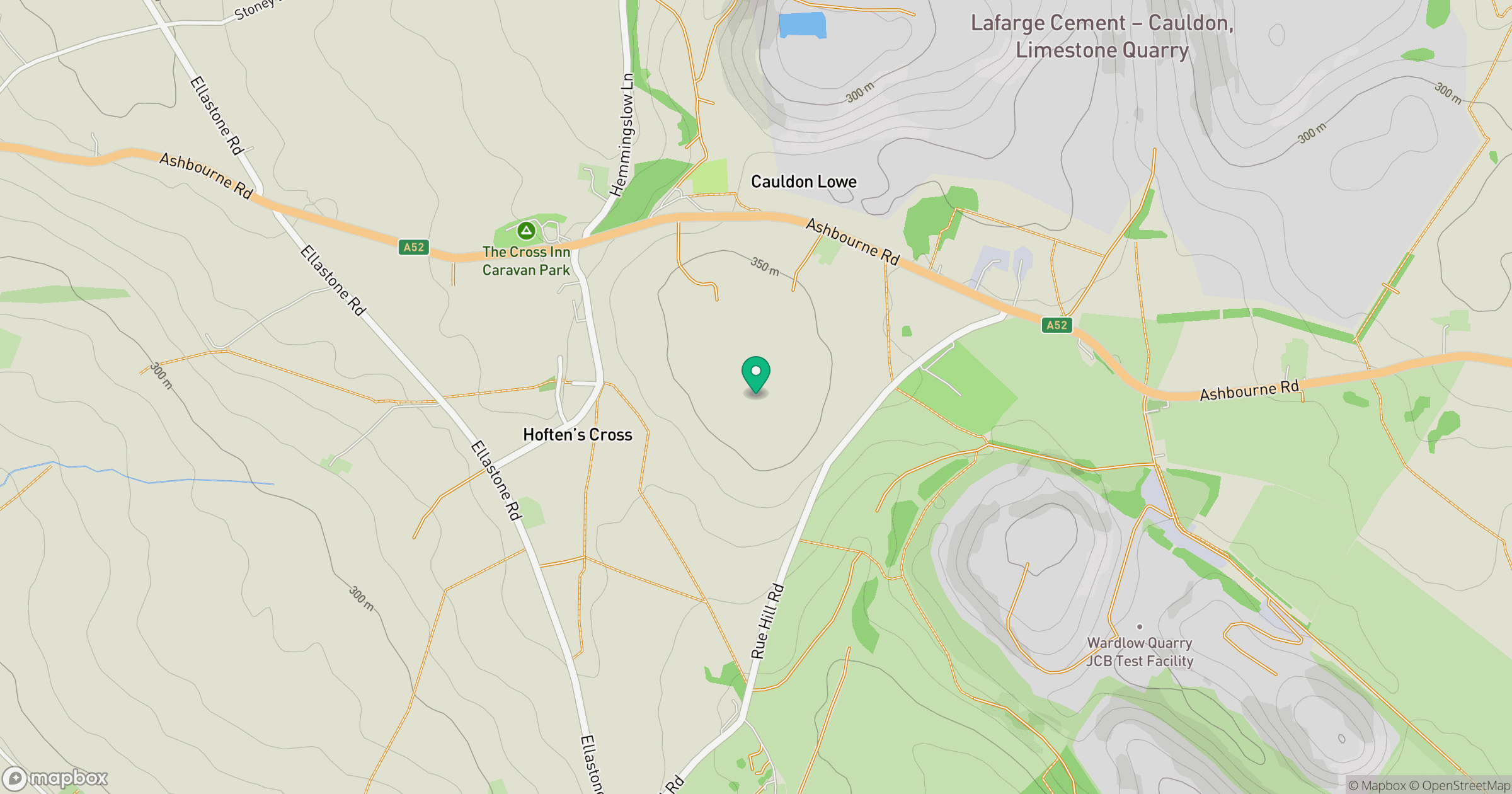
Grid reference: SK076477
View on OpenStreetMapOpens a map in a new tab, centred on the hill.
Nearby Hills
The Roaches
505m

Kinder Scout
636m

The Wrekin
407m
Winter Hill
456m
Rombalds Moor [Ilkley Moor]
402m
No comments yet. Be the first.