

Beinn nan Eachan
Good walks are even better shared.
NN5738 : Drifted snow on Beinn nan Eachan
Doug Lee Photo source
Overview
Beinn nan Eachan: A Jewel in the Scottish Highlands
Nestled in the stunning Scottish Highlands, Beinn nan Eachan stands majestically at 891 meters, providing hikers not only with a challenging ascent but also with breathtaking views.
Geology
The mountain is composed mainly of ancient granite surrounded by layers of schist and gneiss that form an intriguing geological tapestry. As you ascend, take a moment to appreciate the exposed rock faces, which tell a story of Earth's history dating back over 400 million years.
Routes
Northwest Route from Inversnaid is the most popular way up. This picturesque trail winds through the verdant Inversnaid Nature Reserve, where you may encounter diverse flora and fauna. After departing from the forest, the path opens to moorland, making your final push towards the craggy summit well worth the effort.
Summit Features
Upon reaching the summit, you'll be greeted by a sizeable stone cairn and panoramic views that extend far and wide. On a clear day, gaze upon Ben Lomond and the shimmering Loch Lomond – a sight that makes the climb truly worthwhile.
Terrain
The terrain is a mix of rocky outcrops and grassy slopes, with a few boggy patches to keep you on your toes. Good footwear is recommended to negotiate these delightful challenges without losing your footing.
Views
Hikers are treated to some of the best views that Scotland has to offer. From the summit, witness the landscape unfold; famous Ben Lomond to the south and the charming hills of the Trossachs in the distance. The best seasons for views are Spring and early Autumn when the colours burst into life.
Hazards
While the mountain is an exhilarating adventure, it carries with it the risks of sudden weather changes and slippery sections. Always be prepared for a bit of Scottish drizzle!
Nearby Summits
Combine your adventure with nearby peaks like Ben Lomond (974 m) and Beinn Ime (1011 m) for a full day of exploration.
Access
The nearest parking is available at Inversnaid Hotel, which fills up quickly, so early birds may catch the worm here! Public transport options are available but can be limited, so plan accordingly.
Facilities
Facilities are sparse at Inversnaid, with only the hotel offering dining options. Make sure you pack provisions to keep your energy up during the hike!
History
The name Beinn nan Eachan hints at equine history, as it translates to 'mountain of the horses.' Local lore tells of wild horses that once roamed these rugged hills, adding an exciting layer of cultural significance to your hike.
So strap on your boots and get ready to conquer Beinn nan Eachan – an adventure awaits!
Explore routes near Beinn nan Eachan
Walks starting near this hill. Open a route to check its map, distance and full itinerary.
Killin: Falls of Dochart, Finlarig and Moirlanich Longhouse
View route
Kenmore: Drummond Hill Black Rock Trail above Loch Tay
View route
Loch Lubnaig: West Shore Railway Path from Ben Ledi Car Park
View route
Aberfeldy: Glassie Woodland and River Tay Circular
View route
Route planning notes
These notes describe possible approaches. Check a route's map and access information when planning your walk.
Northwest Route from Inversnaid
This route starts at the Inversnaid nature reserve and winds its way up through lush forests before breaking onto the moorland, leading you directly to the summit.
Make a day of it, together
Find someone to share the walk with, or organise a day out along a route you like.
Photo Gallery
View all Photo could not load
NN5738 : Drifted snow on Beinn nan Eachan
Doug Lee
 Photo could not load
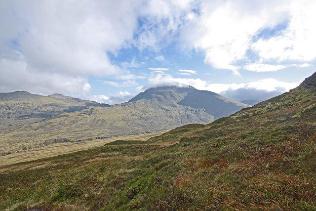
NN5738 : On Beinn nan Eachan looking towards Meall Garbh and Meall nan Tarmachan
Doug Lee
 Photo could not load
NN5638 : First Foot
Adam Ward
 Photo could not load
NN5738 : Small Lochan on Beinn nan Eachan
Iain Lees
 Photo could not load
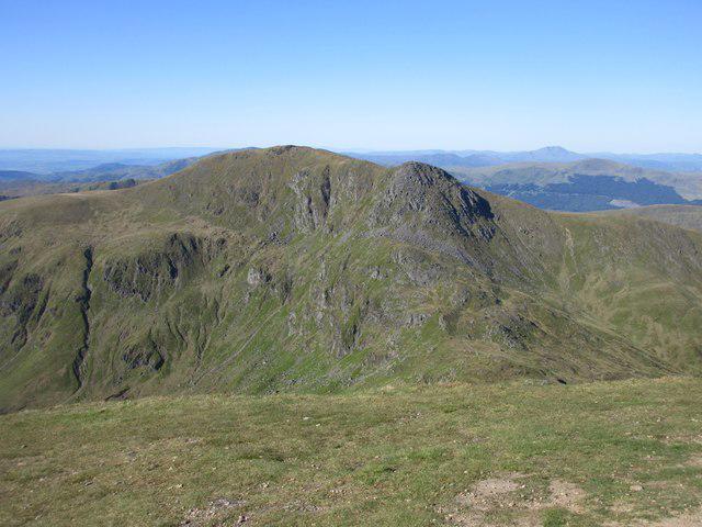
NN5738 : View from the ridge down towards the western end of Loch Tay
Pip Rolls
 Photo could not load
NN5738 : The Summit Cairn on Beinn nan Eachan
Iain Lees
 Photo could not load
NN5738 : The small cairn on Beinn nan Eachan
Iain Lees
 Photo could not load
NN5738 : The Summit Cairn of Beinn nan Eachan
Iain Lees
Hill facts and local notes
Classifications
Elevation
1,000m
3,281 ft
Prominence
90m
Coordinates
56.5156, -4.3253
NN570383
OS Map
51
Explorer: OL48E 378E
At the Summit
The summit features a sizeable rock cairn and stunning panoramic views of the surrounding landscape, with the iconic Loch Lomond just to the south.
Terrain & Geology
Beinn nan Eachan is primarily composed of ancient granite, with some schist and gneiss rock formations that date back over 400 million years. The weathered rock faces reveal fascinating stratifications, making it a photographer's playground.
Views & Scenery
From the summit, you can see the majestic Ben Lomond, the sprawling waters of Loch Lomond, and even, on a clear day, the distant hills of the Trossachs.
History & Heritage
Name Origin
The name Beinn nan Eachan translates to 'mountain of the horses' in Gaelic, likely referencing the area's historical significance for horse breeding.
Historical Significance
Local folklore tells tales of the wild horses that once roamed these hills, adding an air of mystique to your hike.
Getting There & Facilities
Parking
Inversnaid Hotel car park (NN 320 122) has limited spaces and is usually busy, so arrive early to secure a spot.
Public Transport
Buses from central locations like Glasgow run to Inversnaid, but service can be sporadic. Check schedules ahead of time.
Nearby Facilities
Inversnaid has a hotel with dining options, but facilities are limited, so it's wise to pack some snacks and water.
Safety Information
Known Hazards
- Be cautious of sudden weather changes, as conditions can shift rapidly, especially on the summit. Some sections can be slippery, particularly during or after rain.
General Safety Tips
- Check weather conditions before setting out
- Carry appropriate clothing and equipment
- Let someone know your planned route
- Take a map, compass, and GPS device
- Carry emergency supplies: food, water, first aid kit, torch
Hills
Some common questions about the hills answered
Are there group walks up Beinn nan Eachan?
Many walkers use Walkmates to join or organise walks with others. You can check for group walks around Beinn nan Eachan through the maps
Are there other walkers around Beinn nan Eachan?
Activity varies by location and time, but Walkmates lets you see whether others have shared walks or shown interest in this area. Find other people through the walking friends search walking friends for Beinn nan Eachan search or of course create your own walk for Beinn nan Eachan
Can I organise a walk to Beinn nan Eachan?
Yes. If there aren’t any walks listed already, you can create a walk and make it available for others to join.
If you're signed up to Walkmates, you can create a walk to Beinn nan Eachan.
How do I find a walk up this hill?
There are often multiple ways to walk this hill, depending on experience and route preference. Walkmates helps you explore walks and routes that others have shared.
Can I suggest a new route up Beinn nan Eachan?
Yes. You can suggest or create routes to share with others. Walkmates focuses on the social side of walking, so routes are used to help people organise walks and explore areas together, rather than as detailed navigation tools or route libraries.
Other uses really appreciate knowledgeable walkers sharing their routes. Share your favourite route to Beinn nan Eachan here
The is an error or something incorrect about this hill. How do I let you know?
We always strive to keep the information on Walkmates as accurate as possible. If you find an error, please let us know through the contact form and we'll aim to correct it as quickly as possible
Community Discussion
Comments
Location
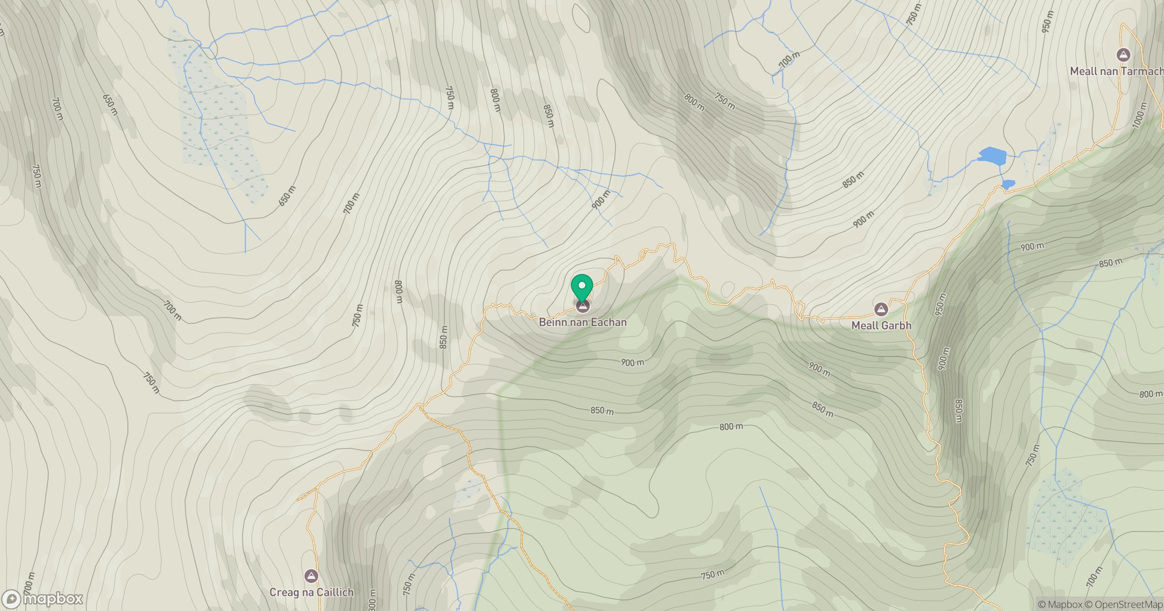
Grid reference: NN570383
View on OpenStreetMapOpens a map in a new tab, centred on the hill.
No comments yet. Be the first.