

Beinn Mhanach
Good walks are even better shared.
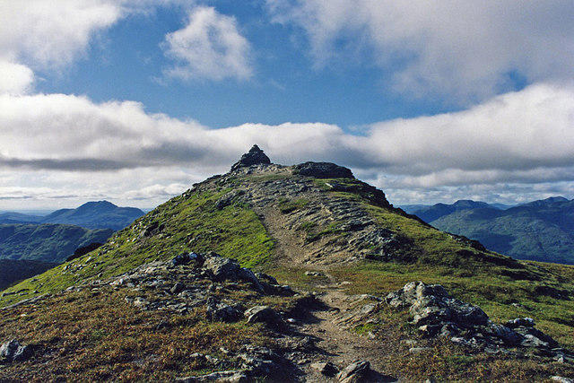
NN3741 : View towards Beinn Achaladair from Beinn Mhanach
Nigel Brown Photo source
Overview
Beinn Mhanach
Elevation: 936 meters (Mountaineering level – one happy chap!)
Nestled within the heart of the Scottish Highlands, Beinn Mhanach stands proudly as a Munro, beckoning hikers with its challenge and rewarding views. The mountain’s elevation of 936 meters makes it a popular target for enthusiasts looking to tick another peak off their list.
Geology
Beinn Mhanach is primarily composed of granite, which provides a robust foundation for the rocky terrain. You might stumble across schist and gneiss as you hike, giving you a mini geology lesson along the way! The formation of this stunning landscape can be traced back to ancient glacial activity, having sculpted the Highlands into their current rugged beauty.
Routes
The most frequented route to the summit starts from the Bridge of Orchy. This pleasant trail winds through varied environments, including delightful grassy slopes and challenging rocky patches. Expect to cover approximately 14.5 km which takes about 5 hours; pack a snack for the journey! Don’t worry, it’s not the slopes of Everest—though you can feel like a champion at the top!
Summit Features
The summit greets you with a substantial cairn, which is not only a great spot to take in the panoramic views but also a perfect place to catch your breath after the ascent. Don’t forget to capture your* ‘I made it!’ moment with the trig point standing sentinel nearby.
Terrain Type
The terrain consists of rocky paths interspersed with blissful grassy areas, but watch out for the boggy sections, especially if it’s been raining. Those muddy patches have a reputation for turning the unprepared hiker into a soggy sock!
Views
Take a moment on a clear day to absorb the unbeatable vistas of Rannoch Moor and the surrounding Black Mount hills. Each season dresses the landscape in new colours, but spring and early autumn are truly the best times to visit for optimal views.
Hazards
As with many Highland hikes, watch out for mischievous boggy areas that can take your foot for a surprise dip! The weather is notorious for quick changes, so be ready for anything – even a cheeky rain shower.
Nearby Summits
Make your way to Meall a' Bhuiridh, another stunning peak at 1108 meters nearby, for even more breathtaking panoramas.
Access
Driving to Beinn Mhanach is best with parking available at the Bridge of Orchy. If you’re relying on public transport, buses run from nearby towns such as Crianlarich and Tyndrum, getting you to your mountainous adventure with ease.
Facilities
Facilities may be limited in the area, but the Bridge of Orchy Hotel offers food and drink, as well as resting facilities – just check those opening hours if you're planning on a late return!
History
‘Beinn Mhanach’ translates beautifully to the 'Mountain of the Monk,' offering a tantalising glimpse into the cultural significance of this area. Hikers not only conquer a physical challenge but also step into a rich tapestry of Scottish history.
In summary, Beinn Mhanach is a rewarding peak for those seeking adventure in the Scottish Highlands. Prepare well, pack your spirit of adventure, and don’t forget to stop and have a look around – even if it’s just to enjoy a gentle moan over how steep that last bit was!
Happy hiking!
Explore routes near Beinn Mhanach
Walks starting near this hill. Open a route to check its map, distance and full itinerary.
Killin: Falls of Dochart, Finlarig and Moirlanich Longhouse
View route
Loch Katrine: Brenachoile Point Shore Walk from Trossachs Pier
View route
The Cobbler from Succoth Carpark
View route
Beinn Ime from Succoth
View route
Route planning notes
These notes describe possible approaches. Check a route's map and access information when planning your walk.
From the Bridge of Orchy
A well-trodden route starting from the Bridge of Orchy, taking you through scenic landscapes to the summit of Beinn Mhanach.
Make a day of it, together
Find someone to share the walk with, or organise a day out along a route you like.
Photo Gallery
View all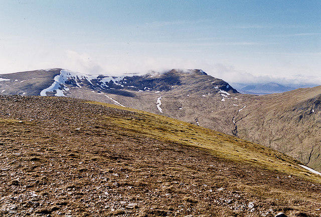 Photo could not load
NN3741 : View towards Beinn Achaladair from Beinn Mhanach
Nigel Brown
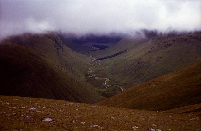 Photo could not load
NN3741 : View from summit cairn on Beinn Mhanach
Russel Wills
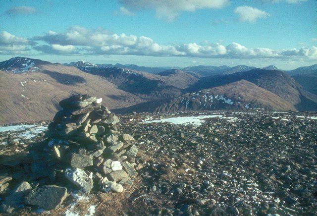 Photo could not load
NN3741 : Beinn Mhanach summit
Alan Reid
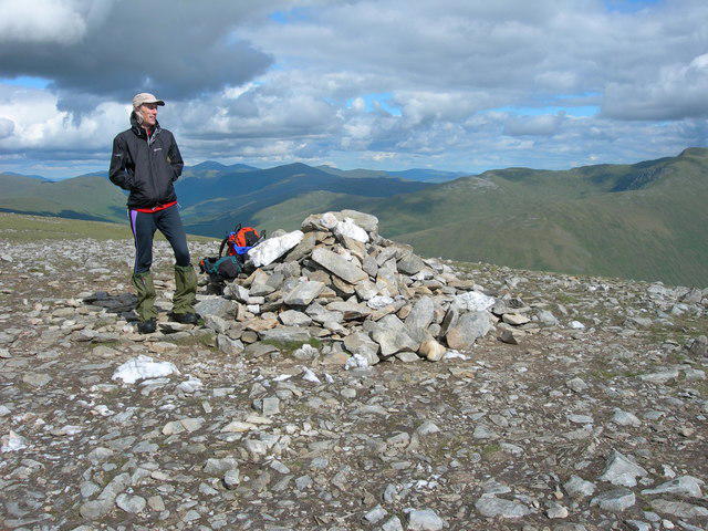 Photo could not load
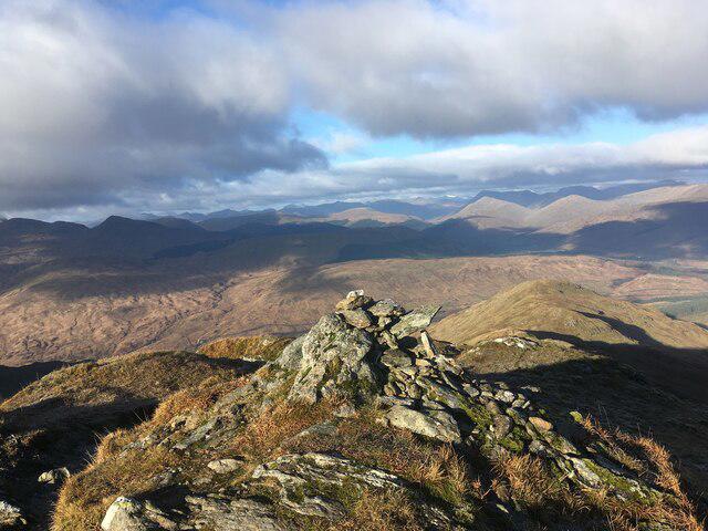
NN3741 : Summit cairn of Beinn Mhanach
Mike Hutchinson
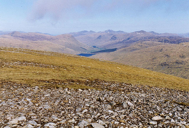 Photo could not load
NN3741 : View east from Beinn Mhanach
Nigel Brown
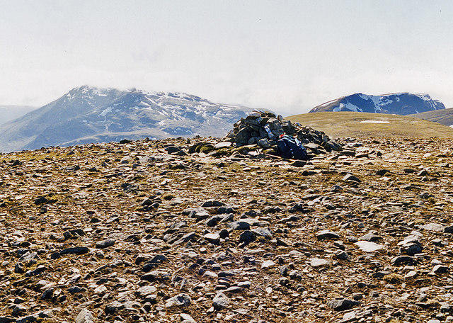 Photo could not load
NN3741 : Beinn Mhanach summit cairn
Nigel Brown
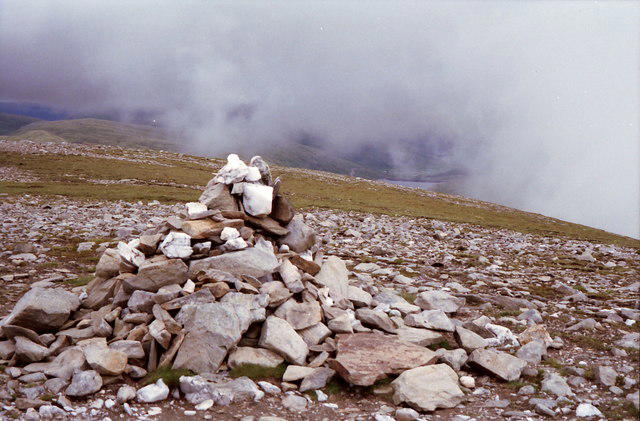 Photo could not load
NN3741 : Summit cairn on Beinn Mhanach
Russel Wills
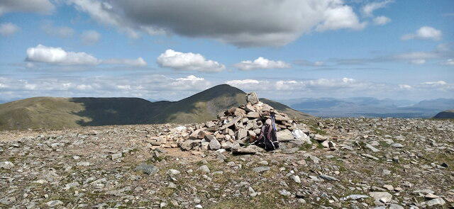 Photo could not load
NN3741 : Summit of Beinn Mhanach
Iain Russell
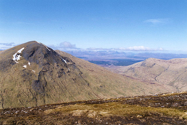 Photo could not load
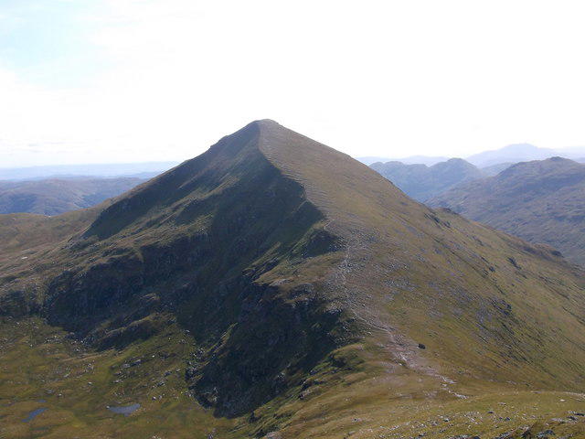
NN3741 : View north northeast from Beinn Mhanach
Nigel Brown
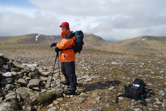
NN3741 : Summit Cairn of Beinn Mhanach
John Chroston
Hill facts and local notes
Classifications
Elevation
952m
3,125 ft
Prominence
315m
Coordinates
56.5340, -4.6460
NN373411
OS Map
50
Explorer: OL48W 377E 378W
At the Summit
The summit is marked by a large stone cairn, offering a prime spot for hikers to rest and admire the views. There’s also a small trig point, perfect for that all-important summit selfie.
Terrain & Geology
Primarily composed of granite, with significant areas of schist and gneiss. Beinn Mhanach showcases the typical rugged geology of the Scottish Highlands, formed through ancient glacial activity.
Views & Scenery
On clear days, views extend across the Rannoch Moor and the distant peaks of the Black Mount range. The sight of the neighbouring hills is nothing short of spectacular.
History & Heritage
Name Origin
The name 'Beinn Mhanach' translates to 'Mountain of the Monk' in Gaelic, hinting at the area's rich history and landscape.
Historical Significance
Beinn Mhanach has historically been a beloved spot for both locals and tourists, celebrated for its stunning views and the exhilarating nature of the ascent.
Getting There & Facilities
Parking
There is parking available at the Bridge of Orchy, which is the main starting point for the hike. Ensure you park responsibly.
Public Transport
Regular bus services operate from nearby towns such as Crianlarich and Tyndrum.
Nearby Facilities
Facilities in Bridge of Orchy are limited; however, there is a hotel that offers meals and refreshments. Toilets are available at the hotel but check opening hours.
Safety Information
Known Hazards
- Slick and boggy areas, especially after rain. The weather can change rapidly in the Highlands, so prepare for all seasons in one day!
General Safety Tips
- Check weather conditions before setting out
- Carry appropriate clothing and equipment
- Let someone know your planned route
- Take a map, compass, and GPS device
- Carry emergency supplies: food, water, first aid kit, torch
Hills
Some common questions about the hills answered
Are there group walks up Beinn Mhanach?
Many walkers use Walkmates to join or organise walks with others. You can check for group walks around Beinn Mhanach through the maps
Are there other walkers around Beinn Mhanach?
Activity varies by location and time, but Walkmates lets you see whether others have shared walks or shown interest in this area. Find other people through the walking friends search walking friends for Beinn Mhanach search or of course create your own walk for Beinn Mhanach
Can I organise a walk to Beinn Mhanach?
Yes. If there aren’t any walks listed already, you can create a walk and make it available for others to join.
If you're signed up to Walkmates, you can create a walk to Beinn Mhanach.
How do I find a walk up this hill?
There are often multiple ways to walk this hill, depending on experience and route preference. Walkmates helps you explore walks and routes that others have shared.
Can I suggest a new route up Beinn Mhanach?
Yes. You can suggest or create routes to share with others. Walkmates focuses on the social side of walking, so routes are used to help people organise walks and explore areas together, rather than as detailed navigation tools or route libraries.
Other uses really appreciate knowledgeable walkers sharing their routes. Share your favourite route to Beinn Mhanach here
The is an error or something incorrect about this hill. How do I let you know?
We always strive to keep the information on Walkmates as accurate as possible. If you find an error, please let us know through the contact form and we'll aim to correct it as quickly as possible
Community Discussion
Comments
Location
View the hill's mapped position and surrounding paths.
Grid reference: NN373411
View on OpenStreetMapOpens a map in a new tab, centred on the hill.
No comments yet. Be the first.