
Ben Vorlich
Good walks are even better shared.
Overview
Ben Vorlich above Loch Lomond
This 942.8 m Munro stands between Loch Lomond and Loch Sloy in the Arrochar Alps. It is DoBIH hill 71, distinct from the 985.3 m Ben Vorlich beside Loch Earn. Ardvorlich and Stùc a’ Chròin belong to that other mountain’s routes.
Route and summit
The described walk starts and finishes at Inveruglas visitor-centre car park. Its 13.5 km and 945 m ascent cover the complete return via the hydro road and steep Lag Dubh path; Walkhighlands gives 5–6.5 hours. Cross the A82 carefully, follow the road approach towards Loch Sloy, and leave it for the steep path before the dam. Retrace the same route after visiting the summit.
The highest point is a cairn on a rocky outcrop at NN2951312467. The trig point at NN2958512300 is lower, approximately 150 m southeast according to DoBIH. Do not stop at the trig if you intend to reach the recorded summit. A descent to Ardlui or Stuckendroin would end elsewhere and needs separate planning.
Landscape and history
Dalradian schist and base-rich outcrops support the protected hill’s montane plant communities. In clear conditions the outlook includes Loch Lomond and its islands, neighbouring Arrochar peaks and Ben Lui. The National Park gives the name’s meaning as “Hill of the Bay”.
The approach also passes the Sloy hydroelectric infrastructure. Water travels beneath Ben Vorlich from Loch Sloy to the power station at Inveruglas, which has operated since 1950.
Access and conditions
Good lower tracks give way to a very steep ascent and a broad rocky ridge. Prepare for mountain weather and poor visibility, and take care on wet or icy ground. Respect conservation interests and current land-management signs.
Inveruglas has charged parking and listed café and toilet facilities; check current opening. Bus services are listed for Inveruglas, but confirm the stop and return timetable. Arrochar provides wider village services. No Loch Earn start or route metrics apply to this hill.
Explore routes near Ben Vorlich
Walks starting near this hill. Open a route to check its map, distance and full itinerary.
Beinn Ime from Succoth
View route
The Cobbler from Succoth Carpark
View route
Ben Lomond in the trossachs
View route
Loch Katrine: Brenachoile Point Shore Walk from Trossachs Pier
View route
Route planning notes
These notes describe possible approaches. Check a route's map and access information when planning your walk.
Ben Vorlich (Loch Lomond) from Inveruglas via Loch Sloy
Start and finish at Inveruglas visitor-centre car park (NN322098). Carefully cross the A82, follow the off-road approach past the power station, then the gated road under the railway towards Loch Sloy. About a kilometre before the dam, take the steep mountain path on the right through Lag Dubh to the rocky ridge. Continue past the lower trig point to the cairn on the rocky outcrop at NN2951312467, the recorded summit; DoBIH places the trig 150m southeast. Retrace the ridge, steep ascent path and hydro-road approach to Inveruglas. Published full-return figures: 13.5 km and 945 m ascent; allow 5–6.5 hours. Ardlui and Stuckendroin descents finish elsewhere and are not part of these figures.
Make a day of it, together
Find someone to share the walk with, or organise a day out along a route you like.
Hill facts and local notes
Classifications
Elevation
943m
3,093 ft
Prominence
632m
Coordinates
56.2740, -4.7551
NN295124
OS Map
50 56
Explorer: OL39N OL39S 364N 364S
At the Summit
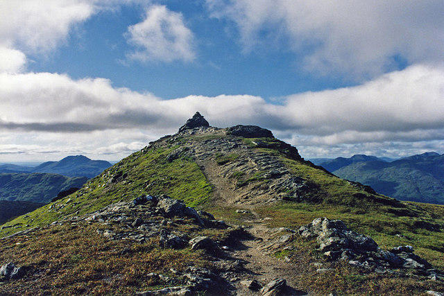
A cairn on a rocky outcrop at NN2951312467 is the recorded summit. It is higher than the trig point 150m southeast at NN2958512300.
Terrain & Geology
Ben Vorlich’s Loch Lomond SSSI includes Dalradian schist and base-rich outcrops supporting montane plant communities. The former Old Red Sandstone description was not supported for this mountain.
Views & Scenery
Views over Loch Lomond and its islands, the Arrochar Alps and north towards Ben Lui, in clear conditions.
History & Heritage
Name Origin
The National Park interprets Ben Vorlich as “Hill of the Bay”, referring to its Loch Lomond setting. There is another Ben Vorlich beside Loch Earn.
Historical Significance
Water from Loch Sloy passes through a tunnel beneath Ben Vorlich to Sloy power station at Inveruglas. The station has generated hydroelectricity since 1950.
Getting There & Facilities
Parking
Inveruglas visitor-centre car park on the A82 beside Loch Lomond (NN322098), the start and finish of the described route. Parking charges apply; check current signs and keep operational access clear.
Public Transport
Walkhighlands lists Glasgow–Fort William buses stopping at Inveruglas; the National Park also lists a bus stop there. Verify that your chosen service stops and check the return timetable before travelling. Ardlui rail or coach approaches are different itineraries.
Nearby Facilities
The National Park lists a café, public toilets including accessible provision, parking and picnic space at Inveruglas. Check current opening arrangements before relying on them.
Safety Information
Known Hazards
- Cross the busy A82 carefully at the Inveruglas approach.
- The mountain path is very steep and the summit ridge rocky; wet or icy ground increases the risk of a slip.
- Carry suitable navigation, clothing and equipment for exposed mountain conditions and poor visibility.
- The trig point is lower than the recorded summit. Descents to Ardlui or Stuckendroin do not return to Inveruglas.
General Safety Tips
- Check weather conditions before setting out
- Carry appropriate clothing and equipment
- Let someone know your planned route
- Take a map, compass, and GPS device
- Carry emergency supplies: food, water, first aid kit, torch
Hills
Some common questions about the hills answered
Are there group walks up Ben Vorlich?
Many walkers use Walkmates to join or organise walks with others. You can check for group walks around Ben Vorlich through the maps
Are there other walkers around Ben Vorlich?
Activity varies by location and time, but Walkmates lets you see whether others have shared walks or shown interest in this area. Find other people through the walking friends search walking friends for Ben Vorlich search or of course create your own walk for Ben Vorlich
Can I organise a walk to Ben Vorlich?
Yes. If there aren’t any walks listed already, you can create a walk and make it available for others to join.
If you're signed up to Walkmates, you can create a walk to Ben Vorlich.
How do I find a walk up this hill?
There are often multiple ways to walk this hill, depending on experience and route preference. Walkmates helps you explore walks and routes that others have shared.
Can I suggest a new route up Ben Vorlich?
Yes. You can suggest or create routes to share with others. Walkmates focuses on the social side of walking, so routes are used to help people organise walks and explore areas together, rather than as detailed navigation tools or route libraries.
Other uses really appreciate knowledgeable walkers sharing their routes. Share your favourite route to Ben Vorlich here
The is an error or something incorrect about this hill. How do I let you know?
We always strive to keep the information on Walkmates as accurate as possible. If you find an error, please let us know through the contact form and we'll aim to correct it as quickly as possible
Community Discussion
Comments
Location
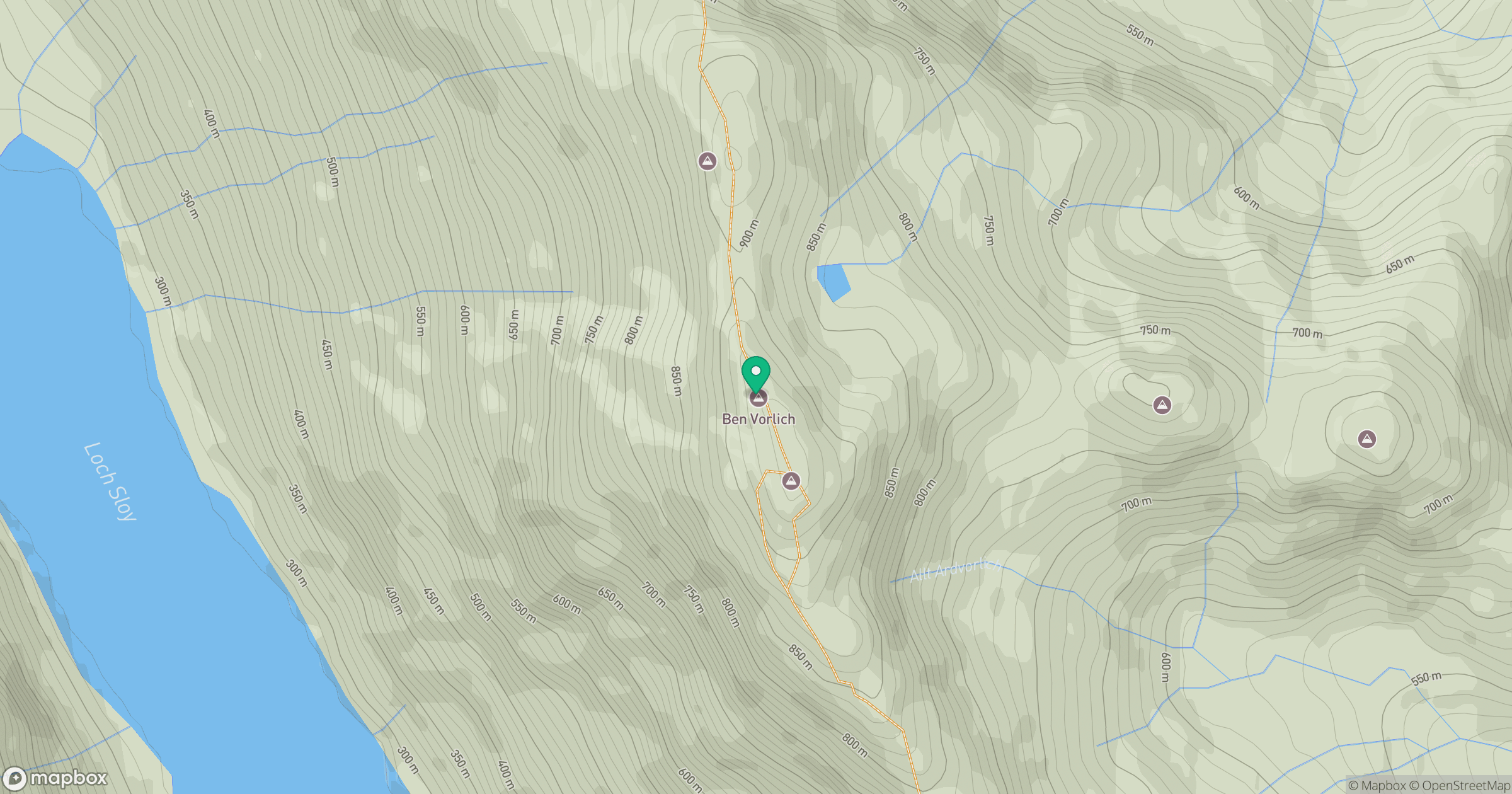
Grid reference: NN295124
View on OpenStreetMapOpens a map in a new tab, centred on the hill.
![The Cobbler [Ben Arthur]](https://cdn.walkmates.com/gallery-images/a1b697040769474a8338b3fb586ebc7a.jpg)
No comments yet. Be the first.