

Beinn Dubh an Iaruinn
Good walks are even better shared.
Overview
Beinn Dubh an Iaruinn
Beinn Dubh an Iaruinn, standing tall at 709 meters, is a captivating component of the Scottish Highlands. Its ancient geology of Lewisian gneiss whispers tales from aeons past, and adventurers today can’t help but be enchanted by its beauty.
Getting There
The nearest parking can be found just off the A87 road at a small layby. It's a convenient spot to leave your vehicle before setting off on your adventure. Don’t forget to grab a snack for the journey!
If you're counting on public transport, your best bet is to make your way to Kyle of Lochalsh. Buses run accordingly, but they might not be the clockwork trains you hoped for.
The Ascent
The East Ridge Route is perhaps the most popular path to the summit. It covers a distance of about 5 km and, depending on how much you fancy stopping for snacks or selfies, it can usually be conquered in about 3 hours. While it starts off fairly gentle, don’t let your guard down; the final push involves a steep climb. Keep your senses sharp and your pace steady!
The Summit Experience
At the top, you’re welcomed by a delightful cairn where weary trekkers can rest their legs. As you gaze across the landscape, prepare to have your breath taken away by sweeping views of the Kintail mountains and Loch Duich. It’s an Instagrammer's paradise, so make sure your phone is fully charged.
Terrain and Hazards
The terrain consists of rocky outcrops interspersed with soft grassy sections. Be wary of the boggy patches, as they can sneak up on you and turn your hike into an accidental splashing match. Weather in the hills can be as unpredictable as a cat on a hot tin roof, so be prepared for changing conditions.
Nearby Explorations
If you’re in the mood for more adventure, consider climbing nearby summits such as Moruisg (928 m) or Beinn Fhada (917 m). They promise rustic landscapes and tranquility – just keep your compass handy!
Conclusion
Beinn Dubh an Iaruinn is a delightful mountain, combining adventure, stunning views, and a sprinkle of history. When you head out, don’t forget to protect the mountain by leaving no trace and taking only photos. Happy hiking!
Explore routes near Beinn Dubh an Iaruinn
Public walks starting within 80 km of this hill. Nearby does not mean a route reaches the summit; check its map and access before setting out.
Glen Affric: Coire Loch Woodland Trail
View route
Loch Affric full circuit from River Affric
View route
Beinn Eighe Lancaster Wreckage at Coire Mhic Fhearchair
View route
Great Glen Way low route: Fort Augustus to Invermoriston Old Bridge
View route
Route planning notes
These notes describe possible approaches, not verified navigable routes or permission to cross land. Check current paths, local access rules and conditions before setting out.
East Ridge Route
This route approaches the summit from the east, offering a gentle ascent followed by a steep climb to the summit.
Make a day of it, together
Find someone to share the walk with, or organise a day out along a route you like.
Photo Gallery
View all Photo could not load
NH1839 : Beinn Dubh an Iaruinn
Richard Webb
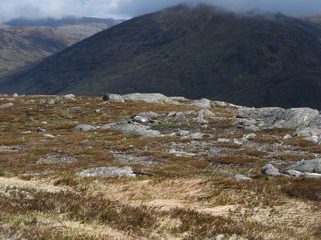 Photo could not load
NH1839 : Beinn Dubh an Iaruinn
Richard Webb
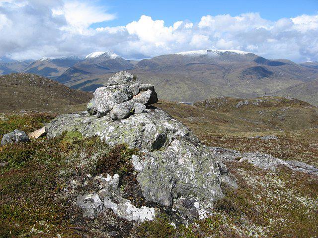 Photo could not load
NH1839 : Beinn Dubh an Iaruinn
Richard Webb
Hill facts and local notes
Classifications
Elevation
591m
1,939 ft
Prominence
240m
Coordinates
57.4069, -5.0274
NH182392
OS Map
25
Explorer: 430
At the Summit
The summit features a modest cairn, which is a perfect resting spot for hikers to catch their breath and take in the breathtaking views.
Terrain & Geology
Beinn Dubh an Iaruinn is primarily composed of ancient Lewisian gneiss, a rock type that dates back over 3 billion years. This rugged geology contributes to the mountain's stunning crags and dramatic scenery.
Views & Scenery
From the summit, enjoy panoramic views of the surrounding mountains, including the impressive peaks of the Kintail range and the shimmering waters of Loch Duich.
History & Heritage
Name Origin
The name 'Beinn Dubh an Iaruinn' translates to 'The Black Mountain of the Iron', possibly due to its dark rocky features.
Historical Significance
This mountain has local cultural significance, often featured in folklore and tales of the region.
Getting There & Facilities
Check current local access restrictions, parking rules and transport timetables before travelling. These notes do not confirm public access to the summit.
Parking
There is a small car park near the base of the hill, just off the A87 road, which is suitable for several vehicles.
Public Transport
While public transport options are limited, there are bus services that run to the nearby town of Kyle of Lochalsh.
Nearby Facilities
The nearest facilities, including cafes and toilets, can be found in Kyle of Lochalsh, with a selection of shops and eateries for your post-hike refreshments.
Safety Information
Known Hazards
- Loose rocks, sudden weather changes, and boggy ground can pose risks, so it is wise to tread carefully and be prepared.
General Safety Tips
- Check weather conditions before setting out
- Carry appropriate clothing and equipment
- Let someone know your planned route
- Take a map, compass, and GPS device
- Carry emergency supplies: food, water, first aid kit, torch
Hills
Some common questions about the hills answered
Are there group walks up Beinn Dubh an Iaruinn?
Many walkers use Walkmates to join or organise walks with others. You can check for group walks around Beinn Dubh an Iaruinn through the maps
Are there other walkers around Beinn Dubh an Iaruinn?
Activity varies by location and time, but Walkmates lets you see whether others have shared walks or shown interest in this area. Find other people through the walking friends search walking friends for Beinn Dubh an Iaruinn search or of course create your own walk for Beinn Dubh an Iaruinn
Can I organise a walk to Beinn Dubh an Iaruinn?
Yes. If there aren’t any walks listed already, you can create a walk and make it available for others to join.
If you're signed up to Walkmates, you can create a walk to Beinn Dubh an Iaruinn.
How do I find a walk up this hill?
There are often multiple ways to walk this hill, depending on experience and route preference. Walkmates helps you explore walks and routes that others have shared.
Can I suggest a new route up Beinn Dubh an Iaruinn?
Yes. You can suggest or create routes to share with others. Walkmates focuses on the social side of walking, so routes are used to help people organise walks and explore areas together, rather than as detailed navigation tools or route libraries.
Other uses really appreciate knowledgeable walkers sharing their routes. Share your favourite route to Beinn Dubh an Iaruinn here
The is an error or something incorrect about this hill. How do I let you know?
We always strive to keep the information on Walkmates as accurate as possible. If you find an error, please let us know through the contact form and we'll aim to correct it as quickly as possible
Community Discussion
Comments
Location
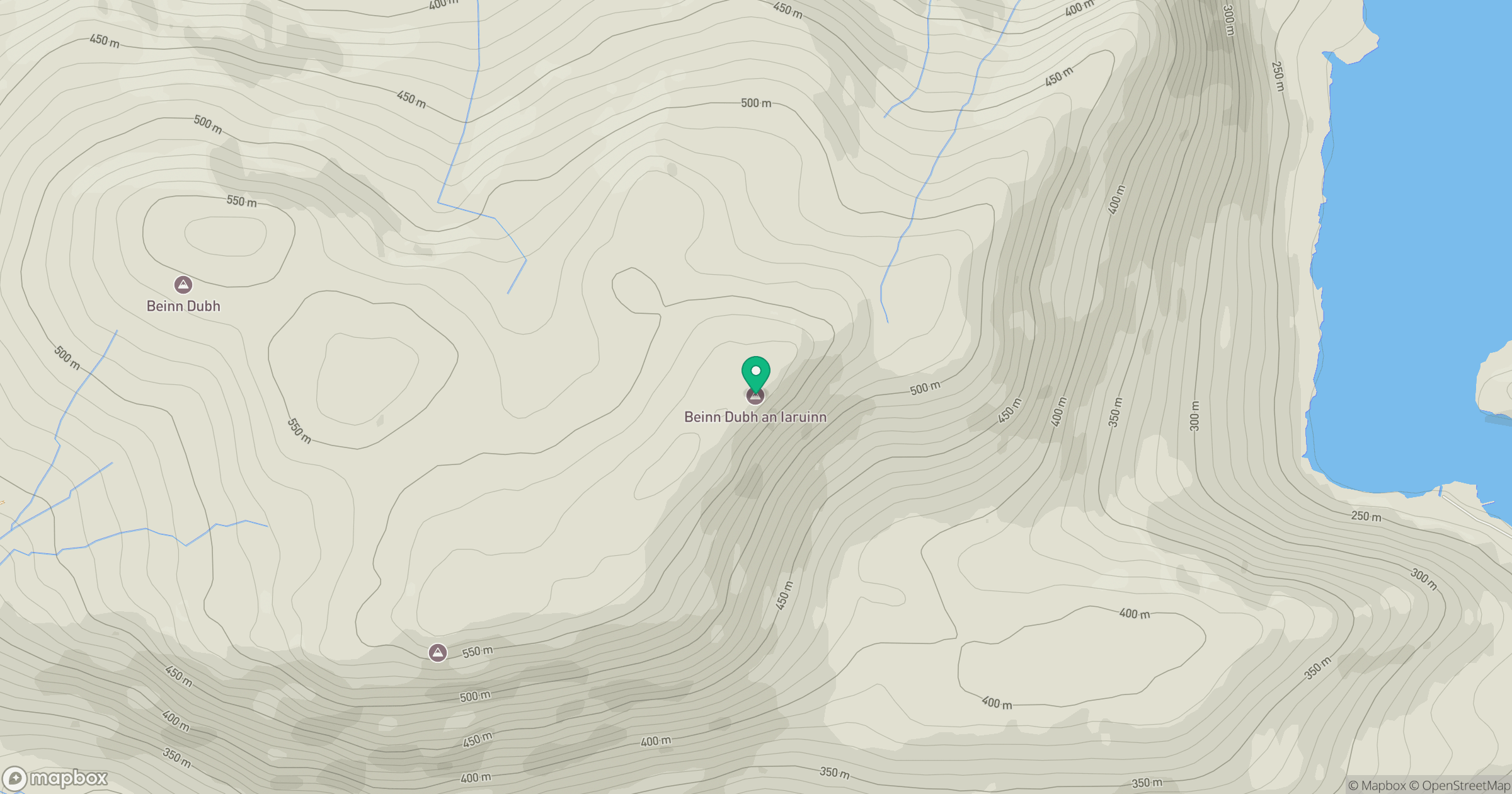
Grid reference: NH182392
View on OpenStreetMapOpens a map in a new tab, centred on the hill.
Hills within 30 km
Straight-line distance, not a walking route or confirmation of access.
Sgurr a' Choire Ghlais
1,084m
Carn Eighe
1,183m
Mam Sodhail
1,179m
Beinn Eighe - Spidean Coire nan Clach
993m
Cul Mor
393m
No comments yet. Be the first.