
Sgurr na Lapaich
Good walks are even better shared.
Overview
Sgurr na Lapaich: A Munro Worth Climbing
Nestled in the stunning Scottish Highlands, Sgurr na Lapaich stands tall at 1158 meters, making it one of the cherished Munros that call this rugged terrain home. Its rugged beauty and accessible routes make it a must-visit for those tackling the Munro challenge.
Geology
Sgurr na Lapaich is primarily composed of Lewisian Gneiss, one of the oldest rock types in the UK, formed billions of years ago. The rock adds resilience and offers climbers a fascinating insight into Scotland’s geological history. Trust me, geology might not sound like a barrel of laughs, but there’s something wonderfully ancient and profound about walking atop rocks that have endured the test of time.
Routes
The most popular route is the North-East Ridge Route, a moderate climb of around 10 km. This pathway allows you to admire panoramic views as you ascend, making every step feel full of purpose. It generally takes about 4 hours to reach the summit, so it's not exactly a stroll in the park, but you won’t need specialist climbing gear either—just a decent pair of boots and some enthusiasm.
Summit Features
At the summit, you'll be greeted by a hefty stone cairn, a spot perfect for snapping a photo or catching your breath. The views stretch far and wide, encompassing peaks and valleys that are legendary in hiking lore... or at least, they would be if they talked. Bring a buddy to share the experience, or else your surprised gasps at the scenery may seem a tad dramatic on your own!
Terrain Type
The terrain is predominantly rocky, with scattered grassy slopes. Be prepared for boggy patches, especially after a rainy spell; it's Scotland we're talking about! Your feet will appreciate sturdy footwear, and you might need to channel your inner amphibian at times.
Views
The views from Sgurr na Lapaich are nothing short of breathtaking. Highlights include the majestic An Teallach and the scenic Loch Monar. The best times to enjoy these vistas tend to be late spring through early autumn, with early mornings serving up a peaceful serenity that’s hard to beat.
Hazards
As with many Highlands adventures, watch for sudden weather changes. A sunny morning can quickly morph into a windy downpour, and with some boggy areas underfoot, a bit of caution is warranted. Always check the local weather forecast and dress accordingly!
Nearby Summits
If you're feeling ambitious, nearby summits include Sgurr na Fhidhleir (1070 m) and Aonach Meadhoin (1115 m). They make lovely additions to your Munro-bagging journey!
Access
Parking is limited but must be done responsibly at the end of the public road by Loch Monar. Unfortunately, the area is fairly remote with scant public transport options, so bringing a car will enhance your adventure considerably. The quaint town of Beauly offers some pre- or post-hike amenities.
Facilities
There are no toilets or cafes at the mountain, but Beauly, 25 km to the south, has plenty of options to refresh and refuel after your adventure.
History
The name 'Sgurr na Lapaich' translates to 'peak of the spider' in Gaelic—an intriguing moniker that may conjure a variety of images, including that one person in your hiking group who always seems to find their way into the web of mountain lore. It’s a peak of cultural significance as a Munro, celebrated by hikers eager to conquer Scotland's heights.
Grab your gear, lace up those boots, and prepare for an exhilarating journey. Sgurr na Lapaich awaits, ready to share its charm and challenge!
Explore routes near Sgurr na Lapaich
Walks starting near this hill. Open a route to check its map, distance and full itinerary.
Glen Affric: Coire Loch Woodland Trail
View route
Beinn Eighe Lancaster Wreckage at Coire Mhic Fhearchair
View route
Fort Augustus to Kytra Lock: Caledonian Canal Towpath
View route
Fairy Lochs Liberator Wreckage Circuit
View route
Route planning notes
These notes describe possible approaches. Check a route's map and access information when planning your walk.
North-East Ridge Route
A popular and straightforward ascent that begins from the north-east ridge, offering panoramic views as you climb.
Make a day of it, together
Find someone to share the walk with, or organise a day out along a route you like.
Hill facts and local notes
Classifications
Elevation
1,152m
3,779 ft
Prominence
841m
Coordinates
57.3693, -5.0597
NH161351
OS Map
25
Explorer: 430
At the Summit
The summit features a large stone cairn and stunning panoramic views over the surrounding mountains and landscape. If you're lucky, you might even find fellow hikers sharing tales of their adventures, provided you don't scare them away with your best (or worst) jokes.
Terrain & Geology
Sgurr na Lapaich is primarily composed of Lewisian Gneiss, one of the oldest rock types in the UK, formed over 2.5 billion years ago. This ancient rock provides a rugged and resilient landscape, characteristic of the Highlands.
Views & Scenery
From the summit, you can see the iconic peaks of An Teallach, the distant Fannichs and the beautiful Loch Monar. It's the perfect spot for your 'Instagram moment' or just to stare in awe at nature's handiwork.
History & Heritage
Name Origin
The name 'Sgurr na Lapaich' translates from Gaelic to 'peak of the spider', possibly referring to the mountain's shape or an abundance of eight-legged arachnids—feel free to leave those at home!
Historical Significance
As a Munro, Sgurr na Lapaich holds a place of pride among climbers and outdoor enthusiasts, marking it as a top achievement for hillwalkers in Scotland.
Getting There & Facilities
Parking
There is limited roadside parking available near the base of the trail, specifically at the end of the public road leading to Loch Monar. Be mindful of local parking regulations to avoid fines.
Public Transport
Unfortunately, public transport to this remote area is limited. The nearest bus stop is many miles away, in the village of Garve, so a car is recommended.
Nearby Facilities
While there are no facilities directly on the mountain, Beauly offers several cafes and a public toilet, so plan your visit accordingly.
Safety Information
Known Hazards
- Beware of sudden weather changes typical of the Highlands, which can turn a sunny this-looks-promising day into a misty challenge. Wet and boggy ground is also to be expected, so proper footwear is a must.
General Safety Tips
- Check weather conditions before setting out
- Carry appropriate clothing and equipment
- Let someone know your planned route
- Take a map, compass, and GPS device
- Carry emergency supplies: food, water, first aid kit, torch
Hills
Some common questions about the hills answered
Are there group walks up Sgurr na Lapaich?
Many walkers use Walkmates to join or organise walks with others. You can check for group walks around Sgurr na Lapaich through the maps
Are there other walkers around Sgurr na Lapaich?
Activity varies by location and time, but Walkmates lets you see whether others have shared walks or shown interest in this area. Find other people through the walking friends search walking friends for Sgurr na Lapaich search or of course create your own walk for Sgurr na Lapaich
Can I organise a walk to Sgurr na Lapaich?
Yes. If there aren’t any walks listed already, you can create a walk and make it available for others to join.
If you're signed up to Walkmates, you can create a walk to Sgurr na Lapaich.
How do I find a walk up this hill?
There are often multiple ways to walk this hill, depending on experience and route preference. Walkmates helps you explore walks and routes that others have shared.
Can I suggest a new route up Sgurr na Lapaich?
Yes. You can suggest or create routes to share with others. Walkmates focuses on the social side of walking, so routes are used to help people organise walks and explore areas together, rather than as detailed navigation tools or route libraries.
Other uses really appreciate knowledgeable walkers sharing their routes. Share your favourite route to Sgurr na Lapaich here
The is an error or something incorrect about this hill. How do I let you know?
We always strive to keep the information on Walkmates as accurate as possible. If you find an error, please let us know through the contact form and we'll aim to correct it as quickly as possible
Community Discussion
Comments
Location
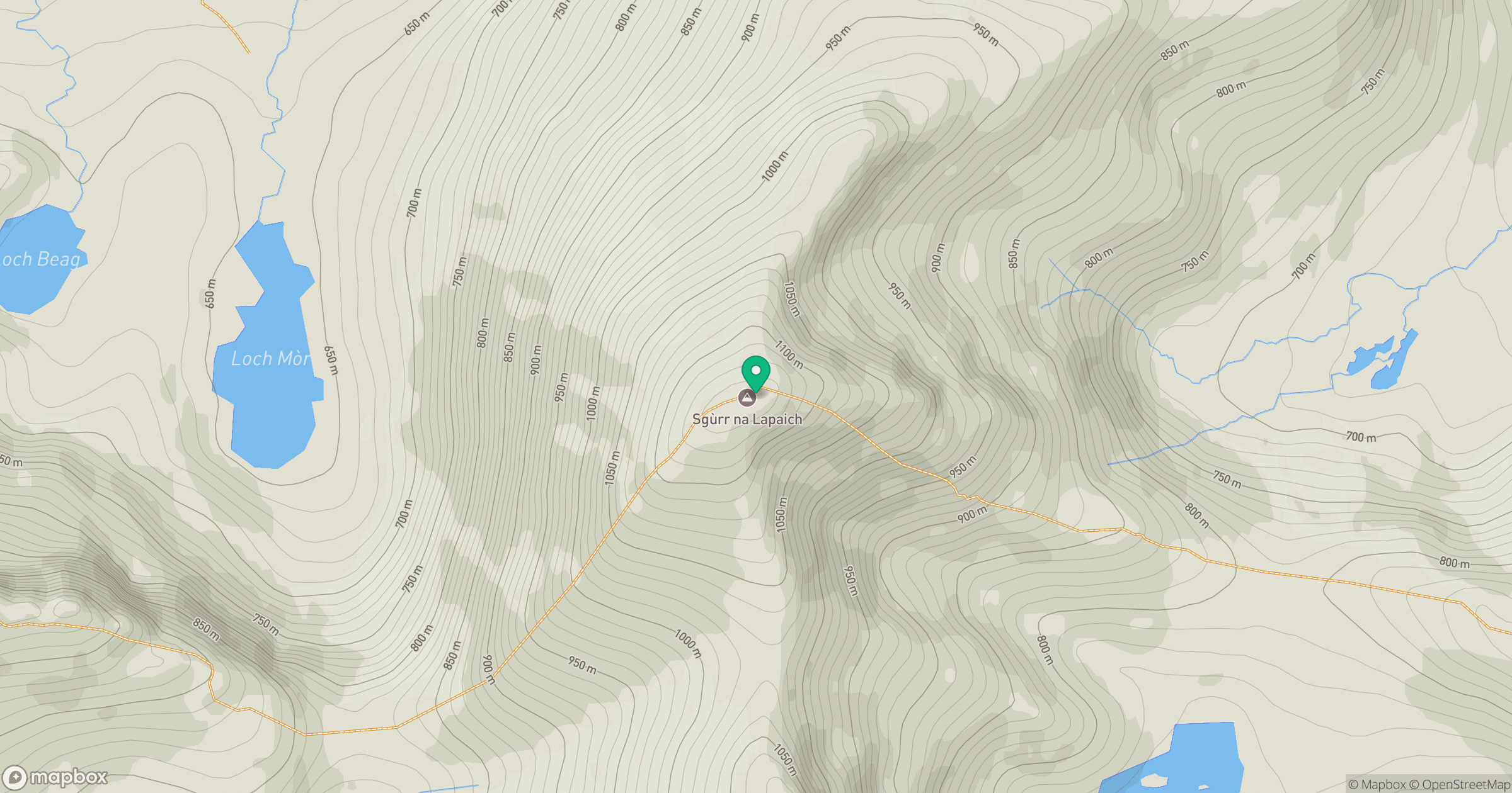
Grid reference: NH161351
View on OpenStreetMapOpens a map in a new tab, centred on the hill.
No comments yet. Be the first.