
Beinn a' Chuirn
Good walks are even better shared.
Overview
Beinn a' Chuirn
Beinn a' Chuirn, towering at 915 meters, is a splendid Munro nestled in the heart of the Scottish Highlands. Known for its rough granite outcrops and panoramic vistas, it is a must-do for keen walkers and mountain lovers alike.
Geology
Rock enthusiasts will appreciate the mountain's complex geology. Comprising mainly granite and gneiss, its storied history reveals the intense geological forces that have shaped it over millions of years. You might even stumble across some fascinating rock formations along the way.
Routes
There are two well-trodden routes to the summit, both starting from the A85. The first route is a manageable 12 km hike, perfect for a day out, whereas the second route, via Coire Chuirn, is a tad more challenging but rewards with breathtaking views. Do bring snacks, as you wouldn't want to be on an empty stomach while chasing the views!
Terrain and Environment
Expect rocky, grassy paths with a touch of bog–so don't buy those fancy new shoes just yet. The landscape is alive with diverse flora, and should you take time to stop, you might spot some local wildlife, including red deer and various bird species.
Views
The summit of Beinn a' Chuirn treats hikers to a visual feast. To the north, the Tyndrum Hills rise impressively while to the south, Loch Awe glimmers in the distance, playing host to all manner of stories and legends. Early spring or autumn are the ideal times to visit for clear skies and killer views.
Access
Accessing Beinn a' Chuirn is relatively straightforward. Parking is available at a nearby layby, but spaces fill up quickly, particularly in good weather. Public transport is available from neighbouring towns, but do check the timetable in advance. The lovely village of Tyndrum is just a stone's throw away and has a couple of delightful cafes to recharge after your hike.
Facilities
In terms of facilities, Tyndrum has you covered with shops and cafes galore. A visit to one of these delightful establishments post-hike can make for a perfect end to your adventure.
History
Beinn a' Chuirn isn't just a mountain; it's a tapestry of history. Its name translates to 'Mountain of the Gem', implying its beauty and the area's rich mineral deposits. Historically, it has been revered by local clans for its hunting grounds. Its cultural and natural significance remains pristine and cherished today.
So, whether you're an experienced hiker or just in it for the views, Beinn a' Chuirn promises a day of exploration, discovery, and perhaps a cheeky wee wander off the beaten path. Just remember to take your camera and perhaps some extra snacks...you never know when the hike might take longer than expected!
Explore routes near Beinn a' Chuirn
Walks starting near this hill. Open a route to check its map, distance and full itinerary.
Killin: Falls of Dochart, Finlarig and Moirlanich Longhouse
View route
Loch Katrine: Brenachoile Point Shore Walk from Trossachs Pier
View route
The Cobbler from Succoth Carpark
View route
Beinn Ime from Succoth
View route
Route planning notes
These notes describe possible approaches. Check a route's map and access information when planning your walk.
Approach from the A85
A popular route starting from the layby along the A85, taking you through scenic moorland before ascending the mountain.
Via Coire Chuirn
This route ascends via Coire Chuirn, providing stunning views of the surrounding peaks.
Make a day of it, together
Find someone to share the walk with, or organise a day out along a route you like.
Hill facts and local notes
Classifications
Elevation
923m
3,028 ft
Prominence
75m
Coordinates
56.5316, -4.6682
NN360409
OS Map
50
Explorer: 377E
At the Summit
The summit boasts a large stone cairn and offers a trig point for those who enjoy dabbling in a bit of peak bagging.
Terrain & Geology
Beinn a' Chuirn is primarily composed of granite and gneiss, which contribute to its rugged and craggy appearance. The geological history reveals a complex formation involving ancient volcanic activity.
Views & Scenery
From the summit, one can see the majestic peaks of the Tyndrum Hills and the expansive Loch Awe. On a clear day, the islands of Mull can be spotted far off in the distance.
History & Heritage
Name Origin
The name 'Beinn a' Chuirn' translates to 'Mountain of the Gem', a reference to both its beauty and the precious stones found in the region.
Historical Significance
Historically, the region was often used as a hunting ground by local clans, and today it remains significant for its natural biodiversity and scenic beauty.
Getting There & Facilities
Parking
There is a layby on the A85 approximately NN365401, with limited space. Arrive early, or you might have to hoof it a bit further to find a suitable spot.
Public Transport
There is a bus service connecting nearby towns but may require some planning as service is limited.
Nearby Facilities
Tyndrum features a couple of cafes and small shops, with toilet facilities available. Perfect for stocking up before you head into the wild!
Safety Information
Known Hazards
- Be aware of sudden weather changes, as this area can become quite treacherous with low visibility. The terrain can be slippery, especially after rain.
General Safety Tips
- Check weather conditions before setting out
- Carry appropriate clothing and equipment
- Let someone know your planned route
- Take a map, compass, and GPS device
- Carry emergency supplies: food, water, first aid kit, torch
Hills
Some common questions about the hills answered
Are there group walks up Beinn a' Chuirn?
Many walkers use Walkmates to join or organise walks with others. You can check for group walks around Beinn a' Chuirn through the maps
Are there other walkers around Beinn a' Chuirn?
Activity varies by location and time, but Walkmates lets you see whether others have shared walks or shown interest in this area. Find other people through the walking friends search walking friends for Beinn a' Chuirn search or of course create your own walk for Beinn a' Chuirn
Can I organise a walk to Beinn a' Chuirn?
Yes. If there aren’t any walks listed already, you can create a walk and make it available for others to join.
If you're signed up to Walkmates, you can create a walk to Beinn a' Chuirn.
How do I find a walk up this hill?
There are often multiple ways to walk this hill, depending on experience and route preference. Walkmates helps you explore walks and routes that others have shared.
Can I suggest a new route up Beinn a' Chuirn?
Yes. You can suggest or create routes to share with others. Walkmates focuses on the social side of walking, so routes are used to help people organise walks and explore areas together, rather than as detailed navigation tools or route libraries.
Other uses really appreciate knowledgeable walkers sharing their routes. Share your favourite route to Beinn a' Chuirn here
The is an error or something incorrect about this hill. How do I let you know?
We always strive to keep the information on Walkmates as accurate as possible. If you find an error, please let us know through the contact form and we'll aim to correct it as quickly as possible
Community Discussion
Comments
Location
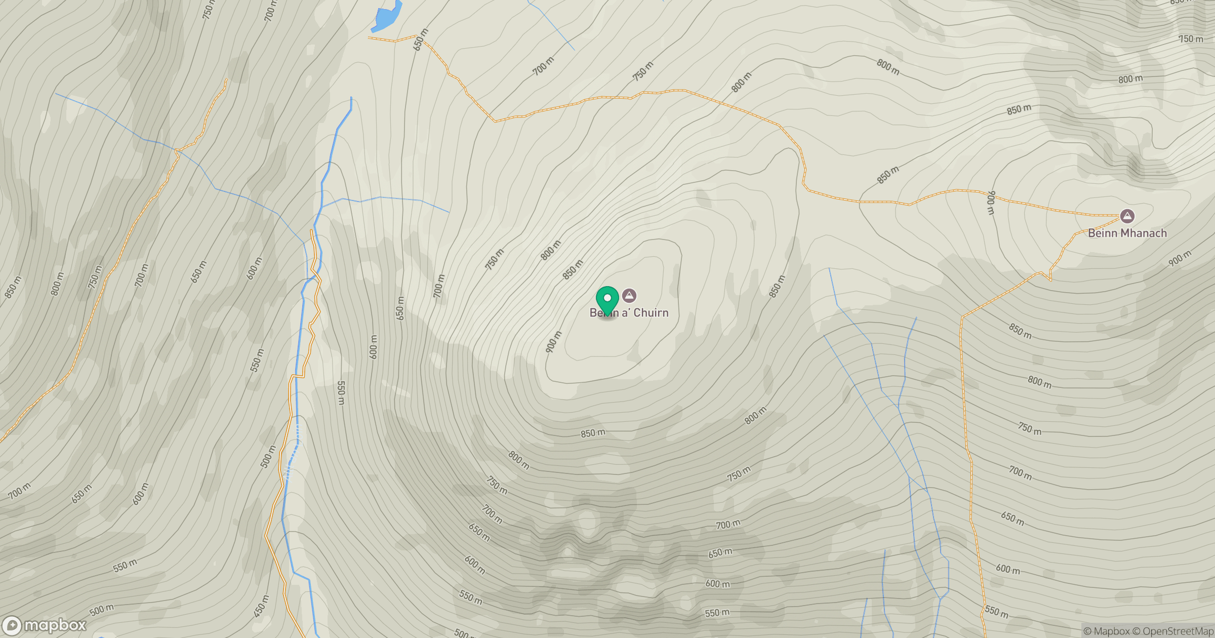
Grid reference: NN360409
View on OpenStreetMapOpens a map in a new tab, centred on the hill.
Nearby Hills
Beinn Dorain
1,076m
Ben More
1,174m
![Ben Lui [Beinn Laoigh]](https://cdn.walkmates.com/gallery-images/20d4da67f4984b329a102d7c3aba012b.jpg)
Ben Lui [Beinn Laoigh]
1,131m
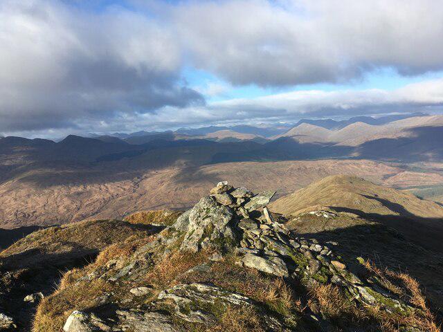
An Caisteal
996m
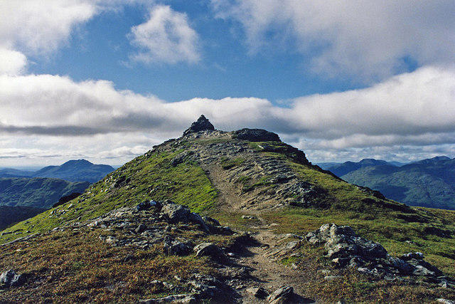
Beinn Chabhair
932m
No comments yet. Be the first.