

Twyn y Fan
Good walks are even better shared.
SN7931 : Road below Twyn y Fan
Philip Halling Photo source
Overview
Twyn y Fan: A Hiker's Paradise
Overview
Nestled in the stunning Brecon Beacons National Park, Twyn y Fan stands proud at an elevation of 658 meters. Designated as a Marilyn, it attracts hikers looking for a rewarding day out amid breathtaking scenery. With its distinct sandstone geology and varied terrains, the mountain offers both challenge and beauty.
Geology
Twyn y Fan is predominantly formed from Old Red Sandstone which gives it that striking reddish hue. Geological formations along the paths present a playful context for those who like to tickle their brains with a bit of geology as they trek.
Routes
Two of the most popular routes to reach the summit are the North Ridge Path and the East Ridge Path. The former provides a gentle ascent, perfect for those who fancy a relaxed hike, while the latter will get your legs working a bit harder but equally exudes the spectacular views.
Summit Features
Upon reaching the top, adventurers often snap a classic photo alongside the stone cairn and trig point—proof you've made it to the top!
Terrain
Expect a mix of grassy paths and some rocky outcrops. If you fancy a bit of a dance with the rocks, you're in for a treat!
Views
The views are to die for. From the summit, gaze upon the majestic Pentwyn Reservoir and the grandeur of Pen y Fan.
Hazards
Remember, the weather can be as fickle as a teenager—it can change in an instant! Be prepared for a sneaky rain shower or gusty winds lurking to test your resolve.
Access
Taf Fechan Forest serves as your nearest parking area, but be sure to secure your spot, as it fills up quicker than a kettle on a high burn. Brecon is just a hop away if you need to stock up on snacks!
Conclusion
Twyn y Fan offers a wonderful day out for walkers and nature lovers alike. Whether you're a seasoned hiker or just out for a casual stroll, the stunning views and fresh Welsh air will leave you feeling invigorated. So lace up those boots and get ready to breathe in some breathtaking moments!
Explore routes near Twyn y Fan
Walks starting near this hill. Open a route to check its map, distance and full itinerary.
Usk Reservoir: Glasfynydd Forest and Dam Circuit
View route
Aircraft Crash Site - Wellington Bomber and Vampire Jet (Black Mountain range)
View route
Dolaucothi Estate: Cothi Valley and Red Waymarked Circuit
View route
Pen y Fan via Corn Du from Storey Arms
View route
Route planning notes
These notes describe possible approaches. Check a route's map and access information when planning your walk.
North Ridge Path
This popular route offers a gradual ascent along a well-marked path with panoramic views of the surrounding landscape.
East Ridge Path
A slightly steeper approach that rewards hikers with spectacular vistas upon reaching the summit.
Make a day of it, together
Find someone to share the walk with, or organise a day out along a route you like.
Photo Gallery
View all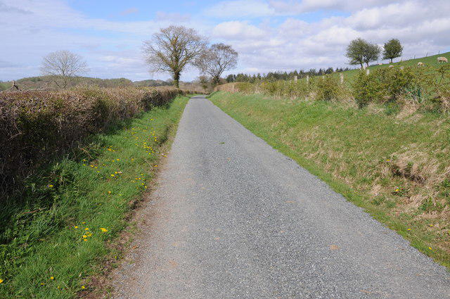 Photo could not load
SN7931 : Road below Twyn y Fan
Philip Halling
Hill facts and local notes
Classifications
Elevation
256m
840 ft
Prominence
43m
Coordinates
51.9654, -3.7571
SN793311
OS Map
146 160
Explorer: OL12W
At the Summit
The summit features a stone cairn, providing a classic hiking snapshot opportunity. On clear days, you'll also find a trig point marking the highest point.
Terrain & Geology
Twyn y Fan is primarily composed of Old Red Sandstone, characterised by its distinct red and brown hues. The area also features stunning outcrops and boulders, making it a treat for geology enthusiasts.
Views & Scenery
At the summit, hikers are treated to views of Pen y Fan, the highest peak in South Wales, and the expansive valleys below. On a clear day, you might even spot the coastline of Devon.
History & Heritage
Name Origin
The name 'Twyn y Fan' translates to 'Hill of the Beacon', reflecting its prominent position in the area.
Historical Significance
This mountain is not only a popular hiking destination but also steeped in local folklore and history, making it a significant landmark in the culture of South Wales.
Getting There & Facilities
Parking
The nearest parking area is at Taf Fechan Forest, about 4 km from the base of the hiking paths. Parking is limited, so arrive early!
Public Transport
The nearest train station is in Merthyr Tydfil, followed by a bus to Brecon from where a short taxi ride can get you to the starting point.
Nearby Facilities
There are few facilities on the mountain, but Brecon offers cafes, shops, and public toilets prior to your hike.
Safety Information
Known Hazards
- Variable weather conditions can change rapidly; always prepare for rain or high winds.
- Some paths may be slippery, especially in wet conditions.
General Safety Tips
- Check weather conditions before setting out
- Carry appropriate clothing and equipment
- Let someone know your planned route
- Take a map, compass, and GPS device
- Carry emergency supplies: food, water, first aid kit, torch
Hills
Some common questions about the hills answered
Are there group walks up Twyn y Fan?
Many walkers use Walkmates to join or organise walks with others. You can check for group walks around Twyn y Fan through the maps
Are there other walkers around Twyn y Fan?
Activity varies by location and time, but Walkmates lets you see whether others have shared walks or shown interest in this area. Find other people through the walking friends search walking friends for Twyn y Fan search or of course create your own walk for Twyn y Fan
Can I organise a walk to Twyn y Fan?
Yes. If there aren’t any walks listed already, you can create a walk and make it available for others to join.
If you're signed up to Walkmates, you can create a walk to Twyn y Fan.
How do I find a walk up this hill?
There are often multiple ways to walk this hill, depending on experience and route preference. Walkmates helps you explore walks and routes that others have shared.
Can I suggest a new route up Twyn y Fan?
Yes. You can suggest or create routes to share with others. Walkmates focuses on the social side of walking, so routes are used to help people organise walks and explore areas together, rather than as detailed navigation tools or route libraries.
Other uses really appreciate knowledgeable walkers sharing their routes. Share your favourite route to Twyn y Fan here
The is an error or something incorrect about this hill. How do I let you know?
We always strive to keep the information on Walkmates as accurate as possible. If you find an error, please let us know through the contact form and we'll aim to correct it as quickly as possible
Community Discussion
Comments
Location
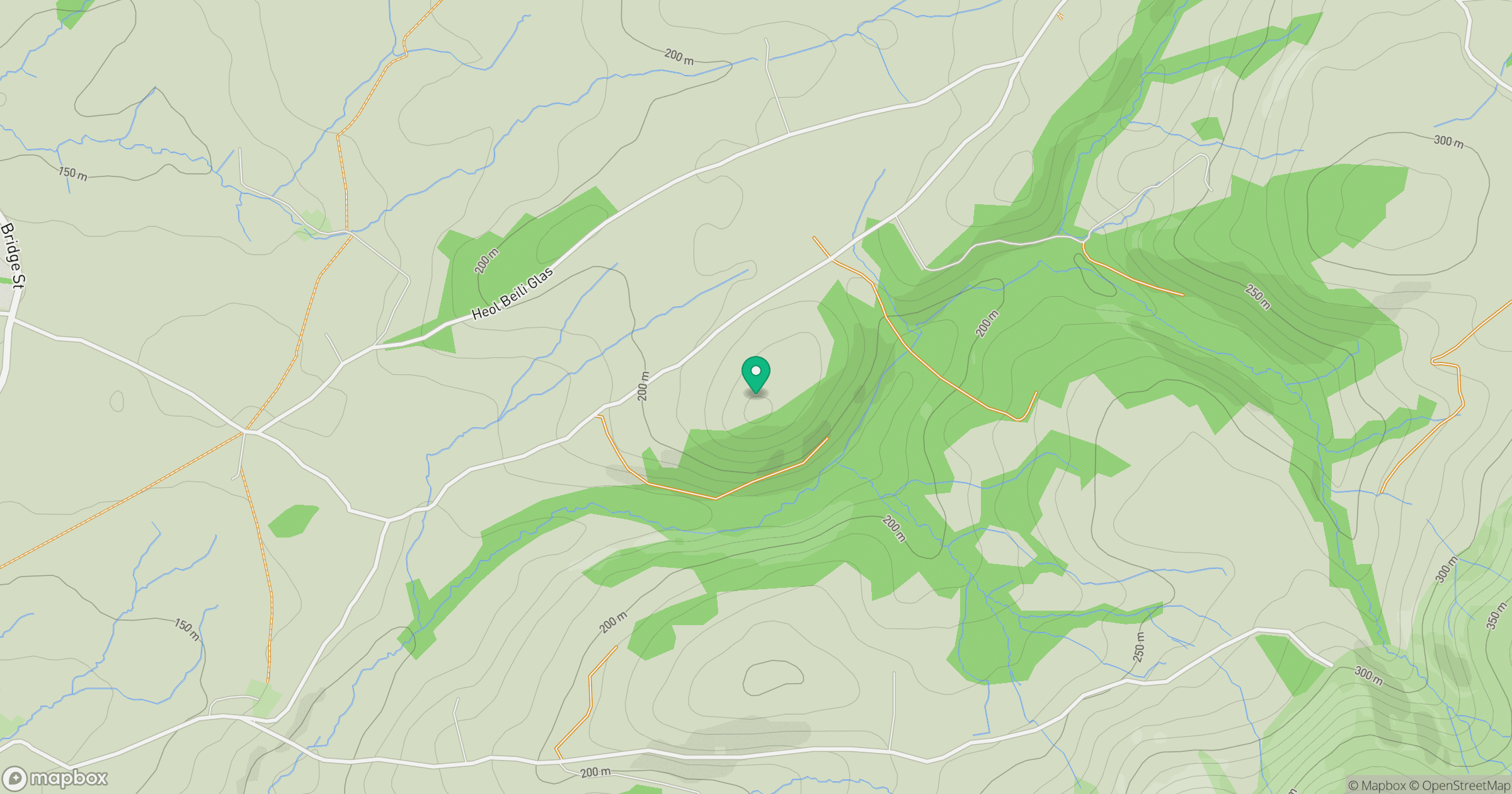
Grid reference: SN793311
View on OpenStreetMapOpens a map in a new tab, centred on the hill.


No comments yet. Be the first.