

The Saddle
Good walks are even better shared.
NG9313 : Flush bracket S9777
Ian Taylor Photo source
Overview
The Saddle
Overview
The Saddle is a prominent peak located in the stunning Monadhliath Mountains, reaching an elevation of 849 meters. Known for its distinctive shape and panoramic views, it promises a rewarding experience for adventurous souls.
Geology
This mountain is primarily composed of granitic and gneiss rocks that tell a tale of their glacial heritage. As you traverse its slopes, you'll encounter fascinating geological features that showcase the rugged beauty of Scotland's natural history.
Routes
Two main routes attract hikers to The Saddle:
- North West Ridge Route: This popular path starts near the Allt a' Chaoil, offering a moderate challenge and a sequential ascent to the summit.
- South East Approach: For those seeking something a little tougher, this trail leads from the Laggan Locks area and winds through some challenging terrain.
Summit Features
The summit features a large rock cairn which serves as a prominent marker for those who reach the peak. Don't miss snapping a picture here while enjoying the expansive Highland panorama that unfolds before you.
Terrain Type
Expect a mix of grassy slopes with rocky outcrops and occasional boggy sections, particularly in the early hiking season. Good waterproof boots are advised!
Views
Once atop The Saddle, you’ll be treated to sweeping views of the Cairngorms to the east and endless vistas of the Highland landscape. To truly appreciate these views, aim for late spring or summer, when weather conditions are kinder.
Hazards
The ever-shifting Highland weather can lead to sudden rain or gales, so it's essential to be prepared. The rocky sections can pose a challenge, particularly if they are wet, so tread carefully.
Access
The nearest parking area can be found at Cluny, which accommodates several vehicles. While public transport does run from Newtonmore, having a car may be more convenient to navigate the hills easily.
Facilities
In the nearby town of Newtonmore, you can find cafes that serve much-needed refreshments post-hike and toilets to clean up after your adventure.
History
The Saddle gets its name from its prominent, saddle-like appearance, a notable feature among the hills. It holds cultural significance among walkers in Scotland, being a favourite among both seasoned climbers and those new to hillwalking.
In summary, The Saddle is not just a hill; it’s an experience filled with breathtaking views, challenging terrains, and both geological and cultural richness waiting to be explored. Happy hiking!
Explore routes near The Saddle
Walks starting near this hill. Open a route to check its map, distance and full itinerary.
Glen Affric: Coire Loch Woodland Trail
View route
Banavie to Glen Loy Aqueduct: Neptune’s Staircase Canal Towpath
View route
Beinn Eighe Lancaster Wreckage at Coire Mhic Fhearchair
View route
Ben Nevis via Mountain Path
View route
Route planning notes
These notes describe possible approaches. Check a route's map and access information when planning your walk.
North West Ridge Route
Starting from the car park near the foot of the Allt a' Chaoil, this route provides a steady ascent with stunning backdrops of the surrounding hills.
South East Approach
A more challenging option leading from Laggan Locks, this approach provides a more rugged trail but rewards hikers with breathtaking views of Loch Laggan.
Make a day of it, together
Find someone to share the walk with, or organise a day out along a route you like.
Photo Gallery
View all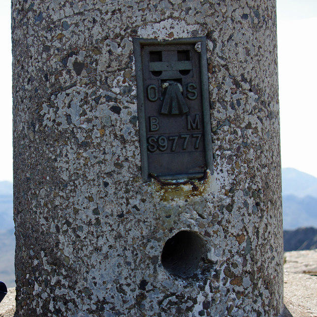 Photo could not load
NG9313 : Flush bracket S9777
Ian Taylor
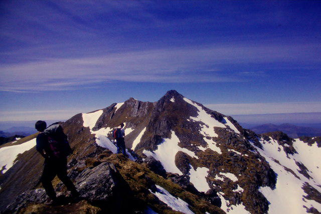 Photo could not load
NG9313 : To The Saddle from Sgùrr nan Forcan
Richard Law
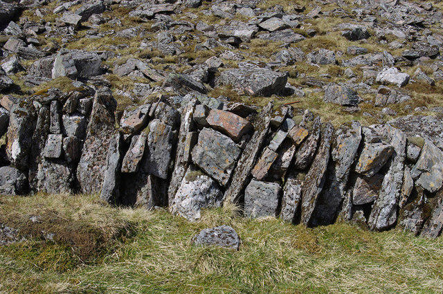 Photo could not load
NG9312 : Old wall below The Saddle
Ian Taylor
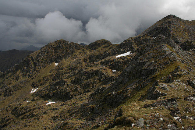 Photo could not load
NG9313 : North-West face
Nic Bullivant
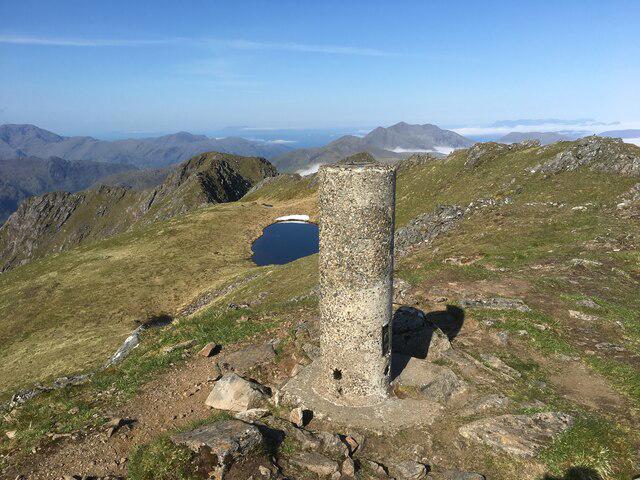 Photo could not load
NG9313 : Trig point on The Saddle
Steven Brown
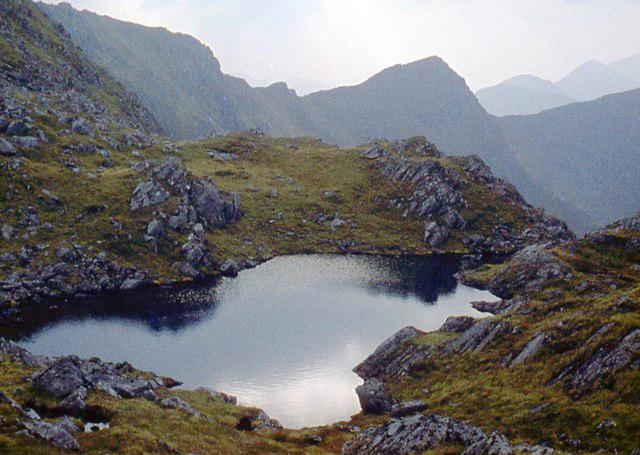 Photo could not load
NG9313 : Lochan north of the Saddle summits
Alan Reid
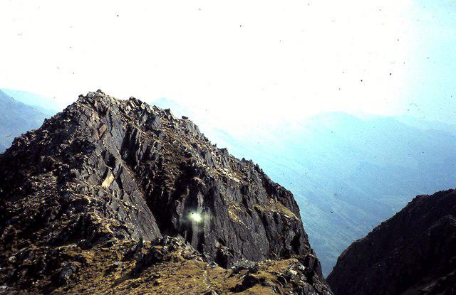 Photo could not load
NG9313 : Summit of the Saddle, 3,317 feet
ronnie leask
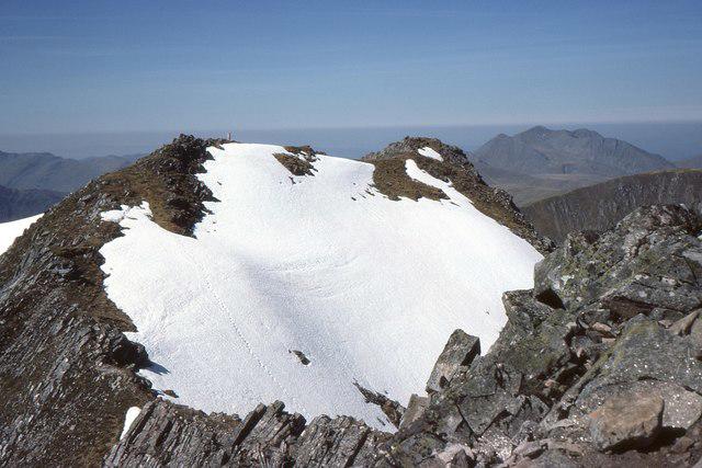 Photo could not load
NG9313 : The Saddle summits
Jim Barton
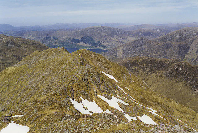 Photo could not load
NG9313 : The north ridge of the Saddle
Nigel Brown
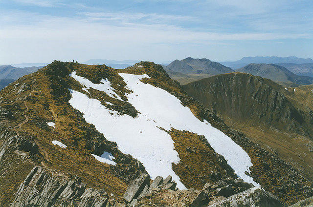
NG9313 : The summit of the Saddle
Nigel Brown
Hill facts and local notes
Classifications
Elevation
1,012m
3,319 ft
Prominence
334m
Coordinates
57.1624, -5.4147
NG936131
OS Map
33
Explorer: 414N 414S
At the Summit
The summit boasts a rocky cairn with a magnificent panoramic view. A perfect backdrop for your summit selfies!
Terrain & Geology
The Saddle features granitic rocks, offering great exposures of gneiss and some fantastic glacial deposits that speak to its ancient geological past. Keep an eye out for interesting rock formations along the route.
Views & Scenery
From the summit, enjoy stunning views of the Cairngorms to the east and the vastness of Highland Scotland sprawled out before you.
History & Heritage
Name Origin
The name 'The Saddle' likely refers to its distinctive shape that resembles a saddle, offering a unique silhouette among the peaks.
Historical Significance
The Saddle is a popular choice among seasoned and novice walkers alike, contributing to the cultural tapestry of Scottish hillwalking traditions.
Getting There & Facilities
Parking
Parking is available at the end of the B862 road at Cluny, with space for several cars.
Public Transport
The nearest train station is in Newtonmore, from which local buses operate, but having a car is beneficial for more flexibility.
Nearby Facilities
Cafes and toilets can be found in Newtonmore, especially appreciated after a long trek up The Saddle.
Safety Information
Known Hazards
- Weather can change quickly in the Highlands, so be prepared for sudden rain or strong winds. The rocky terrain can be tricky, especially when it's wet.
General Safety Tips
- Check weather conditions before setting out
- Carry appropriate clothing and equipment
- Let someone know your planned route
- Take a map, compass, and GPS device
- Carry emergency supplies: food, water, first aid kit, torch
Hills
Some common questions about the hills answered
Are there group walks up The Saddle?
Many walkers use Walkmates to join or organise walks with others. You can check for group walks around The Saddle through the maps
Are there other walkers around The Saddle?
Activity varies by location and time, but Walkmates lets you see whether others have shared walks or shown interest in this area. Find other people through the walking friends search walking friends for The Saddle search or of course create your own walk for The Saddle
Can I organise a walk to The Saddle?
Yes. If there aren’t any walks listed already, you can create a walk and make it available for others to join.
If you're signed up to Walkmates, you can create a walk to The Saddle.
How do I find a walk up this hill?
There are often multiple ways to walk this hill, depending on experience and route preference. Walkmates helps you explore walks and routes that others have shared.
Can I suggest a new route up The Saddle?
Yes. You can suggest or create routes to share with others. Walkmates focuses on the social side of walking, so routes are used to help people organise walks and explore areas together, rather than as detailed navigation tools or route libraries.
Other uses really appreciate knowledgeable walkers sharing their routes. Share your favourite route to The Saddle here
The is an error or something incorrect about this hill. How do I let you know?
We always strive to keep the information on Walkmates as accurate as possible. If you find an error, please let us know through the contact form and we'll aim to correct it as quickly as possible
Community Discussion
Comments
Location
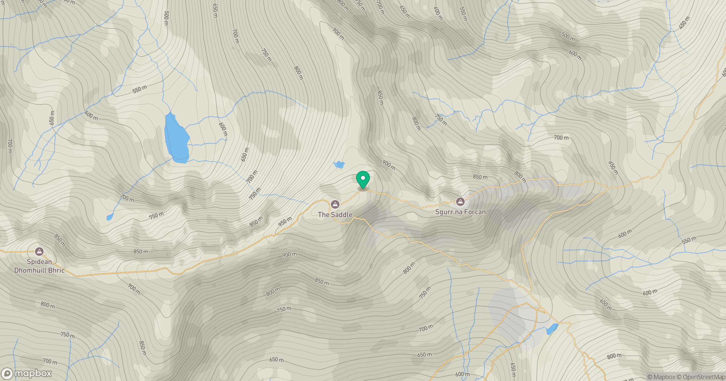
Grid reference: NG936131
View on OpenStreetMapOpens a map in a new tab, centred on the hill.
No comments yet. Be the first.