

Biod an Fhithich
Good walks are even better shared.
Overview
Biod an Fhithich
Nestled in the stunning Scottish Highlands, Biod an Fhithich stands with a proud elevation of 485 meters. This Marilyn is not just another hill; it’s a delightful journey through the landscapes of Skye.
Geology
Composed of schist and gneiss, it showcases layers of rock that reveal ancient geological processes. Hikers can enjoy the playful dance of light on the varied textures and colours of the rock as they make their way up.
Route Information
North Approach
Starting point: Kilmuir
- Distance: 6.5 km
- Estimated Time: 2.5 hours
- Difficulty: Moderate
This route features a pleasant mix of forests and open heather slopes—perfect for nature lovers and those wanting to catch a breather (or several).
Summit Features
Upon reaching the top, you’ll be greeted by a humble cairn, which serves as a beacon reminding everyone of those who’ve walked these paths before. It’s the writer in me who dreams of penning a novel with this view. Feel free to sit back and bring out a sandwich here—after all, it’s much deserved after that climb!
Terrain
The terrain ranges from lush grassy patches to those cheeky rocky outcrops that can catch your foot if you’re not paying attention. Wet grass? You might want to wear your wellies or just bring those gaiters!
Views
Highlights
Expect jaw-dropping views stretching across lochs, mountains, and—if you’re lucky—some local wildlife. The Cuillin Hills will call to you like an old friend.
Best Seasons
Spring and Autumn provide exceptional scenery, especially with the heather in bloom. Don’t forget those early mornings; the golden hour is something you don’t want to miss!
Hazards
Always mind your footing, particularly in wetter conditions. And keep your wits about you—those sheep ARE watching! Sudden changes in weather may also occur, so be prepared to hunker down if necessary.
Nearby Summits
For more explorations, nearby summits like Ben Edra (545 m) and Moidart (532 m) beckon you. Each offers unique challenges and stunning vistas.
Access
Nearest Parking
Parking is available in Kilmuir, but arrive early to avoid the peak hour rush!
Public Transport
District buses operate from Portree to Kilmuir; check the latest schedules before planning your trip.
Nearest Town
Portree, where you can refuel on local delicacies!
Facilities
While there are no toilets on the mountain, the services in Portree have you covered—don't miss the chance for a warm cuppa!
History
Name Meaning
‘Cairn of the Raven’—which makes one wonder if those birds are holding secrets!
Significance
This mountain has been a hillside memory for local clans for many years, filled with stories of hunts, gatherings, and visions of nature.
So there you have it—Biod an Fhithich is not just a hike; it’s an experience chock-full of nature’s wonderful quirks. Get your boots on, and don’t forget to maybe pack your sense of humour too—for if you fall in the mud, it better be good for a laugh!
Explore routes near Biod an Fhithich
Public walks starting within 80 km of this hill. Nearby does not mean a route reaches the summit; check its map and access before setting out.
Loch Affric full circuit from River Affric
View route
Glen Affric: Coire Loch Woodland Trail
View route
Banavie to Glen Loy Aqueduct: Neptune’s Staircase Canal Towpath
View route
Beinn Eighe Lancaster Wreckage at Coire Mhic Fhearchair
View route
Route planning notes
These notes describe possible approaches, not verified navigable routes or permission to cross land. Check current paths, local access rules and conditions before setting out.
North Approach
Starting from the village of Kilmuir, this route offers a gradual ascent along a well-defined path. The first half is through scenic woodlands before opening up to heather-covered slopes.
Make a day of it, together
Find someone to share the walk with, or organise a day out along a route you like.
Photo Gallery
View all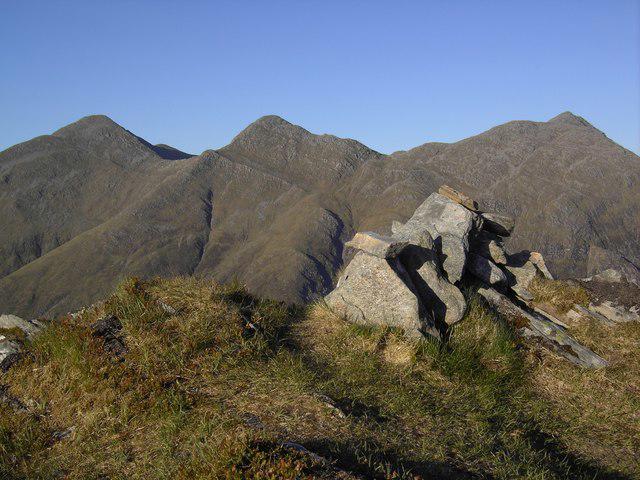 Photo could not load
NG9514 : Biod an Fhithich Summit
Colin Kinnear
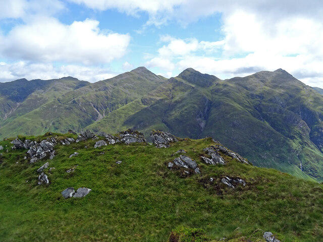 Photo could not load
NG9514 : Five Sisters View
Adam Ward
Hill facts and local notes
Classifications
Elevation
646m
2,119 ft
Prominence
154m
Coordinates
57.1775, -5.3918
NG950147
OS Map
33
Explorer: 413N 414N 414S
At the Summit
The summit features a small stone cairn that doubles as a perfect picnic spot. On a clear day, it offers a striking view of nearby Loch Snizort.
Terrain & Geology
Composed primarily of a mix of schist and gneiss, Biod an Fhithich offers a breathtaking geological canvas that tells the story of ancient tectonic movements and the relentless forces of erosion. Along the ascent, hikers can observe layered rock formations and glacial deposits that signify its storied past.
Views & Scenery
From the summit, hikers can enjoy spectacular views of the surrounding lochs and mountains, including the iconic silhouette of the Storr to the north. Eastwards, you can catch glimpses of the mainland, including the outline of the Cuillin hills on Skye.
History & Heritage
Name Origin
The name 'Biod an Fhithich' translates to 'Cairn of the Raven' in Scottish Gaelic, possibly pointing to the lore surrounding ravens in Celtic mythology.
Historical Significance
The mountain holds cultural significance for local clans, who have traversed these lands for centuries, adding to its rich tapestry of stories and legends.
Getting There & Facilities
Check current local access restrictions, parking rules and transport timetables before travelling. These notes do not confirm public access to the summit.
Parking
Parking is available at Kilmuir, which accommodates several vehicles. Arrive early during peak seasons to secure a spot.
Public Transport
Regular bus services operate from Portree to Kilmuir, though check latest timetables as they can change.
Nearby Facilities
While there are no facilities directly at the mountain, Portree offers various cafes, shops, and public restrooms. The Hungry Gull café is a local favourite—don't forget to sample their famous fish and chips!
Safety Information
Known Hazards
- Be cautious of sudden weather changes typical of the Highlands. The path can be slippery when wet, and the terrain is uneven which may pose risks of sprains. Also, keep an eye out for curious sheep—they can be quite cheeky!
General Safety Tips
- Check weather conditions before setting out
- Carry appropriate clothing and equipment
- Let someone know your planned route
- Take a map, compass, and GPS device
- Carry emergency supplies: food, water, first aid kit, torch
Hills
Some common questions about the hills answered
Are there group walks up Biod an Fhithich?
Many walkers use Walkmates to join or organise walks with others. You can check for group walks around Biod an Fhithich through the maps
Are there other walkers around Biod an Fhithich?
Activity varies by location and time, but Walkmates lets you see whether others have shared walks or shown interest in this area. Find other people through the walking friends search walking friends for Biod an Fhithich search or of course create your own walk for Biod an Fhithich
Can I organise a walk to Biod an Fhithich?
Yes. If there aren’t any walks listed already, you can create a walk and make it available for others to join.
If you're signed up to Walkmates, you can create a walk to Biod an Fhithich.
How do I find a walk up this hill?
There are often multiple ways to walk this hill, depending on experience and route preference. Walkmates helps you explore walks and routes that others have shared.
Can I suggest a new route up Biod an Fhithich?
Yes. You can suggest or create routes to share with others. Walkmates focuses on the social side of walking, so routes are used to help people organise walks and explore areas together, rather than as detailed navigation tools or route libraries.
Other uses really appreciate knowledgeable walkers sharing their routes. Share your favourite route to Biod an Fhithich here
The is an error or something incorrect about this hill. How do I let you know?
We always strive to keep the information on Walkmates as accurate as possible. If you find an error, please let us know through the contact form and we'll aim to correct it as quickly as possible
Community Discussion
Comments
Location
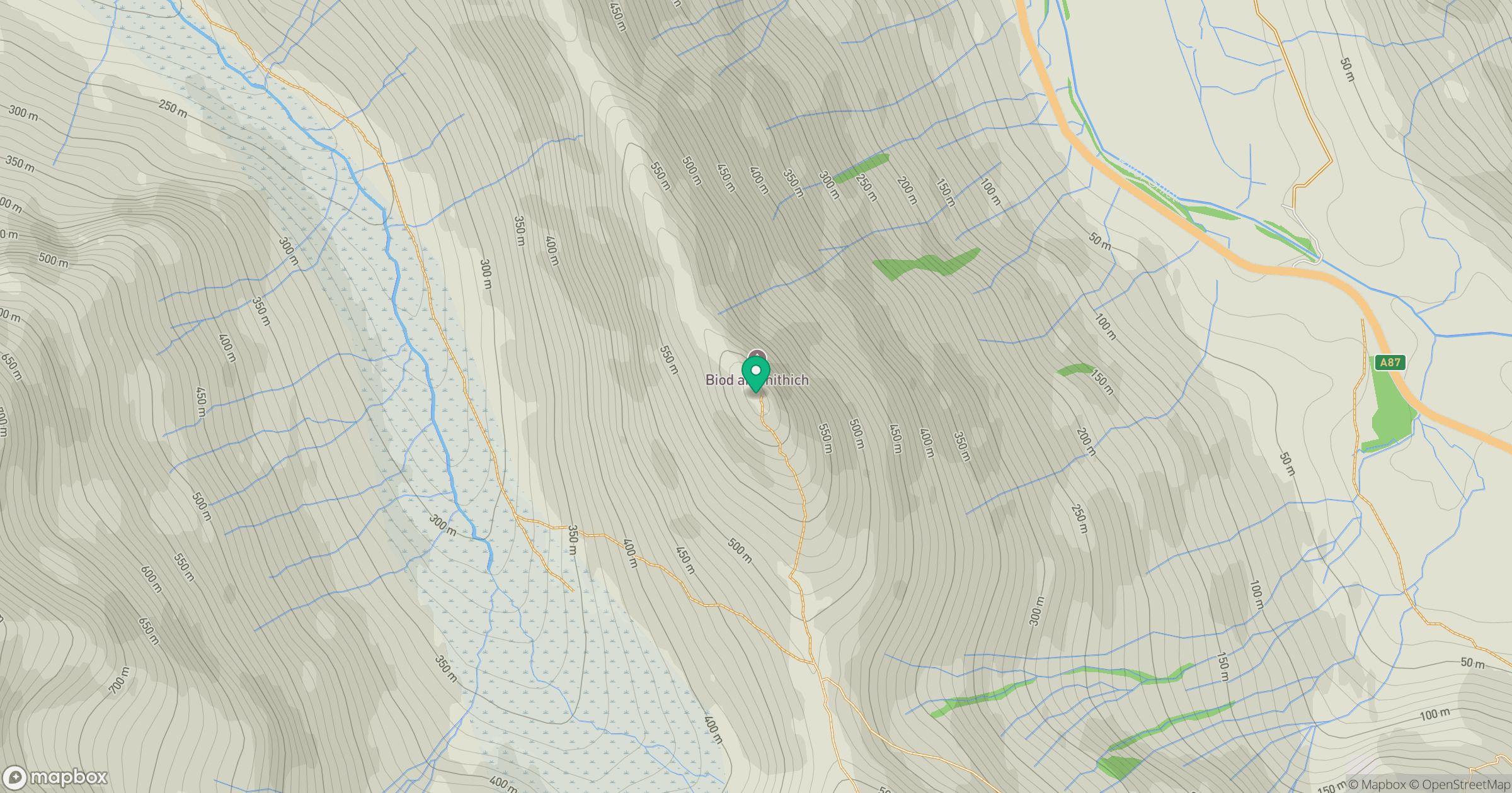
Grid reference: NG950147
View on OpenStreetMapOpens a map in a new tab, centred on the hill.
Hills within 30 km
Straight-line distance, not a walking route or confirmation of access.
Sgurr Fhuaran
1,069m
Sgurr a' Mhaoraich
1,027m
An Caisteal
622m
Gleouraich
1,035m
Beinn Sgritheall
974m
No comments yet. Be the first.