
Glastonbury Tor
Good walks are even better shared.
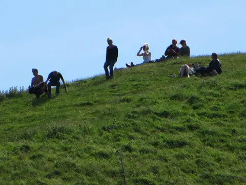
ST5138 : Sat on the Tor
Bill Nicholls Photo source
Overview
Glastonbury Tor is a 158 m hill on the edge of Glastonbury in Somerset, crowned by the roofless medieval tower of St Michael's Church. Steep, stepped paths lead to wide views over the Somerset Levels. Plan town parking and facilities before the climb. The hill has a long documented history and enduring Arthurian legends.
Glastonbury Tor
Glastonbury Tor rises to 158 m above sea level on the edge of Glastonbury. Its roofless medieval tower is a striking landmark above the Somerset Levels. Hill data.
Plan the climb
The summit paths include steep steps and gates. Wear footwear with grip, take water and carry a weatherproof layer. Wet or icy steps need extra care, and the open hilltop can feel much windier than town. The circular route below is unsuitable for wheelchairs or pushchairs. Route and terrain.
There is no general visitor parking at the Tor. The National Trust lists two Blue Badge spaces on Stonedown Lane and paid parking at Draper & Co on Chilkwell Street. Check signs and current arrangements before travelling. Parking information.
There are no toilets on the Tor. Town facilities include those at St John's car park; check opening arrangements locally. National Trust site notes and Town Council.
First Bus 376 serves Glastonbury on its Bristol–Yeovil route via Wells and Street. A separate seasonal Tor Bus is advertised from St Dunstan's car park for April–September. Check the operator timetable and Tor Bus information before setting out.
A town-to-Tor circular walk
The Outdoor Guide describes a complete loop from the Abbey car park, approaching the summit through Wellhouse Lane and returning through Chalice Hill, Bushy Coombe, Dod Lane and the town centre. Read its full directions for the intervening gates and junctions. Visiting Chalice Well Gardens is a separate attraction visit, not a required passage through the gardens.
Rock, tower and history
The Tor is a natural geological outlier containing Jurassic sands and underlying clay or silty mudstone. BGS identifies the Bridport Sand Formation here. BGS regional geology and formation account.
Excavations revealed post-Roman occupation and later monastic remains. Historic England records medieval church rebuilding in the fourteenth century. St Michael's surviving tower is Grade I listed and was restored in 1804. Archaeological record and tower listing.
Arthur, Avalon and the Holy Grail belong to the Tor's rich legendary associations; they are not demonstrated by the archaeological record. The National Trust dates the execution of Abbot Richard Whiting and two monks here to 1539. History and legends.
Around the hill
Views spread across the Levels and towards the Mendips; distant features depend on visibility. Two orchards around the slopes are open to visitors. Sheep and cattle graze the site, so keep dogs on leads and follow local signs. Orchards and wildlife and dog guidance.
Visitor information reviewed 15 October 2026 (UTC). Conditions, services and opening arrangements can change.
Explore routes near Glastonbury Tor
Walks starting near this hill. Open a route to check its map, distance and full itinerary.
Ham Wall: Avalon Hide and Walton Heath wetland circuit, Somerset
View route
Wells Walk with Men Walking & Talking
View route
Three Priddy Droves: Pelting, Dursdon and East Water circuit
View route
Cheddar River Yeo and Stubbingham Drove Circuit
View route
Route planning notes
These notes describe possible approaches. Check a route's map and access information when planning your walk.
Glastonbury Tor circular from the Abbey car park
From the Abbey car park, follow Bere Lane and Chilkwell Street past Chalice Well. Turn into Wellhouse Lane and take the gated path and steps to the tower. Descend the opposite stepped path, turn left on the lane, then follow the published route via Chalice Hill, Bushy Coombe and Dod Lane. Return through High Street and Market Place to the Abbey car park. Steps, gates and road sections; use the full route guide.
Make a day of it, together
Find someone to share the walk with, or organise a day out along a route you like.
Photo Gallery
View all Photo could not load
ST5138 : Sat on the Tor
Bill Nicholls
 Photo could not load
ST5138 : Glastonbury : St Michael's Church Tower
Lewis Clarke
 Photo could not load
ST5138 : Glastonbury Tor
Chris Thomas-Atkin
 Photo could not load
ST5138 : Toposcope on Glastonbury Tor
David Smith
 Photo could not load
ST5138 : Glastonbury Tor
Matt James
 Photo could not load
ST5138 : Glastonbury Tor from Walton Hill, Somerset
Ruth Sharville
 Photo could not load
ST5138 : Having a picnic
Bill Nicholls
 Photo could not load
ST5138 : Toposcope on the Tor
Bill Nicholls
 Photo could not load
ST5138 : Compass of the Toposcope
Bill Nicholls

ST5138 : Remains of church on Glastonbury Tor
Gary Rogers
Hill facts and local notes
Classifications
Elevation
158m
518 ft
Prominence
143m
Coordinates
51.1448, -2.6986
ST512386
OS Map
182 183
Explorer: 141
At the Summit
The roofless medieval tower of St Michael's Church, a Grade I listed building, dominates the summit. DoBIH locates the highest ground 8 m east of the tower's north corner.
Terrain & Geology
Glastonbury Tor is a natural outlier of Jurassic sedimentary rocks. British Geological Survey accounts identify the Bridport Sand Formation here, with sands above clay or silty mudstone. The sands form the upper part of the local sequence.
Views & Scenery
Wide views across the Somerset Levels and towards the Mendips. In clear conditions the wider panorama extends into neighbouring counties and towards Wales; visibility varies with weather.
History & Heritage
Name Origin
Glastonbury appears as Glestingaburg in early charters. The -burg element may mean a fortified place or monastic enclosure; the meaning of Glestinga is uncertain.
Historical Significance
Excavations revealed post-Roman settlement and later monastic remains. Historic England records fourteenth-century rebuilding of St Michael's Church; its medieval tower survives. Abbot Richard Whiting and two monks were executed on the Tor in 1539. Arthur, Avalon and Holy Grail associations are legends, not established archaeological identifications.
Getting There & Facilities
Parking
There is no general visitor car park at the Tor. National Trust lists two Blue Badge spaces on Stonedown Lane and paid parking at Draper & Co, Chilkwell Street, BA6 8DB. Town-centre car parks provide other starting points. Check parking signs and current restrictions; do not assume roadside parking at an entrance is permitted.
Public Transport
First Bus 376 links Glastonbury with Bristol, Wells, Street and Yeovil. The seasonal Tor Bus is advertised from St Dunstan's car park, April–September. Castle Cary is the nearest railway station, with onward travel required. Check current timetables and the return journey before travelling.
Nearby Facilities
There are no toilets on the Tor. Town facilities include public toilets at St John's car park, plus shops, cafes and pubs; check opening arrangements locally. Take water for the climb. Dogs should be on leads because livestock graze the site.
Safety Information
Known Hazards
- Steep steps and paths can be slippery when wet; take particular care descending.
- The summit is open and exposed to wind; check the forecast and wear suitable footwear.
- Road sections need care around traffic.
- Sheep and cattle graze the site; keep dogs on leads and follow local signs.
Seasonal Hazards
Wet weather can make grass and steps slippery; frost or ice increases the risk. Short winter daylight reduces the time available for the return. Carry water in warm weather and avoid exposed high ground during thunderstorms.
General Safety Tips
- Check weather conditions before setting out
- Carry appropriate clothing and equipment
- Let someone know your planned route
- Take a map, compass, and GPS device
- Carry emergency supplies: food, water, first aid kit, torch
Hills
Some common questions about the hills answered
Are there group walks up Glastonbury Tor?
Many walkers use Walkmates to join or organise walks with others. You can check for group walks around Glastonbury Tor through the maps
Are there other walkers around Glastonbury Tor?
Activity varies by location and time, but Walkmates lets you see whether others have shared walks or shown interest in this area. Find other people through the walking friends search walking friends for Glastonbury Tor search or of course create your own walk for Glastonbury Tor
Can I organise a walk to Glastonbury Tor?
Yes. If there aren’t any walks listed already, you can create a walk and make it available for others to join.
If you're signed up to Walkmates, you can create a walk to Glastonbury Tor.
How do I find a walk up this hill?
There are often multiple ways to walk this hill, depending on experience and route preference. Walkmates helps you explore walks and routes that others have shared.
Can I suggest a new route up Glastonbury Tor?
Yes. You can suggest or create routes to share with others. Walkmates focuses on the social side of walking, so routes are used to help people organise walks and explore areas together, rather than as detailed navigation tools or route libraries.
Other uses really appreciate knowledgeable walkers sharing their routes. Share your favourite route to Glastonbury Tor here
The is an error or something incorrect about this hill. How do I let you know?
We always strive to keep the information on Walkmates as accurate as possible. If you find an error, please let us know through the contact form and we'll aim to correct it as quickly as possible
Community Discussion
Comments
Location
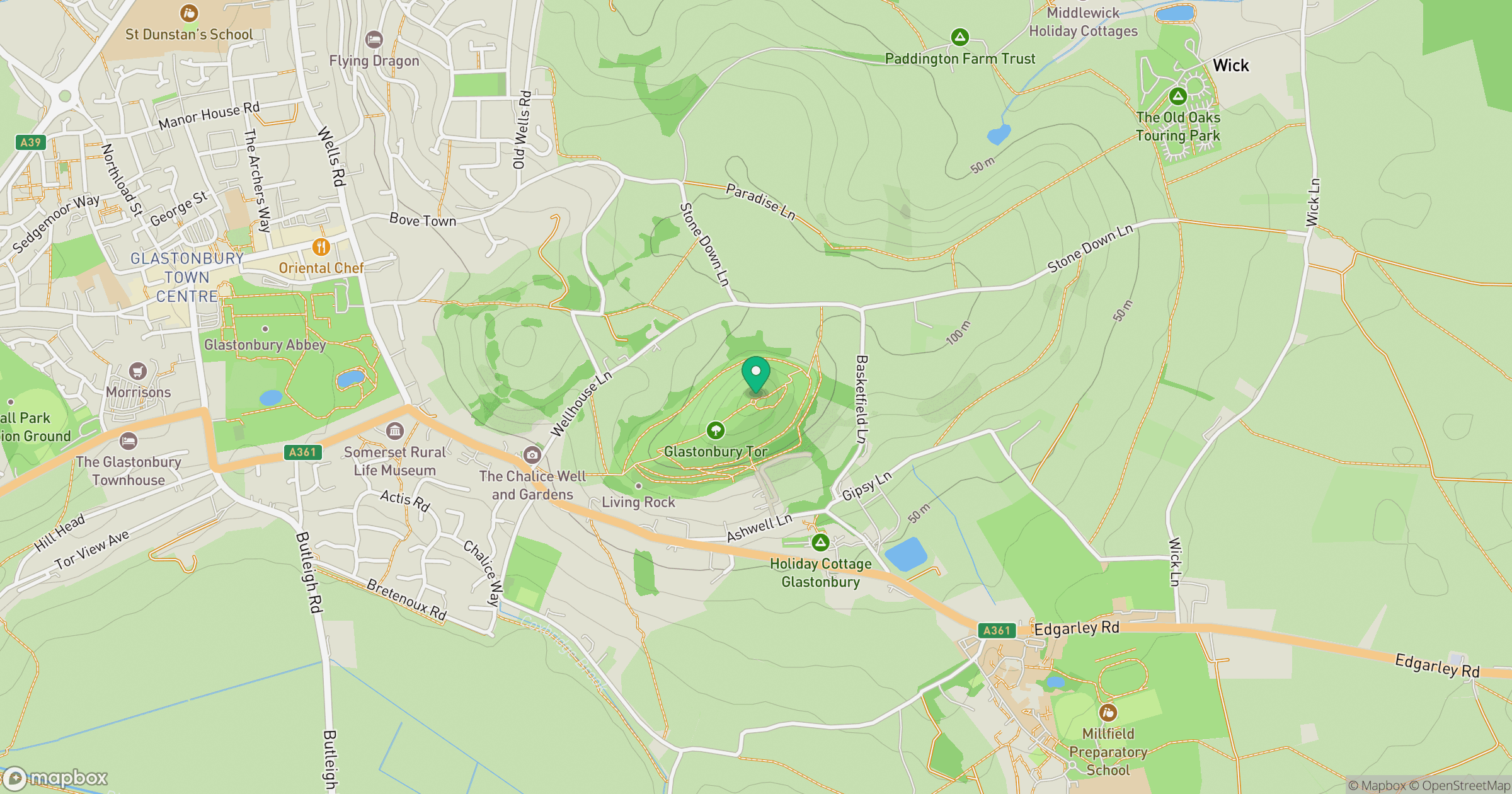
Grid reference: ST512386
View on OpenStreetMapOpens a map in a new tab, centred on the hill.
No comments yet. Be the first.