

Win Green
Good walks are even better shared.
ST9220 : Molehills on Win Green
Maigheach-gheal Photo source
Overview
Win Green: A Hidden Gem in Wessex
Known fondly by locals, Win Green is a delightful Marilyn that offers a relatively easy hike combined with stunning views and intriguing geology.
Elevation and Prominence
Climbing up to a modest 297 meters with a prominence of 59 meters, Win Green isn’t the highest peak in the area, but it can certainly hold its own!
Geology
As you amble along the paths, you'll notice the distinguishing chalk geology of Win Green. This rock type not only creates a lovely environment for grazing sheep but also hints at the region's prehistoric marine history. Fossils abound, so keep your eyes peeled for any ancient sea creatures!
Routes
The most popular route is the Win Green Circular. This 7.5 km loop takes roughly 2.5 hours and provides a perfect blend of scenic beauty and physical activity. The path is well-defined and moderately challenging, perfect for a family outing or a solo adventure.
Summit Features
At the summit, you'll be greeted by a trig point standing sentinel over the stunning surrounds. It’s the ideal spot for that triumphant top-of-the-world photo!
Terrain
The terrain is predominantly grassy, allowing for a pleasant walking experience. Just watch your step as certain areas can get a little slippery.
Views
From the summit, you can enjoy breathtaking views of the Blackmore Vale, and on clearer days, the Mendip Hills in the distance concede a superb backdrop. Spring and summer are the best seasons for a hike here; however, don’t underestimate the golden hues of autumn.
Hazards
A few steep sections might raise your heart rate, and remember, a wet day can lead to slippery conditions.
Nearby Summits
If you're keen to explore further, you might venture to nearby peaks such as Hawkesdown Hill or Ham Hill, both offering their own unique views and experiences.
Access
Getting to Win Green is straightforward. The nearest parking is at The Greyhound Inn, providing a convenient spot to start your adventure. Just remember to be courteous to the locals. Public transport can be a challenge unless you’re happy with a taxi ride from Shaftesbury.
Facilities
After your hike, why not take a pit stop at The Greyhound Inn? With refreshments and toilets, it’s a lovely way to unwind.
History
The name 'Win Green' carries the joyful essence of the lush landscape. Additionally, this area has historical significance with ancient earthworks nearby, steeped in the mystery of the times.
In conclusion, Win Green may not have the highest peaks, but its combination of easy hiking, impressive views, and delightful facilities make it well worth a visit. Pack your boots, grab some snacks, and get ready for a splendid day out!
Happy hiking!
Explore routes near Win Green
Walks starting near this hill. Open a route to check its map, distance and full itinerary.
Sturminster Newton, Cutt Mill and Stalbridge Lane
View route
Badbury Rings and The Oaks from Heron Drove, Dorset
View route
Stourhead: Alfred's Tower, Park Hill Camp and Turner's Paddock
View route
Warminster Walk with Men Walking & Talking
View route
Route planning notes
These notes describe possible approaches. Check a route's map and access information when planning your walk.
Win Green Circular
A scenic loop starting from The Greyhound Inn, taking you through rolling hills and open fields.
Make a day of it, together
Find someone to share the walk with, or organise a day out along a route you like.
Photo Gallery
View all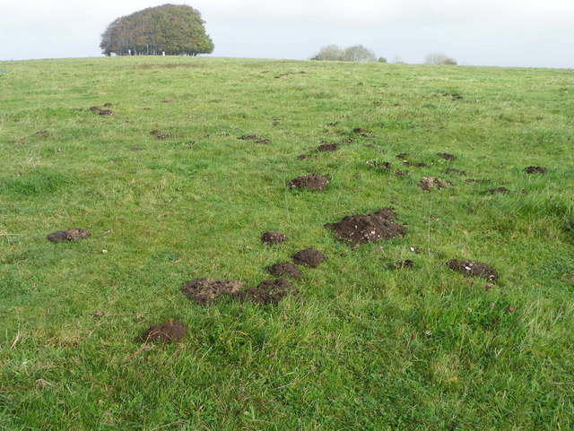 Photo could not load
ST9220 : Molehills on Win Green
Maigheach-gheal
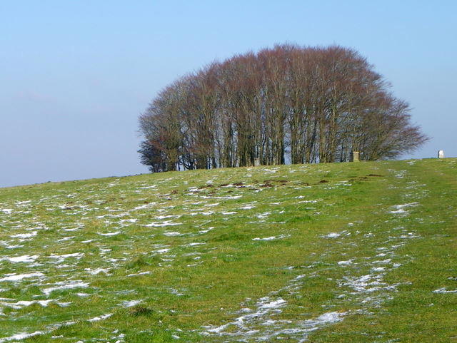 Photo could not load
ST9220 : Towards Win Green Clump
Maigheach-gheal
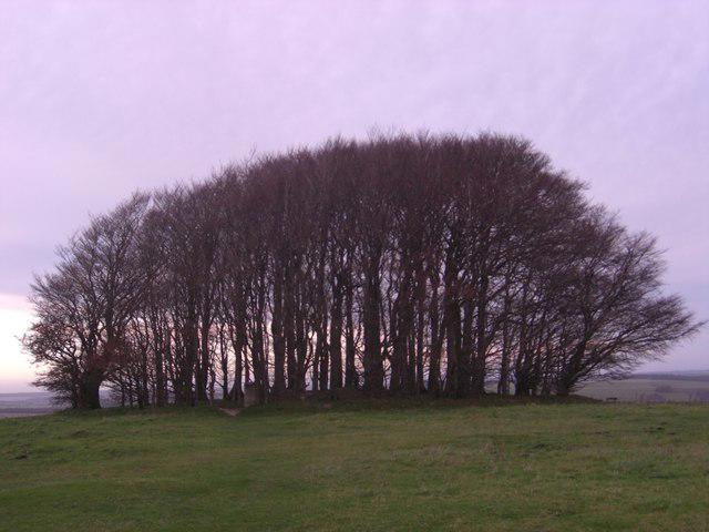 Photo could not load
ST9220 : Win Green Clump
Ibn Musa
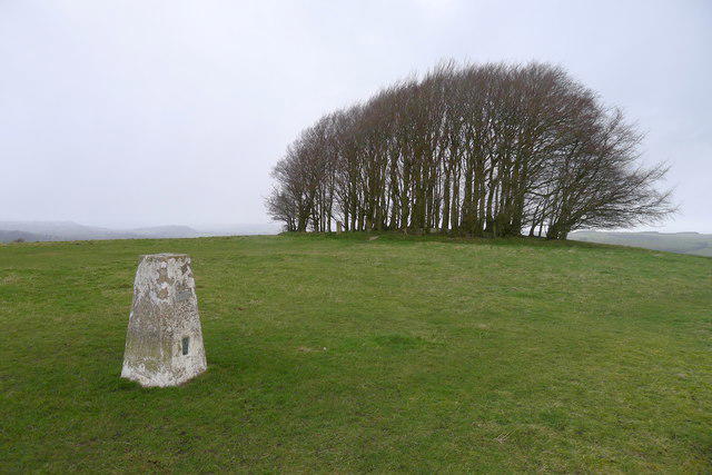 Photo could not load
ST9220 : Trig point and beech trees on the summit of Win Green
Tim Heaton
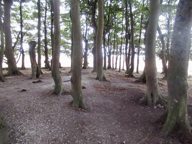 Photo could not load
ST9220 : Summit clump, Win Green
Richard Webb
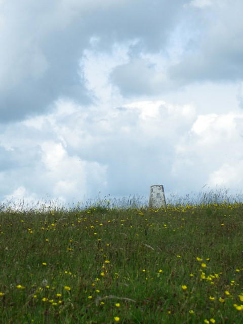 Photo could not load
ST9220 : Triangulation pillar, Win Green
Maigheach-gheal
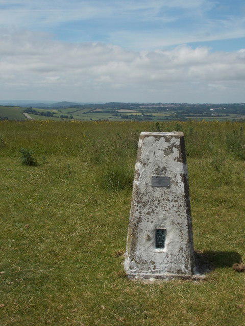 Photo could not load
ST9220 : Win Green: the trig point
Chris Downer
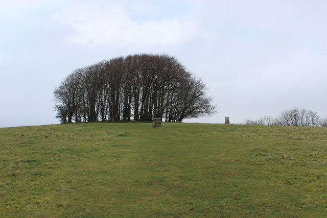 Photo could not load
ST9220 : Furnishings upon the Summit of Win Green
Chris Heaton
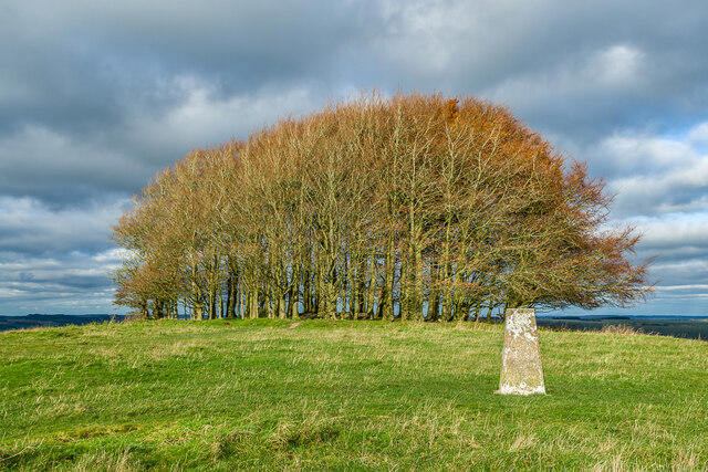 Photo could not load
ST9220 : Win Green Clump
Ian Capper
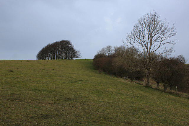
ST9220 : Win Green from the Wessex Ridgeway
Chris Heaton
Hill facts and local notes
Classifications
Elevation
277m
909 ft
Prominence
157m
Coordinates
50.9856, -2.1080
ST925206
OS Map
184
Explorer: 118N
At the Summit
The summit features a prominent trig point, a great spot for a selfie if you can catch your breath after the brisk walk!
Terrain & Geology
Win Green is primarily composed of chalk, a well-known sedimentary rock that was formed during the late Cretaceous period. The surrounding area features fossil-rich deposits, telling a tale of ancient seas.
Views & Scenery
On a clear day, you can see across the beautiful Blackmore Vale and even glimpse the distant Mendip Hills.
History & Heritage
Name Origin
The name 'Win Green' likely derives from 'wynn', meaning 'joy', and 'green', referring to the lush landscape.
Historical Significance
The area has historical significance due to its association with ancient earthworks, likely dating back to the early Iron Age.
Getting There & Facilities
Parking
Parking is available at The Greyhound Inn on the A30; please be considerate and don’t block their entrance.
Public Transport
The nearest bus stop is at the village of Shaftesbury, approximately 5 miles away, so a taxi may be needed.
Nearby Facilities
The Greyhound Inn provides refreshments and toilets, as well as a lovely beer garden for post-hike relaxation.
Safety Information
Known Hazards
- Occasional steep sections and wet grass can be slippery, especially after rain. Don't forget your wellies!
General Safety Tips
- Check weather conditions before setting out
- Carry appropriate clothing and equipment
- Let someone know your planned route
- Take a map, compass, and GPS device
- Carry emergency supplies: food, water, first aid kit, torch
Hills
Some common questions about the hills answered
Are there group walks up Win Green?
Many walkers use Walkmates to join or organise walks with others. You can check for group walks around Win Green through the maps
Are there other walkers around Win Green?
Activity varies by location and time, but Walkmates lets you see whether others have shared walks or shown interest in this area. Find other people through the walking friends search walking friends for Win Green search or of course create your own walk for Win Green
Can I organise a walk to Win Green?
Yes. If there aren’t any walks listed already, you can create a walk and make it available for others to join.
If you're signed up to Walkmates, you can create a walk to Win Green.
How do I find a walk up this hill?
There are often multiple ways to walk this hill, depending on experience and route preference. Walkmates helps you explore walks and routes that others have shared.
Can I suggest a new route up Win Green?
Yes. You can suggest or create routes to share with others. Walkmates focuses on the social side of walking, so routes are used to help people organise walks and explore areas together, rather than as detailed navigation tools or route libraries.
Other uses really appreciate knowledgeable walkers sharing their routes. Share your favourite route to Win Green here
The is an error or something incorrect about this hill. How do I let you know?
We always strive to keep the information on Walkmates as accurate as possible. If you find an error, please let us know through the contact form and we'll aim to correct it as quickly as possible
Community Discussion
Comments
Location
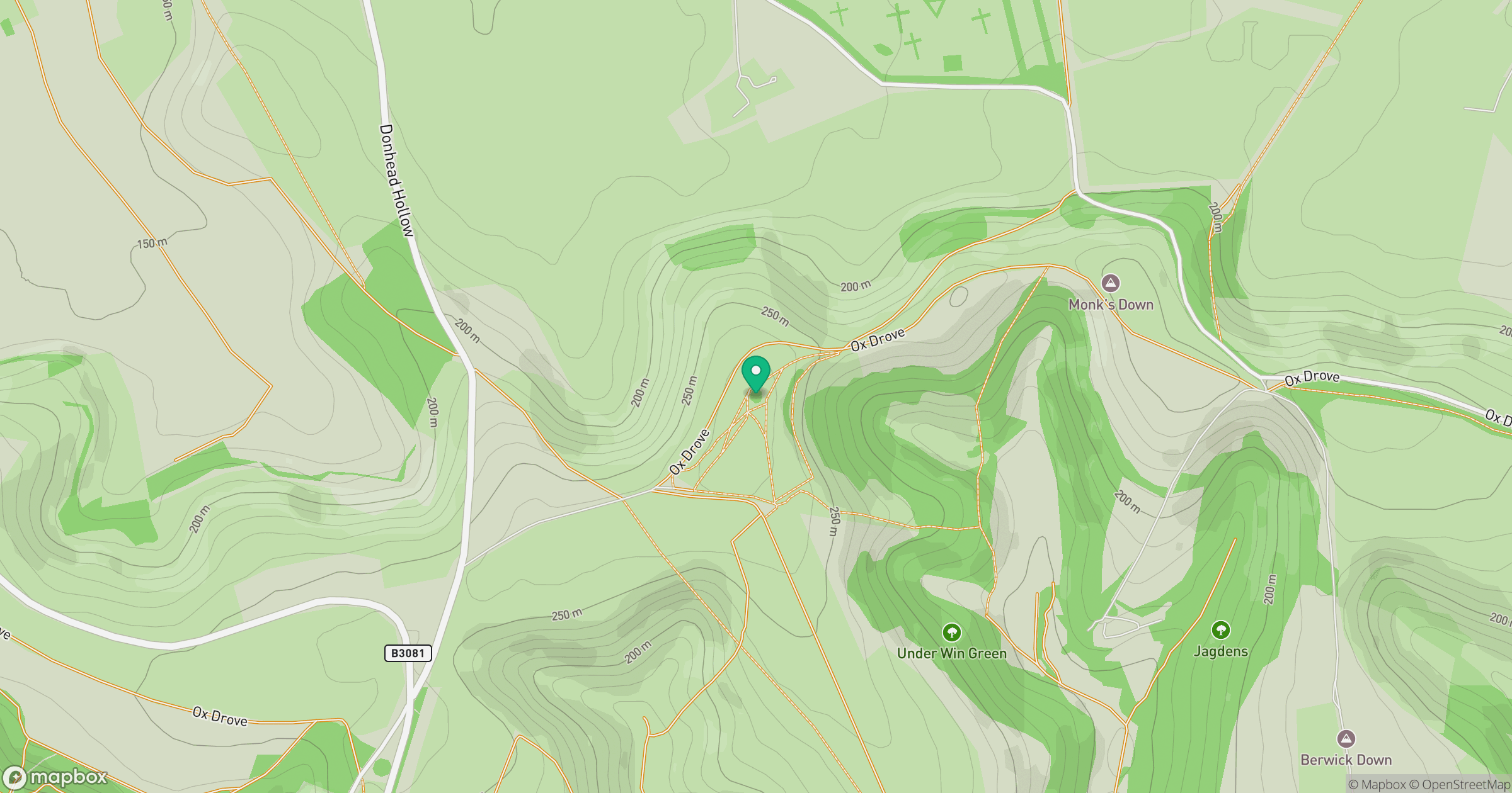
Grid reference: ST925206
View on OpenStreetMapOpens a map in a new tab, centred on the hill.
Nearby Hills
Glastonbury Tor
158m
Worcestershire Beacon
425m

Dunkery Beacon
520m
Titterstone Clee Hill
533m

Cribyn
794m
No comments yet. Be the first.