

Stuc a' Chroin North Top
Good walks are even better shared.
NN6118 : Northeast Buttress of Stùc a' Chroin
wfmillar Photo source
Overview
Stuc a' Chroin North Top
Stuc a' Chroin North Top is a magnificent Munro located in the heart of the Scottish Highlands. Rising to an elevation of 961 meters, it offers adventurers a challenging ascent with spectacular rewards.
Geology
The mountain showcases a rich geological past, primarily composed of sandstone with volcanic intrusions that create dramatic vistas. The area is a prime spot for amateur geologists, particularly those curious about glacial features and erosion patterns.
Routes
One of the most popular routes begins at Balquhidder, a picturesque village that serves as the gateway to your adventure. The path meanders through lush glens before presenting a delightful ascent to the summit. Expect to cover approximately 11.5 km, taking around 5 hours depending on your pace and how often you stop to take in the views (and catch your breath!).
Terrain
The terrain varies significantly, with rocky outcrops juxtaposed against grassy slopes and the occasional boggy patch. Good footwear is a must, as you wouldn’t want to have an unplanned swim amidst the highlands!
Views
At the top, you’ll be greeted by some of the finest views imaginable. Loch Earn glimmers below while the majestic Ben Vorlich looms proudly to the south. There’s nothing quite like the sight to make you feel on top of the world—literally! For the best visibility, aim for the late spring or early autumn when the heather is in bloom and the skies are often clear.
Hazards
Do keep an eye on the ever-changing weather conditions; the Highlands are notorious for their sudden mood swings! Mist can roll in faster than you can say 'where’s my GPS?', and the terrain may become slippery in unexpected rain.
Nearby Summits
Stuc a' Chroin is a part of a beautiful mountain range, with its namesake, Stuc a' Chroin (941 m), and Ben Vorlich (985 m) nearby, making for great additions to your hiking itinerary.
Access
Access is relatively straightforward, starting from Balquhidder, where you can park up and prepare for your hike. Public transport options are available from Callander, but check the schedules to avoid being left high and dry!
Facilities
While there are no facilities on the mountain itself, Balquhidder has some basic amenities, including a small shop and places to grab refreshments—always good to refuel and chat about your journey!
History
The name Stuc a' Chroin translates to 'Peak of the Cattle', a nod to its historical significance as grazing land. As you traverse the slopes, take a moment to appreciate the rich cultural backdrop that this area represents.
In conclusion, a hike up Stuc a' Chroin North Top is not just a journey; it's an experience filled with breathtaking sights, rich geology, and a touch of historical charm. Pack your bags, lace up your boots, and prepare for adventure!
Explore routes near Stuc a' Chroin North Top
Walks starting near this hill. Open a route to check its map, distance and full itinerary.
Loch Lubnaig: West Shore Railway Path from Ben Ledi Car Park
View route
Killin: Falls of Dochart, Finlarig and Moirlanich Longhouse
View route
Loch Katrine: Brenachoile Point Shore Walk from Trossachs Pier
View route
Aberfoyle woodland wellbeing walk
View route
Route planning notes
These notes describe possible approaches. Check a route's map and access information when planning your walk.
Main Route from Balquhidder
A popular route that begins at Balquhidder, following paths through scenic glens before ascending the mountain.
Make a day of it, together
Find someone to share the walk with, or organise a day out along a route you like.
Photo Gallery
View all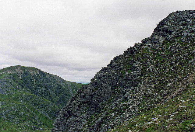 Photo could not load
NN6118 : Northeast Buttress of Stùc a' Chroin
wfmillar
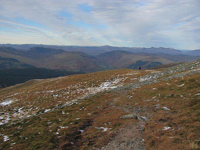 Photo could not load
NN6117 : Path on Stùc a' Chroin
Richard Webb
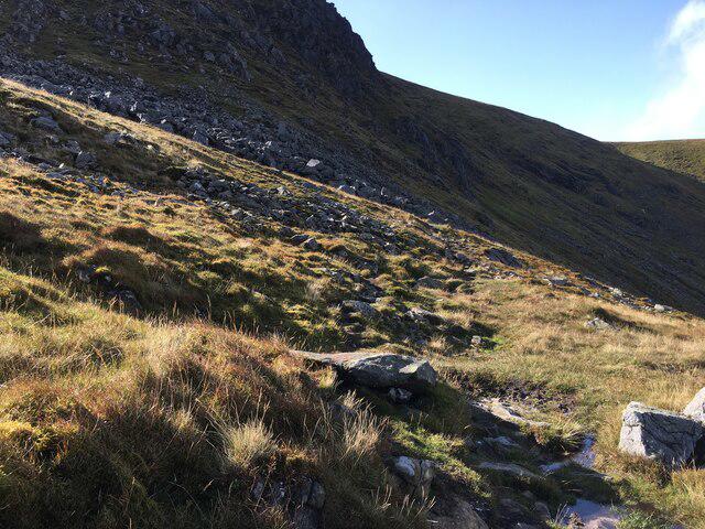 Photo could not load
NN6118 : Path towards Stuc a’ Chroin
Steven Brown
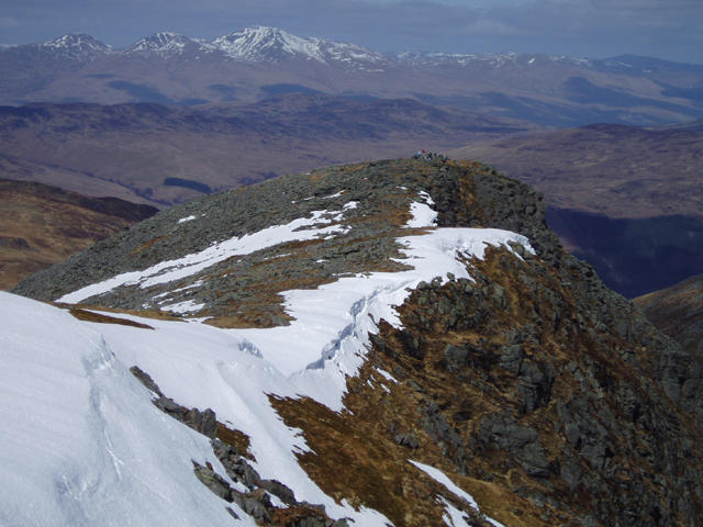 Photo could not load
NN6117 : Stuc a' Chroin
Kevin Rae
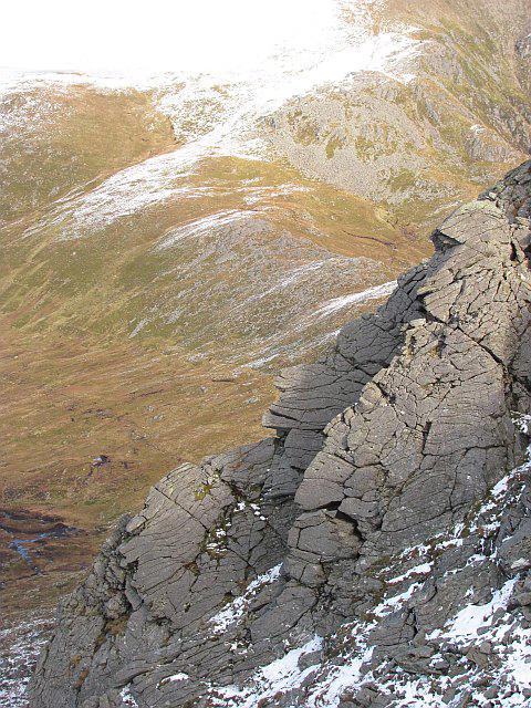 Photo could not load
NN6118 : Crags, Northeast Buttress of Stùc a' Chroin
Richard Webb
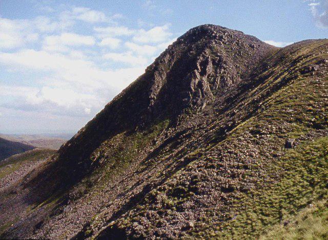 Photo could not load
NN6118 : Northeast Buttress of Stùc a' Chroin
Alan Reid
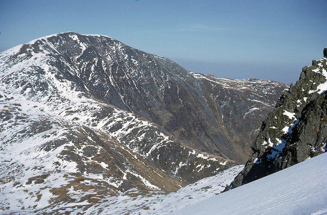 Photo could not load
NN6118 : Ben Vorlich from the northern ridge of Stuc a' Chroin
Julian Paren
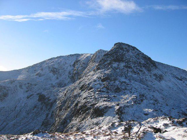 Photo could not load
NN6118 : Stuc a Chroin northern ridge
Hill Walker
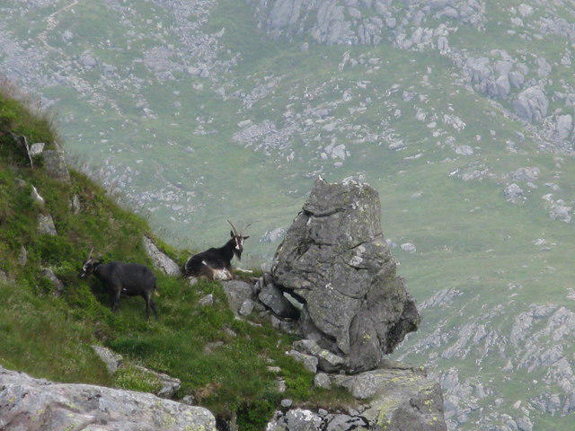 Photo could not load
NN6117 : Wild Goats on Stùc a’ Chroin
G Laird
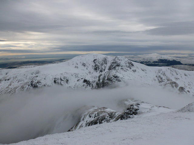
NN6117 : Stuc a' Chroin
Alan O'Dowd
Hill facts and local notes
Classifications
Elevation
950m
3,115 ft
Prominence
19m
Coordinates
56.3335, -4.2365
NN618179
OS Map
57
Explorer: OL46N OL47W 365N 368W
At the Summit
The summit features a distinctive cairn along with a breathtaking vista that stretches across the surrounding glens and peaks.
Terrain & Geology
Composed primarily of sandstone with some volcanic intrusions, the area presents a dramatic landscape formed by glacial erosion. The rock formations are often fascinating to geological enthusiasts.
Views & Scenery
From the summit, you can spot the stunning Loch Earn, the mighty Ben Vorlich, and the expansive vistas of the central Highlands.
History & Heritage
Name Origin
The name 'Stuc a' Chroin' translates to 'Peak of the Cattle', likely referring to the area's historical use for grazing.
Historical Significance
This mountain has been a popular destination for hikers for generations, steeped in local folklore and surrounded by natural beauty.
Getting There & Facilities
Parking
Parking is available at Balquhidder, with spaces provided at the village. Please ensure not to block local residents’ access.
Public Transport
The nearest bus service is from Callander to Balquhidder, with services running a few times daily.
Nearby Facilities
There are no facilities on the mountain itself, but Balquhidder provides some basic amenities including a small shop and options for refreshments.
Safety Information
Known Hazards
- Sudden changes in weather can occur; be prepared for mist and rain. The terrain can be slippery, especially in wet conditions.
General Safety Tips
- Check weather conditions before setting out
- Carry appropriate clothing and equipment
- Let someone know your planned route
- Take a map, compass, and GPS device
- Carry emergency supplies: food, water, first aid kit, torch
Hills
Some common questions about the hills answered
Are there group walks up Stuc a' Chroin North Top?
Many walkers use Walkmates to join or organise walks with others. You can check for group walks around Stuc a' Chroin North Top through the maps
Are there other walkers around Stuc a' Chroin North Top?
Activity varies by location and time, but Walkmates lets you see whether others have shared walks or shown interest in this area. Find other people through the walking friends search walking friends for Stuc a' Chroin North Top search or of course create your own walk for Stuc a' Chroin North Top
Can I organise a walk to Stuc a' Chroin North Top?
Yes. If there aren’t any walks listed already, you can create a walk and make it available for others to join.
If you're signed up to Walkmates, you can create a walk to Stuc a' Chroin North Top.
How do I find a walk up this hill?
There are often multiple ways to walk this hill, depending on experience and route preference. Walkmates helps you explore walks and routes that others have shared.
Can I suggest a new route up Stuc a' Chroin North Top?
Yes. You can suggest or create routes to share with others. Walkmates focuses on the social side of walking, so routes are used to help people organise walks and explore areas together, rather than as detailed navigation tools or route libraries.
Other uses really appreciate knowledgeable walkers sharing their routes. Share your favourite route to Stuc a' Chroin North Top here
The is an error or something incorrect about this hill. How do I let you know?
We always strive to keep the information on Walkmates as accurate as possible. If you find an error, please let us know through the contact form and we'll aim to correct it as quickly as possible
Community Discussion
Comments
Location
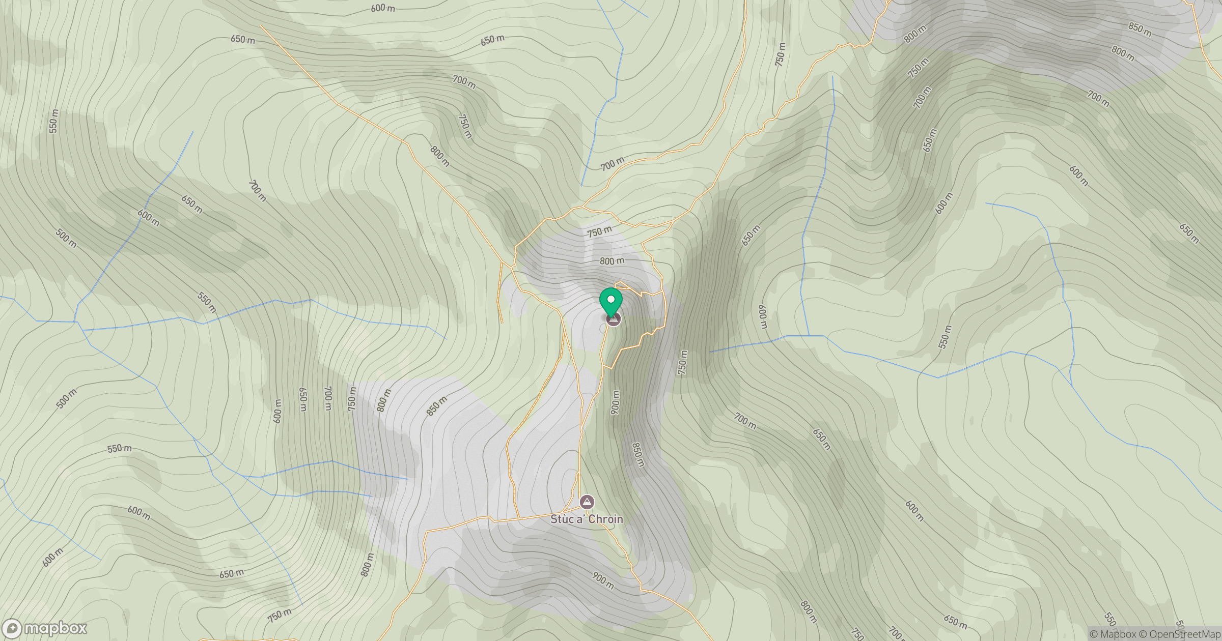
Grid reference: NN618179
View on OpenStreetMapOpens a map in a new tab, centred on the hill.


No comments yet. Be the first.