

Stob Coire Bhuidhe
Good walks are even better shared.
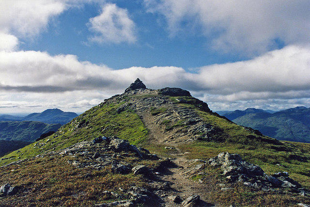
NN4022 : Stob Coire Bhuide from NNW ridge of Stob Garbh
Cary O'Donnell Photo source
Overview
Stob Coire Bhuidhe
Introduction
Stob Coire Bhuidhe is a striking Munro nestled in the breathtaking Scottish Highlands. With an elevation of 1011 meters, it promises both challenge and delight for hikers. As one of the hidden gems just off the beaten path, it offers stunning views and a taste of Scotland's rugged beauty.
Geology
The mountain’s foundation consists of metamorphic rocks that have been shaped over millennia. These rocks not only provide a stunning backdrop but also embody the rich geological history of the area. The rugged terrain is typical of the highlands and presents a magnificent sight for any eager hiker.
Routes
There are several trails leading to the summit, with the Coire nan Lochan Route being a favourite among locals. Spanning approximately 11 km, this moderate climb weaves through magnificent landscapes and rewards hikers with panoramic views.
For those in search of a bit more excitement, the West Ridge Route presents a steeper ascent, approximately 9 km long. This route is more demanding and caters to those looking for a challenge.
Summit Features
At the summit, adventurers are greeted with a formidable cairn marking the peak. The surrounding view is nothing short of spectacular, showcasing famed peaks like Ben Nevis, adding to the mountain’s impressive allure.
Terrain Type
Expect a mixed terrain of rocky slopes and grassy hills, interspersed with some boggy sections near the base. Sturdy boots are a must as you traverse this enchanting landscape.
Views
The views from Stob Coire Bhuidhe are absolutely unforgettable. On a clear day, one can enjoy sights extending to massive peaks and valleys. The best seasons for these views are late spring through early autumn, when the weather is generally more stable and the wildflowers blossom.
Hazards
Hikers should be wary of the ever-changing weather conditions typical of the Highlands. Additionally, loose rocks and steep drops can pose risks. Make sure you’re appropriately prepared – it’s not the place to forget your gear!
Nearby Summits
The surrounding landscape boasts other prominent peaks, including Stob Ghabhar and Meall a' Bhuiridh, making it an excellent area for multi-peak adventures.
Access
Access to Stob Coire Bhuidhe is relatively straightforward. The nearest parking can be found at the Bridge of Orchy. For those travelling by public transport, take the train to Bridge of Orchy for a scenic route into the hills.
Facilities
Crianlarich, located 16 km north of the mountain, provides all necessary facilities, including cafes and shops to fuel up before your trek.
History and Name Meaning
Stob Coire Bhuidhe translates to 'peak of the yellow corrie'. This etymology reflects the beautiful natural features of the mountains and their place in Scottish culture. The mountain is intertwined with local folklore, making it a significant landmark in the landscape.
Final Thoughts
Whether you’re a seasoned hiker or a budding enthusiast, Stob Coire Bhuidhe promises rewarding experiences and unforgettable vistas. Remember to pack your lunch, a good book, and maybe even a joke or two for the rest stop at the top!
Explore routes near Stob Coire Bhuidhe
Walks starting near this hill. Open a route to check its map, distance and full itinerary.
Loch Katrine: Brenachoile Point Shore Walk from Trossachs Pier
View route
Killin: Falls of Dochart, Finlarig and Moirlanich Longhouse
View route
The Cobbler from Succoth Carpark
View route
Beinn Ime from Succoth
View route
Route planning notes
These notes describe possible approaches. Check a route's map and access information when planning your walk.
Coire nan Lochan Route
A popular ascent via Coire nan Lochan, offering spectacular views as you progress upwards.
West Ridge Route
This route takes you up the west ridge, providing a slightly steeper and more engaging climb.
Make a day of it, together
Find someone to share the walk with, or organise a day out along a route you like.
Photo Gallery
View all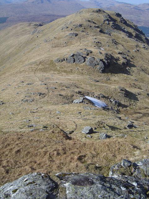 Photo could not load
NN4022 : Stob Coire Bhuide from NNW ridge of Stob Garbh
Cary O'Donnell
Hill facts and local notes
Classifications
Elevation
857m
2,811 ft
Prominence
42m
Coordinates
56.3713, -4.5773
NN409228
OS Map
51
Explorer: OL39N 364N
At the Summit
The summit features a large cairn and offers a breathtaking panorama of the surrounding peaks.
Terrain & Geology
Stob Coire Bhuidhe is predominantly composed of rugged metamorphic rocks, primarily schists and gneisses, which give a rugged character to the landscape. The geological history of the region has led to spectacular scenery and diverse habitats.
Views & Scenery
From the summit, you'll see the impressive landscape of the Scottish Highlands, including Ben Nevis and the often misty Glencoe.
History & Heritage
Name Origin
The name 'Stob Coire Bhuidhe' can be translated to 'peak of the yellow corrie', referring to the yellow-tinged sods found in the corrie.
Historical Significance
This mountain is part of the historical landscape of the Highlands, often featured in local folklore and stories.
Getting There & Facilities
Parking
Parking is available at the 'Bridge of Orchy', close to the A82 road.
Public Transport
The area is accessible via train services to Bridge of Orchy, with some bus connections.
Nearby Facilities
In Crianlarich, there are cafes, shops, and accommodation options, including public toilets.
Safety Information
Known Hazards
- Potential for sudden weather changes, loose rocks, and steep drops in places. Proper gear and preparation are essential.
General Safety Tips
- Check weather conditions before setting out
- Carry appropriate clothing and equipment
- Let someone know your planned route
- Take a map, compass, and GPS device
- Carry emergency supplies: food, water, first aid kit, torch
Hills
Some common questions about the hills answered
Are there group walks up Stob Coire Bhuidhe?
Many walkers use Walkmates to join or organise walks with others. You can check for group walks around Stob Coire Bhuidhe through the maps
Are there other walkers around Stob Coire Bhuidhe?
Activity varies by location and time, but Walkmates lets you see whether others have shared walks or shown interest in this area. Find other people through the walking friends search walking friends for Stob Coire Bhuidhe search or of course create your own walk for Stob Coire Bhuidhe
Can I organise a walk to Stob Coire Bhuidhe?
Yes. If there aren’t any walks listed already, you can create a walk and make it available for others to join.
If you're signed up to Walkmates, you can create a walk to Stob Coire Bhuidhe.
How do I find a walk up this hill?
There are often multiple ways to walk this hill, depending on experience and route preference. Walkmates helps you explore walks and routes that others have shared.
Can I suggest a new route up Stob Coire Bhuidhe?
Yes. You can suggest or create routes to share with others. Walkmates focuses on the social side of walking, so routes are used to help people organise walks and explore areas together, rather than as detailed navigation tools or route libraries.
Other uses really appreciate knowledgeable walkers sharing their routes. Share your favourite route to Stob Coire Bhuidhe here
The is an error or something incorrect about this hill. How do I let you know?
We always strive to keep the information on Walkmates as accurate as possible. If you find an error, please let us know through the contact form and we'll aim to correct it as quickly as possible
Community Discussion
Comments
Location
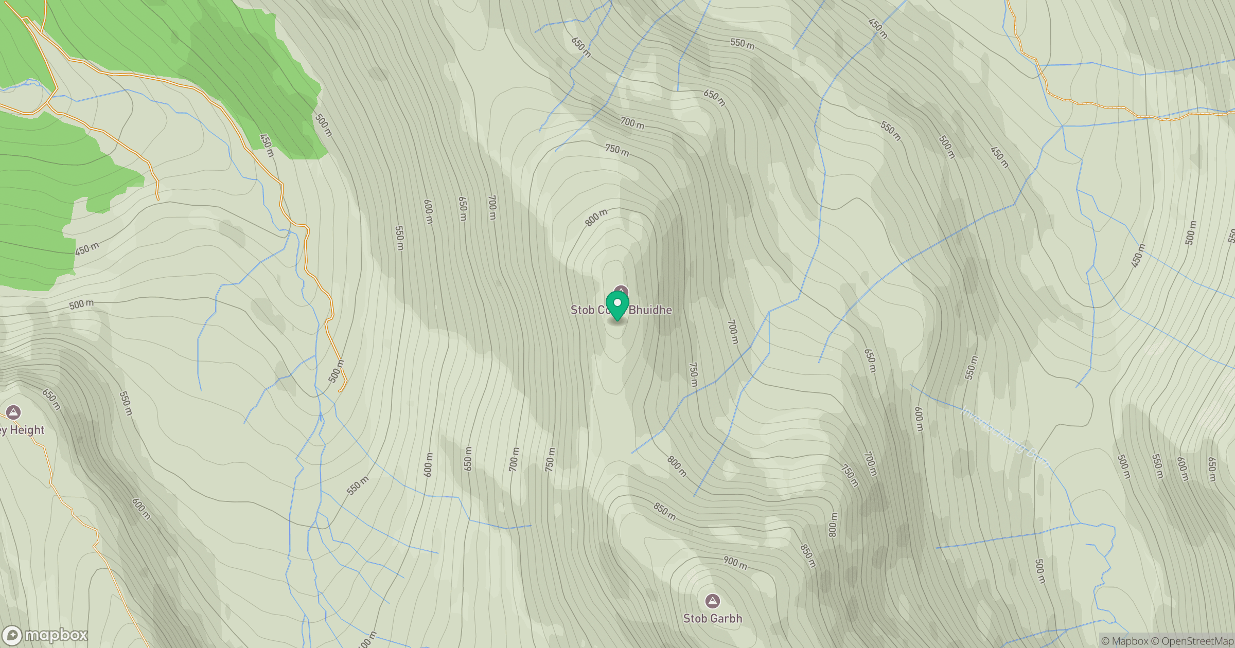
Grid reference: NN409228
View on OpenStreetMapOpens a map in a new tab, centred on the hill.
No comments yet. Be the first.