

Stob a' Choin
Good walks are even better shared.
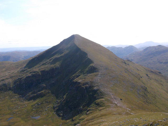
NN4116 : Subsidiary summit of Stob a' Choin
Richard Law Photo source
Overview
Stob a' Choin
Stob a' Choin is a proud Munro standing at 941 meters, nestled in the breathtaking Scottish Highlands. With its stunning vistas and diverse terrain, it’s a favourite for both seasoned hikers and those just wanting to stretch their legs amidst some of the UK's most striking landscapes.
Geology
This magnificent peak is primarily made up of granite, intersected with schist, which may sound like a fancy dessert but is actually one of nature's many masterpieces. The rocks you’ll stumble upon here are ancient—over a billion years old, giving Stob a' Choin a sense of history that could rival even your grandmother's stories!
Routes
A popular route begins at Inversnaid, weaving through charming woodlands before the ascent becomes more pronounced. It covers approximately 12 km and typically takes around 4.5 hours, placing it firmly in the moderate category. As you make your way up, remember that not all heroes wear capes—some wear boots and enjoy the occasional rest by the cairn.
Terrain
Expect a delightful mix of rocky paths and grassy hillsides, punctuated by the odd boggy patch—watch your step and keep your gaiters handy! After all, nothing says adventure like a good splash!
Views
On a clear day, the panoramic views from the summit are nothing short of spectacular; you can feast your eyes on Loch Lomond, Ben Lomond, and a myriad of peaks that paint the horizon. For the best views, aim for late spring or early autumn. Oh, and bring a camera—your friends are going to need proof!
Hazards
Keep your wits about you; the trails can be slippery, especially post-rain. And let's not forget the unpredictable Scottish weather! Always come prepared with layers and a sense of humour to combat the sudden change.
Nearby Summits
Stob a' Choin is not a lone wolf; nearby, you'll find its sibling, the East Stob a' Choin, and Ben Lomond, both serious contenders for your hiking itinerary.
Access
Accessing Stob a' Choin is relatively straightforward. Park at Inversnaid (a small fee applies), where you’ll find parking and facilities. If you're relying on public transport, be prepared for a bit of a wait. Callander is the nearest town, approximately 20 miles away, offering various amenities.
Facilities
The Inversnaid Hotel is perfect for a refreshing cup of tea or a hearty lunch after your hike. Just don’t get too comfy; the fresh air outside is calling!
History
The name 'Stob a' Choin' translates to 'Peak of the Dog' in Scots Gaelic, a fitting moniker for this majestic mountain. It holds significant value to local hikers and the surrounding culture, embodying the spirit of adventure so prevalent in Scotland.
So, lace up your boots, grab that rucksack, and head out for a day that promises both challenge and beauty. Just remember to bring a sense of humour and your favourite snack! Good luck!
Explore routes near Stob a' Choin
Walks starting near this hill. Open a route to check its map, distance and full itinerary.
Loch Katrine: Brenachoile Point Shore Walk from Trossachs Pier
View route
The Cobbler from Succoth Carpark
View route
Beinn Ime from Succoth
View route
Loch Ard Forest: Sculpture Trail and Little Loch Ard
View route
Route planning notes
These notes describe possible approaches. Check a route's map and access information when planning your walk.
From Inversnaid
A popular route starting from Inversnaid, traversing through lush woodland before tackling the ascent.
Make a day of it, together
Find someone to share the walk with, or organise a day out along a route you like.
Photo Gallery
View all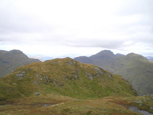 Photo could not load
NN4116 : Subsidiary summit of Stob a' Choin
Richard Law
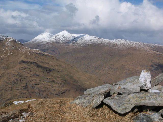 Photo could not load
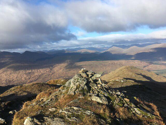
NN4116 : Cairn on Stob a' Choin's north top
Alec MacKinnon
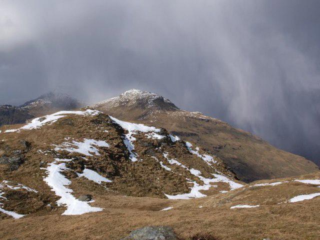 Photo could not load
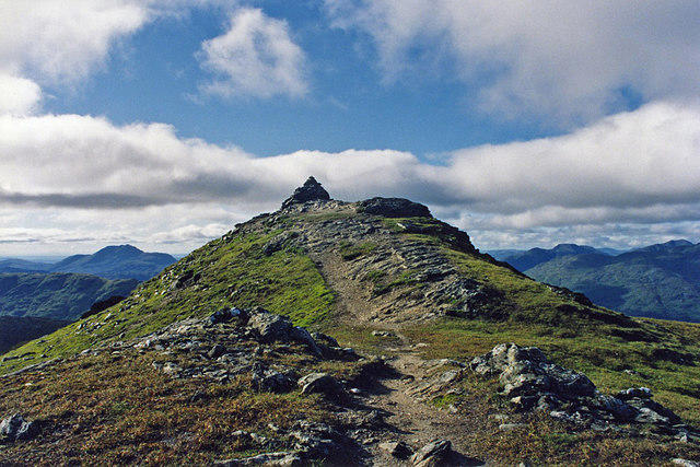
NN4116 : North top of Stob a'Choin
Alec MacKinnon
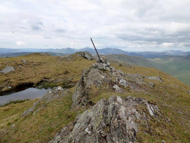 Photo could not load
NN4115 : Stob a'Choin
Rude Health
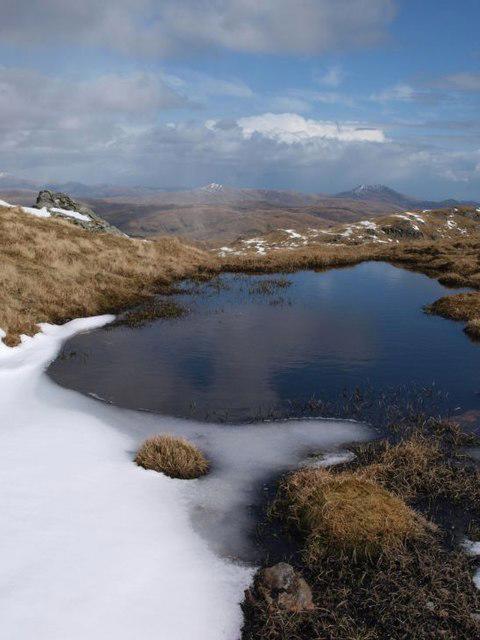 Photo could not load
NN4115 : Tiny lochan on Stob a'Choin
Alec MacKinnon
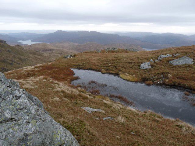 Photo could not load
NN4115 : On Stob a' Choin
Alan Reid
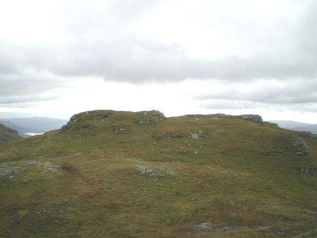 Photo could not load
NN4115 : Summit of Stob a' Choin
Richard Law
Hill facts and local notes
Classifications
Elevation
867m
2,845 ft
Prominence
478m
Coordinates
56.3097, -4.5602
NN417159
OS Map
56
Explorer: OL46N 365N
At the Summit
The summit boasts a large granite cairn, which may serve as a perfect spot for a selfie or a well-deserved snack break.
Terrain & Geology
Stob a' Choin is primarily composed of granite and schist, featuring ancient rocks that are over a billion years old, which might explain why they’ve seen some things!
Views & Scenery
Breathtaking views of Loch Lomond, Ben Lomond, and the surrounding peaks of the Trossachs National Park.
History & Heritage
Name Origin
The name 'Stob a' Choin' translates to 'Peak of the Dog,' perhaps a nod to its canine-like stature among the hills.
Historical Significance
This Munro is cherished by local hikers and forms part of the rich tapestry of Scottish mountain culture.
Getting There & Facilities
Parking
There is a car park at Inversnaid, which charges a fee but offers easy access to various trails.
Public Transport
Buses run to Inversnaid from more populated areas, though services can be limited.
Nearby Facilities
The nearby Inversnaid Hotel provides refreshments and amenities, but don't expect a five-star menu—after all, this is the great outdoors!
Safety Information
Known Hazards
- Potentially slippery trails, especially after rain; watch your step! Sudden weather changes can also occur, so be prepared.
General Safety Tips
- Check weather conditions before setting out
- Carry appropriate clothing and equipment
- Let someone know your planned route
- Take a map, compass, and GPS device
- Carry emergency supplies: food, water, first aid kit, torch
Hills
Some common questions about the hills answered
Are there group walks up Stob a' Choin?
Many walkers use Walkmates to join or organise walks with others. You can check for group walks around Stob a' Choin through the maps
Are there other walkers around Stob a' Choin?
Activity varies by location and time, but Walkmates lets you see whether others have shared walks or shown interest in this area. Find other people through the walking friends search walking friends for Stob a' Choin search or of course create your own walk for Stob a' Choin
Can I organise a walk to Stob a' Choin?
Yes. If there aren’t any walks listed already, you can create a walk and make it available for others to join.
If you're signed up to Walkmates, you can create a walk to Stob a' Choin.
How do I find a walk up this hill?
There are often multiple ways to walk this hill, depending on experience and route preference. Walkmates helps you explore walks and routes that others have shared.
Can I suggest a new route up Stob a' Choin?
Yes. You can suggest or create routes to share with others. Walkmates focuses on the social side of walking, so routes are used to help people organise walks and explore areas together, rather than as detailed navigation tools or route libraries.
Other uses really appreciate knowledgeable walkers sharing their routes. Share your favourite route to Stob a' Choin here
The is an error or something incorrect about this hill. How do I let you know?
We always strive to keep the information on Walkmates as accurate as possible. If you find an error, please let us know through the contact form and we'll aim to correct it as quickly as possible
Community Discussion
Comments
Location
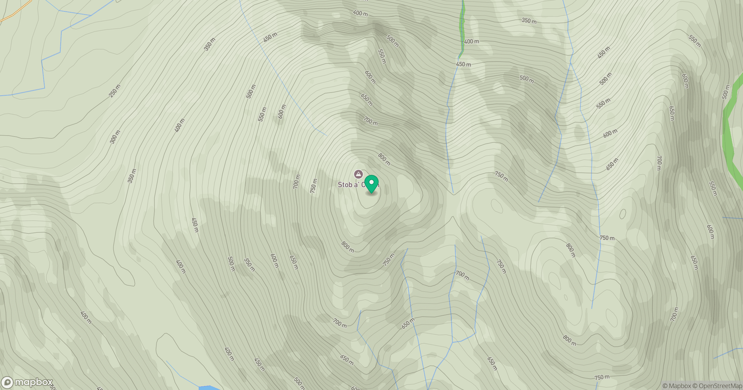
Grid reference: NN417159
View on OpenStreetMapOpens a map in a new tab, centred on the hill.
No comments yet. Be the first.