

Sgurr nan Saighead
Good walks are even better shared.
Overview
Sgurr nan Saighead
Nestled in the heart of the Scottish Highlands, Sgurr nan Saighead stands at an impressive 956 meters. This Munro, a must for peak-baggers and outdoor enthusiasts alike, serves up challenges and outstanding views that reward your efforts.
Route
The most popular route starts from the Glen Shiel road viewpoint car park. It's a moderate hike of about 10.5 kilometers that typically takes around 5 hours. While the path is well-trodden, keep an eye on your footing—those loose rocks have a habit of rolling away just when you least expect it!
Terrain and Geology
Expect a patchwork of rocky outcrops and grassy knolls interspersed with a few boggy areas that could be mistaken for swamps by the less experienced hiker. The geology primarily showcases ancient Lewisian gneiss, adding a rugged character to the landscape.
Views
From the summit, brace yourself for some of the finest Highland views imaginable! On a clear day, the panorama includes the magnificent Five Sisters of Kintail, the shimmering waters of Loch Duich, and even distant glimpses of the Isle of Skye. Best of all, the views are particularly vibrant in late spring and autumn.
Hazards
As with any mountain adventure, remember there are hazards to keep in check. Loose rocks can create tricky footing, so sturdy walking shoes are a must. The weather can also throw a curveball—be prepared with waterproofs and layers.
Nearby Peaks
For those looking to extend their adventure, consider tackling nearby Sgurr an Fhuarain (874 meters) or the slightly taller Sgurr na Ciste Dhuibh (1027 meters). Both offer their own unique views and challenges.
Access
While Sgurr nan Saighead is a gem in the mountains, access requires some planning. The nearest parking is at the viewpoint on the A87, and there's limited public transport from nearby towns, so car-pooling is recommended. Once in Kyle of Lochalsh, you're in for some culinary delights to fuel your journey!
Conclusion
In conclusion, Sgurr nan Saighead is not just a hill—it’s an adventure waiting to unfold. With its rich heritage, stunning vistas, and temperamental weather, this peak promises a memorable experience. Grab your gear, put on those hiking boots, and set off on a journey that echoes the footsteps of those who’ve come before you. Just remember, if in doubt, the summit isn’t going anywhere anytime soon, so take your time and enjoy the journey!
Explore routes near Sgurr nan Saighead
Public walks starting within 80 km of this hill. Nearby does not mean a route reaches the summit; check its map and access before setting out.
Loch Affric full circuit from River Affric
View route
Glen Affric: Coire Loch Woodland Trail
View route
Beinn Eighe Lancaster Wreckage at Coire Mhic Fhearchair
View route
Fort Augustus to Kytra Lock: Caledonian Canal Towpath
View route
Route planning notes
These notes describe possible approaches, not verified navigable routes or permission to cross land. Check current paths, local access rules and conditions before setting out.
From the Glen Shiel road
This route begins at the viewpoint car park along the A87 and takes hikers directly up towards the summit, entwined with scenic views of the surrounding peaks.
Make a day of it, together
Find someone to share the walk with, or organise a day out along a route you like.
Photo Gallery
View all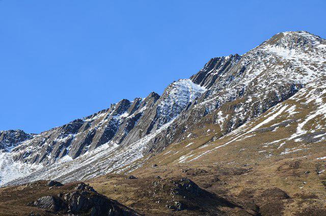 Photo could not load
NG9717 : Slabs on Sgurr nan Saighead
Jim Barton
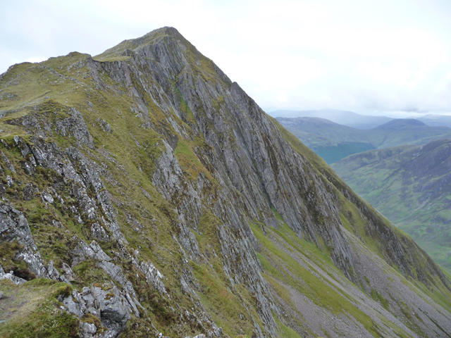 Photo could not load
NG9717 : Sgurr nan Saighead
John Allan
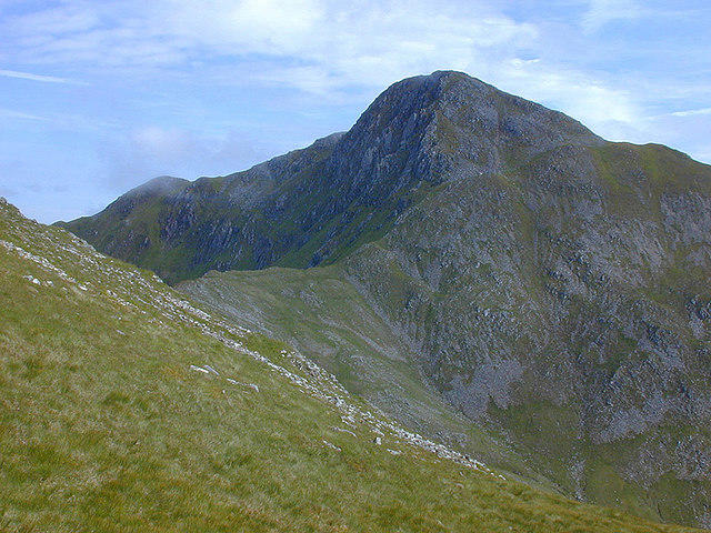 Photo could not load
NG9717 : Southern slopes of Sgùrr nan Saighead
Nigel Brown
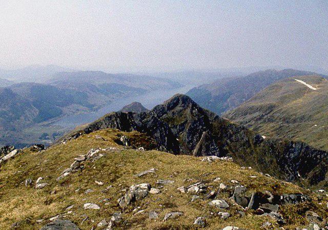 Photo could not load
NG9717 : Sgùrr nan Saighead
Alan Reid
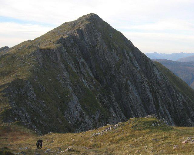 Photo could not load
NG9717 : Cliffs of Sgurr nan Saighead
Hill Walker
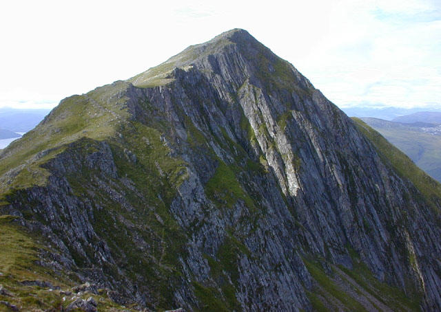 Photo could not load
NG9717 : Sgurr nan Saighead
Nigel Brown
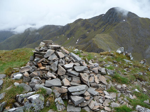 Photo could not load
NG9717 : Sgurr nan Saighead summit
John Allan
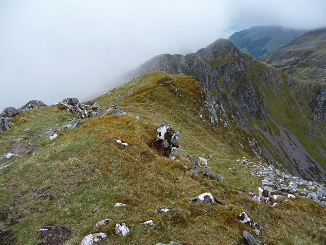 Photo could not load
NG9717 : North-west ridge of Sgurr nan Saighead
John Allan
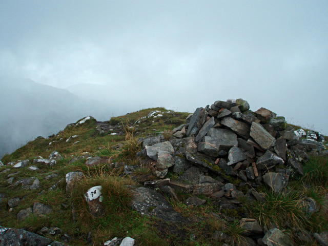 Photo could not load
NG9717 : Summit cairn, Sgurr nan Saighead
Chris Eilbeck
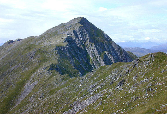 Photo could not load
NG9717 : Sgùrr nan Saighead
Nigel Brown
Hill facts and local notes
Classifications
Elevation
929m
3,048 ft
Prominence
108m
Coordinates
57.2060, -5.3549
NG974177
OS Map
33
Explorer: 414N
At the Summit
The summit is marked by a prominent cairn and offers a sweeping panorama that is nothing short of breathtaking.
Terrain & Geology
Primarily composed of ancient Lewisian gneiss, Sgurr nan Saighead boasts rugged rocky outcrops and impressive geological features that tell the story of millions of years of geological history. The mountain's slopes are sprinkled with scree, and its summit reveals fascinating glacial striations.
Views & Scenery
From the summit, enjoy spectacular views of the Five Sisters of Kintail, Loch Duich and even the Isle of Skye on a clear day.
History & Heritage
Name Origin
The name 'Sgurr nan Saighead' translates to 'peak of the arrows', which is thought to refer to a local legend of archery, capturing the spirit of the local heritage.
Historical Significance
This mountain is part of the traditional lands of the Clan MacKenzie, making it a site of cultural importance.
Getting There & Facilities
Check current local access restrictions, parking rules and transport timetables before travelling. These notes do not confirm public access to the summit.
Parking
There’s a small car park at the viewpoint off the A87, just south of the mountain. Limited space, so arrive early!
Public Transport
The closest bus stop is in Shiel Bridge, a short taxi ride away. Unfortunately, public transport into the mountains is not frequent, so plan ahead.
Nearby Facilities
While there are no facilities on the mountain itself, Kyle of Lochalsh offers cafés, restaurants, and toilets to accommodate your pre- or post-hike needs.
Safety Information
Known Hazards
- Loose rocks and steep slopes can be deceptive; proper footwear and awareness of footing are required. Additionally, weather can change rapidly, so don’t forget your waterproofs!
General Safety Tips
- Check weather conditions before setting out
- Carry appropriate clothing and equipment
- Let someone know your planned route
- Take a map, compass, and GPS device
- Carry emergency supplies: food, water, first aid kit, torch
Hills
Some common questions about the hills answered
Are there group walks up Sgurr nan Saighead?
Many walkers use Walkmates to join or organise walks with others. You can check for group walks around Sgurr nan Saighead through the maps
Are there other walkers around Sgurr nan Saighead?
Activity varies by location and time, but Walkmates lets you see whether others have shared walks or shown interest in this area. Find other people through the walking friends search walking friends for Sgurr nan Saighead search or of course create your own walk for Sgurr nan Saighead
Can I organise a walk to Sgurr nan Saighead?
Yes. If there aren’t any walks listed already, you can create a walk and make it available for others to join.
If you're signed up to Walkmates, you can create a walk to Sgurr nan Saighead.
How do I find a walk up this hill?
There are often multiple ways to walk this hill, depending on experience and route preference. Walkmates helps you explore walks and routes that others have shared.
Can I suggest a new route up Sgurr nan Saighead?
Yes. You can suggest or create routes to share with others. Walkmates focuses on the social side of walking, so routes are used to help people organise walks and explore areas together, rather than as detailed navigation tools or route libraries.
Other uses really appreciate knowledgeable walkers sharing their routes. Share your favourite route to Sgurr nan Saighead here
The is an error or something incorrect about this hill. How do I let you know?
We always strive to keep the information on Walkmates as accurate as possible. If you find an error, please let us know through the contact form and we'll aim to correct it as quickly as possible
Community Discussion
Comments
Location
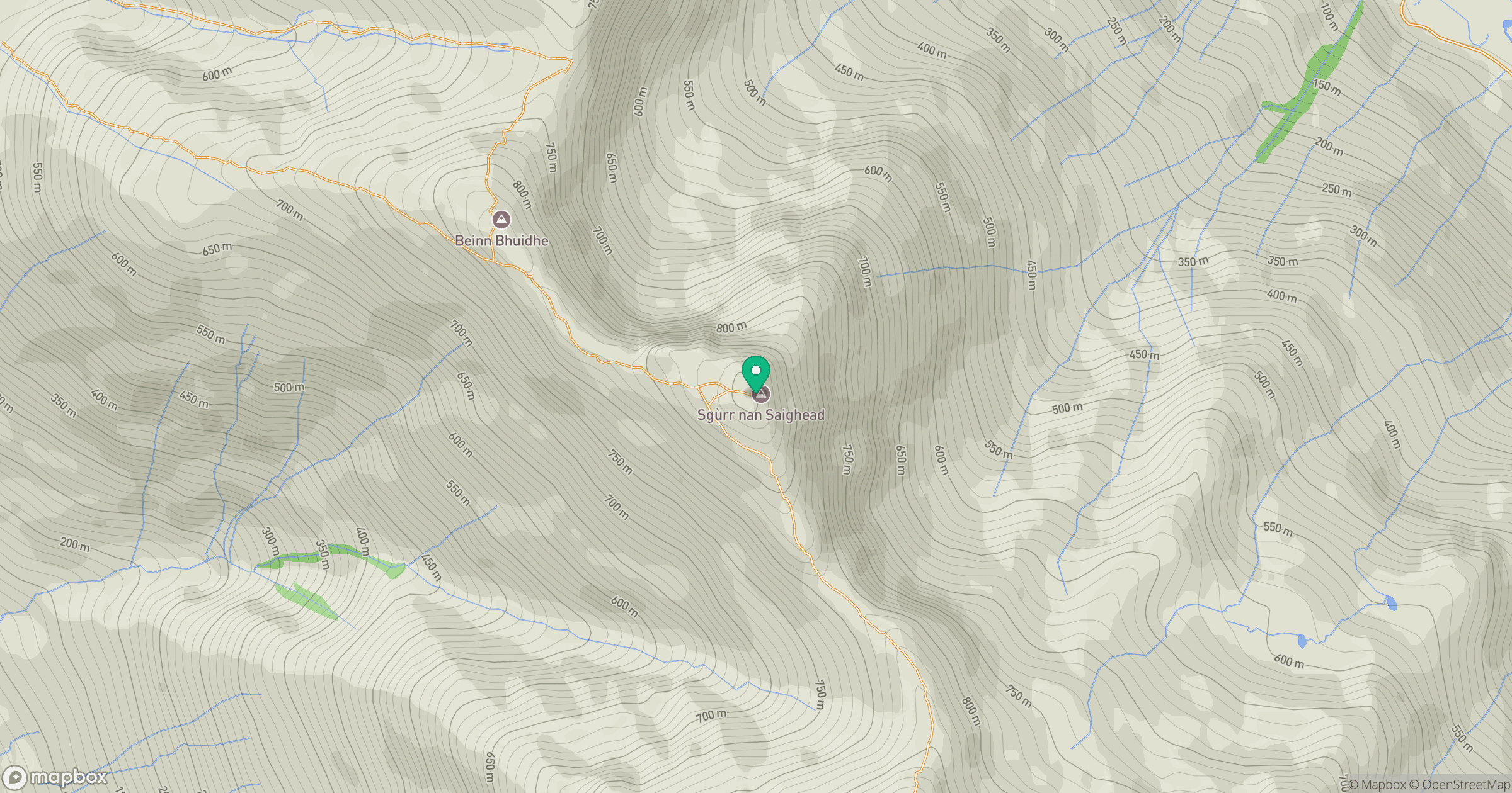
Grid reference: NG974177
View on OpenStreetMapOpens a map in a new tab, centred on the hill.
Hills within 30 km
Straight-line distance, not a walking route or confirmation of access.
Sgurr Fhuaran
1,069m
Sgurr a' Mhaoraich
1,027m
Gleouraich
1,035m
An Caisteal
622m
Beinn Sgritheall
974m
No comments yet. Be the first.