

Sgurr an t-Searraich
Good walks are even better shared.
Overview
Sgurr an t-Searraich: An Outdoor Delight
Nestled in the heart of the Scottish Highlands, Sgurr an t-Searraich is not just another Munro to tick off your list, but a chance to immerse yourself in Scotland’s wild beauty. Towering at 665 meters, it’s a delightful half-day hike that offers astounding views and a taste of the rugged Highland habitat.
Geology
Sgurr an t-Searraich is predominantly composed of Lewisian gneiss, and if you ever fancied climbing a mountain that’s older than your great-granddad, then you’re in for a treat. It provides a unique glimpse into ancient geological history, with the rocks beneath your feet whispering secrets of millennia gone by.
The Route
One popular route to the summit starts at Carn nan Gobhar, a nearby peak that can serve as your friendly warm-up. The trail is rocky yet manageable, and at about 8.5 km in distance, it will grant you ample time to appreciate the stunning vistas as you ascend.
Summit Features
Upon reaching the summit, enjoy the simple beauty of the rocky outcrop where you can stop for a proper breather and a snack. While there’s no trig point here, you’ll find the views more than compensate for the lack of a concrete post.
Terrain
Watch your footing! The terrain can be a bit tricky, with rocky patches interspersed with lovely grassy areas. Keep an eye out for the enchanting heather, particularly in late summer when the mountain lights up with vibrant hues. You might want to avoid dancing in the bogs—it may look like fun, but muddy boots are no laughing matter!
Views
The vistas from the summit are akin to looking at a postcard—the stunning panorama captures the essence of the Scottish Highlands. Look out for other peaks, like the mighty Black Cuillin, which is simply awe-inspiring. Spring and autumn are prime viewing seasons, where nature shows off her best clothing.
Hazards
Be wary of loose rocks and sudden changes in weather that can turn your expedition from tranquil to tempestuous in the blink of an eye. And remember to be mindful of the bog! One wrong step could leave you in a muddy predicament that you didn’t sign up for.
Access
Driving to NG 926 205 will lead you to a car park with sufficient space to accommodate your chariot. For those relying on public transportation, Portree is your closest good bet, with a bit of taxi magic needed to get to the hiking point.
Facilities
Before you hit the trail, make sure to refuel in Portree. There’s plenty of good food to fill those boots, along with public toilets near your parking area.
History
The name 'Sgurr an t-Searraich' translates to 'Peak of the wandering fawn', creating a lovely image to ponder as you ascend.
Whether you’re a seasoned mountaineer or a curious day-tripper, Sgurr an t-Searraich promises an unforgettable Scottish adventure. Remember, it’s all in a day’s work; just make sure to pack a camera—you'll want to share the views!
Explore routes near Sgurr an t-Searraich
Public walks starting within 80 km of this hill. Nearby does not mean a route reaches the summit; check its map and access before setting out.
Loch Affric full circuit from River Affric
View route
Glen Affric: Coire Loch Woodland Trail
View route
Beinn Eighe Lancaster Wreckage at Coire Mhic Fhearchair
View route
Fort Augustus to Kytra Lock: Caledonian Canal Towpath
View route
Route planning notes
These notes describe possible approaches, not verified navigable routes or permission to cross land. Check current paths, local access rules and conditions before setting out.
Carn nan Gobhar to Sgurr an t-Searraich
A relatively straightforward ridge walk that offers stunning views and a chance to bag both summits in one outing.
Make a day of it, together
Find someone to share the walk with, or organise a day out along a route you like.
Photo Gallery
View all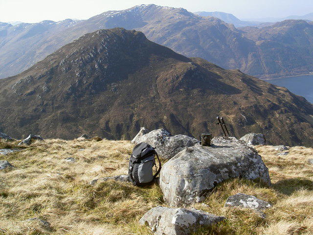 Photo could not load
NG9519 : Sgurr an t-Searraich
Alan Reid
Hill facts and local notes
Classifications
Elevation
576m
1,890 ft
Prominence
127m
Coordinates
57.2170, -5.3967
NG950191
OS Map
33
Explorer: 413N 414N
At the Summit
The summit boasts a humble rocky outcrop, perfect for a celebratory picnic and a stunning view of the surrounding Hills. There’s no trig point to mark the spot, but the views are worth every step.
Terrain & Geology
The mountain is predominantly composed of Lewisian gneiss, one of the oldest rock types in the world, which adds a sense of ancient wisdom to your outdoor adventure. You might even feel like you're walking on a piece of history.
Views & Scenery
From the summit, you can see the breathtaking panorama of the Skye mountains, the Black Cuillin, and beyond to the Isle of Skye – a real treat for the eyes.
History & Heritage
Name Origin
The name 'Sgurr an t-Searraich' loosely translates to 'Peak of the wandering fawn', which evokes a sense of whimsy for those traversing its slopes.
Historical Significance
This mountain is part of the rich tapestry of Scottish culture, often featured in local folklore and stories of the Highland clans.
Getting There & Facilities
Check current local access restrictions, parking rules and transport timetables before travelling. These notes do not confirm public access to the summit.
Parking
Parking available at the end of the road near NG 926 205, which offers ample space for cars and some picturesque views while you gear up.
Public Transport
The nearest bus stop is in Portree, and from there, local taxis or a pre-arranged lift can get you closer to the start of the hike.
Nearby Facilities
Nearby facilities include the lovely cafes and restaurants in Portree and a public toilet at the car park.
Safety Information
Known Hazards
- Be mindful of unstable rocks, sudden weather changes, and the bogginess that might catch the unwary. It’s a Highland adventure after all!
General Safety Tips
- Check weather conditions before setting out
- Carry appropriate clothing and equipment
- Let someone know your planned route
- Take a map, compass, and GPS device
- Carry emergency supplies: food, water, first aid kit, torch
Hills
Some common questions about the hills answered
Are there group walks up Sgurr an t-Searraich?
Many walkers use Walkmates to join or organise walks with others. You can check for group walks around Sgurr an t-Searraich through the maps
Are there other walkers around Sgurr an t-Searraich?
Activity varies by location and time, but Walkmates lets you see whether others have shared walks or shown interest in this area. Find other people through the walking friends search walking friends for Sgurr an t-Searraich search or of course create your own walk for Sgurr an t-Searraich
Can I organise a walk to Sgurr an t-Searraich?
Yes. If there aren’t any walks listed already, you can create a walk and make it available for others to join.
If you're signed up to Walkmates, you can create a walk to Sgurr an t-Searraich.
How do I find a walk up this hill?
There are often multiple ways to walk this hill, depending on experience and route preference. Walkmates helps you explore walks and routes that others have shared.
Can I suggest a new route up Sgurr an t-Searraich?
Yes. You can suggest or create routes to share with others. Walkmates focuses on the social side of walking, so routes are used to help people organise walks and explore areas together, rather than as detailed navigation tools or route libraries.
Other uses really appreciate knowledgeable walkers sharing their routes. Share your favourite route to Sgurr an t-Searraich here
The is an error or something incorrect about this hill. How do I let you know?
We always strive to keep the information on Walkmates as accurate as possible. If you find an error, please let us know through the contact form and we'll aim to correct it as quickly as possible
Community Discussion
Comments
Location
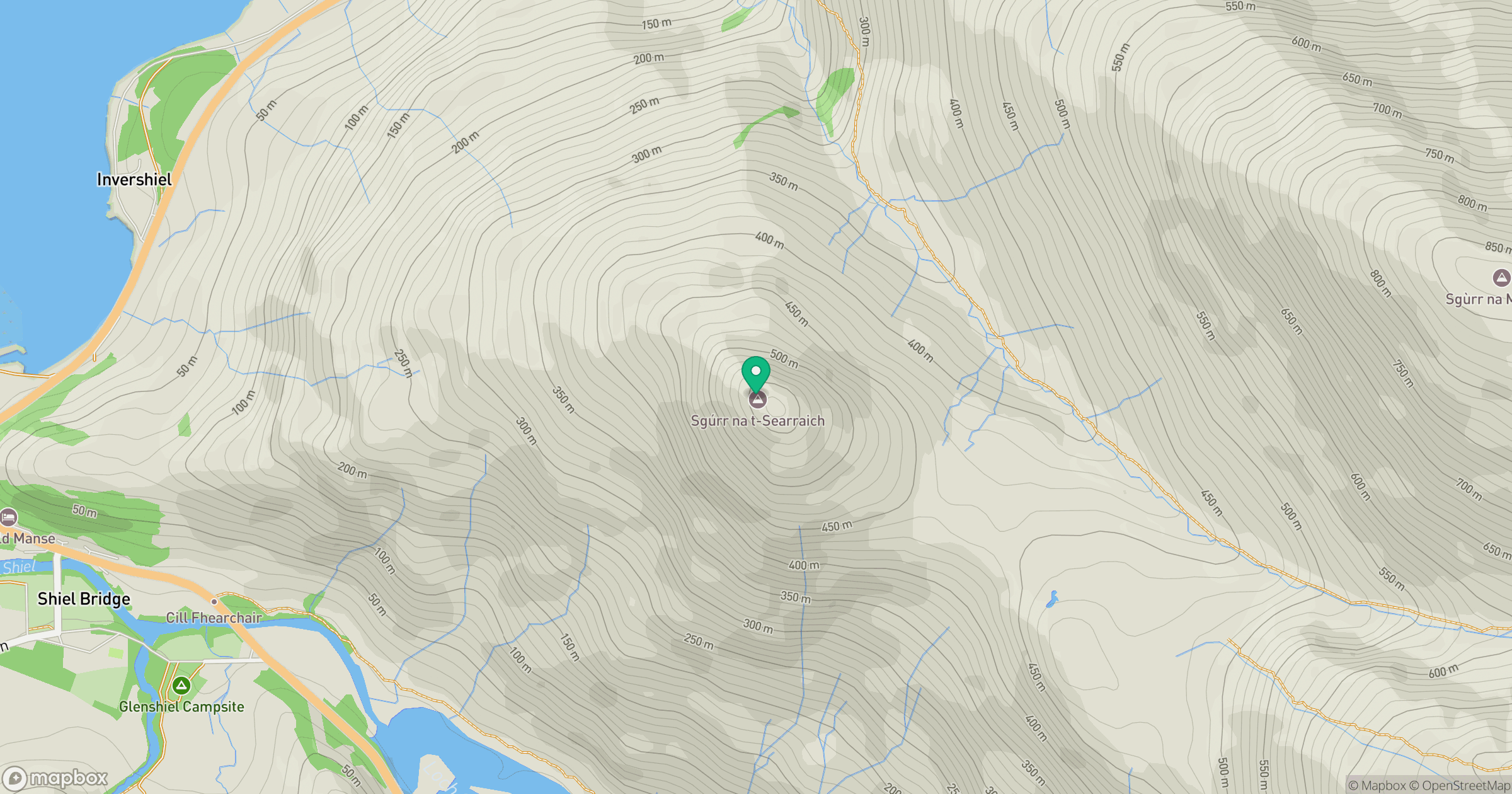
Grid reference: NG950191
View on OpenStreetMapOpens a map in a new tab, centred on the hill.
Hills within 30 km
Straight-line distance, not a walking route or confirmation of access.
Sgurr Fhuaran
1,069m
Sgurr a' Mhaoraich
1,027m
An Caisteal
622m
Beinn Sgritheall
974m
Gleouraich
1,035m
No comments yet. Be the first.