
Sgurr a' Bhraonain
Good walks are even better shared.
Overview
Sgurr a' Bhraonain
Overview
Sgurr a' Bhraonain rises majestically within the rugged beauty of the Scottish Highlands, standing proud at 900 meters. As part of the Munro collection, this peak offers an invigorating challenge and stunning vantage points over the surrounding landscape.
Geology
This mountain showcases exceptional geological features, primarily made up of ancient schist that painstakingly developed over millions of years. The interplay of granite adds a rugged charm, rewarding geology enthusiasts with a firsthand look at nature's artistry.
Routes
A popular route is the Sgurr a' Bhraonain Circuit, a 14.5 km loop from Strathcarron, offering a delightful mix of terrain and breathtaking views. Expect to spend around 5.5 hours wandering through some truly stunning landscapes.
Summit Features
At the summit, hikers are greeted by spectacular rock formations and a sturdy stone cairn. It's the kind of spot that begs for a group photo, just to immortalise that moment of triumph when reaching the top!
Terrain Type
The terrain is rocky, with grassy moorland and the occasional boggy patch that can surprise the unsuspecting hiker. So, wear your sturdy boots and perhaps pack a spare pair of socks—just in case!
Views
From the summit, the vistas are nothing short of breathtaking. You'll catch sight of nearby giants like Beinn Alligin and Liathach, replete with dramatic ridges and stunning scenery that could inspire even the most jaded of souls. For the best views, aim for June or early autumn.
Hazards
While hiking here is a joy, it's not without its perils. Loose rocks make for tricky footing, and those quick Scottish fogs can turn a clear day into a scene out of a mystery novel in the blink of an eye. Always prepare with a map and compass!
Access
The nearest parking for this adventure lies at the information centre in Strathcarron, just a short drive from the trailhead. Public transport via train and bus services makes this gem accessible, ensuring that even those without a car can reach the trail.
Facilities
After a rewarding hike, the local café in Strathcarron provides the ideal spot to refuel with a well-deserved slice of cake, and public toilets are available to freshen up.
History
The name 'Sgurr a' Bhraonain,' meaning 'peak of the little grey one,' hints at the history and charm of this locale. For hikers and climbers, conquering Sgurr a' Bhraonain is not just a physical achievement but also a significant step in exploring the storied highlands of Scotland.
Happy hiking, and remember: the best views come after the hardest climbs!
Explore routes near Sgurr a' Bhraonain
Public walks starting within 80 km of this hill. Nearby does not mean a route reaches the summit; check its map and access before setting out.
Loch Affric full circuit from River Affric
View route
Beinn Eighe Lancaster Wreckage at Coire Mhic Fhearchair
View route
Glen Affric: Coire Loch Woodland Trail
View route
Banavie to Glen Loy Aqueduct: Neptune’s Staircase Canal Towpath
View route
Route planning notes
These notes describe possible approaches, not verified navigable routes or permission to cross land. Check current paths, local access rules and conditions before setting out.
Sgurr a' Bhraonain Circuit
This circular route starts from the village of Strathcarron and offers a scenic hike through glens and over moorland, culminating at the summit of Sgurr a' Bhraonain.
Make a day of it, together
Find someone to share the walk with, or organise a day out along a route you like.
Hill facts and local notes
Classifications
Elevation
502m
1,647 ft
Prominence
126m
Coordinates
57.2137, -5.4695
NG905190
OS Map
33
Explorer: 413N
At the Summit
The summit features a prominent rocky outcrop and a small stone cairn, providing perfect opportunities for that all-important selfie against a breathtaking backdrop.
Terrain & Geology
Sgurr a' Bhraonain is primarily composed of ancient metamorphic rock, notably schist, which has weathered into characteristic craggy outcrops. The presence of granite in the region adds an interesting texture to the landscape, making it a hotspot for geology enthusiasts.
Views & Scenery
Stunning views of the surrounding peaks including Beinn Alligin and Liathach, alongside sweeping vistas of the torrid landscape of the Highlands.
History & Heritage
Name Origin
The name 'Sgurr a' Bhraonain' roughly translates to 'peak of the little grey one,' possibly referencing the mountain's distinctive features or the local wildlife.
Historical Significance
This mountain is part of the revered Munros of Scotland, appealing to climbers and hikers eager to tick off one of their heights in the majestic Highland landscape.
Getting There & Facilities
Check current local access restrictions, parking rules and transport timetables before travelling. These notes do not confirm public access to the summit.
Parking
Parking is available at the information centre in Strathcarron, approximately 3 km from the trailhead.
Public Transport
Strathcarron is accessible by train from Inverness and Kyle of Lochalsh, with bus services available seasonally.
Nearby Facilities
The nearest facilities include a small cafe in Strathcarron and public toilets available at the information centre.
Safety Information
Known Hazards
- Watch for loose rocks on the ascent and descent. Fog can roll in quickly, reducing visibility, so it's wise to carry a map and compass.
General Safety Tips
- Check weather conditions before setting out
- Carry appropriate clothing and equipment
- Let someone know your planned route
- Take a map, compass, and GPS device
- Carry emergency supplies: food, water, first aid kit, torch
Hills
Some common questions about the hills answered
Are there group walks up Sgurr a' Bhraonain?
Many walkers use Walkmates to join or organise walks with others. You can check for group walks around Sgurr a' Bhraonain through the maps
Are there other walkers around Sgurr a' Bhraonain?
Activity varies by location and time, but Walkmates lets you see whether others have shared walks or shown interest in this area. Find other people through the walking friends search walking friends for Sgurr a' Bhraonain search or of course create your own walk for Sgurr a' Bhraonain
Can I organise a walk to Sgurr a' Bhraonain?
Yes. If there aren’t any walks listed already, you can create a walk and make it available for others to join.
If you're signed up to Walkmates, you can create a walk to Sgurr a' Bhraonain.
How do I find a walk up this hill?
There are often multiple ways to walk this hill, depending on experience and route preference. Walkmates helps you explore walks and routes that others have shared.
Can I suggest a new route up Sgurr a' Bhraonain?
Yes. You can suggest or create routes to share with others. Walkmates focuses on the social side of walking, so routes are used to help people organise walks and explore areas together, rather than as detailed navigation tools or route libraries.
Other uses really appreciate knowledgeable walkers sharing their routes. Share your favourite route to Sgurr a' Bhraonain here
The is an error or something incorrect about this hill. How do I let you know?
We always strive to keep the information on Walkmates as accurate as possible. If you find an error, please let us know through the contact form and we'll aim to correct it as quickly as possible
Community Discussion
Comments
Location
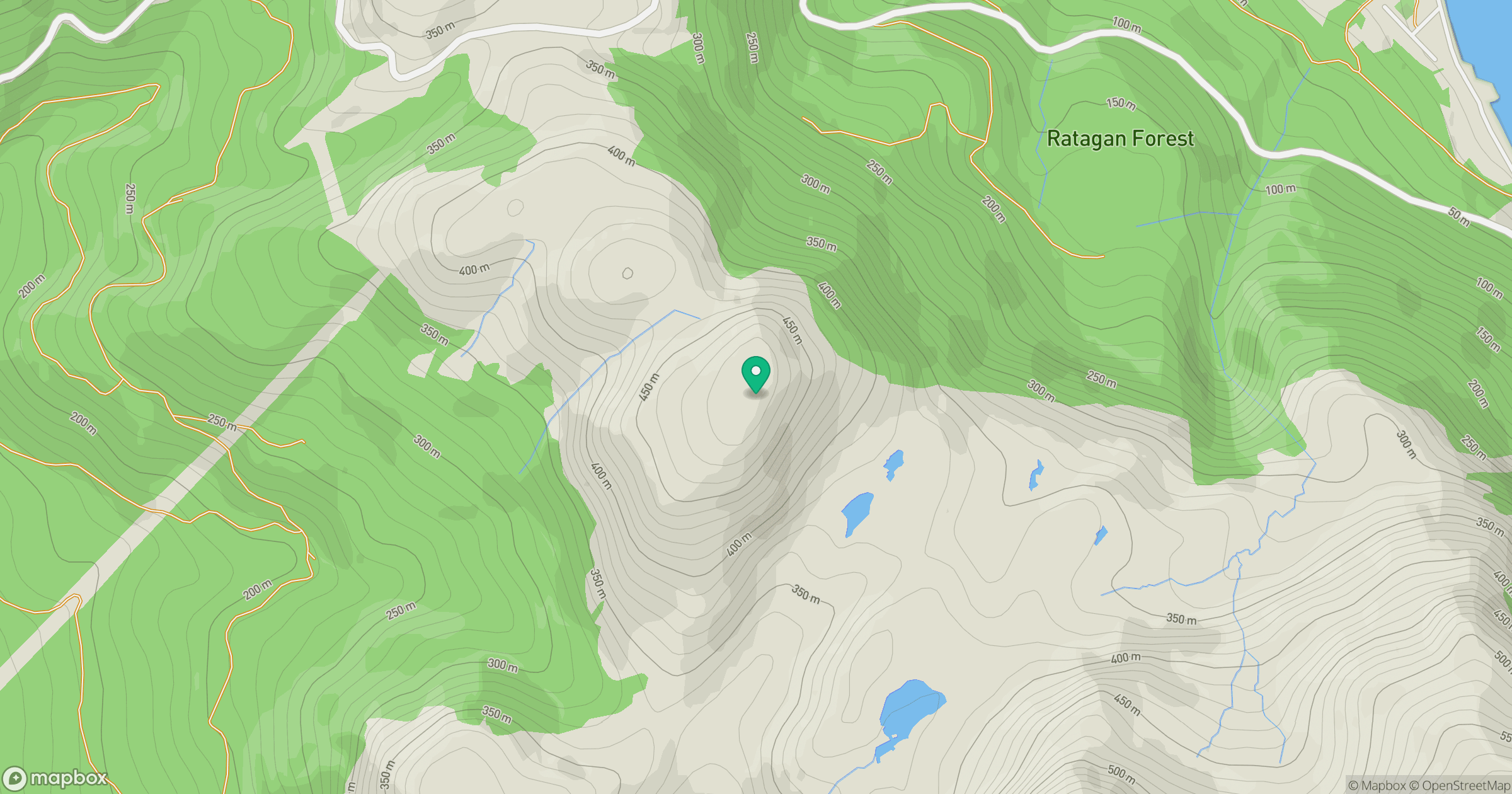
Grid reference: NG905190
View on OpenStreetMapOpens a map in a new tab, centred on the hill.
Hills within 30 km
Straight-line distance, not a walking route or confirmation of access.
Sgurr Fhuaran
1,069m
Beinn Sgritheall
974m
An Caisteal
622m
Sgurr a' Mhaoraich
1,027m
Ladhar Bheinn
1,020m
No comments yet. Be the first.