

Sgurr Mhic Bharraich
Good walks are even better shared.
NG9117 : Sgurr Mhic Bharraich summit area
Simon Waddicor Photo source
Overview
Sgurr Mhic Bharraich
Located in the breathtaking Scottish Highlands, Sgurr Mhic Bharraich stands proudly at 951 meters, offering intrepid hikers a truly rewarding experience. Known for its rugged beauty and dramatic scenery, it is classified as a Munro, making it a popular destination for hillwalkers.
Geology
The mountain is predominantly made up of ancient schists and gneisses, which tell tales of the Earth's tumultuous geological past. Hikers will appreciate the unique formations that add character to the rugged terrain.
Routes
The An Aird Path Route is the most frequented and starts from the charming village of Kintail. The path meanders through picturesque landscapes, offering stunning vistas that make the uphill journey worthwhile. It covers a distance of approximately 14.0 km and generally takes around 5 hours to complete, depending on your pace and enthusiasm.
Summit Features
At the summit, you will find a well-constructed cairn that not only serves as a marker but also as a fantastic viewpoint. Feel free to take a breather here and soak in the sights; you’ve earned it!
Terrain Type
The terrain is a delightful mix of rocky outcrops and grassy patches, interspersed with areas prone to bogginess after rainfall—just a little reminder of Scotland’s unique charm!
Views
The panoramic views from the top are simply breathtaking. You can feast your eyes on Loch Duich and marvel at the Five Sisters of Kintail. On a clear day, you might even catch a glimpse of Ben Nevis, standing tall against the horizon. The best seasons to experience these views are spring and autumn, particularly in September when the heather starts to bloom, painting the landscape in vibrant hues.
Hazards
Outdoor enthusiasts should be aware of the unpredictable weather that can sweep in quickly over the Highlands. Be mindful of slippery rocks and the potential for boggy areas that can arise, especially after rainfall—consider this your friendly reminder to pack sturdy footwear!
Nearby Summits
If you're feeling adventurous and want to conquer more peaks, Sgurr Mhic Bharraich lies near several other noteworthy summits like Beinn Fhada and Sgurr na Ciste Dubh, both offering stunning vistas and challenging ascents.
Access
Reaching Sgurr Mhic Bharraich is relatively straightforward. The nearest parking is located at the end of the road in Kintail, with sufficient space for vehicles. Public transport is available with regular bus services connecting from Kyle of Lochalsh.
Facilities
While Kintail has limited facilities, nearby Kyle of Lochalsh provides various cafes and restaurants to replenish your energy post-hike.
History
The intriguing name 'Sgurr Mhic Bharraich' reflects the region's Gaelic heritage, translating to 'The Peak of the Son of Bharrach'. The mountain is steeped in local folklore, adding an extra layer of intrigue to your hiking experience.
In summary, Sgurr Mhic Bharraich offers a delightful adventure amidst the stunning landscapes of the Scottish Highlands—just remember to pack your sense of humour and explore safely!
Explore routes near Sgurr Mhic Bharraich
Walks starting near this hill. Open a route to check its map, distance and full itinerary.
Glen Affric: Coire Loch Woodland Trail
View route
Beinn Eighe Lancaster Wreckage at Coire Mhic Fhearchair
View route
Banavie to Glen Loy Aqueduct: Neptune’s Staircase Canal Towpath
View route
Fort Augustus to Kytra Lock: Caledonian Canal Towpath
View route
Route planning notes
These notes describe possible approaches. Check a route's map and access information when planning your walk.
An Aird Path Route
A popular route starting from the village of Kintail, this path weaves through stunning landscapes, allowing hikers to enjoy the majesty of nature while ascending to the summit.
Make a day of it, together
Find someone to share the walk with, or organise a day out along a route you like.
Photo Gallery
View all Photo could not load
NG9117 : Sgurr Mhic Bharraich summit area
Simon Waddicor
 Photo could not load
NG9117 : Sgurr Mhic Bharraich summit cairn
Simon Waddicor
 Photo could not load
NG9117 : Summit of Sgurr Mhic Bharraich
Julian Paren
 Photo could not load
NG9117 : Hillwalkers arriving at the top of Sgurr Mhic Bharraich
Julian Paren
 Photo could not load
NG9117 : Towards the summit of Sgurr Mhic Bharraich
Steven Brown
Hill facts and local notes
Classifications
Elevation
779m
2,556 ft
Prominence
317m
Coordinates
57.1996, -5.4487
NG917173
OS Map
33
Explorer: 413N
At the Summit
The summit features a prominent cairn and stunning rock formations that provide a perfect spot for a well-deserved rest and panoramic views.
Terrain & Geology
Sgurr Mhic Bharraich is primarily composed of ancient schists and gneisses, providing a rugged and distinctive appearance typical of the Scottish Highlands. The geology reflects the dramatic tectonic activity that shaped the region.
Views & Scenery
From the summit, one can gaze over Loch Duich, the Five Sisters of Kintail, and the majestic peaks of the surrounding area, including the legendary Ben Nevis in the distance.
History & Heritage
Name Origin
The name 'Sgurr Mhic Bharraich' translates roughly to 'The Peak of the Son of Bharrach', which reflects the area’s rich Gaelic heritage.
Historical Significance
This mountain holds cultural significance due to its prominence in local folklore and its stunning landscapes that attract hikers and nature lovers alike.
Getting There & Facilities
Parking
The nearest parking area is at the end of the road in Kintail, providing ample space, but it can get busy during peak seasons.
Public Transport
Buses run regularly to Kintail from nearby towns, such as Kyle of Lochalsh, making it relatively easy to reach without a car.
Nearby Facilities
There are limited facilities in Kintail itself, but Kyle of Lochalsh has cafes, restaurants, and toilet facilities.
Safety Information
Known Hazards
- Watch out for sudden weather changes common in the Highlands, as well as slippery rocks and boggy patches that can challenge even the most seasoned hiker.
General Safety Tips
- Check weather conditions before setting out
- Carry appropriate clothing and equipment
- Let someone know your planned route
- Take a map, compass, and GPS device
- Carry emergency supplies: food, water, first aid kit, torch
Hills
Some common questions about the hills answered
Are there group walks up Sgurr Mhic Bharraich?
Many walkers use Walkmates to join or organise walks with others. You can check for group walks around Sgurr Mhic Bharraich through the maps
Are there other walkers around Sgurr Mhic Bharraich?
Activity varies by location and time, but Walkmates lets you see whether others have shared walks or shown interest in this area. Find other people through the walking friends search walking friends for Sgurr Mhic Bharraich search or of course create your own walk for Sgurr Mhic Bharraich
Can I organise a walk to Sgurr Mhic Bharraich?
Yes. If there aren’t any walks listed already, you can create a walk and make it available for others to join.
If you're signed up to Walkmates, you can create a walk to Sgurr Mhic Bharraich.
How do I find a walk up this hill?
There are often multiple ways to walk this hill, depending on experience and route preference. Walkmates helps you explore walks and routes that others have shared.
Can I suggest a new route up Sgurr Mhic Bharraich?
Yes. You can suggest or create routes to share with others. Walkmates focuses on the social side of walking, so routes are used to help people organise walks and explore areas together, rather than as detailed navigation tools or route libraries.
Other uses really appreciate knowledgeable walkers sharing their routes. Share your favourite route to Sgurr Mhic Bharraich here
The is an error or something incorrect about this hill. How do I let you know?
We always strive to keep the information on Walkmates as accurate as possible. If you find an error, please let us know through the contact form and we'll aim to correct it as quickly as possible
Community Discussion
Comments
Location
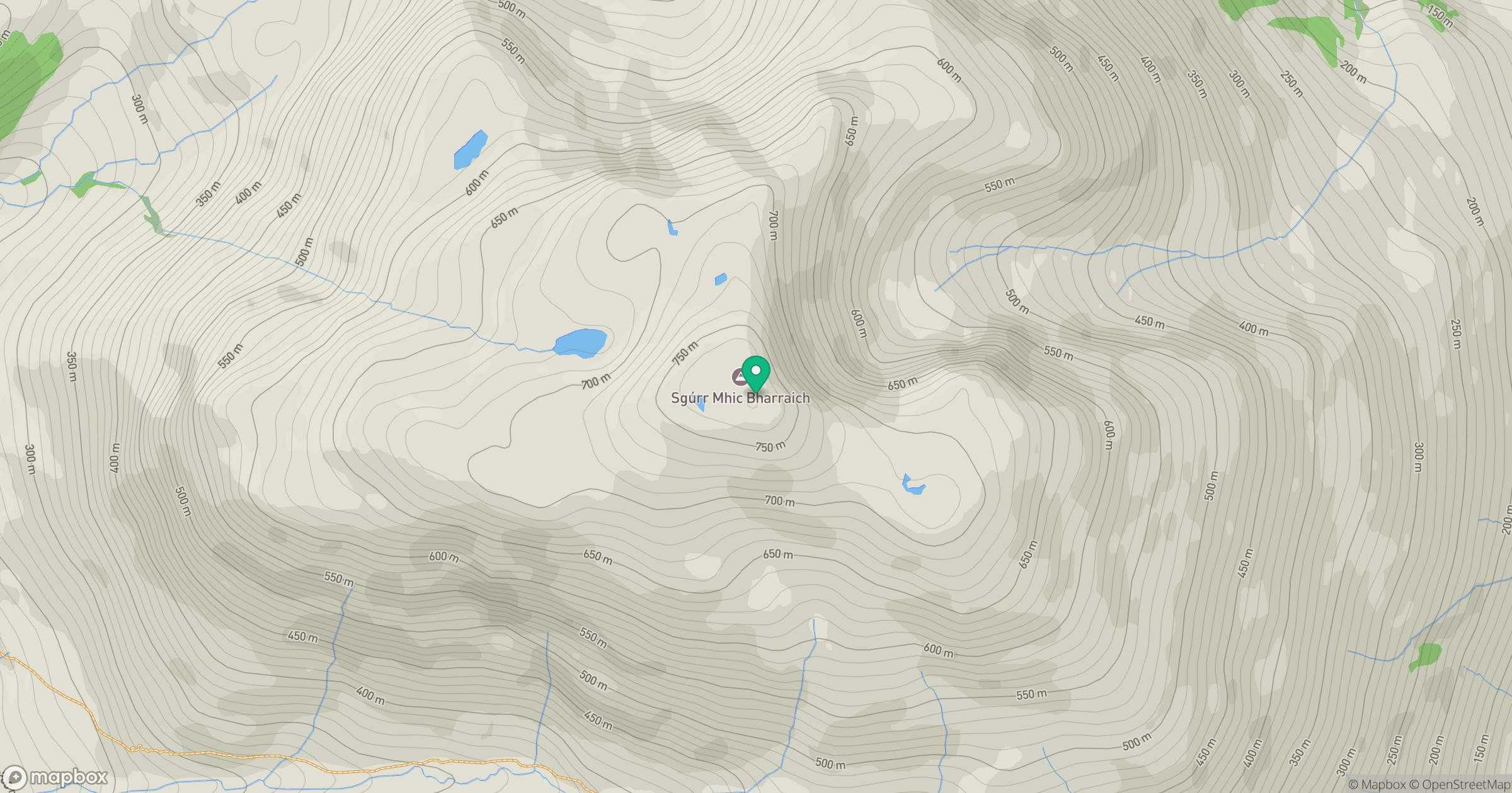
Grid reference: NG917173
View on OpenStreetMapOpens a map in a new tab, centred on the hill.
No comments yet. Be the first.