

Sgorr Ruadh
Good walks are even better shared.
NG9550 : The northwest ridge of Sgorr Ruadh
John Allan Photo source
Overview
Sgorr Ruadh
Sgorr Ruadh, which translates to 'red peak', stands proudly at 962 metres in the stunning Scottish Highlands. Known for both its breathtaking views and challenging terrain, it attracts hikers from all walks of life.
Geology
The mountain is largely composed of granite and schist, providing striking geological features that inspire both awe and respect from the numerous hikers who make the journey. Its eroded cliffs and rocky crags shaped by centuries of weather make for a dramatic landscape.
Routes
One of the most loved approaches is the Beinn Bhan route, which meanders through lush glens before a gradual incline leads to the summit. The full trek covers approximately 12.5 km and can take around five hours, depending on your pace. It’s classified as moderate, but expect to grit your teeth at some of the steeper sections!
Summit Features
At the top, you'll be greeted by a stone cairn—a perfect spot to catch your breath, admire the view, and to remind yourself that yes, you did climb that!
Terrain Type
The terrain varies from rocky paths to grassy slopes. You might find yourself joyfully splashing through the occasional boggy patch, so don’t forget your waterproof boots. You’ll want them after a good rain, which is sadly not rare in these parts.
Views
The views from Sgorr Ruadh are truly majestic. On a clear day, you can see the Cuillin Ridge in the distance, with Loch Carron shimmering below. Spring and autumn are particularly stunning, with vibrant heather and the changing colours painting the landscape.
Hazards
While the climb can be rewarding, it’s important to be cautious of the steep drops, especially near the summit. Weather conditions can change in a heartbeat in the Highlands, so prepare for anything from sunshine to showers—or a delightful mix of both!
Access
Parking is available at NG967512, around a 15-minute walk from the base. If you're relying on public transport, the nearest station is in Kyle of Lochalsh, with limited local bus services. Dornie is the closest town, about 10 km away, where you can grab a bite to eat and refuel for your adventure.
Facilities
In terms of amenities, Dornie offers a quaint café and small shops. However, don’t expect plush toilets on the trail; they are only available back in town!
History
The name Sgorr Ruadh reflects its local heritage, with its reddish tinge captivating the imagination of those who traverse its slopes. It has been an integral part of the local culture, a peak that has witnessed the passage of traders and the stories of the past woven into its rugged fabric.
So lace up your hiking boots, grab your walking pole, and set forth to visit Sgorr Ruadh—a magnificent mountain that is as much about the journey as it is about the destination!
There’s nothing quite like conquering a Munro!
Explore routes near Sgorr Ruadh
Walks starting near this hill. Open a route to check its map, distance and full itinerary.
Beinn Eighe Lancaster Wreckage at Coire Mhic Fhearchair
View route
Fairy Lochs Liberator Wreckage Circuit
View route
Glen Affric: Coire Loch Woodland Trail
View route
Fort Augustus to Kytra Lock: Caledonian Canal Towpath
View route
Route planning notes
These notes describe possible approaches. Check a route's map and access information when planning your walk.
Beinn Bhan Route
A popular route starting from the car park near Allt Ceardach, weaving through scenic glens before ascending to the summit. Perfect for those keen for a bit of leg stretching.
Make a day of it, together
Find someone to share the walk with, or organise a day out along a route you like.
Photo Gallery
View all Photo could not load
NG9550 : The northwest ridge of Sgorr Ruadh
John Allan
 Photo could not load
NG9550 : Sgorr Ruadh
David Maclennan
 Photo could not load
NG9550 : Sgorr Ruadh
David Maclennan
 Photo could not load
NG9650 : Sgorr Ruadh
David Maclennan
 Photo could not load
NG9550 : Sgorr Ruadh
David Maclennan
 Photo could not load
NG9550 : Nearly there
David Maclennan
 Photo could not load
NG9550 : Sgorr Ruadh
AlastairG
 Photo could not load
NG9550 : Summit area of Sgorr Ruadh
Steven Brown
 Photo could not load
NG9550 : Sgorr Ruadh
wfmillar

NG9550 : Summit shelter on Sgorr Ruadh
John Allan
Hill facts and local notes
Classifications
Elevation
961m
3,152 ft
Prominence
723m
Coordinates
57.4986, -5.4078
NG959505
OS Map
25
Explorer: 429
At the Summit
The summit boasts a stone cairn, providing a perfect backdrop for those all-important summit selfies. On a clear day, the views are nothing short of breathtaking.
Terrain & Geology
Sgorr Ruadh is primarily composed of granite and schist rock, characteristic of the Scottish Highlands. The erosion process has created stunning craggy formations and deep ravines that are both beautiful and intimidating.
Views & Scenery
From the summit, gaze across to the impressive fingers of the Cuillin Ridge, Loch Carron below, and the rolling hills of the Highlands stretching into the distance.
History & Heritage
Name Origin
Sgorr Ruadh translates to 'red peak' in Gaelic, likely referring to its reddish hues in certain lights, especially during sunrise and sunset.
Historical Significance
Like many peaks in the Highlands, Sgorr Ruadh holds significance in local folklore and was part of ancient routes for traders and herders.
Getting There & Facilities
Parking
There is a small parking area at NG967512, about a 15-minute walk from the base of the mountain.
Public Transport
Public transport options are limited; however, the nearest train station is in Kyle of Lochalsh, followed by a local bus that connects to the nearby villages.
Nearby Facilities
Facilities are quite sparse around Sgorr Ruadh. Dornie has a café and small shops for refreshments, and toilets are available at the village.
Safety Information
Known Hazards
- Be aware of steep drops near the summit, sudden weather changes, and the infamous Scottish midge in summer.
General Safety Tips
- Check weather conditions before setting out
- Carry appropriate clothing and equipment
- Let someone know your planned route
- Take a map, compass, and GPS device
- Carry emergency supplies: food, water, first aid kit, torch
Hills
Some common questions about the hills answered
Are there group walks up Sgorr Ruadh?
Many walkers use Walkmates to join or organise walks with others. You can check for group walks around Sgorr Ruadh through the maps
Are there other walkers around Sgorr Ruadh?
Activity varies by location and time, but Walkmates lets you see whether others have shared walks or shown interest in this area. Find other people through the walking friends search walking friends for Sgorr Ruadh search or of course create your own walk for Sgorr Ruadh
Can I organise a walk to Sgorr Ruadh?
Yes. If there aren’t any walks listed already, you can create a walk and make it available for others to join.
If you're signed up to Walkmates, you can create a walk to Sgorr Ruadh.
How do I find a walk up this hill?
There are often multiple ways to walk this hill, depending on experience and route preference. Walkmates helps you explore walks and routes that others have shared.
Can I suggest a new route up Sgorr Ruadh?
Yes. You can suggest or create routes to share with others. Walkmates focuses on the social side of walking, so routes are used to help people organise walks and explore areas together, rather than as detailed navigation tools or route libraries.
Other uses really appreciate knowledgeable walkers sharing their routes. Share your favourite route to Sgorr Ruadh here
The is an error or something incorrect about this hill. How do I let you know?
We always strive to keep the information on Walkmates as accurate as possible. If you find an error, please let us know through the contact form and we'll aim to correct it as quickly as possible
Community Discussion
Comments
Location
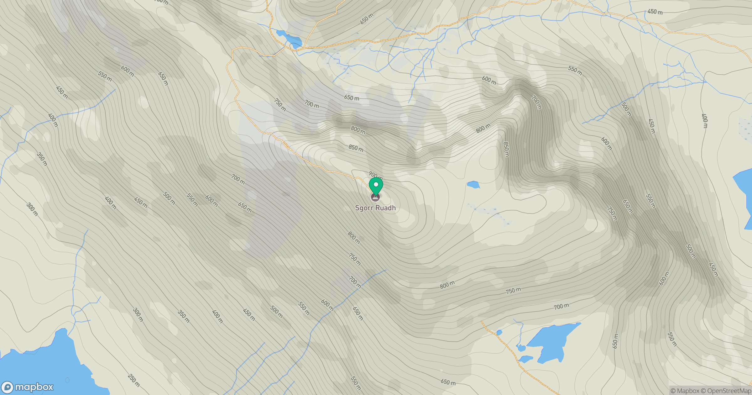
Grid reference: NG959505
View on OpenStreetMapOpens a map in a new tab, centred on the hill.
No comments yet. Be the first.