

Preston Hill
Good walks are even better shared.
Overview
Preston Hill: A Hiker's Delight
Overview
Preston Hill, with its accessible climbing routes and picturesque views, stands as an inviting challenge for hikers of all levels. Nestled in the stunning Lake District, this Marilyn boasts not just height but character, imbued with a rich history and scenic beauty.
Geology
The geological formations of Preston Hill reveal a tumultuous past, forged from ancient volcanic activity. As you traverse the rugged terrain, you'll be treading over rocks that tell tales of long-forgotten eruptions and the relentless wearing of time.
Routes
Preston Hill can be approached via two main routes. The Preston Hill Circular Route offers a delightful wander around the hill, ideal for families and less experienced hikers. On the other hand, the Direct Ascent from Loughrigg Fell is intended for the more adventurous spirit, demanding both stamina and a touch of reckless enthusiasm.
Summit Features
At the summit, you'll find a distinctive trig point. This stone structure, seemingly constructed as a resting spot for weary hikers, also provides a welcome incentive to snap a photo or two!
Terrain
Expect a blend of rocky paths, grassy patches, and a few boggy sections that'll keep you on your toes. Waterproof footwear is advised—unless you fancy the surprise of squelching through mud!
Views
From the crown of Preston Hill, the scenery unfolds spectacularly. Gaze over to Windermere, where shimmering waters reflect the sky, and on a clear day, get a load of Coniston Old Man, standing proudly among the peaks.
Best Seasons
For optimal views, spring offers greenery bursting to life, while autumn paints the landscape in hues of gold and amber. If you're an early bird, mornings can reward you with incredible sunrises—the early worm gets the view, after all!
Hazards
While Preston Hill is an inviting trek, don’t underestimate its potential hazards. Be cautious of slippery rocks, particularly in wet conditions, and watch out for icy patches in winter—you might find yourself inadvertently auditioning for a role in a slapstick comedy!
Access
Nearest Parking
The Loughrigg Tarn layby is your best bet. Just a short saunter from the starting point, it's easy to find and offers a convenient stop.
Public Transport
Ambleside is accessible via buses from Windermere station, making it a cinch for public transport users to reach the hill's base.
Nearest Town
Ambleside is your closest haven, with all the trimmings of a quaint English town.
Facilities
Once you’ve conquered the hill, treat yourself to a well-earned break at one of Ambleside’s cosy cafes. Whether you fancy a slice of cake or a full meal, there’s no shortage of options here!
History
Name Meaning
The name Preston reveals its roots in Old English, with 'prēost' signifying 'priest'. Hill? Well, that’s pretty obvious!
Significance
This area has been a hub of human activity for centuries, a testament to timeless beauty and historical richness that continues to attract and inspire us to this day.
Happy hiking and don't forget to enjoy every step of the way!
Explore routes near Preston Hill
Public walks starting within 80 km of this hill. Nearby does not mean a route reaches the summit; check its map and access before setting out.
The Cheviot - two ww2 wrecks
View route
Hedgehope Hill from Langleeford via Housey Crags
View route
Cheviot and Hedgehope circlular
View route
Cheviot from Langleeford over scald hill
View route
Route planning notes
These notes describe possible approaches, not verified navigable routes or permission to cross land. Check current paths, local access rules and conditions before setting out.
Preston Hill Circular Route
A picturesque circuit that takes you around the hill and offers varying perspectives, ideal for those keen on exploration without going off the beaten path.
Direct Ascent from Loughrigg Fell
A steep ascent directly from Loughrigg Fell, providing a quick route to the summit for those feeling particularly sprightly.
Make a day of it, together
Find someone to share the walk with, or organise a day out along a route you like.
Photo Gallery
View all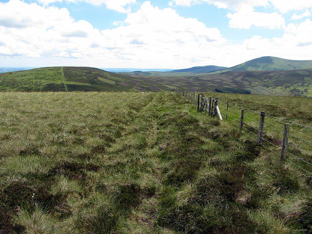 Photo could not load
NT9223 : Fence on Preston Hill
Andrew Curtis
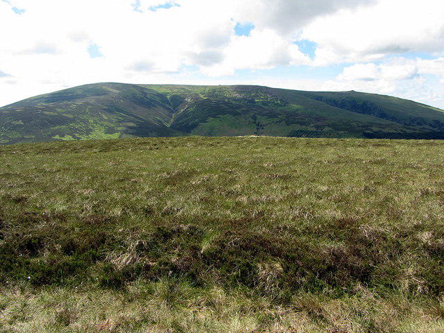 Photo could not load
NT9223 : The Cheviot from Preston Hill
Andrew Curtis
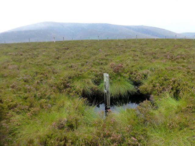 Photo could not load
NT9223 : Preston Hill
Rude Health
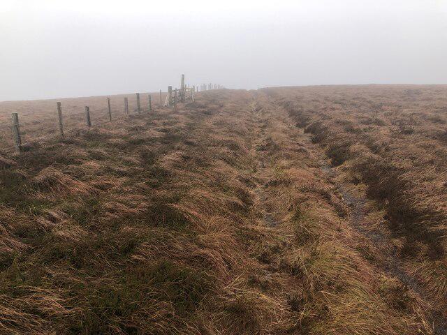 Photo could not load
NT9223 : Summit area, Preston Hill
Richard Webb
Hill facts and local notes
Classifications
Elevation
526m
1,726 ft
Prominence
106m
Coordinates
55.5078, -2.1238
NT922237
OS Map
74 75
Explorer: OL16E
At the Summit
The summit boasts a substantial stone trig point and impressive panoramic views, making it a popular stop for tired legs and eager eyes alike.
Terrain & Geology
Primarily composed of ancient volcanic rock, Preston Hill features rugged outcrops and is surrounded by scenic glacial lakes, giving insight into the region's tumultuous geological past.
Views & Scenery
From the summit, you can enjoy sweeping views of Windermere and the surrounding fells, including the impressive Coniston Old Man on clear days.
History & Heritage
Name Origin
The name 'Preston' is derived from the Old English 'prēost', meaning 'priest', while 'Hill' quite literally tells you what it is—there’s no mystery here!
Historical Significance
The area has been inhabited for centuries, with ancient paths and stone structures hinting at a rich history dating back to the Romans.
Getting There & Facilities
Check current local access restrictions, parking rules and transport timetables before travelling. These notes do not confirm public access to the summit.
Parking
Parking is readily available at the Loughrigg Tarn layby, which is just a short walk away from the start of the trails.
Public Transport
Buses frequently run from Windermere station to Ambleside, where you can pick up local services to the trailheads.
Nearby Facilities
After your trek, treat yourself to a cuppa at one of the delightful cafes in Ambleside, and for emergencies, both toilets and shops are found in town.
Safety Information
Known Hazards
- Careful of the slippery rocks, particularly after rain. In winter, conditions can turn treacherous due to ice.
General Safety Tips
- Check weather conditions before setting out
- Carry appropriate clothing and equipment
- Let someone know your planned route
- Take a map, compass, and GPS device
- Carry emergency supplies: food, water, first aid kit, torch
Hills
Some common questions about the hills answered
Are there group walks up Preston Hill?
Many walkers use Walkmates to join or organise walks with others. You can check for group walks around Preston Hill through the maps
Are there other walkers around Preston Hill?
Activity varies by location and time, but Walkmates lets you see whether others have shared walks or shown interest in this area. Find other people through the walking friends search walking friends for Preston Hill search or of course create your own walk for Preston Hill
Can I organise a walk to Preston Hill?
Yes. If there aren’t any walks listed already, you can create a walk and make it available for others to join.
If you're signed up to Walkmates, you can create a walk to Preston Hill.
How do I find a walk up this hill?
There are often multiple ways to walk this hill, depending on experience and route preference. Walkmates helps you explore walks and routes that others have shared.
Can I suggest a new route up Preston Hill?
Yes. You can suggest or create routes to share with others. Walkmates focuses on the social side of walking, so routes are used to help people organise walks and explore areas together, rather than as detailed navigation tools or route libraries.
Other uses really appreciate knowledgeable walkers sharing their routes. Share your favourite route to Preston Hill here
The is an error or something incorrect about this hill. How do I let you know?
We always strive to keep the information on Walkmates as accurate as possible. If you find an error, please let us know through the contact form and we'll aim to correct it as quickly as possible
Community Discussion
Comments
Location
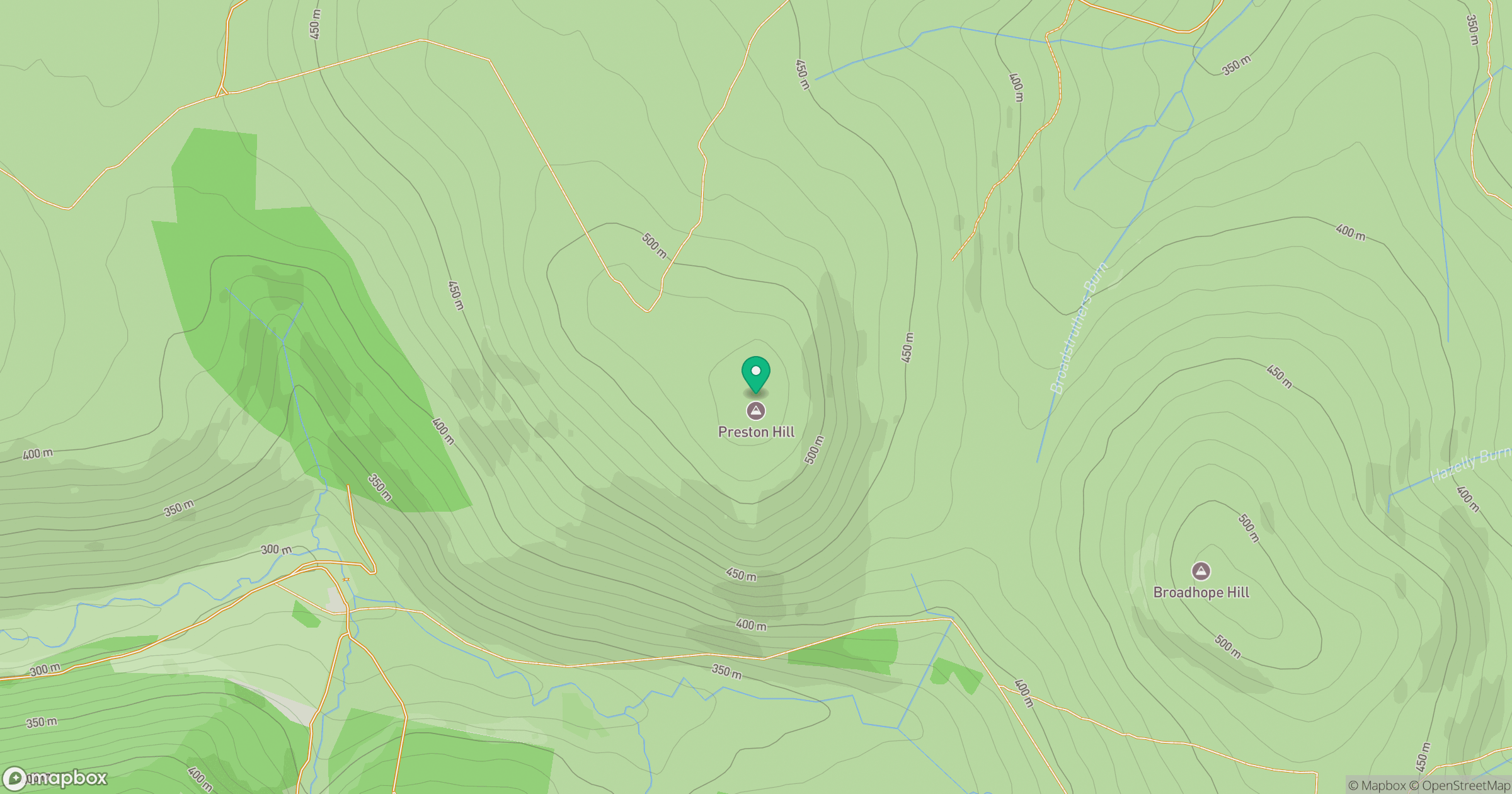
Grid reference: NT922237
View on OpenStreetMapOpens a map in a new tab, centred on the hill.
Hills within 30 km
Straight-line distance, not a walking route or confirmation of access.
No comments yet. Be the first.