
Shill Moor
Good walks are even better shared.
Overview
Shill Moor
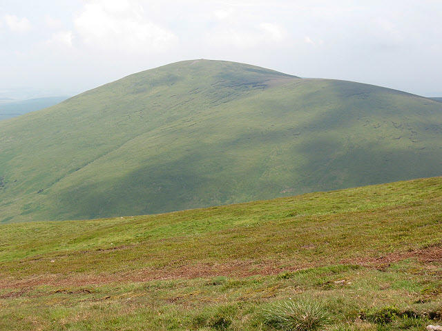
Shill Moor, standing at a proud 482 meters, offers all who dare to hike it a rewarding experience steeped in natural beauty and historical significance. Nestled within the breathtaking Northumberland National Park, this Marilyn provides not just a challenge but a visual feast for those with a penchant for the great outdoors.
Geology
The geological foundation of Shill Moor is predominantly volcanic, with both andesite and basalt rock types playing a key role in its impressive formation. Having been shaped by the relentless forces of nature, primarily glacial activities, visitors can expect a variety of landscapes; from imposing rocky outcrops to soft, grassy patches that invite a leisurely stroll.
Access and Parking
Getting to Shill Moor is straightforward. The primary access point is from the stunning Breamish Valley, just a stone's throw from Wooler. Ample parking facilities are available at Breamish Valley car park, where you can park your car comfortably before embarking on your hike. Wooler, the nearest town, is a delightful spot where you might indulge in some hearty fare after your trek.
The Route
The most commonly taken route is Shill Moor from the Breamish Valley. Spanning approximately 6.5 km, this moderate trail is best experienced on a crisp day when the vistas are at their best. Remember, hiking isn’t just about the destination—enjoy the journey, and maybe even make a new woolly friend along the way!
Summit Features
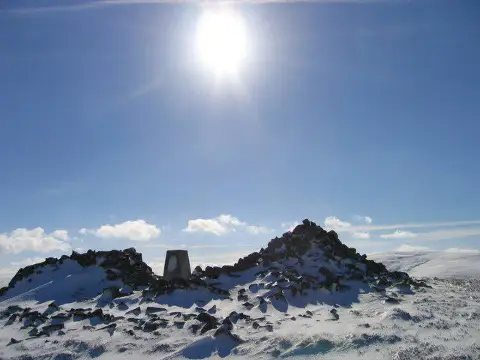
Upon reaching the summit, hikers are greeted by a substantial cairn—ideal for a quick photo op or to plop down and catch your breath. On clear days, expect to be awestruck by the panorama stretching before you, including the iconic Cheviot Hills and the remnants of Hadrian's Wall, a reminder of ancient history not too far away.
Views
The best views from Shill Moor can be relished in spring and autumn. Just imagine standing there, with a canvas of colourful leaves below you in the fall, or observing revitalised greenery in the springtime. It’s nothing short of enchanting. Bring your camera, as the views are bound to inspire envy amongst your friends and family back home.
Hazards
Although hiking Shill Moor is generally safe, be vigilant about weather changes. Northumberland has a knack for throwing out a surprise downpour! Additionally, some areas may become slippery, making sturdy footwear a necessity.
Nearby Summits
For those thirsty for more peaks, nearby summits include the Cheviot, towering above at 815 meters, and Wooler Common, relatively modest at 365 meters. Both offer their unique charms and challenges.
Conclusion
All in all, Shill Moor encapsulates the beauty and unpredictability of Northumberland National Park. With its rich history, geological wonders, and stunning vistas, it’s an essential destination for any avid hiker or nature lover. So lace up your walking boots and go explore—you won’t regret it!
Happy hiking!
Explore routes near Shill Moor
Public walks starting within 80 km of this hill. Nearby does not mean a route reaches the summit; check its map and access before setting out.
Linhope Rig Ju88 crash site from Hartside
View route
Great Standrop and Little Standrop from Linhope (Ingram)
View route
Hedgehope Hill from Linhope
View route
Linhope Spout from Hartside
View route
Route planning notes
These notes describe possible approaches, not verified navigable routes or permission to cross land. Check current paths, local access rules and conditions before setting out.
Shill Moor from the Breamish Valley
A popular route starting from the scenic Breamish Valley that offers striking views of the surrounding landscape.
Make a day of it, together
Find someone to share the walk with, or organise a day out along a route you like.
Photo Gallery
View all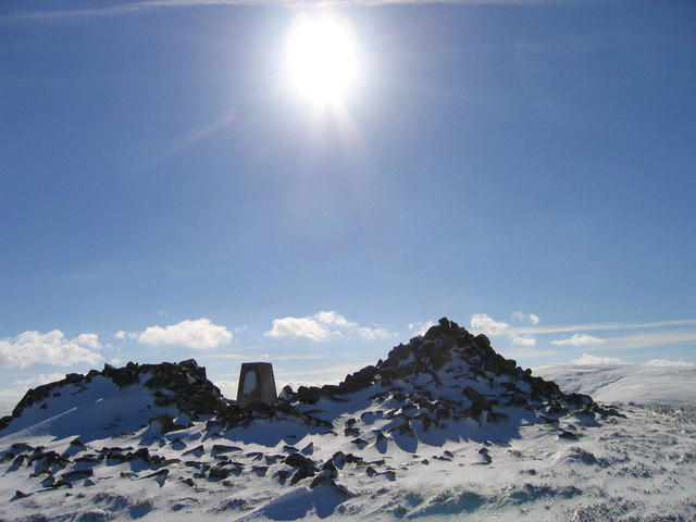 Photo could not load
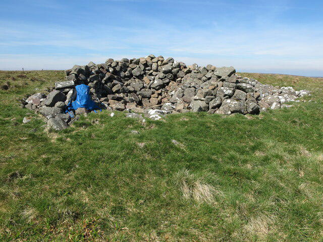
NT9415 : Summit Cairn in the snow at Shill Moor
Ed Jennings
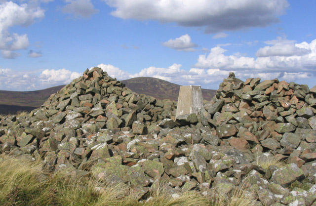 Photo could not load
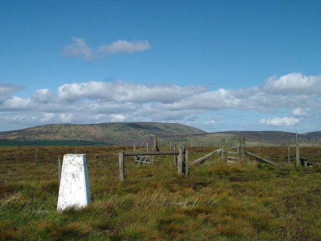
NT9415 : The trig point at 528m on Shill Moor
Walter Baxter
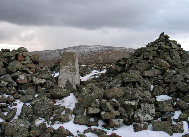 Photo could not load
NT9415 : Trig point in shelter on Shill Moor
Trevor Littlewood
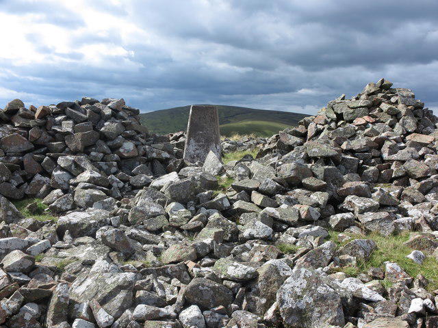 Photo could not load
NT9415 : Triangulation Pillar and Cairn, Shill Moor
Geoff Holland
Hill facts and local notes
Classifications
Elevation
529m
1,735 ft
Prominence
106m
Coordinates
55.4317, -2.0902
NT943153
OS Map
80
Explorer: OL16E
At the Summit
The summit is marked by a large cairn, providing a great spot for a well-deserved rest after the climb. On clear days, you might even spot adventurous sheep eyeing you skeptically.
Terrain & Geology
Shill Moor is primarily composed of volcanic rock, specifically andesite and basalt. The rugged terrain was shaped by glacial activity, leaving behind striking features such as steep cliffs and deep valleys.
Views & Scenery
From the summit, you can see the Cheviot Hills to the south and Hadrian's Wall to the west, making it a visual feast for history buffs and nature lovers alike.
History & Heritage
Name Origin
The name 'Shill' is believed to come from the Old English word meaning 'shelter', reflecting the summit's positioning offering refuge to weary travellers.
Historical Significance
Historically, Shill Moor formed part of the boundary for grazing rights for local farmers and continues to be an important landmark for those exploring the Northumberland National Park.
Getting There & Facilities
Check current local access restrictions, parking rules and transport timetables before travelling. These notes do not confirm public access to the summit.
Parking
There is parking available at the Breamish Valley car park, which has space for several vehicles and is a short walk from the starting point of the trail.
Public Transport
The area is best accessed by car, though local bus services may run from nearby towns like Alnwick and Wooler.
Nearby Facilities
Wooler provides amenities such as cafes, pubs, and toilet facilities, perfect for a post-hike meal or a warm drink during colder months.
Safety Information
Known Hazards
- Be cautious of sudden weather changes, as Northumberland can be notoriously unpredictable. The rocky terrain may also pose risks of slips, particularly in wet conditions.
General Safety Tips
- Check weather conditions before setting out
- Carry appropriate clothing and equipment
- Let someone know your planned route
- Take a map, compass, and GPS device
- Carry emergency supplies: food, water, first aid kit, torch
Hills
Some common questions about the hills answered
Are there group walks up Shill Moor?
Many walkers use Walkmates to join or organise walks with others. You can check for group walks around Shill Moor through the maps
Are there other walkers around Shill Moor?
Activity varies by location and time, but Walkmates lets you see whether others have shared walks or shown interest in this area. Find other people through the walking friends search walking friends for Shill Moor search or of course create your own walk for Shill Moor
Can I organise a walk to Shill Moor?
Yes. If there aren’t any walks listed already, you can create a walk and make it available for others to join.
If you're signed up to Walkmates, you can create a walk to Shill Moor.
How do I find a walk up this hill?
There are often multiple ways to walk this hill, depending on experience and route preference. Walkmates helps you explore walks and routes that others have shared.
Can I suggest a new route up Shill Moor?
Yes. You can suggest or create routes to share with others. Walkmates focuses on the social side of walking, so routes are used to help people organise walks and explore areas together, rather than as detailed navigation tools or route libraries.
Other uses really appreciate knowledgeable walkers sharing their routes. Share your favourite route to Shill Moor here
The is an error or something incorrect about this hill. How do I let you know?
We always strive to keep the information on Walkmates as accurate as possible. If you find an error, please let us know through the contact form and we'll aim to correct it as quickly as possible
Community Discussion
Comments
Location
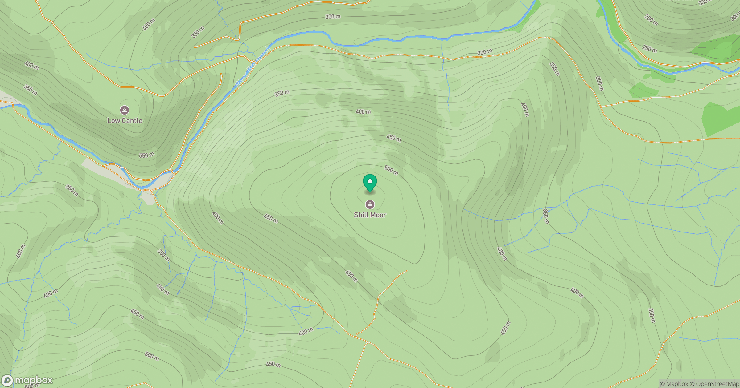
Grid reference: NT943153
View on OpenStreetMapOpens a map in a new tab, centred on the hill.
Hills within 30 km
Straight-line distance, not a walking route or confirmation of access.
No comments yet. Be the first.