

Bloodybush Edge
Good walks are even better shared.
Overview
Bloodybush Edge
Bloodybush Edge stands proudly at an elevation of 682 meters, nestled in the heart of the North Pennines. This Marilyn offers a sense of adventure without the arduous climb associated with some of its taller companions.
Geology
The underlying geology of Bloodybush Edge is a testament to millennia of natural history, with limestone and shale forming the bedrock. This unique composition leads to fascinating karst formations, and the area is rich in both flora and fauna, making it a haven for nature enthusiasts. So, bring your binoculars and a sense of wonder!
Routes
Bloodybush Edge Circular Walk
This delightful circular route is approximately 8 kilometres long and takes around 3.5 hours to complete. It takes you through heather-clad moorlands and rocky paths, providing an excellent opportunity to connect with nature and, of course, the odd sheep or two, as they are the proud locals here.
Summit Features
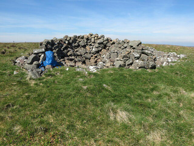
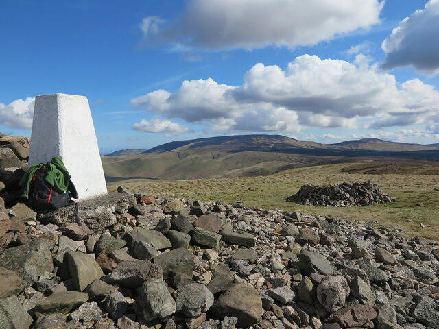
Reaching the summit rewards you with a well-constructed stone cairn, perfect for resting your weary legs and contemplating life's mysteries or simply planning your next walk! A picnic at the top is highly recommended; don’t forget the sausages!
Terrain Type
Expect a delightful mix of moorland, rocky paths, and grassy areas. Keep your eyes peeled for curious wildlife and wildflowers that paint the landscape in multiple colours.
Views
The views from Bloodybush Edge are nothing short of breathtaking! You’ll witness the vast expanse of the North Pennines, with Weardale and even the Northumbrian hills stretching into the distance. The colours in late spring and early autumn are especially enchanting, creating a vista that will leave you breathless.
Hazards
As beautiful as this region is, it’s essential to be aware of the hazards. The weather can be capricious, so always be prepared for change. Also, beware of boggy patches that may be lurking to trip up unsuspecting hikers (like that clumsy friend of yours who always wears the wrong shoes).
Access
Finding your way to Bloodybush Edge is fairly straightforward. The nearest parking is at the village of St John's Chapel, located about 3km from the trailhead. Public transport can be a tad limited, so check local bus schedules if you're relying on them. St John's Chapel is the nearest settlement, providing a perfect place for a pre-hike caffeine fix!
Facilities
For those in need of a little luxury after a long hike, St John's Chapel features cafes and toilets, ensuring you can freshen up and fuel up.
History
The name ‘Bloodybush’ adds a fun twist to your hike, derived from the local flora known for its striking crimson berries. This area has a long-standing history of grazing and ancient paths, indicative of the timeless relationship between mankind and nature.
In summary, a visit to Bloodybush Edge is sure to delight the avid hiker and casual wanderer alike. Pack your essentials, lace your boots, and embrace the wild beauty of the North Pennines. You won’t regret it!
Happy hiking!
Explore routes near Bloodybush Edge
Public walks starting within 80 km of this hill. Nearby does not mean a route reaches the summit; check its map and access before setting out.
Windy Gyle Circular from Coquet Valley
View route
Shillhope Law and Inner Hill Circuit from Wedder Leap
View route
Barrowburn Meadows from Wedder Leap
View route
Linhope Rig Ju88 crash site from Hartside
View route
Route planning notes
These notes describe possible approaches, not verified navigable routes or permission to cross land. Check current paths, local access rules and conditions before setting out.
Bloodybush Edge Circular Walk
A stunning circular route that showcases the best of Bloodybush Edge and its surroundings, taking you through lush heather and rugged moorland.
Make a day of it, together
Find someone to share the walk with, or organise a day out along a route you like.
Photo Gallery
View all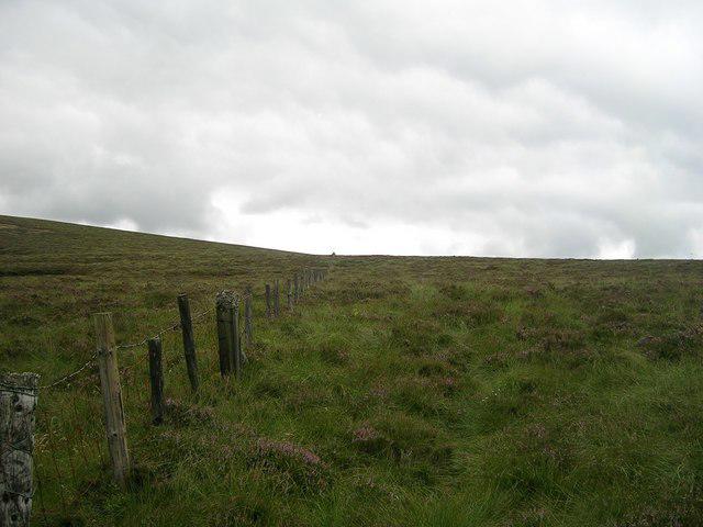 Photo could not load
NT9014 : Fence to Bloodybush Edge (Summer)
Newbiggin Hall Scouts
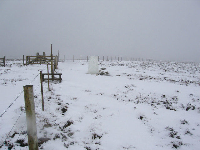 Photo could not load
NT9014 : Summit of Bloodybush Edge 610m asl
Eric Hardman
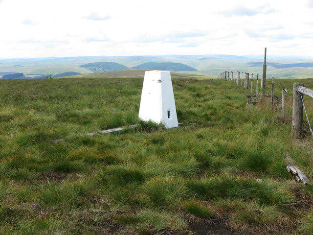 Photo could not load
NT9014 : Summit of Bloodybush Edge
Geoff Holland
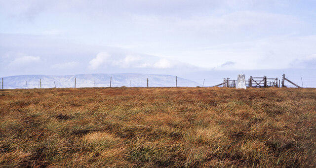 Photo could not load
NT9014 : Fences and trig point at Bloodybush Edge
Trevor Littlewood
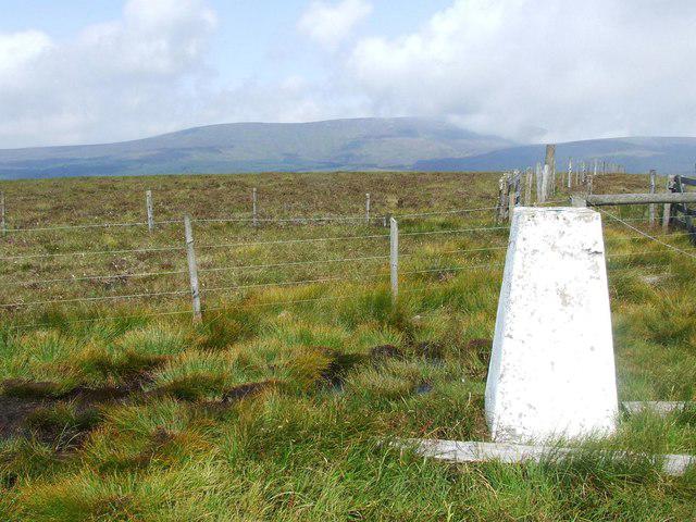 Photo could not load
NT9014 : Trig point on Bloodybush Edge
Tim Glover
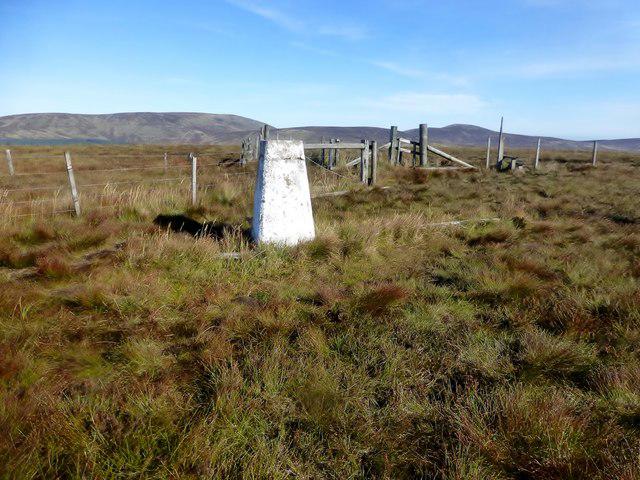 Photo could not load
NT9014 : Bloodybush Edge
Rude Health
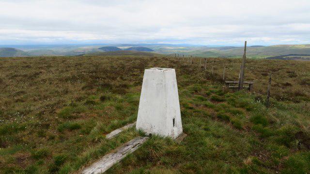 Photo could not load
NT9014 : Bloodybush Edge Trig Point - view west
Colin Park
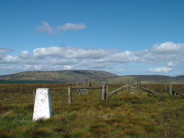 Photo could not load
NT9014 : Bloodybush Edge
David Brown
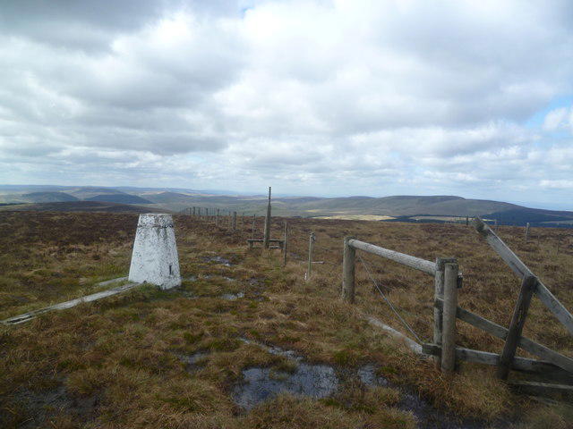 Photo could not load
NT9014 : Trig Pillar, Bloodybush Edge
Michael Graham
Hill facts and local notes
Classifications
Elevation
610m
2,001 ft
Prominence
114m
Coordinates
55.4229, -2.1560
NT902143
OS Map
80
Explorer: OL16E
At the Summit
The summit boasts a modest stone cairn and offers sweeping views of the surrounding hills. It's a prime spot for a picnic (or a cheeky flask of tea).
Terrain & Geology
The region is primarily composed of limestone and shale, giving rise to interesting karst features and a rich ecosystem. The geological history here is characterised by the sedimentation of marine deposits from an ancient sea.
Views & Scenery
From the top, you can enjoy panoramic views of the North Pennines, including Weardale and the distant Northumberland hills.
History & Heritage
Name Origin
The name 'Bloodybush' is thought to derive from the local flora known for its striking crimson berries, adding a splash of colour to the moorlands.
Historical Significance
Historically, this area has been used as grazing land and has some ancient routes trodden by both men and beasts over the centuries.
Getting There & Facilities
Check current local access restrictions, parking rules and transport timetables before travelling. These notes do not confirm public access to the summit.
Parking
Parking is available at the village of St John's Chapel, approximately 3km from the trailhead.
Public Transport
Buses run from larger towns like Middleton-in-Teesdale, but check schedules as they may be limited.
Nearby Facilities
The nearest facilities, including cafes and toilets, can be found in St John's Chapel, where a warm welcome awaits weary wanderers.
Safety Information
Known Hazards
- Be cautious of sudden weather changes, as moorland can be deceptively unpredictable. Also, watch out for boggy patches that might just want to swallow your boots!
General Safety Tips
- Check weather conditions before setting out
- Carry appropriate clothing and equipment
- Let someone know your planned route
- Take a map, compass, and GPS device
- Carry emergency supplies: food, water, first aid kit, torch
Hills
Some common questions about the hills answered
Are there group walks up Bloodybush Edge?
Many walkers use Walkmates to join or organise walks with others. You can check for group walks around Bloodybush Edge through the maps
Are there other walkers around Bloodybush Edge?
Activity varies by location and time, but Walkmates lets you see whether others have shared walks or shown interest in this area. Find other people through the walking friends search walking friends for Bloodybush Edge search or of course create your own walk for Bloodybush Edge
Can I organise a walk to Bloodybush Edge?
Yes. If there aren’t any walks listed already, you can create a walk and make it available for others to join.
If you're signed up to Walkmates, you can create a walk to Bloodybush Edge.
How do I find a walk up this hill?
There are often multiple ways to walk this hill, depending on experience and route preference. Walkmates helps you explore walks and routes that others have shared.
Can I suggest a new route up Bloodybush Edge?
Yes. You can suggest or create routes to share with others. Walkmates focuses on the social side of walking, so routes are used to help people organise walks and explore areas together, rather than as detailed navigation tools or route libraries.
Other uses really appreciate knowledgeable walkers sharing their routes. Share your favourite route to Bloodybush Edge here
The is an error or something incorrect about this hill. How do I let you know?
We always strive to keep the information on Walkmates as accurate as possible. If you find an error, please let us know through the contact form and we'll aim to correct it as quickly as possible
Community Discussion
Comments
Location
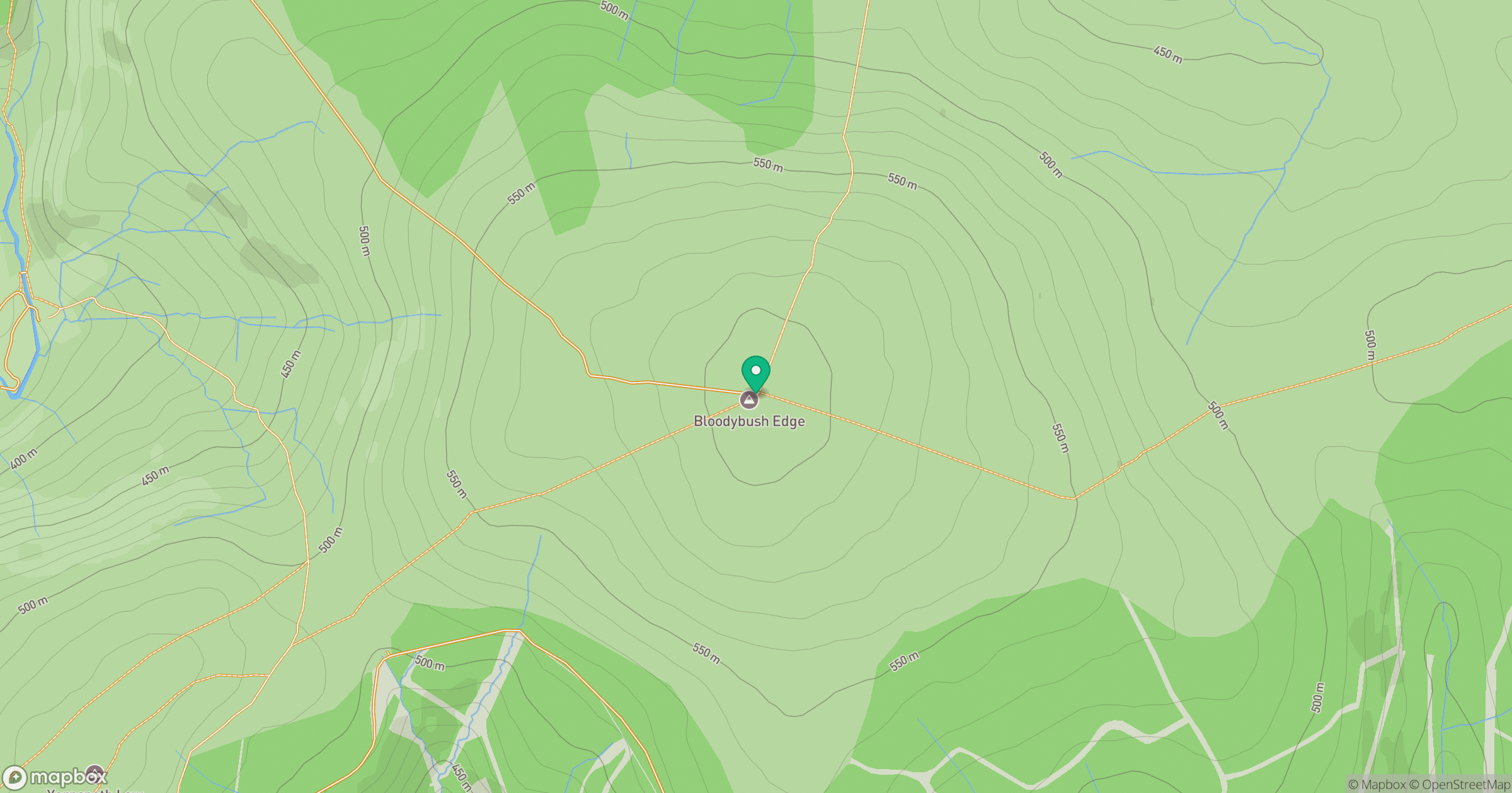
Grid reference: NT902143
View on OpenStreetMapOpens a map in a new tab, centred on the hill.
Hills within 30 km
Straight-line distance, not a walking route or confirmation of access.
No comments yet. Be the first.