

Overmoor
Good walks are even better shared.
Overview
Overmoor: The Jewel of the Peak District
Welcome to Overmoor, a splendid Marilyn situated within the heart of the Peak District. At an elevation of 482 meters, Overmoor might not be the highest peak in the area, but it certainly packs a punch with its stunning views and rugged terrain.
Geology
The mountain's underlying geology comprises primarily gritstone, a hallmark of the Peak District. This durable rock not only forms striking outcrops but also contributes to the unique biodiversity in the area. Be prepared to witness the raw beauty of nature while watching your step on the rocky paths!
Summit Features
At the pinnacle of Overmoor, hikers are greeted by a large, imposing rock outcrop perfect for taking photos or simply soaking in the scenery. A small stone cairn sits nearby, serving as a gentle reminder of the many trekkers who have preceded you. Pack a sandwich and enjoy a family picnic; after all, climbing this gem is hard work!
Terrain and Hazards
The terrain is mostly rocky with patches of grass, providing a welcome challenges. However, do keep an eye out for boggy areas, which can be quite slippery post-rain. It’s all part of the adventure—just don't wear your Sunday best!
Views
From the summit, the views are magnificent, spanning across the valleys with the jagged edges of Kinder Scout and Bleaklow visible in the distance.
The best seasons for those picture-perfect moments are spring, with its delightful wildflower displays, and early autumn, when the leaves put on a fiery show.
Access
Getting to Overmoor is straightforward. The nearest parking is at Stockport Road Path, which is free of charge and offers ample space for eager hikers. For those relying on public transport, regular buses from Glossop make this a convenient day trip from town.
Facilities
Once you've finished your hike, venture back to Glossop, where you can find various amenities, including charming cafes to satisfy your cravings. Plus, public toilets ensure you're comfortable for the journey home.
History
The name 'Overmoor' gives a nod to its elevated position, derived from Old English. Throughout history, this area has been a patchwork of farming and nature conservation efforts, creating a landscape rich in culture and heritage.
So lace up your hiking boots, grab your backpack, and embark on an unforgettable journey to Overmoor!
Explore routes near Overmoor
Public walks starting within 80 km of this hill. Nearby does not mean a route reaches the summit; check its map and access before setting out.
Park Hall: pine woods, heathland and meadow circuit
View route
Deep Hayes Country Park: Cumberledge Pool and woodland circuit
View route
Rudyard Lake Circuit near Leek
View route
Tittesworth Reservoir
View route
Route planning notes
These notes describe possible approaches, not verified navigable routes or permission to cross land. Check current paths, local access rules and conditions before setting out.
Stockport Road Path
A scenic route starting from the well-marked Stockport Road leading to the summit, perfect for a brisk walk.
Make a day of it, together
Find someone to share the walk with, or organise a day out along a route you like.
Photo Gallery
View all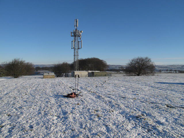 Photo could not load
SJ9647 : Overmoor Summit
Rude Health
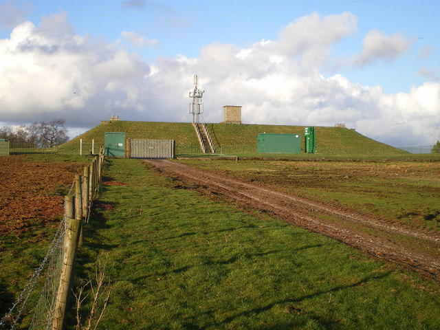 Photo could not load
SJ9647 : Cellarhead reservoir and phone mast
Richard Law
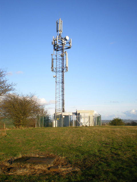 Photo could not load
SJ9647 : The phone mast above Cellarhead
Richard Law
Hill facts and local notes
Classifications
Elevation
289m
948 ft
Prominence
141m
Coordinates
53.0269, -2.0534
SJ965477
OS Map
118
Explorer: 258
At the Summit
The summit features a large rock outcrop that makes for an excellent picnic spot, with a small stone cairn nearby to mark the top.
Terrain & Geology
Overmoor is primarily composed of gritstone, characteristic of the Peak District. This provides a rugged terrain and excellent views that can take your breath away—just be careful not to trip while gasping!
Views & Scenery
The stunning vistas span the surrounding valleys and nearby hills, including views toward the famous Kinder Scout and the distant Dark Peak.
History & Heritage
Name Origin
The name 'Overmoor' suggests a high moorland area, perhaps derived from the Old English 'ofer', meaning 'high' or 'above'.
Historical Significance
This area is steeped in the history of the shape and management of the landscape by generations of farmers and conservationists.
Getting There & Facilities
Check current local access restrictions, parking rules and transport timetables before travelling. These notes do not confirm public access to the summit.
Parking
There is a parking area located at the start of the Stockport Road Path, free and spacious for all hiking enthusiasts.
Public Transport
Buses run frequently from nearby towns, including Glossop. Check local timetables for the best routes.
Nearby Facilities
You will find several cafes in Glossop to grab a hearty breakfast or snack to fuel your hike, plus public toilets in the town.
Safety Information
Known Hazards
- Beware of slippery rocks, especially after rain. Additionally, some areas can be boggy and uneven underfoot.
General Safety Tips
- Check weather conditions before setting out
- Carry appropriate clothing and equipment
- Let someone know your planned route
- Take a map, compass, and GPS device
- Carry emergency supplies: food, water, first aid kit, torch
Hills
Some common questions about the hills answered
Are there group walks up Overmoor?
Many walkers use Walkmates to join or organise walks with others. You can check for group walks around Overmoor through the maps
Are there other walkers around Overmoor?
Activity varies by location and time, but Walkmates lets you see whether others have shared walks or shown interest in this area. Find other people through the walking friends search walking friends for Overmoor search or of course create your own walk for Overmoor
Can I organise a walk to Overmoor?
Yes. If there aren’t any walks listed already, you can create a walk and make it available for others to join.
If you're signed up to Walkmates, you can create a walk to Overmoor.
How do I find a walk up this hill?
There are often multiple ways to walk this hill, depending on experience and route preference. Walkmates helps you explore walks and routes that others have shared.
Can I suggest a new route up Overmoor?
Yes. You can suggest or create routes to share with others. Walkmates focuses on the social side of walking, so routes are used to help people organise walks and explore areas together, rather than as detailed navigation tools or route libraries.
Other uses really appreciate knowledgeable walkers sharing their routes. Share your favourite route to Overmoor here
The is an error or something incorrect about this hill. How do I let you know?
We always strive to keep the information on Walkmates as accurate as possible. If you find an error, please let us know through the contact form and we'll aim to correct it as quickly as possible
Community Discussion
Comments
Location
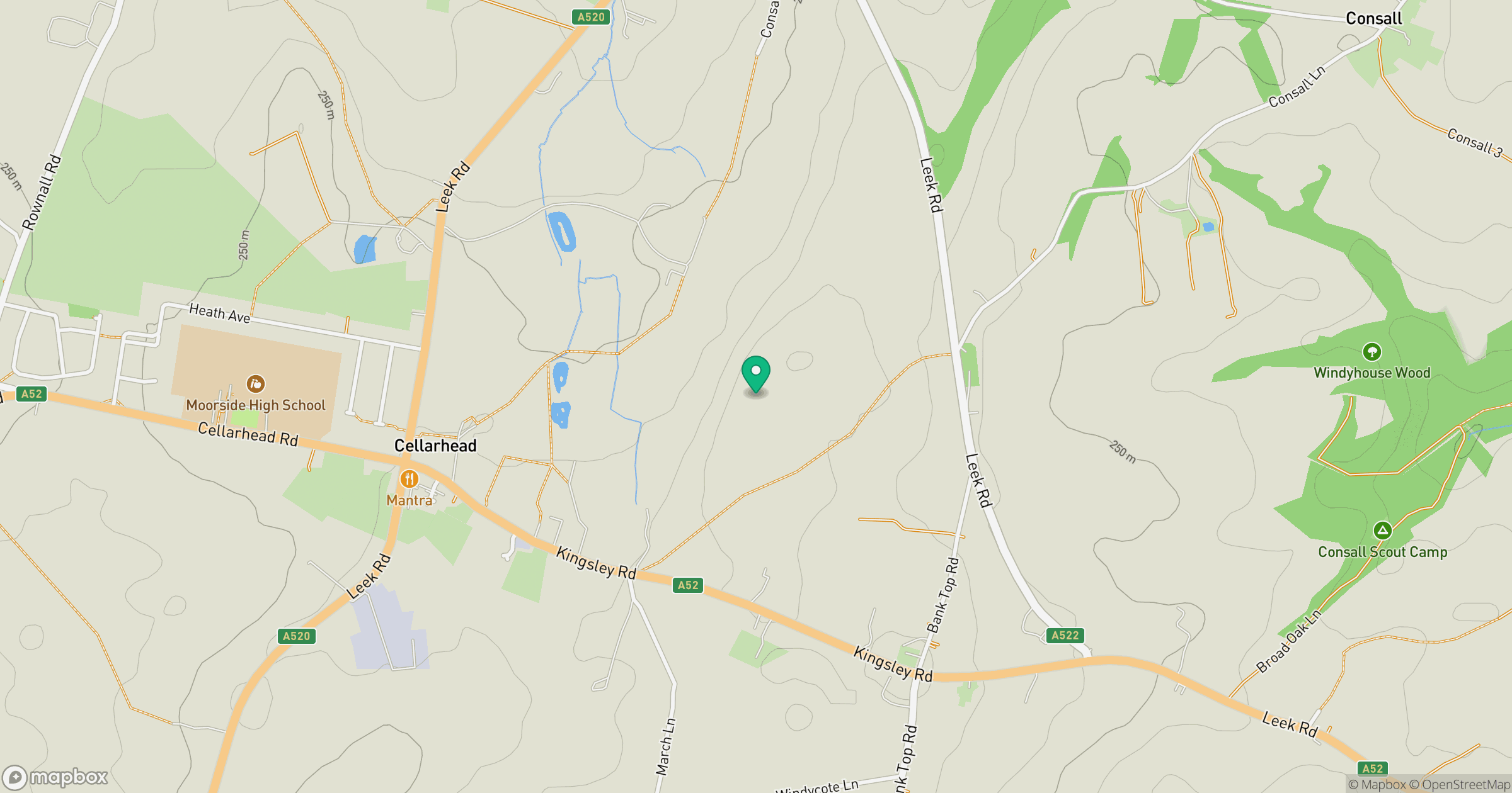
Grid reference: SJ965477
View on OpenStreetMapOpens a map in a new tab, centred on the hill.
Hills within 30 km
Straight-line distance, not a walking route or confirmation of access.
No comments yet. Be the first.