
Ashley Heath
Good walks are even better shared.
Overview
Hiking Ashley Heath
Welcome to Ashley Heath, a hidden gem nestled in the Birmingham Hills. Standing at a modest elevation of 250 meters, this hill may not boast towering heights like the Scottish Munros, but what it lacks in altitude, it makes up for in charm and scenic beauty.
Geology
Ashley Heath presents a delightful combination of sandy loam soil and lush heathland, shaped by ancient glacial activity. The diverse geology contributes to a vibrant ecosystem, where walkers can often spot various flora and fauna delighting in the rich soil.
Access
Getting There: Accessing Ashley Heath is a breeze. The nearest public car park lies right by the start of the Ashley Heath Circular Walk, fitting 20 vehicles. If you’re relying on public transport, worry not! Regular bus services ply from Birmingham city centre to a stop that's just a 1-mile stroll away.
Nearest Town
The lovely market town of Bromsgrove is your nearest hub, offering everything from charming cafés to historical sights.
Hiking Routes
The Ashley Heath Circular Walk is a local favourite. Stretching about 5 km and taking around 2 hours, it's of moderate difficulty. This route weaves through the picturesque heathland, and the gentle undulations keep your legs engaged without leaving you gasping for breath.
Summit Features
Upon reaching the summit, you’ll find a wooden observation platform, complete with benches to rest those weary legs. Sit for a while and soak in the fantastic views!
Terrain Type
The terrain features a delightful mix of grassy patches interspersed with rocky areas, perfect for anyone eager to stretch their legs.
Scenic Views
From the summit, the views can be breathtaking. Gaze upon the Birmingham skyline and, in the distance, the striking Malvern Hills come into view on clear days. For the best experience, visit during the summer or autumn; sunrise and sunset transform the landscape into a painter’s palette of colours.
Hazards
Like any good adventure, keep your wits about you! Slippery sections may crop up after rainfall, along with some overgrown bits that might try to trip you up. Sturdy footwear is recommended!
Nearby Summits
If you're up for more exploration, make sure to check out the nearby Clent Hills, standing proudly at 300 meters.
History and Significance
The name ‘Ashley’ harks back to Old English roots, meaning 'ash tree clearing.' This historical note echoes the natural essence of the place. The site has been a beloved spot for recreational activities since the Victorian times, demonstrating its significance in local culture and wildlife conservation efforts.
Final Thoughts
So, lace up those walking boots and grab your walking stick! Ashley Heath might not be the Empire State Building, but it’s surely a spot that enchants with its tranquil beauty, making it well worth the visit. Happy hiking!
Explore routes near Ashley Heath
Public walks starting within 80 km of this hill. Nearby does not mean a route reaches the summit; check its map and access before setting out.
Apedale Circular Route
View route
Nantwich Walk with Men Walking & Talking
View route
Park Hall: pine woods, heathland and meadow circuit
View route
Crewe Walk with Men Walking & Talking
View route
Route planning notes
These notes describe possible approaches, not verified navigable routes or permission to cross land. Check current paths, local access rules and conditions before setting out.
Ashley Heath Circular Walk
A scenic route that winds through the heathland and offers panoramic views of the surrounding countryside.
Make a day of it, together
Find someone to share the walk with, or organise a day out along a route you like.
Hill facts and local notes
Classifications
Elevation
236m
774 ft
Prominence
119m
Coordinates
52.9190, -2.3794
SJ745357
OS Map
127
Explorer: 243
At the Summit
The summit is marked by a well-constructed wooden observation platform that offers stunning views and a few benches for a well-earned rest.
Terrain & Geology
Ashley Heath primarily consists of sandy loam soil, indicative of the area's glacial history. The soft soil allows for diverse vegetation, making it a haven for nature enthusiasts.
Views & Scenery
On clear days, you can see the highlights of the Birmingham skyline and, to the north, the rolling hills of the Malvern Range.
History & Heritage
Name Origin
The name 'Ashley' derives from Old English, meaning 'ash tree clearing,' reflecting the area's natural woodland past.
Historical Significance
The area has been a popular recreational site since the Victorian era and holds historical significance for local wildlife conservation.
Getting There & Facilities
Check current local access restrictions, parking rules and transport timetables before travelling. These notes do not confirm public access to the summit.
Parking
There is a public car park located at the start of the Ashley Heath Circular Walk, accommodating about 20 vehicles.
Public Transport
Regular bus services run from Birmingham city centre to the nearest stop, approximately 1 mile from the starting point.
Nearby Facilities
A quaint café is located 0.5 km from the parking area, perfect for a cup of tea post-hike. Public toilets are available in Bromsgrove.
Safety Information
Known Hazards
- Occasional slippery sections, especially after rain, and some overgrown areas that may hide uneven ground.
General Safety Tips
- Check weather conditions before setting out
- Carry appropriate clothing and equipment
- Let someone know your planned route
- Take a map, compass, and GPS device
- Carry emergency supplies: food, water, first aid kit, torch
Hills
Some common questions about the hills answered
Are there group walks up Ashley Heath?
Many walkers use Walkmates to join or organise walks with others. You can check for group walks around Ashley Heath through the maps
Are there other walkers around Ashley Heath?
Activity varies by location and time, but Walkmates lets you see whether others have shared walks or shown interest in this area. Find other people through the walking friends search walking friends for Ashley Heath search or of course create your own walk for Ashley Heath
Can I organise a walk to Ashley Heath?
Yes. If there aren’t any walks listed already, you can create a walk and make it available for others to join.
If you're signed up to Walkmates, you can create a walk to Ashley Heath.
How do I find a walk up this hill?
There are often multiple ways to walk this hill, depending on experience and route preference. Walkmates helps you explore walks and routes that others have shared.
Can I suggest a new route up Ashley Heath?
Yes. You can suggest or create routes to share with others. Walkmates focuses on the social side of walking, so routes are used to help people organise walks and explore areas together, rather than as detailed navigation tools or route libraries.
Other uses really appreciate knowledgeable walkers sharing their routes. Share your favourite route to Ashley Heath here
The is an error or something incorrect about this hill. How do I let you know?
We always strive to keep the information on Walkmates as accurate as possible. If you find an error, please let us know through the contact form and we'll aim to correct it as quickly as possible
Community Discussion
Comments
Location
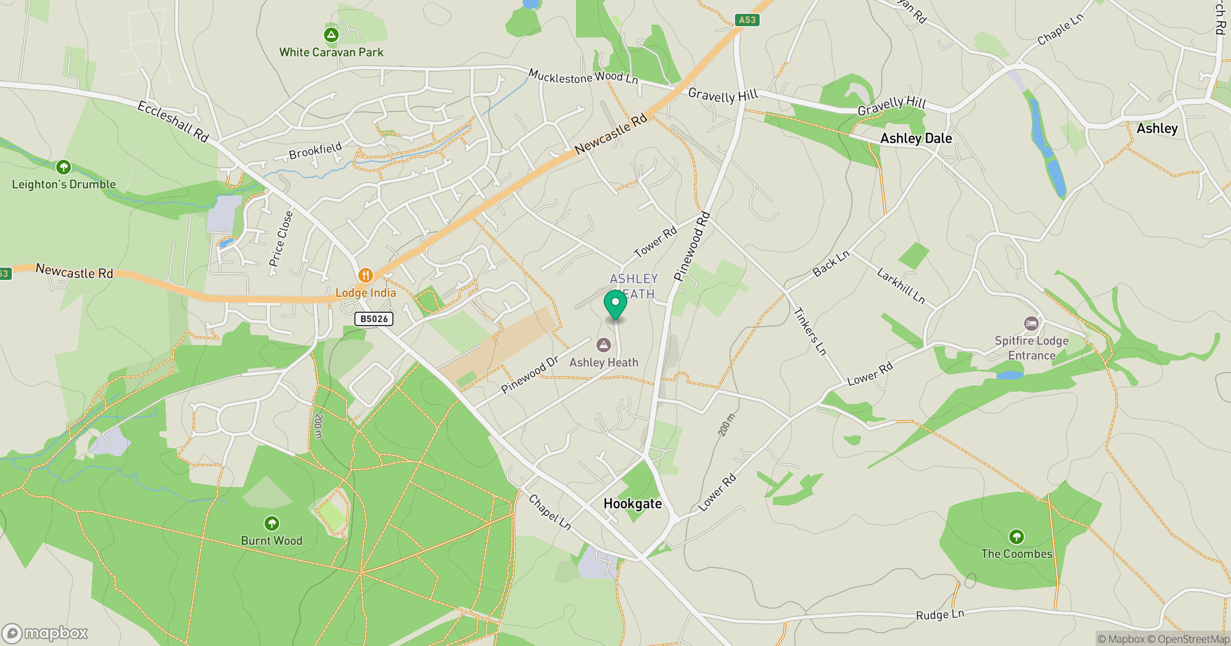
Grid reference: SJ745357
View on OpenStreetMapOpens a map in a new tab, centred on the hill.
Hills within 30 km
Straight-line distance, not a walking route or confirmation of access.
No comments yet. Be the first.