
Oughtmore
Good walks are even better shared.
Overview
Oughtmore Mountain
Oughtmore, standing proudly at 649 meters, is a gem within the Sperrin Mountains. This glorious peak offers not just a hike but an adventure steeped in history, geology, and stunning views.
Geology
The mountain is a fascinating mix of schist and granite, showcasing the earth's processes over millennia. Look closely at the rocky outcrops, and you might just imagine the ancient sea that once roamed these lands. And while you're at it, keep an eye out for quartz veins glimmering in the sunlight—they might not grant wishes, but they certainly add character!
The Ascent
One of the most popular routes to tackle Oughtmore is the Oughtmore Trail from Gortin, a 7.5 km trek that promises a bit of a workout mixed with delightful scenery. The trail is perfect for moderate climbers; it starts off gently through rich woodland, gradually revealing the open hillside. It’s a bit like peeling an onion; you’ve got to get through the layers before the beauty really hits you. Expect around 2.5 hours of walking, but don't rush—savour the sights!
Summit Features
At the summit, you'll be greeted by a monumental stone cairn, a historical marker and perfect spot for a selfie. Just be sure to get creative—nobody wants a boring summit photo!
Terrain and Views
The terrain of Oughtmore is a delightful mix of rocky paths and grassy sections, with patches of heather adding splashes of colour, especially in summer. And while you're huffing and puffing up to the top, take a moment to look around. The views from the summit are breathtaking, with the surrounding Sperrin Mountains sprawling below you and Lough Neagh twinkling in the distance. Spring and early autumn are the prime times to savour these vistas, when the air is crisp and the landscape blooms.
Hazards
Like any wild place, Oughtmore has its share of treachery for the unwary. The paths can become muddy after rains, and certain rocky areas demand caution. Always be prepared for sudden weather changes—Mother Nature has a quirky sense of humour!
Nearby Summits
If you're feeling adventurous, consider tackling the nearby Slieve Snaght, which, at 704 meters, offers even more heights to conquer, alongside Mullaghaneany standing at 582 meters—because why not collect mountains like some collect stamps?
Access
Getting to Oughtmore is easy peasy lemon squeezy. The nearest parking is available at Gortin Glen Forest Park, only 2 km from the trailhead, with plenty of spots to leave your car. If you prefer public transport, local buses from Omagh can drop you off nearby, though checking the schedule beforehand is wise. Omagh town, just a hop away, is your best bet for grabbing a bite or a well-deserved pint after your adventure.
Facilities
When nature calls, Gortin Glen Forest Park has your back with picnic areas and toilets. You can head back down to Omagh for a wider array of facilities, including cafes and shops—where a post-hike nibble is practically mandatory!
History
The name Oughtmore, or 'An Ócht Mhór', literally means 'the great height', which feels a tad cheeky for a mountain that stands proud among its peers. Historically, this area is rich with ancient burial sites and local legends that speak of the ethereal spirits said to dance upon the hills, adding just the right amount of intrigue to your hiking tales.
So grab your walking boots and set off for Oughtmore! It promises a hike that’s well worth the bragging rights, and perhaps the odd laugh along the way!
Explore routes near Oughtmore
Public walks starting within 80 km of this hill. Nearby does not mean a route reaches the summit; check its map and access before setting out.
Banagher Glen and Forest: complete higher-return circuit
View route
Derry~Londonderry City Walls Circuit
View route
Peatlands Park Red Trail: Annagarriff Wood and Derryadd Lough
View route
Portballintrae to Giant's Causeway: railway path and Blue Trail return
View route
Route planning notes
These notes describe possible approaches, not verified navigable routes or permission to cross land. Check current paths, local access rules and conditions before setting out.
Oughtmore Trail from Gortin
A scenic yet moderately challenging ascent that winds through woodland before breaking into open hillside, offering rich biodiversity and stunning views.
Make a day of it, together
Find someone to share the walk with, or organise a day out along a route you like.
Hill facts and local notes
Classifications
Elevation
569m
1,867 ft
Prominence
102m
Coordinates
54.8204, -6.9117
H700974
OS Map
13
At the Summit
The summit is marked by a substantial stone cairn, providing a fine resting spot and an ideal backdrop for photos that will make your friends green with envy.
Terrain & Geology
Oughtmore is predominantly composed of schist and granite, offering a glimpse into the geological past of the region with its rugged water-worn formations and occasional quartz veins.
Views & Scenery
On a clear day, you'll be treated to sweeping views of the surrounding Sperrin Mountains, rolling hills, and distant valleys, with possibly a glimpse of Lough Neagh to the south.
History & Heritage
Name Origin
The name Oughtmore is derived from the Gaelic 'An Ócht Mhór', meaning 'the great height', reflecting its notable prominence in the local landscape.
Historical Significance
Historically, the area around Oughtmore has been significant for its ancient burial sites and its role in local folklore, with numerous tales of the spirits said to roam the hills.
Getting There & Facilities
Check current local access restrictions, parking rules and transport timetables before travelling. These notes do not confirm public access to the summit.
Parking
Parking is available at the Gortin Glen Forest Park, which is approximately 2 km from the trailhead. The park has ample spaces and beautiful surroundings.
Public Transport
Local buses run from Omagh to Gortin, but check the latest schedules as services can vary.
Nearby Facilities
Gortin Glen Forest Park includes picnic areas and toilets. For cafes and shops, head back into Omagh where choices abound.
Safety Information
Known Hazards
- Potential for muddy patches after rain, steep rocky areas that require careful navigation, and sudden changes in weather.
General Safety Tips
- Check weather conditions before setting out
- Carry appropriate clothing and equipment
- Let someone know your planned route
- Take a map, compass, and GPS device
- Carry emergency supplies: food, water, first aid kit, torch
Hills
Some common questions about the hills answered
Are there group walks up Oughtmore?
Many walkers use Walkmates to join or organise walks with others. You can check for group walks around Oughtmore through the maps
Are there other walkers around Oughtmore?
Activity varies by location and time, but Walkmates lets you see whether others have shared walks or shown interest in this area. Find other people through the walking friends search walking friends for Oughtmore search or of course create your own walk for Oughtmore
Can I organise a walk to Oughtmore?
Yes. If there aren’t any walks listed already, you can create a walk and make it available for others to join.
If you're signed up to Walkmates, you can create a walk to Oughtmore.
How do I find a walk up this hill?
There are often multiple ways to walk this hill, depending on experience and route preference. Walkmates helps you explore walks and routes that others have shared.
Can I suggest a new route up Oughtmore?
Yes. You can suggest or create routes to share with others. Walkmates focuses on the social side of walking, so routes are used to help people organise walks and explore areas together, rather than as detailed navigation tools or route libraries.
Other uses really appreciate knowledgeable walkers sharing their routes. Share your favourite route to Oughtmore here
The is an error or something incorrect about this hill. How do I let you know?
We always strive to keep the information on Walkmates as accurate as possible. If you find an error, please let us know through the contact form and we'll aim to correct it as quickly as possible
Community Discussion
Comments
Location
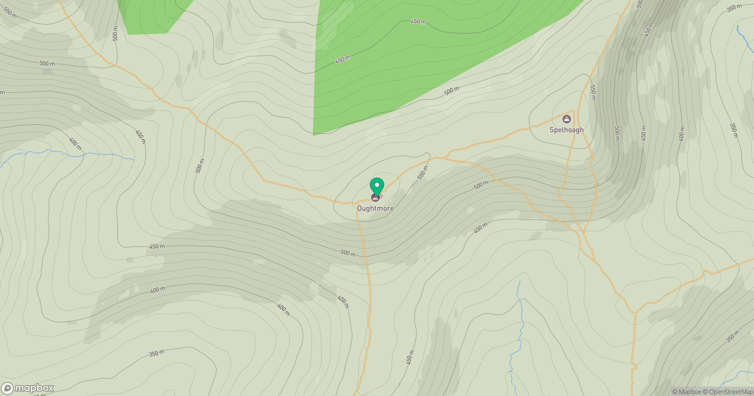
Grid reference: H700974
View on OpenStreetMapOpens a map in a new tab, centred on the hill.
Hills within 30 km
Straight-line distance, not a walking route or confirmation of access.
No comments yet. Be the first.