

Mullaghmore
Good walks are even better shared.
C7300 : Mullaghmore Summit. "Communications Mast"
Michael Murtagh Photo source
Overview
Mullaghmore: A Hidden Gem
Overview
Mullaghmore, standing tall at 665 meters, is a delightful Marilyn located in the scenic Northwest of Ireland. With its limestone cliffs and rolling hills, it’s a love letter to nature that welcomes hikers and outdoor enthusiasts alike.
Geology
The geology of Mullaghmore speaks volumes of its ancient past. Once submerged under tropical seas, the limestone formations tell tales of an era long gone. These rocky features provide not only a unique landscape but also create habitats where nature thrives.
Routes
The Mullaghmore Loop is the primary route taken by most hikers. It’s a moderate walk that weaves through beautiful countryside, offering striking coastal views that may have you reaching for your camera. Carry a flask of tea; you'll want to savour the moment at the top.
Summit Features
Reaching the summit presents you with a stone marker commemorating your achievement. The views are nothing short of spectacular, making it a perfect spot for a picnic—or a much-deserved rest with a well-earned sandwich.
Terrain
The terrain is a delightful mix of grassy patches and stony paths, providing both a comforting and challenging hike that suits a variety of walking styles. Just remember to keep an eye out for those sneaky slippery spots!
Views
From the summit, you can feast your eyes on the breathtaking landscapes, including the Slieve League cliffs and Donegal Bay. The vistas vary beautifully with the seasons, but spring and autumn offer the most picturesque experiences. Just keep on looking ahead—avoid tripping over the heather!
Hazards
Weather can change quicker than you can say 'Look out, sheep!' so always be prepared. The terrain can be tricky, especially after rainfall, so sturdy footwear is highly recommended.
Nearby Summits
If you’re feeling ambitious (or just like to keep your options open), Knocknarea and Slieve League are close companions that promise additional adventures.
Access
Parking is available in Mullaghmore village, and public transport options are limited but present if you’re feeling brave enough to rely on them. Treat yourself to a coffee or a bite in the village before heading out!
Facilities
Mullaghmore offers some lovely cafés and public toilets, ensuring that your hiking trip won’t require any bushcraft skills when nature calls.
History
The name Mullaghmore echoes its great hill stature in Irish, and its historical significance fills the pages of local lore, making this not just a simple climb but a trip through time.
Conclusion
In conclusion, Mullaghmore is a delightful spot that deserves a place on your hiking bucket list. With stunning views, a bit of history, and landscapes that would make any artist swoon, it's an adventure waiting to happen!
Happy Hiking!
Explore routes near Mullaghmore
Walks starting near this hill. Open a route to check its map, distance and full itinerary.
Banagher Glen and Forest: complete higher-return circuit
View route
Peatlands Park Red Trail: Annagarriff Wood and Derryadd Lough
View route
Portballintrae to Giant's Causeway: railway path and Blue Trail return
View route
Portadown to Knock Bridge: Bann Boulevard and Moneypenny’s Lock
View route
Route planning notes
These notes describe possible approaches. Check a route's map and access information when planning your walk.
Mullaghmore Loop
A scenic loop starting from the village, providing a blend of coastal views and hillside terrain. A walk that’ll make you feel on top of the world, or at least a hill!
Make a day of it, together
Find someone to share the walk with, or organise a day out along a route you like.
Photo Gallery
View all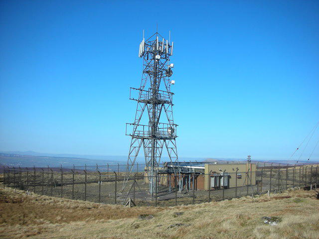 Photo could not load
C7300 : Mullaghmore Summit. "Communications Mast"
Michael Murtagh
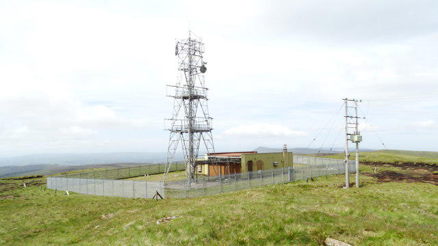 Photo could not load
C7300 : Summit of Mullaghmore, Sperrins
Colin Park
Hill facts and local notes
Classifications
Elevation
550m
1,804 ft
Prominence
236m
Coordinates
54.8497, -6.8510
C738008
OS Map
08
At the Summit
At the summit, you'll find a stone marker and breathtaking views that might just take your breath away—hopefully not literally! There's ample space to spread out and enjoy a picnic if you're feeling social.
Terrain & Geology
Mullaghmore is primarily composed of limestone, which is a result of the shallow tropical seas that once covered this area millions of years ago. This geological history has created stunning coastal cliffs that are a feature of the surrounding landscape.
Views & Scenery
From the top, gaze out over Donegal Bay, the Slieve League cliffs, and the enchanting Sligo landscape. On a clear day, it feels like you can see all the way to the stars, although do keep your eyes on the ground!
History & Heritage
Name Origin
The name Mullaghmore is derived from the Irish 'Mullach Mór', meaning 'great hill'. So, rest assured, it’s aptly named!
Historical Significance
Mullaghmore is not just a pretty face; it's steeped in lore and has been a beloved spot for outdoor lovers and historians alike, often mentioned in tales of the region's rich history.
Getting There & Facilities
Parking
There is a public car park located in Mullaghmore village, just a short walk from the trailhead. Make sure to arrive early, especially during peak seasons, as spots fill up faster than you can say 'Whisky'!
Public Transport
There are limited public transport options, but local buses connect Mullaghmore with larger towns like Sligo. Check local schedules, as they can be as temperamental as the weather.
Nearby Facilities
Hearty café options and public toilets can be found in the village, ensuring you have a place to refuel and freshen up post-exploration.
Safety Information
Known Hazards
- Be cautious of slippery rocks, especially after rain. Also, watch out for sudden changes in weather, as they're as unpredictable as the British summer!
General Safety Tips
- Check weather conditions before setting out
- Carry appropriate clothing and equipment
- Let someone know your planned route
- Take a map, compass, and GPS device
- Carry emergency supplies: food, water, first aid kit, torch
Hills
Some common questions about the hills answered
Are there group walks up Mullaghmore?
Many walkers use Walkmates to join or organise walks with others. You can check for group walks around Mullaghmore through the maps
Are there other walkers around Mullaghmore?
Activity varies by location and time, but Walkmates lets you see whether others have shared walks or shown interest in this area. Find other people through the walking friends search walking friends for Mullaghmore search or of course create your own walk for Mullaghmore
Can I organise a walk to Mullaghmore?
Yes. If there aren’t any walks listed already, you can create a walk and make it available for others to join.
If you're signed up to Walkmates, you can create a walk to Mullaghmore.
How do I find a walk up this hill?
There are often multiple ways to walk this hill, depending on experience and route preference. Walkmates helps you explore walks and routes that others have shared.
Can I suggest a new route up Mullaghmore?
Yes. You can suggest or create routes to share with others. Walkmates focuses on the social side of walking, so routes are used to help people organise walks and explore areas together, rather than as detailed navigation tools or route libraries.
Other uses really appreciate knowledgeable walkers sharing their routes. Share your favourite route to Mullaghmore here
The is an error or something incorrect about this hill. How do I let you know?
We always strive to keep the information on Walkmates as accurate as possible. If you find an error, please let us know through the contact form and we'll aim to correct it as quickly as possible
Community Discussion
Comments
Location
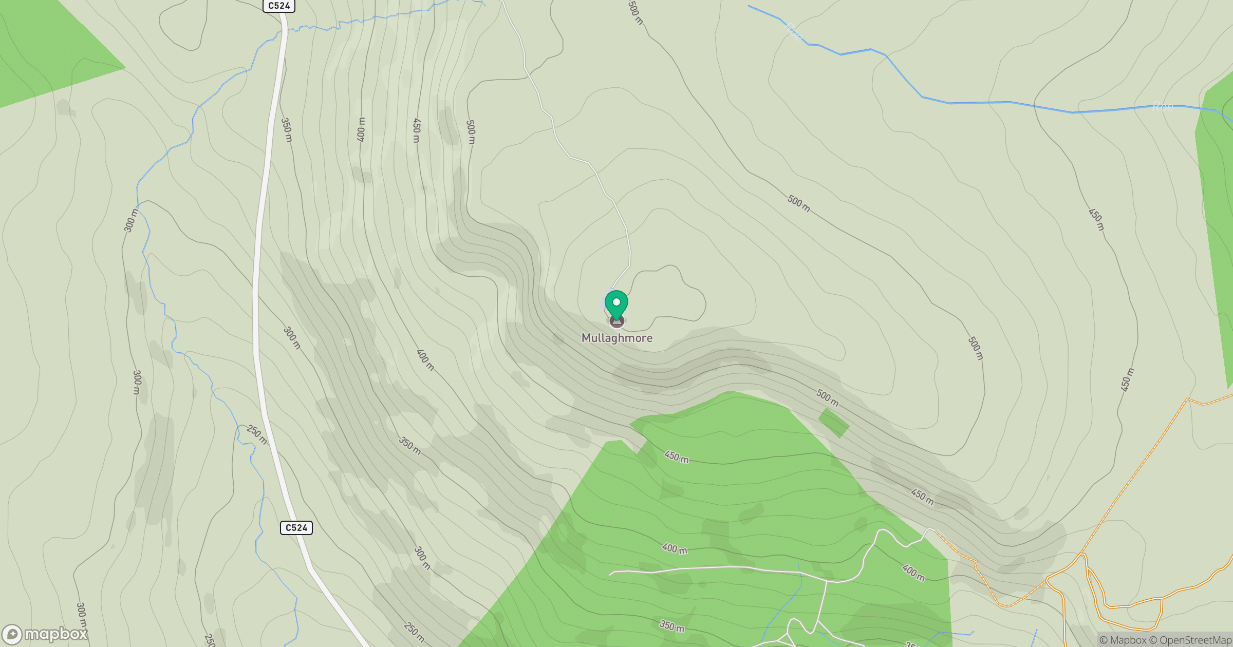
Grid reference: C738008
View on OpenStreetMapOpens a map in a new tab, centred on the hill.
No comments yet. Be the first.