

Slieve Gallion
Good walks are even better shared.
H7987 : Slieve Gallion Triangulation Pillar
Rossographer Photo source
Overview
Slieve Gallion is a 526.6 m mountain at the eastern edge of the Sperrins in County Londonderry, Northern Ireland. Its main summit is the trig point at H798878, southwest of the separate, lower northeast top with its communications mast. An ascent through Iniscarn Forest continues across open upland to the main summit, with views towards Lough Neagh.
Slieve Gallion
Overview
Slieve Gallion is a 526.6 m mountain at the eastern edge of the Sperrins in County Londonderry, Northern Ireland. Its main summit is the trig point at H798878, southwest of the separate, lower northeast top with its communications mast. An ascent through Iniscarn Forest continues across open upland to the main summit, with views towards Lough Neagh.
Main summit and northeast top
The main summit is the trig point at H798878, 526.6 m above sea level. The communications mast and visitor cairn are on the separate northeast top at H813896, which is 493.6 m high. Reaching the mast does not complete an ascent of the main summit.
Route: Iniscarn Forest to the main summit and back
Start and finish at the Iniscarn Forest entrance on Iniscarn Road near Brackagh Road. Follow the climbing forest road, take the left branch by the old house and continue through the upper forest. Cross the stile onto moorland and climb to the northeast mast top. Continue southwest across the upland saddle to the main trig-point summit at H798878. Retrace the same route over the northeast top and down through the forest to the start. Allow 3.5–5 hours for this 12.4 km return outing, with 513 m of ascent. Expect steep, uneven ground and exposed moorland; follow forestry notices and keep dogs on a lead.
Terrain and navigation
Gravel forest roads and narrower tracks climb through Iniscarn Forest to a stile and open moorland. Beyond the northeast top, the route crosses uneven, peat-covered upland towards the main summit. Open upland and peat-covered ground separate the northeast top from the main summit; mist can obscure the route. Carry a map and compass and know how to use them.
Parking and access
Parking is permitted at the Iniscarn Forest entrance on Iniscarn Road, near Brackagh Road. Keep the gates and forestry-vehicle access clear. Follow any operational signs or temporary restrictions. Iniscarn is a working forest. Obey forestry safety signs, closures and diversions, and keep vehicle access clear. The uplands include privately owned grazing land. Keep dogs on a lead, respect livestock and use gates and stiles carefully.
Public transport and facilities
Check Translink’s journey planner for buses to Desertmartin or Magherafelt and confirm the outward and last return services for your walking date. Arrange the onward connection to the Iniscarn Forest entrance. There are no toilets at the Iniscarn Forest trailhead. Use facilities in the surrounding towns before setting out and carry food and water for the full return walk.
Views and wildlife
In clear weather, the upper slopes and summits overlook Lough Neagh and the surrounding countryside. The northeast top also gives views towards the Antrim plateau and north towards Donegal. Clear visibility offers the best views over Lough Neagh and the surrounding countryside. Buzzards may be seen displaying above Iniscarn’s mature hardwoods in spring.
Geology and peat
Slieve Gallion has complex igneous geology, including granodiorite and rhyolitic porphyry exposed on its southeastern side. Its volcanic rocks are associated with the Tyrone Volcanic Group. Peat in the saddle between the two tops preserves a vegetation record extending back about 10,000 years, while later blanket peat covers much of the upland.
Name and history
Sliabh gCallann is interpreted as “mountain of the heights”. Local stories also associate the mountain with the legendary Callan. Slieve Gallion features in the traditional song Slieve Gallion’s Braes. Local folklore associates the cairn on the northeast top with Callan, a legendary descendant of Colla Uais. The mountain’s peat deposits also preserve a much longer record of environmental change.
Nearby summit
The separate Slieve Gallion NE Top is 493.6 m high at H813896 and is visited on the Iniscarn approach to the main summit.
Conditions
Heavy rain can soften peat and make paths muddy. Wind, low cloud and short winter days increase the demands of the open upland section; frost or snow can make steep ground slippery. Check the forecast and allow time to return through the forest in daylight.
Explore routes near Slieve Gallion
Walks starting near this hill. Open a route to check its map, distance and full itinerary.
Peatlands Park Red Trail: Annagarriff Wood and Derryadd Lough
View route
Portadown to Knock Bridge: Bann Boulevard and Moneypenny’s Lock
View route
Scarva to Poyntzpass: Newry Canal and Lough Shark Return
View route
Drumbeg to Hilden Bridge: Lagan Towpath, Lambeg and Canal Locks
View route
Route planning notes
These notes describe possible approaches. Check a route's map and access information when planning your walk.
Slieve Gallion main summit via Iniscarn Forest
Start and finish at the Iniscarn Forest entrance on Iniscarn Road near Brackagh Road. Follow the climbing forest road, take the left branch by the old house and continue through the upper forest. Cross the stile onto moorland and climb to the northeast mast top. Continue southwest across the upland saddle to the main trig-point summit at H798878. Retrace the same route over the northeast top and down through the forest to the start. Allow 3.5–5 hours for this 12.4 km return outing, with 513 m of ascent. Expect steep, uneven ground and exposed moorland; follow forestry notices and keep dogs on a lead.
Make a day of it, together
Find someone to share the walk with, or organise a day out along a route you like.
Photo Gallery
View all Photo could not load
H7987 : Slieve Gallion Triangulation Pillar
Rossographer
 Photo could not load
H7987 : Flush Bracket, Slieve Gallion Triangulation Pillar
Rossographer
 Photo could not load
H7987 : Spider, Slieve Gallion Triangulation Pillar
Rossographer
Hill facts and local notes
Classifications
Elevation
527m
1,728 ft
Prominence
331m
Coordinates
54.7319, -6.7612
H798878
OS Map
13
At the Summit
The main summit is the trig point at H798878, 526.6 m above sea level. The communications mast and visitor cairn are on the separate northeast top at H813896, which is 493.6 m high. Reaching the mast does not complete an ascent of the main summit.
Terrain & Geology
Slieve Gallion has complex igneous geology, including granodiorite and rhyolitic porphyry exposed on its southeastern side. Its volcanic rocks are associated with the Tyrone Volcanic Group. Peat in the saddle between the two tops preserves a vegetation record extending back about 10,000 years, while later blanket peat covers much of the upland.
Views & Scenery
In clear weather, the upper slopes and summits overlook Lough Neagh and the surrounding countryside. The northeast top also gives views towards the Antrim plateau and north towards Donegal.
Best Seasons
Clear visibility offers the best views over Lough Neagh and the surrounding countryside. Buzzards may be seen displaying above Iniscarn’s mature hardwoods in spring.
History & Heritage
Name Origin
Sliabh gCallann is interpreted as “mountain of the heights”. Local stories also associate the mountain with the legendary Callan.
Historical Significance
Slieve Gallion features in the traditional song Slieve Gallion’s Braes. Local folklore associates the cairn on the northeast top with Callan, a legendary descendant of Colla Uais. The mountain’s peat deposits also preserve a much longer record of environmental change.
Getting There & Facilities
Parking
Parking is permitted at the Iniscarn Forest entrance on Iniscarn Road, near Brackagh Road. Keep the gates and forestry-vehicle access clear. Follow any operational signs or temporary restrictions.
Public Transport
Check Translink’s journey planner for buses to Desertmartin or Magherafelt and confirm the outward and last return services for your walking date. Arrange the onward connection to the Iniscarn Forest entrance.
Nearby Facilities
There are no toilets at the Iniscarn Forest trailhead. Use facilities in the surrounding towns before setting out and carry food and water for the full return walk.
Safety Information
Known Hazards
- Steep, uneven ground on the forest-to-moorland ascent can be slippery when wet.
- Open upland and peat-covered ground separate the northeast top from the main summit; mist can obscure the route. Carry a map and compass and know how to use them.
- Iniscarn is a working forest. Obey forestry safety signs, closures and diversions, and keep vehicle access clear.
- The uplands include privately owned grazing land. Keep dogs on a lead, respect livestock and use gates and stiles carefully.
Seasonal Hazards
Heavy rain can soften peat and make paths muddy. Wind, low cloud and short winter days increase the demands of the open upland section; frost or snow can make steep ground slippery. Check the forecast and allow time to return through the forest in daylight.
General Safety Tips
- Check weather conditions before setting out
- Carry appropriate clothing and equipment
- Let someone know your planned route
- Take a map, compass, and GPS device
- Carry emergency supplies: food, water, first aid kit, torch
Hills
Some common questions about the hills answered
Are there group walks up Slieve Gallion?
Many walkers use Walkmates to join or organise walks with others. You can check for group walks around Slieve Gallion through the maps
Are there other walkers around Slieve Gallion?
Activity varies by location and time, but Walkmates lets you see whether others have shared walks or shown interest in this area. Find other people through the walking friends search walking friends for Slieve Gallion search or of course create your own walk for Slieve Gallion
Can I organise a walk to Slieve Gallion?
Yes. If there aren’t any walks listed already, you can create a walk and make it available for others to join.
If you're signed up to Walkmates, you can create a walk to Slieve Gallion.
How do I find a walk up this hill?
There are often multiple ways to walk this hill, depending on experience and route preference. Walkmates helps you explore walks and routes that others have shared.
Can I suggest a new route up Slieve Gallion?
Yes. You can suggest or create routes to share with others. Walkmates focuses on the social side of walking, so routes are used to help people organise walks and explore areas together, rather than as detailed navigation tools or route libraries.
Other uses really appreciate knowledgeable walkers sharing their routes. Share your favourite route to Slieve Gallion here
The is an error or something incorrect about this hill. How do I let you know?
We always strive to keep the information on Walkmates as accurate as possible. If you find an error, please let us know through the contact form and we'll aim to correct it as quickly as possible
Community Discussion
Comments
Location
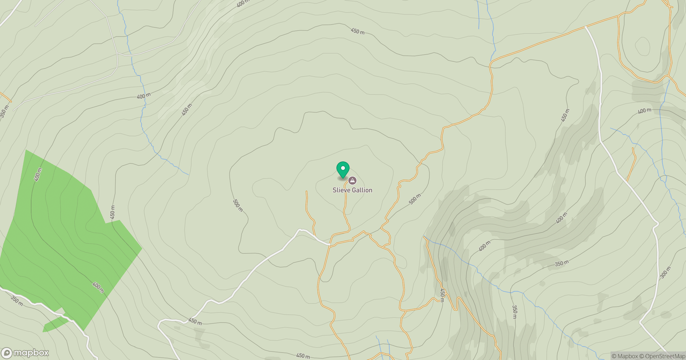
Grid reference: H798878
View on OpenStreetMapOpens a map in a new tab, centred on the hill.
No comments yet. Be the first.