
Letterlogher
Good walks are even better shared.
Overview
Letterlogher: A Hidden Gem in the Sperrins
Introduction
Nestled within the charming and rugged terrain of the Sperrin Mountains, Letterlogher stands as a magnificent Marilyn, beckoning hikers and nature enthusiasts alike. At an elevation of 598 meters, it offers a delightful escape into the wilds of Northern Ireland.
Geology
The rich geological tapestry of Letterlogher is mainly composed of Old Red Sandstone. Visitors can appreciate the impressive glacially sculpted landscapes, where ancient forces have shaped the very rock beneath your boots.
Our Recommended Route
The Sperrin Way is a fantastic choice for those looking to explore Letterlogher. This 8 km circular loop combines scenic beauty and moderate challenge, making it suitable for many hiking enthusiasts. Prepare for stunning views and a chance to catch a glimpse of the local wildlife, including the occasional sheep, minding their own business!
Summit Features
Upon reaching the summit, you will find a quaint stone cairn—really, it’s as close to a trophy as nature offers! It’s a perfect spot for a selfie or just soaking up the panoramic scenery.
Terrain Type
Expect to traverse grassy slopes adorned with heather, mixed in with rocky outcrops. A bit of heather never hurt anyone, though it can be sneaky—wear good footwear!
Breathtaking Views
The vistas from Letterlogher’s peak are nothing short of spectacular. Look eastward for glimpses of the Mourne Mountains, and on a clear day, the coastline of Donegal can be spotted, giving you ample opportunities for “oohing” and “aahing”. Late spring through early autumn is the prime time for those dreamy views.
Potential Hazards
As enchanting as the terrain may be, keep your wits about you—wet rocks and hidden bogs might just be waiting for an unwary foot. Always remember: your shoes should be more than just an accessory!
Nearby Summits
For those looking to extend their hiking adventures, consider summiting Meenagahan (604 m) or Broughderg (630 m). Both provide their unique allure and attractive panoramas.
Access & Facilities
Plenty of parking can be found at the base of Letterlogher along the B46. For those relying on public transport, services from Cookstown to Gortin are near, giving you access to the trailhead with a short walk. Omagh, about 20 km away, offers all the amenities one could desire, including cafes and toilets, perfect for filling up before your hike.
Historical Significance
The name Letterlogher is derived from the Irish ‘Leitir Logha’, reminding us of the area's deep-rooted cultural heritage. The Sperrins have long been a source of myth and legend, further enhancing the mountain's significance.
Conclusion
Letterlogher may not be the highest peak in Northern Ireland, but it certainly competes when it comes to charm and breath-taking views. Whether you're an experienced hiker or a laid-back stroller who just appreciates a nice view, Letterlogher deserves a spot on your exploration list.
Happy hiking!
Explore routes near Letterlogher
Public walks starting within 80 km of this hill. Nearby does not mean a route reaches the summit; check its map and access before setting out.
Banagher Glen and Forest: complete higher-return circuit
View route
Derry~Londonderry City Walls Circuit
View route
Portballintrae to Giant's Causeway: railway path and Blue Trail return
View route
Peatlands Park Red Trail: Annagarriff Wood and Derryadd Lough
View route
Route planning notes
These notes describe possible approaches, not verified navigable routes or permission to cross land. Check current paths, local access rules and conditions before setting out.
Sperrin Way
A scenic circular loop that traverses the lower slopes of Letterlogher, providing access to both the summit and the spectacular surrounding landscapes.
Make a day of it, together
Find someone to share the walk with, or organise a day out along a route you like.
Hill facts and local notes
Classifications
Elevation
249m
817 ft
Prominence
114m
Coordinates
54.9108, -7.0824
C589074
OS Map
07
At the Summit
The summit is topped with a small stone cairn, offering a perfect spot for a well-deserved rest and photo opportunity.
Terrain & Geology
The geology of Letterlogher consists predominantly of Old Red Sandstone. The area is characterised by classic glacial features, with evidence of past glaciation visible in the surrounding valleys.
Views & Scenery
From the summit, you can see the distant peaks of the Mourne Mountains to the east, the lush valleys below, and on a clear day, the coast of Donegal is in sight.
History & Heritage
Name Origin
The name ‘Letterlogher’ is thought to be derived from the Irish 'Leitir Logha', meaning 'slope of the hollow'.
Historical Significance
The Sperrin Mountains, including Letterlogher, are steeped in folklore and history, often regarded as sacred by local communities.
Getting There & Facilities
Check current local access restrictions, parking rules and transport timetables before travelling. These notes do not confirm public access to the summit.
Parking
There is a small car park at the base of the hill on the B46 road, which can accommodate several vehicles.
Public Transport
Regular bus services operate from Cookstown to the nearby village of Gortin, with a short walk to access trailheads.
Nearby Facilities
Omagh provides several cafes, restaurants, and public toilets for your comfort before or after your hike.
Safety Information
Known Hazards
- Be cautious of slippery rocks on wet days and the odd boggy patch that could surprise unsuspecting hikers.
General Safety Tips
- Check weather conditions before setting out
- Carry appropriate clothing and equipment
- Let someone know your planned route
- Take a map, compass, and GPS device
- Carry emergency supplies: food, water, first aid kit, torch
Hills
Some common questions about the hills answered
Are there group walks up Letterlogher?
Many walkers use Walkmates to join or organise walks with others. You can check for group walks around Letterlogher through the maps
Are there other walkers around Letterlogher?
Activity varies by location and time, but Walkmates lets you see whether others have shared walks or shown interest in this area. Find other people through the walking friends search walking friends for Letterlogher search or of course create your own walk for Letterlogher
Can I organise a walk to Letterlogher?
Yes. If there aren’t any walks listed already, you can create a walk and make it available for others to join.
If you're signed up to Walkmates, you can create a walk to Letterlogher.
How do I find a walk up this hill?
There are often multiple ways to walk this hill, depending on experience and route preference. Walkmates helps you explore walks and routes that others have shared.
Can I suggest a new route up Letterlogher?
Yes. You can suggest or create routes to share with others. Walkmates focuses on the social side of walking, so routes are used to help people organise walks and explore areas together, rather than as detailed navigation tools or route libraries.
Other uses really appreciate knowledgeable walkers sharing their routes. Share your favourite route to Letterlogher here
The is an error or something incorrect about this hill. How do I let you know?
We always strive to keep the information on Walkmates as accurate as possible. If you find an error, please let us know through the contact form and we'll aim to correct it as quickly as possible
Community Discussion
Comments
Location
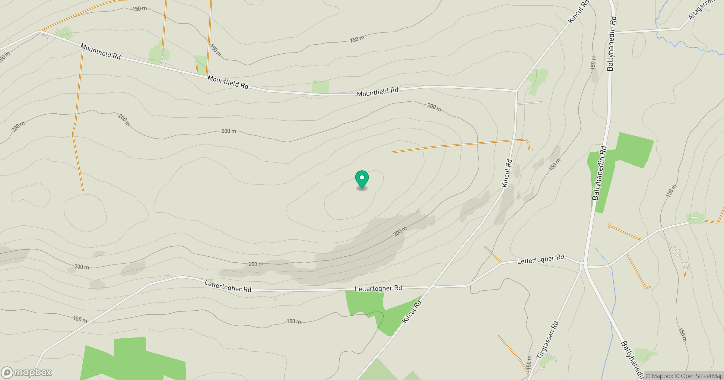
Grid reference: C589074
View on OpenStreetMapOpens a map in a new tab, centred on the hill.
Hills within 30 km
Straight-line distance, not a walking route or confirmation of access.
No comments yet. Be the first.