
Straid Hill
Good walks are even better shared.
Overview
Straid Hill: A Hidden Gem of County Antrim
Nestled in the lovely County Antrim, Straid Hill offers a delightful escape for both seasoned hikers and those just fancying a gentle stroll. Standing at 278 meters, it may not be the tallest hill around, but its scenic views and diverse landscape are not to be sniffed at!
Geology
The unique geology of Straid Hill is comprised mainly of limestone and sandstone, resulting in striking rocky outcrops amidst expanses of lush greenery. This combination not only makes for an interesting landscape but also supports a diverse range of flora and fauna.
Access
To access the hill, you can park at the small roadside pull-in near C590037. This convenient point allows easy access to the start of the C590037 Trail, which is moderately challenging and about 3.5 km long. It’s a pleasant walk that takes around one and a half hours to reach the summit, perfect for a quick morning adventure!
Bus services from Ballymena offer limited access for those relying on public transport, though it is advisable to check the latest schedules. Once you've conquered the hill, a well-deserved coffee in one of the local cafes in Ballymena is certainly in order.
Terrain
Be prepared for a mix of rocky paths with some mud patches after rain—best to wear those sturdy boots! The grassy pastures allow for relaxed walking, but stay vigilant of the occasional livestock encounters; they tend to be curious creatures.
Summit Features
Upon reaching the top, walkers are greeted by a modest stone cairn and a trig point. The grassy platters are ideal for a picnic, so don’t forget to pack some snacks; after all, life is too short not to enjoy a sandwich with a view!
Views
The views from the summit are simply spectacular! On a clear day, you can feast your eyes on the majestic Mourne Mountains to the south, and get a glimpse of Belfast and Lisburn sprawled out to the east. Spring and autumn are the best seasons to visit, granting vivid colours and clearer sights.
Nearby Summits
For those looking to explore further, Cairnryan Hill and Knocklayd are nearby options that offer their own distinct experiences and landscapes.
In summary, while Straid Hill may not be the biggest name on the block, its charm and scenic beauty offer a compelling adventure for anyone willing to lace up their hiking boots. So grab your gear, and take a trip out to this charming spot in County Antrim—you won’t regret it!
Happy hiking!
Explore routes near Straid Hill
Public walks starting within 80 km of this hill. Nearby does not mean a route reaches the summit; check its map and access before setting out.
Banagher Glen and Forest: complete higher-return circuit
View route
Derry~Londonderry City Walls Circuit
View route
Portballintrae to Giant's Causeway: railway path and Blue Trail return
View route
Peatlands Park Red Trail: Annagarriff Wood and Derryadd Lough
View route
Route planning notes
These notes describe possible approaches, not verified navigable routes or permission to cross land. Check current paths, local access rules and conditions before setting out.
C590037 Trail
This trail starts from the quiet roadside at C590037, leading through a mix of rocky outcrops and grassy pastures, gently ascending to the summit.
Make a day of it, together
Find someone to share the walk with, or organise a day out along a route you like.
Hill facts and local notes
Classifications
Elevation
303m
994 ft
Prominence
128m
Coordinates
54.8775, -7.0816
C590037
OS Map
07
At the Summit
At the summit, you'll find a grassy plateau marked by a small stone cairn and a trig point, perfect for that brag-worthy photo.
Terrain & Geology
Straid Hill is primarily composed of limestone and sandstone, giving it a unique blend of geological features. The limestone can be quite eroded, creating interesting rock formations, while the sandstone offers a sturdier base.
Views & Scenery
On a clear day, you can spot the Mourne Mountains to the south and the sprawling cities of Belfast and Lisburn to the east.
History & Heritage
Name Origin
The name 'Straid' originates from the Irish word 'Straid' meaning 'a way or path', hinting at the historical significance of trails through the area.
Historical Significance
This region holds a strong cultural heritage, with ancient pathways used by generations of locals.
Getting There & Facilities
Check current local access restrictions, parking rules and transport timetables before travelling. These notes do not confirm public access to the summit.
Parking
There is a small pull-in at the roadside near the C590037 trailhead, suitable for a couple of cars.
Public Transport
Limited bus services operate from nearby towns, with the nearest stop around 3 km from the trailhead.
Nearby Facilities
While there are no facilities on the hill itself, Ballymena offers several cafes, restaurants, and public toilets for a pre- or post-hike refreshment.
Safety Information
Known Hazards
- Beware of the muddy sections after rain, and be cautious of the occasional livestock roaming the hills. It's their turf, after all!
General Safety Tips
- Check weather conditions before setting out
- Carry appropriate clothing and equipment
- Let someone know your planned route
- Take a map, compass, and GPS device
- Carry emergency supplies: food, water, first aid kit, torch
Hills
Some common questions about the hills answered
Are there group walks up Straid Hill?
Many walkers use Walkmates to join or organise walks with others. You can check for group walks around Straid Hill through the maps
Are there other walkers around Straid Hill?
Activity varies by location and time, but Walkmates lets you see whether others have shared walks or shown interest in this area. Find other people through the walking friends search walking friends for Straid Hill search or of course create your own walk for Straid Hill
Can I organise a walk to Straid Hill?
Yes. If there aren’t any walks listed already, you can create a walk and make it available for others to join.
If you're signed up to Walkmates, you can create a walk to Straid Hill.
How do I find a walk up this hill?
There are often multiple ways to walk this hill, depending on experience and route preference. Walkmates helps you explore walks and routes that others have shared.
Can I suggest a new route up Straid Hill?
Yes. You can suggest or create routes to share with others. Walkmates focuses on the social side of walking, so routes are used to help people organise walks and explore areas together, rather than as detailed navigation tools or route libraries.
Other uses really appreciate knowledgeable walkers sharing their routes. Share your favourite route to Straid Hill here
The is an error or something incorrect about this hill. How do I let you know?
We always strive to keep the information on Walkmates as accurate as possible. If you find an error, please let us know through the contact form and we'll aim to correct it as quickly as possible
Community Discussion
Comments
Location
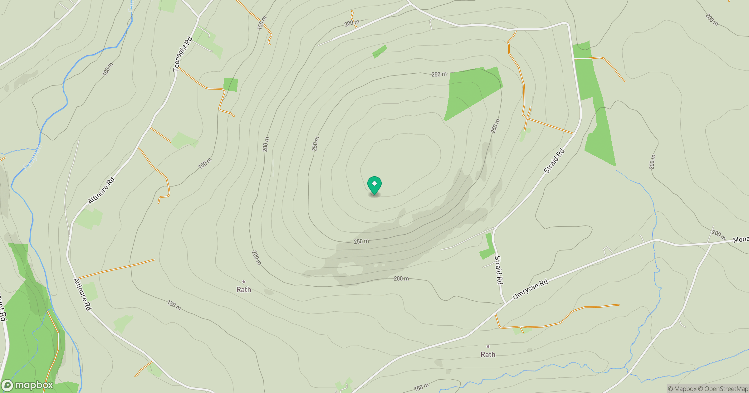
Grid reference: C590037
View on OpenStreetMapOpens a map in a new tab, centred on the hill.
Hills within 30 km
Straight-line distance, not a walking route or confirmation of access.
No comments yet. Be the first.