
Banc y Garreg
Good walks are even better shared.
Overview
Banc y Garreg
Introduction
Nestled in the heart of the Brecon Beacons National Park, Banc y Garreg is a charming hill that's often overshadowed by its taller siblings. Standing at 505 meters, it's not the highest peak in the region, but it offers a delightful experience for walkers and nature lovers alike.
Geology
Banc y Garreg boasts Old Red Sandstone formations, which tell tales of ancient river systems. The reddish hues of the rock lend a unique character to the landscape and are a reminder of the region's rich geological history. So, when you step upon these stones, remember, they’ve been here long before you!
Routes
Bwlch y Sarnau Route
This route is perfect for a leisurely half-day hike. Starting at Bwlch y Sarnau, it offers a gradual ascent, allowing you to take in the scenery without breaking too much of a sweat. The 5.8 km trek should take approximately 2.5 hours, making it ideal for families and seasoned walkers alike. Just don’t forget your camera!
Summit Features
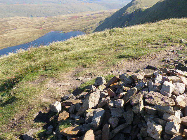
Upon reaching the summit, you'll find a commendable stone cairn, solid proof that you’ve made it to the top! It serves as a great resting point and an ideal spot for those Instagram-worthy shots. If you see a sheep trying to photobomb you, well, they clearly want their moment of fame too!
Terrain and Hazards
Expect a mix of grassy areas interspersed with rocky patches. Be advised, some sections can be boggy, so ensure your footwear is up to the task; nobody wants soggy socks on a hike. Weather can change at the drop of a hat here, so be prepared for a bit of drizzle if the clouds decide to roll in.
Views
From the summit, take in unbelievable panoramic views of the surrounding mountains, including the impressive Pen y Fan. Autumn and spring provide the best opportunities for picturesque vistas as colours come alive in the landscape. Don’t forget to pause and reflect on the beauty around you—it's what hiking is all about!
Access
Parking can be found nearby at Bwlch y Sarnau layby, but get there early—popular spots tend to fill up like hotcakes. If public transport is your preferred mode of travel, the quaint town of Brecon is your best bet, albeit with limited bus services.
Facilities
While you won’t find any facilities on the mountain, the nearby town of Brecon is well-equipped with cafes to refuel after your adventure. Make sure to treat yourself—after all, you’ve earned it!
Conclusion
Banc y Garreg may not be the highest mountain, but its charm and stunning views make it a worthwhile trek. So throw on those hiking boots, grab your walking sticks, and bask in the beauty of this hidden gem in the Brecon Beacons National Park. Happy hiking!
Explore routes near Banc y Garreg
Public walks starting within 80 km of this hill. Nearby does not mean a route reaches the summit; check its map and access before setting out.
Dolaucothi Estate: Cothi Valley and Red Waymarked Circuit
View route
Usk Reservoir: Glasfynydd Forest and Dam Circuit
View route
Aircraft Crash Site - Wellington Bomber and Vampire Jet (Black Mountain range)
View route
World Curlew Day Walk and Talk at Mynydd Illtud
View route
Route planning notes
These notes describe possible approaches, not verified navigable routes or permission to cross land. Check current paths, local access rules and conditions before setting out.
Bwlch y Sarnau Route
A delightful route starting from Bwlch y Sarnau with gentle inclines and beautiful views of surrounding valleys.
Make a day of it, together
Find someone to share the walk with, or organise a day out along a route you like.
Hill facts and local notes
Classifications
Elevation
332m
1,089 ft
Prominence
107m
Coordinates
52.0143, -3.8873
SN705367
OS Map
146 160
Explorer: 187S
At the Summit
The summit features a substantial stone cairn that offers a perfect backdrop for those all-important summit selfies. Keep an eye out for the occasional sheep trying to join the photo!
Terrain & Geology
Banc y Garreg is primarily composed of Old Red Sandstone, formed during the Devonian period. This geological formation gives the mountain its distinctive red hue and provides a relatively stable footing for hikers.
Views & Scenery
From the summit, you can take in a sweeping vista across the Brecon Beacons, including the majestic Pen y Fan and the scenic Usk Valley. On a clear day, the views stretch as far as the Black Mountains.
History & Heritage
Name Origin
The name 'Banc y Garreg' translates to 'Bank of the Stone', a nod possibly to its rocky outcrops and natural features.
Historical Significance
Banc y Garreg has historic footprints dating back to prehistoric times; its gentle slopes have long been a sanctuary for wildlife.
Getting There & Facilities
Check current local access restrictions, parking rules and transport timetables before travelling. These notes do not confirm public access to the summit.
Parking
The nearest parking is at the Bwlch y Sarnau layby (SN 986 225), which provides a convenient starting point for your hike. Take care as spaces can fill up quickly!
Public Transport
The closest public transport options are available in the nearby town of Brecon, with bus services that reach the area; however, check local timetables as services can be sparse.
Nearby Facilities
There are no facilities directly on the mountain, but the town of Brecon has cafes, pubs, and public toilets. Refreshments post-hike are always welcome!
Safety Information
Known Hazards
- Beware of changing weather conditions; they can turn from sunny to rainy faster than you can say 'wet socks'. Some paths can be slippery, especially after rain, so take care on slippery rocks.
General Safety Tips
- Check weather conditions before setting out
- Carry appropriate clothing and equipment
- Let someone know your planned route
- Take a map, compass, and GPS device
- Carry emergency supplies: food, water, first aid kit, torch
Hills
Some common questions about the hills answered
Are there group walks up Banc y Garreg?
Many walkers use Walkmates to join or organise walks with others. You can check for group walks around Banc y Garreg through the maps
Are there other walkers around Banc y Garreg?
Activity varies by location and time, but Walkmates lets you see whether others have shared walks or shown interest in this area. Find other people through the walking friends search walking friends for Banc y Garreg search or of course create your own walk for Banc y Garreg
Can I organise a walk to Banc y Garreg?
Yes. If there aren’t any walks listed already, you can create a walk and make it available for others to join.
If you're signed up to Walkmates, you can create a walk to Banc y Garreg.
How do I find a walk up this hill?
There are often multiple ways to walk this hill, depending on experience and route preference. Walkmates helps you explore walks and routes that others have shared.
Can I suggest a new route up Banc y Garreg?
Yes. You can suggest or create routes to share with others. Walkmates focuses on the social side of walking, so routes are used to help people organise walks and explore areas together, rather than as detailed navigation tools or route libraries.
Other uses really appreciate knowledgeable walkers sharing their routes. Share your favourite route to Banc y Garreg here
The is an error or something incorrect about this hill. How do I let you know?
We always strive to keep the information on Walkmates as accurate as possible. If you find an error, please let us know through the contact form and we'll aim to correct it as quickly as possible
Community Discussion
Comments
Location
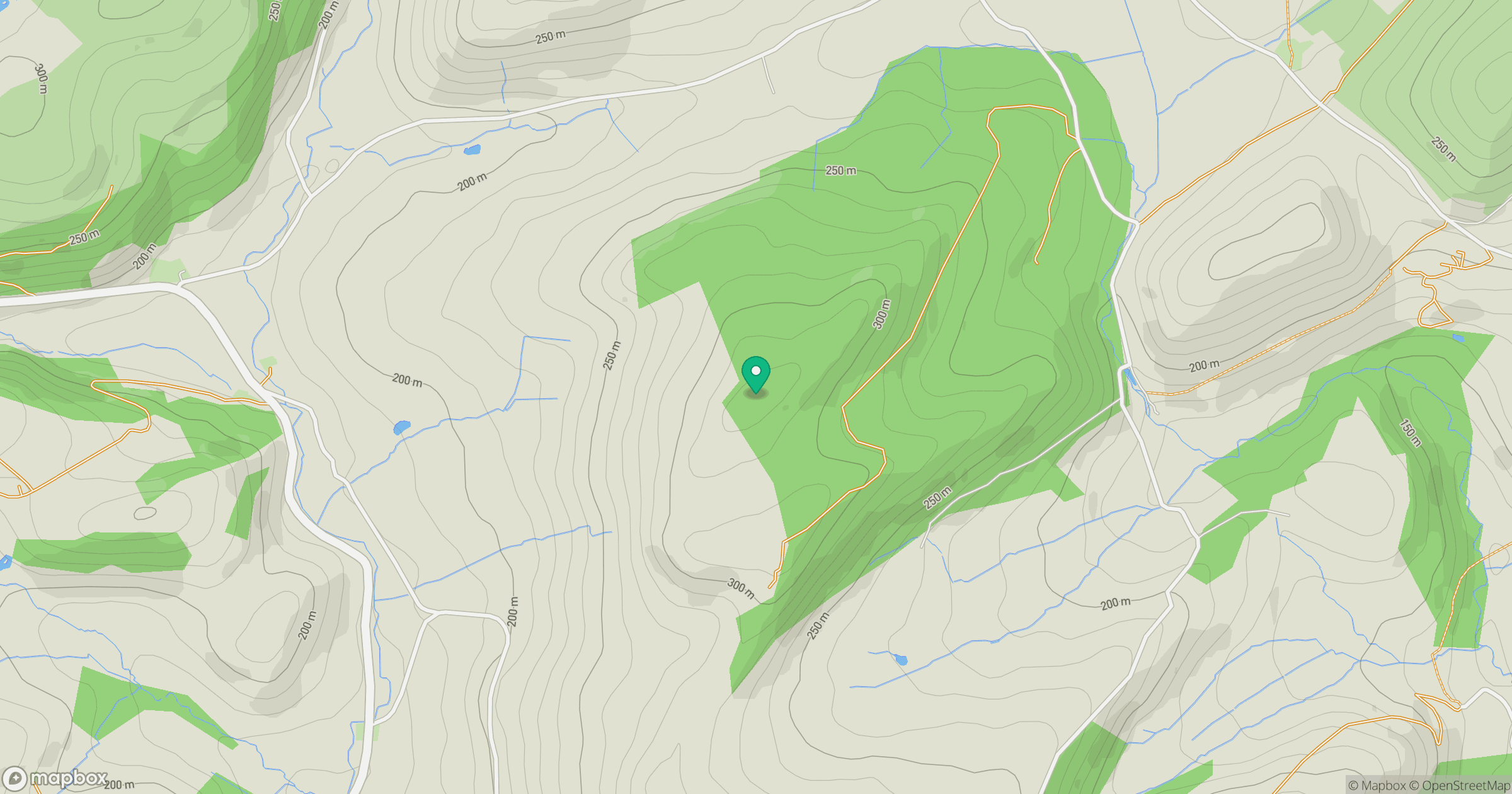
Grid reference: SN705367
View on OpenStreetMapOpens a map in a new tab, centred on the hill.
Hills within 30 km
Straight-line distance, not a walking route or confirmation of access.
Fan Brycheiniog - Twr y Fan Foel
802m
Fan Gyhirych
726m
Mynydd Llansadwrn
345m
Allt Ddu
244m
Allt yr Hebog
342m
No comments yet. Be the first.