
Moel Gallt-y-cwm
Good walks are even better shared.
Overview
Moel Gallt-y-cwm: A Hiker's Hidden Gem
Introduction
Nestled in the stunning Brecon Beacons National Park, Moel Gallt-y-cwm is a delightful Marilyn that stands at an elevation of 629 meters. This mountain provides a wonderfully moderate hike that appeals to both beginners and seasoned walkers alike, offering breathtaking views and a touch of Welsh charm.
Geology
The mountain is primarily made of sandstone, shaping its rugged character. If you’ve ever tripped over a rock on your hike, you’ll appreciate that this mountain has your back with an enthralling geological narrative!
Hiking Routes
One of the most popular routes is the Cwm Glo Route, a 4.5 km trail that usually takes around 1.5 hours to complete. The path meanders through gentle grassy slopes, presenting a feast for the eyes as you ascend.
Summit Features
Reaching the summit is a reward in itself, complete with a sturdy cairn that stands proudly amidst the landscape. Don’t forget to take a moment to enjoy your surroundings — you’ve earned it!
Terrain Type
Expect grassy slopes leading to rocky outcrops at the summit and even some heathland. This varied terrain keeps your hike interesting, with a somewhat cheeky twist as you negotiate your way through it.
Views
On a clear day, the summit offers stunning vistas of Pen y Fan and other majestic peaks. Bring your camera; the views are utterly Instagram-worthy! The best seasons for enjoying these sights are spring and early autumn.
Hazards
As wonderful as this mountain is, the UK weather can be a bit fickle. Be prepared for sudden changes and keep an eye out for boggy areas, especially after a downpour. Think of it as nature’s own version of an obstacle course!
Nearby Summits
Just a stone's throw away, you’ll find Pen y Fan (886 meters) and Corn Du (873 meters). If you're feeling adventurous, they make fantastic additions to your hiking itinerary.
Access
The nearest parking is at Cwm Glo, accessible from the A470 road. There’s a small fee, but remember, parking proceeds contribute towards keeping the beautiful trails pristine!
Public transport is available, with bus services from Brecon and Merthyr Tydfil dropping you off at the A470 stop. The picturesque town of Brecon, located about 12 km away, is perfect for post-hike refreshments.
Facilities
On the mountain itself, you won't find any cafes or toilets, so make sure to pack those essentials. However, the nearby town of Brecon has plenty of options to refuel after your adventure.
History
In Welsh, Moel Gallt-y-cwm translates to 'Hill of the Cwm' — a name befitting its majestic stature. This mountain is part of the rich cultural heritage of the area, which is known for its historical significance and folklore.
Enjoy your hike up Moel Gallt-y-cwm. It’s a journey worth making, with nature, history, and, of course, beautiful views that will stick in your memory — just like that last slice of cake you’re saving for after the hike!
Explore routes near Moel Gallt-y-cwm
Walks starting near this hill. Open a route to check its map, distance and full itinerary.
Swansea Canal: Coed Gwilym Park to Pontardawe Aqueduct
View route
Swansea Clyne Valley Railway Walk: Blackpill to Dunvant
View route
Aberdare Walk with Men Walking & Talking
View route
Aircraft Crash Site - Wellington Bomber and Vampire Jet (Black Mountain range)
View route
Route planning notes
These notes describe possible approaches. Check a route's map and access information when planning your walk.
Cwm Glo Route
A scenic and relatively straightforward ascent starting from the Cwm Glo car park, weaving through gentle grassy slopes and offering excellent views of the surrounding hills.
Make a day of it, together
Find someone to share the walk with, or organise a day out along a route you like.
Hill facts and local notes
Classifications
Elevation
272m
892 ft
Prominence
30m
Coordinates
51.6045, -3.7176
SS811909
OS Map
170
Explorer: 165 166W
At the Summit
At the summit, hikers are greeted by a sturdy cairn and a stone marker, both excellent spots for a celebratory selfie (and a well-deserved snack).
Terrain & Geology
Moel Gallt-y-cwm is composed primarily of sandstone, which gives rise to its robust and rugged terrain. The surrounding areas showcase glacial features, including rounded hills and valleys shaped by ancient ice flows.
Views & Scenery
The summit offers breathtaking views of nearby peaks like Pen y Fan and the expansive valleys of the Brecon Beacons, making it a photographers' delight.
History & Heritage
Name Origin
The name translates from Welsh to 'Hill of the Cwm', referring to its prominent position overlooking the surrounding valleys.
Historical Significance
Moel Gallt-y-cwm is part of the rich cultural tapestry of the Brecon Beacons, steeped in ancient history and Welsh folklore.
Getting There & Facilities
Parking
Cwm Glo car park, located just off the A470 road. There is a small charge for parking, but the views are well worth it!
Public Transport
The nearest bus stop is at the A470, with services running from local towns like Brecon and Merthyr Tydfil.
Nearby Facilities
There are no facilities directly on the mountain. The nearest café and toilet facilities are in Brecon. Remember to pack your snacks and water!
Safety Information
Known Hazards
- Watch out for sudden weather changes typical of the UK, and be mindful of boggy areas, particularly after heavy rain.
General Safety Tips
- Check weather conditions before setting out
- Carry appropriate clothing and equipment
- Let someone know your planned route
- Take a map, compass, and GPS device
- Carry emergency supplies: food, water, first aid kit, torch
Hills
Some common questions about the hills answered
Are there group walks up Moel Gallt-y-cwm?
Many walkers use Walkmates to join or organise walks with others. You can check for group walks around Moel Gallt-y-cwm through the maps
Are there other walkers around Moel Gallt-y-cwm?
Activity varies by location and time, but Walkmates lets you see whether others have shared walks or shown interest in this area. Find other people through the walking friends search walking friends for Moel Gallt-y-cwm search or of course create your own walk for Moel Gallt-y-cwm
Can I organise a walk to Moel Gallt-y-cwm?
Yes. If there aren’t any walks listed already, you can create a walk and make it available for others to join.
If you're signed up to Walkmates, you can create a walk to Moel Gallt-y-cwm.
How do I find a walk up this hill?
There are often multiple ways to walk this hill, depending on experience and route preference. Walkmates helps you explore walks and routes that others have shared.
Can I suggest a new route up Moel Gallt-y-cwm?
Yes. You can suggest or create routes to share with others. Walkmates focuses on the social side of walking, so routes are used to help people organise walks and explore areas together, rather than as detailed navigation tools or route libraries.
Other uses really appreciate knowledgeable walkers sharing their routes. Share your favourite route to Moel Gallt-y-cwm here
The is an error or something incorrect about this hill. How do I let you know?
We always strive to keep the information on Walkmates as accurate as possible. If you find an error, please let us know through the contact form and we'll aim to correct it as quickly as possible
Community Discussion
Comments
Location
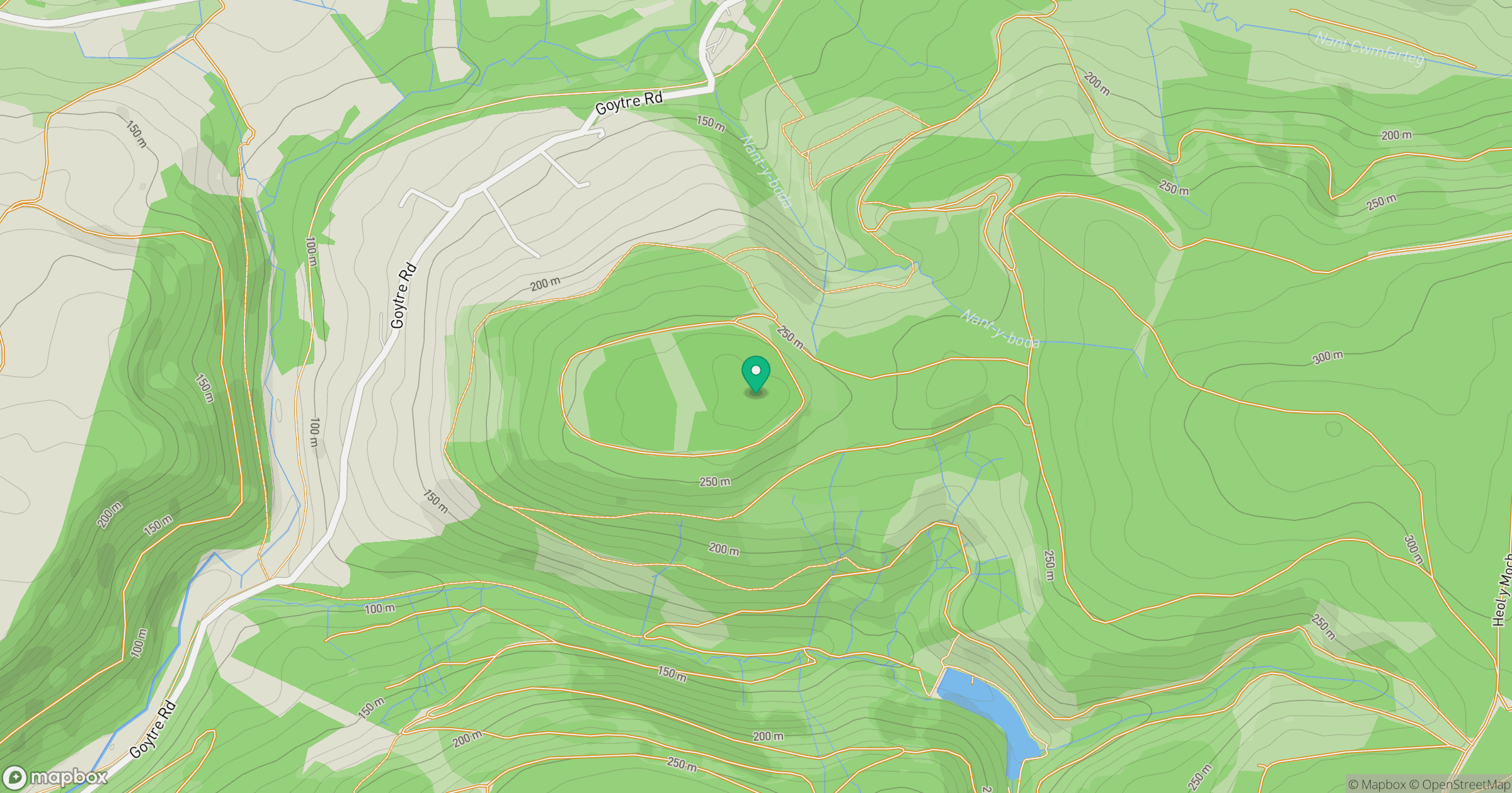
Grid reference: SS811909
View on OpenStreetMapOpens a map in a new tab, centred on the hill.
Nearby Hills
Fan Gyhirych
726m

Fan Brycheiniog - Twr y Fan Foel
802m
Pen y Fan
886m

Cribyn
794m

Dunkery Beacon
520m
No comments yet. Be the first.