

Mynydd Drumau
Good walks are even better shared.
SN7200 : Panoramic view from the slopes of Mynydd Drumau
Alan Hughes Photo source
Overview
Mynydd Drumau
Mynydd Drumau is a delightful peak located in the South Wales region, celebrated for its accessibility and stunning views. Rising to an elevation of 412 meters, it provides an excellent escape for those wanting to stretch their legs and lungs!
Geology
The mountain is formed of sedimentary rock, predominantly sandstone and mudstone, telling a geological story of the region's environmental history. The various layers etched into the landscape are a haven for aspiring geologists and casual walkers alike.
Routes
The most popular route is the Mynydd Drumau Circular Route, spanning approximately 7.5 kilometers. It's well-marked and takes you across the scenic countryside, gradually leading you to the summit. This trail is classified as moderate in difficulty, making it suitable for families and seasoned adventurers alike.
Summit Features
At the summit, you'll find a charming trig point where you can catch your breath and indulge in some spectacular vistas. Don’t forget to snap a few pictures before heading back down!
Terrain Type
Expect a mix of grassy paths interspersed with rocky outcrops. Depending on the time of year, you might encounter some muddy patches, so sturdy walking boots are a must!
Views
As you reach the top of Mynydd Drumau, your efforts will be rewarded with breathtaking views over the valleys. On exceptionally clear days, the magic of the Brecon Beacons can be seen in the distance, making the climb all the more worthwhile. Spring and early autumn are particularly lovely times to attempt this hike, thanks to the vibrant flora and clear blue skies.
Hazards
While the hike is manageable, always be prepared for sudden weather changes. The mountain can be shrouded in fog quicker than you can say “Where did I park the car?” Hence, it's advisable to keep an eye on the forecast and pack accordingly.
Nearby Summits
Mynydd Garnllwyd and Mynydd Ysgyryd Fawr are nearby summits that offer additional exploration opportunities for the eager hiker looking for more than just a bit of leg stretching.
Access
Starting your adventure is a breeze! The nearest parking is conveniently located in Rhydyfelin, along with public transport options from Pontypridd. The village also has a local pub and a few shops for refreshments, perfect for after your mountain escapades.
Facilities
Facilities are basic in this wild landscape, with few options available directly on the mountain. However, the nearby village offers a local pub for a celebratory pint post-hike.
History
From its name—translating to ‘Hill of the Drums’—it’s thought to refer to the wind's melodic sounds as it dances over the hills. Historically, this area was home to mining activities, offering visitors a glimpse into the industrious past of the region.
Overall, Mynydd Drumau is a great spot for outdoor enthusiasts looking to enjoy a mix of nature, history, and a bit of exercise. So pack your bags, lace up your boots, and get ready to explore this charming mountain haven!
Explore routes near Mynydd Drumau
Walks starting near this hill. Open a route to check its map, distance and full itinerary.
Swansea Canal: Coed Gwilym Park to Pontardawe Aqueduct
View route
Swansea Clyne Valley Railway Walk: Blackpill to Dunvant
View route
Ammanford Walk with Men Walking & Talking
View route
Llanelli warden-led wildlife walk
View route
Route planning notes
These notes describe possible approaches. Check a route's map and access information when planning your walk.
Mynydd Drumau Circular Route
A gentle yet rewarding circular walk starting from the village of Rhydyfelin, taking you up to the summit and back.
Make a day of it, together
Find someone to share the walk with, or organise a day out along a route you like.
Photo Gallery
View all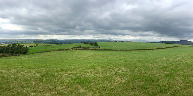 Photo could not load
SN7200 : Panoramic view from the slopes of Mynydd Drumau
Alan Hughes
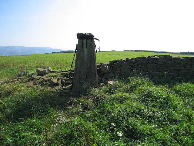 Photo could not load
SN7200 : Mynydd Drumau
Rude Health
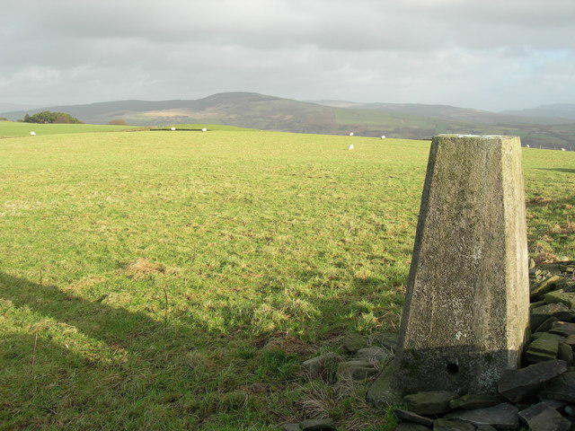 Photo could not load
SN7200 : Triangulation Pillar (S2059)
Adrian Dust
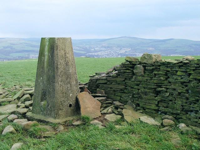 Photo could not load
SN7200 : Trig pillar on Mynydd Drumau
Nigel Davies
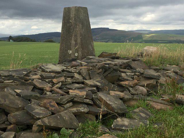 Photo could not load
SN7200 : Trig point at Mynydd Drumau
Alan Hughes
Hill facts and local notes
Classifications
Elevation
272m
892 ft
Prominence
171m
Coordinates
51.6858, -3.8458
SN725001
OS Map
170
Explorer: 165
At the Summit
The summit features a clear trig point which offers a perfect backdrop for those obligatory summit selfies.
Terrain & Geology
Mynydd Drumau is primarily composed of sedimentary rock, featuring layers of sandstone and mudstone that have evolved through geological processes over millennia, resulting in a rich and diverse landscape.
Views & Scenery
From the summit, one can enjoy panoramic views of the surrounding valleys and distant peaks, including the Brecon Beacons and Cardiff skyline on a clear day.
History & Heritage
Name Origin
Mynydd Drumau translates to 'Hill of the Drums', possibly referencing the sounds once made by the winds in the area.
Historical Significance
The area is steeped in mining history, with remnants from the industrial past found along the lower slopes.
Getting There & Facilities
Parking
Parking is available at the village of Rhydyfelin, with a small parking area located at the start of the trail.
Public Transport
Local bus services run from Pontypridd and Cardiff to Rhydyfelin, making it accessible for hikers without cars.
Nearby Facilities
There are no facilities directly on the mountain, but Rhydyfelin offers a local pub and small shops for refreshments post-hike.
Safety Information
Known Hazards
- Beware of sudden weather changes, especially in winter months; fog can roll in faster than you'd think!
General Safety Tips
- Check weather conditions before setting out
- Carry appropriate clothing and equipment
- Let someone know your planned route
- Take a map, compass, and GPS device
- Carry emergency supplies: food, water, first aid kit, torch
Hills
Some common questions about the hills answered
Are there group walks up Mynydd Drumau?
Many walkers use Walkmates to join or organise walks with others. You can check for group walks around Mynydd Drumau through the maps
Are there other walkers around Mynydd Drumau?
Activity varies by location and time, but Walkmates lets you see whether others have shared walks or shown interest in this area. Find other people through the walking friends search walking friends for Mynydd Drumau search or of course create your own walk for Mynydd Drumau
Can I organise a walk to Mynydd Drumau?
Yes. If there aren’t any walks listed already, you can create a walk and make it available for others to join.
If you're signed up to Walkmates, you can create a walk to Mynydd Drumau.
How do I find a walk up this hill?
There are often multiple ways to walk this hill, depending on experience and route preference. Walkmates helps you explore walks and routes that others have shared.
Can I suggest a new route up Mynydd Drumau?
Yes. You can suggest or create routes to share with others. Walkmates focuses on the social side of walking, so routes are used to help people organise walks and explore areas together, rather than as detailed navigation tools or route libraries.
Other uses really appreciate knowledgeable walkers sharing their routes. Share your favourite route to Mynydd Drumau here
The is an error or something incorrect about this hill. How do I let you know?
We always strive to keep the information on Walkmates as accurate as possible. If you find an error, please let us know through the contact form and we'll aim to correct it as quickly as possible
Community Discussion
Comments
Location
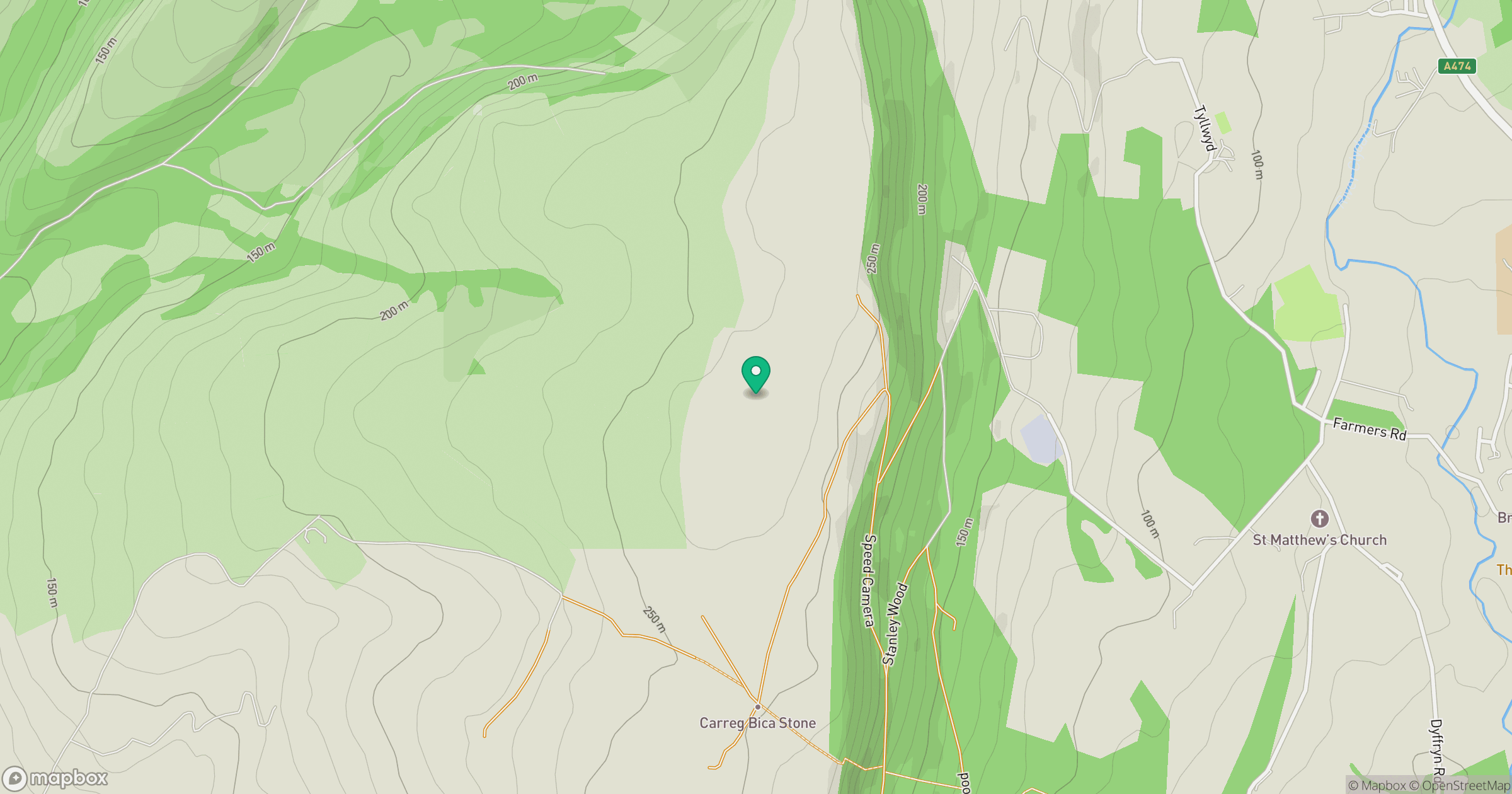
Grid reference: SN725001
View on OpenStreetMapOpens a map in a new tab, centred on the hill.


No comments yet. Be the first.