

Moel Feity
Good walks are even better shared.
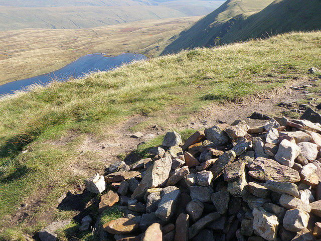
SN8423 : Pile of stones on Moel Feity
Adrian Dust Photo source
Overview
Moel Feity: A Hidden Gem in Snowdonia
Nestled within the breathtaking backdrop of Snowdonia, Moel Feity stands as a testament to the rugged beauty of North Wales. With an elevation of 526 meters, it's a Marilyn—an encourage to get out for a walk without the need for climbing gear.
Geology
Moel Feity showcases the rugged volcanic rock typical of this region, left behind by ancient geological processes. The varied terrain offers a tactile adventure underfoot, shifting from rocky paths to soft grass, with the odd bog sneaking in to test your agility.
Routes
Moel Feity Circuit
The Moel Feity Circuit takes you on a delightful 8.5 km loop through stunning landscapes. Expect to spend about 3.5 hours exploring the route which is rated as moderate—perfect for those wanting a bit of a workout without overdoing it.
Direct Ascent from Coed y Brenin
For those with less time, the Direct Ascent from Coed y Brenin is a quick and easy hike. Spanning just 3.2 km and taking approximately 1.5 hours, it allows you to enjoy the views without sweating buckets.
Summit Features
Upon reaching the summit, a stone cairn awaits to greet you, inviting you to take a break and enjoy the 360-degree view. It’s the kind of place where you can either reflect on life or just enjoy the scenery—though don’t forget to take plenty of photos!
Terrain Type
Be prepared for all kinds of underfoot conditions! You’ll experience a mix of rocky trails, grassy hillsides, and the potential for some boggy patches that will keep you on your toes (literally). Always keep a keen eye out, lest your boot finds itself swimming in a surprise puddle!
Views
The vistas from the top are nothing short of breathtaking. Look out towards Cadair Idris and the other peaks of Snowdonia, with the glimmering Cardigan Bay on clear days, just to remind you how vast and lovely this country is. Spring and early autumn bring the best clarity, making your efforts worthwhile.
Hazards
Be cautious of low visibility, especially if you decide to take on this adventure in the winter months. The paths, while well-trod, can be slippery after rainfall, so tread carefully. Safety first, after all!
Nearby Summits
For those who want to extend their hiking regime, nearby summits like the formidable Cadair Idris and Moelwyn Penmaenmawr offer additional challenges and stunning scenery.
Access
Getting to Moel Feity is straightforward. You can park at Coed y Brenin Forest Park, which is well-equipped with facilities. If you prefer public transport, local buses to Dolgellau can get you close, making it an accessible gem for all.
Nearby, Dolgellau has plenty of cafes to refuel post-hike, ensuring your efforts can be celebrated over a well-earned slice of cake.
Conclusion
Whether you’re a seasoned hiker or just fancy a jaunt in the hills, Moel Feity promises adventure without the need to summit Everest. So lace up those boots, grab a friend, and let the beauty of Snowdonia pull you in. It’s perfect for a day out; after all, the only thing better than conquering a mountain is enjoying a nice cuppa after!
Explore routes near Moel Feity
Walks starting near this hill. Open a route to check its map, distance and full itinerary.
Usk Reservoir: Glasfynydd Forest and Dam Circuit
View route
Aircraft Crash Site - Wellington Bomber and Vampire Jet (Black Mountain range)
View route
Pen y Fan via Corn Du from Storey Arms
View route
Brecon Basin to Brynich Aqueduct: Canal Towpath Walk
View route
Route planning notes
These notes describe possible approaches. Check a route's map and access information when planning your walk.
Moel Feity Circuit
A well-trodden loop that introduces hikers to the beautiful landscapes surrounding Moel Feity.
Direct Ascent from Coed y Brenin
A straightforward ascent offering stunning views of the surrounding countryside, perfect for a quick hike.
Make a day of it, together
Find someone to share the walk with, or organise a day out along a route you like.
Photo Gallery
View all Photo could not load
SN8423 : Pile of stones on Moel Feity
Adrian Dust
 Photo could not load
SN8422 : Safle damwain awyren Liberator / Liberator aircraft crash site
Alan Richards
 Photo could not load
SN8422 : Memorial on Moel Feity
Adrian Dust
Hill facts and local notes
Classifications
Elevation
591m
1,939 ft
Prominence
79m
Coordinates
51.8940, -3.6747
SN848230
OS Map
160
Explorer: OL12W
At the Summit
The summit is marked by a stone cairn and offers a wind-sheltered spot for a quick break. There’s also a delightful view of the nearby hills which can make you feel like the king or queen of all you survey.
Terrain & Geology
Moel Feity is primarily composed of volcanic rock, typical of the Snowdonia region. Its rugged terrain showcases layers of ancient volcanic activity, providing a fascinating glimpse into the geological past.
Views & Scenery
From the summit, enjoy views of the expansive valleys, including the impressive Cadair Idris and the peaks of Snowdonia in the distance. On clear days, you might even spot the coast of Cardigan Bay.
History & Heritage
Name Origin
The name 'Moel Feity' roughly translates to 'hill of the pasture', indicating its pastoral roots.
Historical Significance
Historically, the area has been significant for local agriculture and timber production, acting as a center for forestry activities.
Getting There & Facilities
Parking
The nearest parking is at Coed y Brenin Forest Park, with ample space and facilities. Note that some areas may require a small fee.
Public Transport
Local buses service nearby towns like Dolgellau. For full details, check local bus company schedules.
Nearby Facilities
Nearby facilities include cafes and restrooms at Coed y Brenin Forest Park, perfect for grabbing a warming drink before or after your hike.
Safety Information
Known Hazards
- Low visibility conditions can occur, especially in winter months. The terrain can become slippery and boggy after rain.
General Safety Tips
- Check weather conditions before setting out
- Carry appropriate clothing and equipment
- Let someone know your planned route
- Take a map, compass, and GPS device
- Carry emergency supplies: food, water, first aid kit, torch
Hills
Some common questions about the hills answered
Are there group walks up Moel Feity?
Many walkers use Walkmates to join or organise walks with others. You can check for group walks around Moel Feity through the maps
Are there other walkers around Moel Feity?
Activity varies by location and time, but Walkmates lets you see whether others have shared walks or shown interest in this area. Find other people through the walking friends search walking friends for Moel Feity search or of course create your own walk for Moel Feity
Can I organise a walk to Moel Feity?
Yes. If there aren’t any walks listed already, you can create a walk and make it available for others to join.
If you're signed up to Walkmates, you can create a walk to Moel Feity.
How do I find a walk up this hill?
There are often multiple ways to walk this hill, depending on experience and route preference. Walkmates helps you explore walks and routes that others have shared.
Can I suggest a new route up Moel Feity?
Yes. You can suggest or create routes to share with others. Walkmates focuses on the social side of walking, so routes are used to help people organise walks and explore areas together, rather than as detailed navigation tools or route libraries.
Other uses really appreciate knowledgeable walkers sharing their routes. Share your favourite route to Moel Feity here
The is an error or something incorrect about this hill. How do I let you know?
We always strive to keep the information on Walkmates as accurate as possible. If you find an error, please let us know through the contact form and we'll aim to correct it as quickly as possible
Community Discussion
Comments
Location
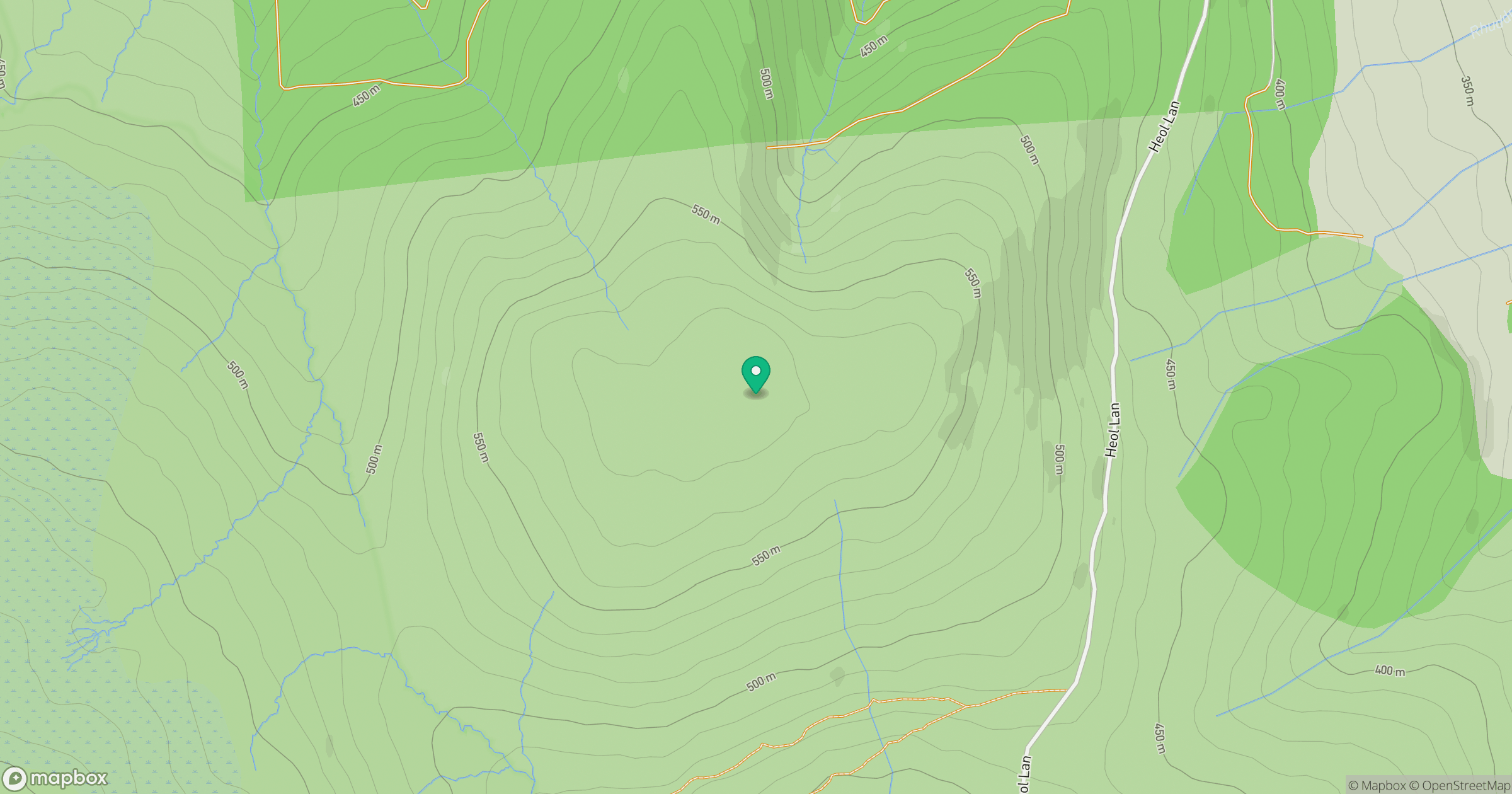
Grid reference: SN848230
View on OpenStreetMapOpens a map in a new tab, centred on the hill.
No comments yet. Be the first.