
Mochrum Fell
Good walks are even better shared.
Overview
Mochrum Fell: A Hiker's Delight
Mochrum Fell, standing tall at 224 meters, is not the highest mountain in the Southern Uplands but it's certainly one of the most charming. Nestled comfortably at coordinates 54.9833 latitude and -4.1844 longitude, this Marilyn offers a delightful escape for those seeking a peaceful trek amidst stunning landscapes.
Geology
The fell's geology is predominantly made up of sedimentary rocks, with layers of sandstone and mudstone that tell tales of ancient times. As you hike, keep an eye out for interesting rock formations that showcase millions of years of Earth’s history.
Routes
Though many routes can lead to its summit, the most popular is the Mochrum Fell Trail. This easily navigable path stretches 4.5 km, typically taking hikers about 1.5 hours to conquer. Beginning at the minor road south of Mochrum Farm, it'll wind you through lush fields, allowing you the chance to spot grazing cattle and perhaps even some curious sheep—just don't expect a detailed chat!
Summit Features
Upon reaching the summit, you'll find a modest cairn, a popular sight amongst hikers. This spot not only marks your achievement but also presents an ideal vantage point for some spectacular views.
Terrain
The terrain is primarily grassy, interspread with rocky outcrops. The smooth paths are welcoming to both seasoned adventurers and those just dipping their toes into hiking.
Views
From the pinnacle of Mochrum Fell, you are treated to awe-inspiring vistas. The best sights include expansive views of the Solway Firth, the surrounding Southern Uplands, and—if the weather is cooperating—the impressive peaks of the Lake District on the horizon. For the most enchanting experiences, explore during late spring or early autumn when the scenery is at its finest.
Hazards
While Mochrum Fell is generally safe for hikers, do keep an eye out for occasional slippery rocks and, of course, the resident cattle. Remember, they may be friendly but they have their own agenda!
Access
The nearest layby for parking is found on the minor road close to Mochrum Farm, allowing for convenient access. If you're considering public transport, availability is a bit sparse. An alternative might be to hop on a bus to Wigtown, approximately 8 km away, and enjoy a leisurely stroll to the trailhead.
Facilities
After an invigorating hike up Mochrum Fell, you might desire a hot cup of tea or perhaps a snack. Wigtown has several lovely cafes that cater to your cravings, in addition to public toilets for a quick pit stop.
History
The name 'Mochrum' comes from the Gaelic term 'Mochradh', which means 'mossy place'. There's a certain poetic charm in being able to hike to a mossy haven!
Further adding to its allure, Mochrum Fell holds historical significance, believed to be a gathering site for ancient druids.
So whether you're an experienced hiker or just fancy a gentle stroll through the countryside, Mochrum Fell provides a perfect blend of comfort, beauty, and a sprinkle of local history. Happy hiking!
Explore routes near Mochrum Fell
Public walks starting within 80 km of this hill. Nearby does not mean a route reaches the summit; check its map and access before setting out.
Kilsture Forest Woodpecker Trail
View route
Knockman Wood Cairn and Woodland Trail
View route
Kirroughtree Little Bruntis Lochs and Woodland Trail
View route
Wood of Cree Waterfalls and Scrubland Circuit
View route
Route planning notes
These notes describe possible approaches, not verified navigable routes or permission to cross land. Check current paths, local access rules and conditions before setting out.
Mochrum Fell Trail
A gentle ascent starting from the minor road south of Mochrum Farm, leading through lush fields and grazing land before reaching the summit.
Make a day of it, together
Find someone to share the walk with, or organise a day out along a route you like.
Hill facts and local notes
Classifications
Elevation
197m
646 ft
Prominence
114m
Coordinates
54.8165, -4.6404
NX304500
OS Map
82
Explorer: 310 311
At the Summit
The summit is adorned with a modest cairn, offering a perfect spot for a well-deserved breather and photo op with the aerial view.
Terrain & Geology
Mochrum Fell is primarily composed of sedimentary rock, showcasing layers that are a testament to millions of years of geological history. The presence of sandstone and mudstone contributes to the rugged beauty of the landscape.
Views & Scenery
From the summit, one can enjoy panoramic views of the Solway Firth, the rugged hills of the Southern Uplands, and on a clear day, even the peaks of the Lake District.
History & Heritage
Name Origin
The name 'Mochrum' is derived from the Scottish Gaelic 'Mochradh,' meaning 'mossy place', indicative of the lush, green surroundings.
Historical Significance
Mochrum Fell has been popular with local hikers for generations, harboring stories of ancient druids who supposedly used the hilltop for their gatherings.
Getting There & Facilities
Check current local access restrictions, parking rules and transport timetables before travelling. These notes do not confirm public access to the summit.
Parking
There is a small layby on the minor road near Mochrum Farm where parking is available for a few vehicles.
Public Transport
Limited public transport is available; consider taking a bus to the nearest town and then walking or cycling to the start point.
Nearby Facilities
Wigtown has several cafes, and public toilets, perfect for a refreshing stop after your hike.
Safety Information
Known Hazards
- Watch out for the occasional slippery rock and livestock in the grazing fields; a cow could be more curious than you expect!
General Safety Tips
- Check weather conditions before setting out
- Carry appropriate clothing and equipment
- Let someone know your planned route
- Take a map, compass, and GPS device
- Carry emergency supplies: food, water, first aid kit, torch
Hills
Some common questions about the hills answered
Are there group walks up Mochrum Fell?
Many walkers use Walkmates to join or organise walks with others. You can check for group walks around Mochrum Fell through the maps
Are there other walkers around Mochrum Fell?
Activity varies by location and time, but Walkmates lets you see whether others have shared walks or shown interest in this area. Find other people through the walking friends search walking friends for Mochrum Fell search or of course create your own walk for Mochrum Fell
Can I organise a walk to Mochrum Fell?
Yes. If there aren’t any walks listed already, you can create a walk and make it available for others to join.
If you're signed up to Walkmates, you can create a walk to Mochrum Fell.
How do I find a walk up this hill?
There are often multiple ways to walk this hill, depending on experience and route preference. Walkmates helps you explore walks and routes that others have shared.
Can I suggest a new route up Mochrum Fell?
Yes. You can suggest or create routes to share with others. Walkmates focuses on the social side of walking, so routes are used to help people organise walks and explore areas together, rather than as detailed navigation tools or route libraries.
Other uses really appreciate knowledgeable walkers sharing their routes. Share your favourite route to Mochrum Fell here
The is an error or something incorrect about this hill. How do I let you know?
We always strive to keep the information on Walkmates as accurate as possible. If you find an error, please let us know through the contact form and we'll aim to correct it as quickly as possible
Community Discussion
Comments
Location
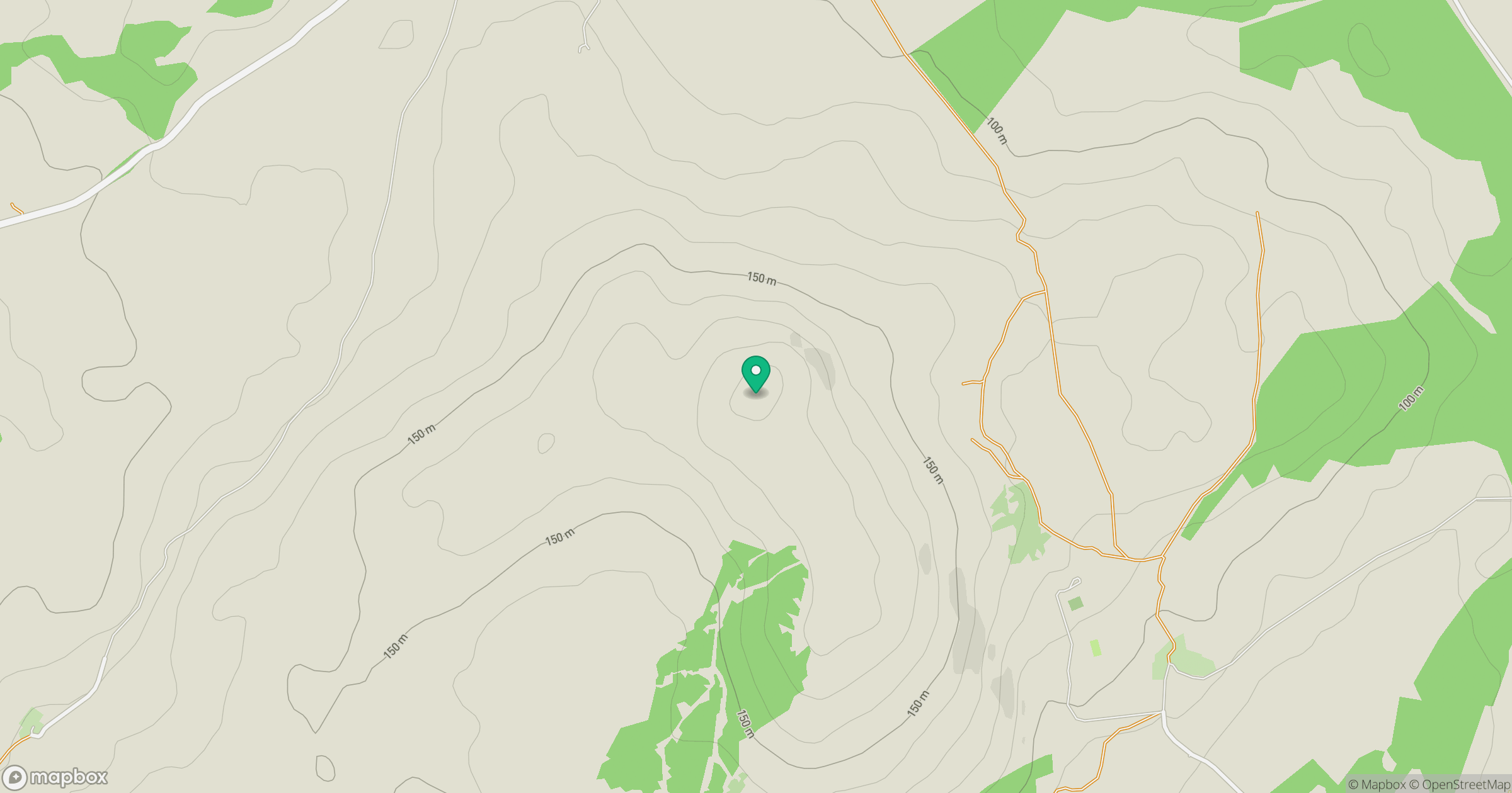
Grid reference: NX304500
View on OpenStreetMapOpens a map in a new tab, centred on the hill.
Hills within 30 km
Straight-line distance, not a walking route or confirmation of access.
No comments yet. Be the first.