

Lamachan Hill
Good walks are even better shared.
NX4376 : Lamachan seen from the A712 near Glenamour
David Baird Photo source
Overview
Lamachan Hill
Location: Southern Uplands, Scotland
Elevation: 660 meters (2,165 feet)
Lamachan Hill is one of those lovely walks that makes you feel like a hero without actually needing spandex. Standing tall in the Southern Uplands, this Marilyn (a hill with a prominence of at least 150 meters) is perfect for both the seasoned hiker and the casual wanderer.
Geology
The hill is composed of Old Red Sandstone, which gives it a charmingly rugged character. Over millennia, erosion has sculpted the landscape, leaving behind striking boulders and tabletops that’ll make you feel like you've wandered into a natural art gallery.
Routes
- Eastside Approach: Starting from the junction between the B794 and an unclassified road, this route offers a pleasant stroll through farmland before you hit the gentle, grassy ascent towards the summit.
- Annalong Glen Route: If you're looking for a more picturesque route, start at Annalong Glen. This leisurely trek wraps around the hillside, giving you ample opportunity to admire the views as you make your way up.
Summit Features
When you finally reach the summit, you’ll find a trusty trig point standing guard. It’s a fantastic spot to plop down and enjoy that packed lunch, while contemplating the meaning of life or just what to snack on next.
Terrain Type
With primarily grassy slopes interspersed with rocky outcrops and patches of heather, the terrain is a mix of ease and a touch of adventure—perfectly suited for a pleasant day out.
Views
Once at the summit, prepare to be gobsmacked. The sprawling sights include the majestic Galloway Hills and the sparkling Solway Firth. If you squint hard enough (or don’t squint at all), you might catch a glimpse of the famous Lake District sliding into view on particularly clear days. The seasons really do add their flair; spring’s blooms are stunning and the autumn’s colours are something to write home about.
Hazards
Remember, the weather's as changeable as your uncle at Christmas dinner. Always dress in layers, bring sturdy footwear, and don’t be surprised if a wild sheep decides to join you for a photo. They’re notoriously camera-shy but will occasionally pop up in your pics!
Nearby Summits
For those with an appetite for more elevation, consider taking on nearby Corserine (814m) or Merrick (843m). Each boasts stunning views and ample challenges.
Access
If you're driving, park at the junction of the B794. A few cars can fit there. Newton Stewart is the nearest town, where you can stock up on snacks or pastries to fuel your climb. Buses from Newton Stewart can help get you to other nearby villages if you fancy catching a ride.
Facilities
Cafes and public toilets are available in the neighbouring Newton Stewart, making it convenient to refresh after your long trek.
History
The name Lamachan is believed to derive from Gaelic, translating roughly as 'the place of the marsh'. Historically significant, the Southern Uplands were home to early agricultural communities, making it a culturally rich area to explore.
So, whether you’re seeking solitude, a chat with likeminded wanderers, or just a banging view, Lamachan Hill should be on your bucket list—just don’t forget your sandwiches!
Last Updated: 2023-10-01
Source: Ordnance Survey
Explore routes near Lamachan Hill
Walks starting near this hill. Open a route to check its map, distance and full itinerary.
Loch Trool: Full Loch and Oak Woodland Circuit
View route
Glentrool Water of Trool and Spout Head Trail
View route
Wood of Cree Waterfalls and Scrubland Circuit
View route
Knockman Wood Cairn and Woodland Trail
View route
Route planning notes
These notes describe possible approaches. Check a route's map and access information when planning your walk.
Eastside Approach
Starting from the small parking area at the junction of the B794 and an unclassified road, this route offers a steady ascent through open farmland before hitting the hill's grassy flanks.
Annalong Glen Route
This scenic route begins in Annalong Glen and winds around the hillside, providing a more leisurely trek with stunning views as you approach the summit of Lamachan Hill.
Make a day of it, together
Find someone to share the walk with, or organise a day out along a route you like.
Photo Gallery
View all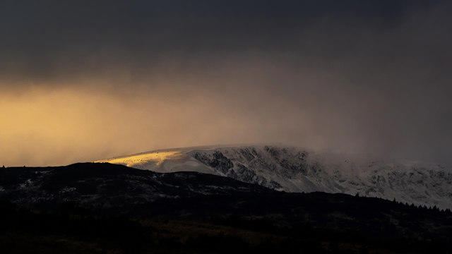 Photo could not load
NX4376 : Lamachan seen from the A712 near Glenamour
David Baird
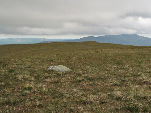 Photo could not load
NX4377 : Summit plateau of Lamachan Hill
wrobison
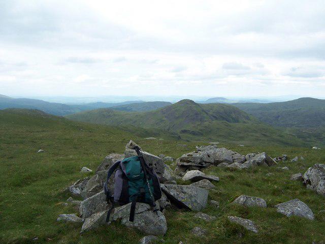 Photo could not load
NX4377 : The summit cairn on Lamachan.
bill copland
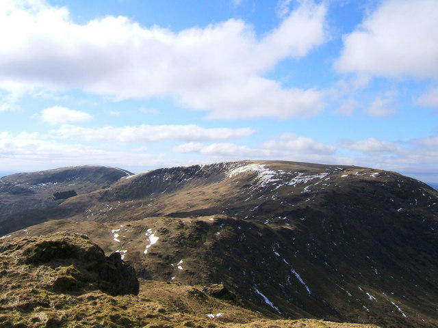 Photo could not load
NX4377 : Lamachan 717 metres photographed from the summit of Curlywee
Colin McDonald
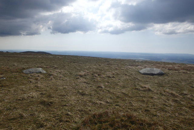 Photo could not load
NX4377 : Lamachan Hill Summit
Michael Graham
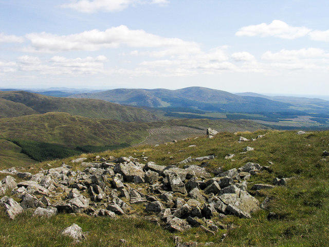 Photo could not load
NX4376 : Angular boulders on Lamachan Hill
Trevor Littlewood
Hill facts and local notes
Classifications
Elevation
717m
2,351 ft
Prominence
453m
Coordinates
55.0628, -4.4515
NX435769
OS Map
77
Explorer: 319
At the Summit
The summit is marked by a prominent trig point, with room for hikers to gather and enjoy the views—perfect for a celebratory snack after the climb.
Terrain & Geology
The hills primarily consist of Old Red Sandstone, featuring erosion-resistant features and scattered boulders, while the area is also influenced by glacial activity.
Views & Scenery
From the summit, hikers can spot the striking peaks of the Galloway Hills and the vast expanse of the Solway Firth, stretching out to the north. On a clear day, the Lake District can also be seen in the distance.
History & Heritage
Name Origin
The name Lamachan is believed to derive from Gaelic, potentially meaning 'the place of the marsh'—no surprise given the area’s wetland features.
Historical Significance
The Southern Uplands, including Lamachan Hill, have a rich history of early agriculture and sheep farming, shaping the landscape and culture of the region.
Getting There & Facilities
Parking
The nearest parking area is at the junction of the B794 and an unclassified road, with space for several vehicles.
Public Transport
The closest public transportation is from the town of Newton Stewart, where bus services can connect you to various villages nearby.
Nearby Facilities
The nearest facilities, including cafes and toilets, can be found in Newton Stewart, where you can grab a warm drink or a light snack before or after your adventure.
Safety Information
Known Hazards
- As with many hills, beware of sudden changes in weather and ensure good footwear, as some paths can be muddy or uneven. Wild sheep may also surprise unsuspecting hikers.
General Safety Tips
- Check weather conditions before setting out
- Carry appropriate clothing and equipment
- Let someone know your planned route
- Take a map, compass, and GPS device
- Carry emergency supplies: food, water, first aid kit, torch
Hills
Some common questions about the hills answered
Are there group walks up Lamachan Hill?
Many walkers use Walkmates to join or organise walks with others. You can check for group walks around Lamachan Hill through the maps
Are there other walkers around Lamachan Hill?
Activity varies by location and time, but Walkmates lets you see whether others have shared walks or shown interest in this area. Find other people through the walking friends search walking friends for Lamachan Hill search or of course create your own walk for Lamachan Hill
Can I organise a walk to Lamachan Hill?
Yes. If there aren’t any walks listed already, you can create a walk and make it available for others to join.
If you're signed up to Walkmates, you can create a walk to Lamachan Hill.
How do I find a walk up this hill?
There are often multiple ways to walk this hill, depending on experience and route preference. Walkmates helps you explore walks and routes that others have shared.
Can I suggest a new route up Lamachan Hill?
Yes. You can suggest or create routes to share with others. Walkmates focuses on the social side of walking, so routes are used to help people organise walks and explore areas together, rather than as detailed navigation tools or route libraries.
Other uses really appreciate knowledgeable walkers sharing their routes. Share your favourite route to Lamachan Hill here
The is an error or something incorrect about this hill. How do I let you know?
We always strive to keep the information on Walkmates as accurate as possible. If you find an error, please let us know through the contact form and we'll aim to correct it as quickly as possible
Community Discussion
Comments
Location
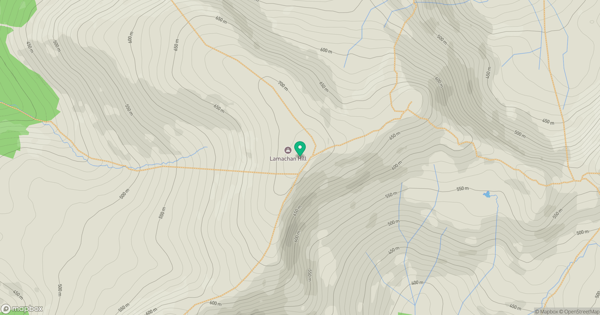
Grid reference: NX435769
View on OpenStreetMapOpens a map in a new tab, centred on the hill.
No comments yet. Be the first.