

Cairn Fell
Good walks are even better shared.
Overview
Cairn Fell: An Overview
Cairn Fell is a delightful Marilyn perched at 602 metres, beckoning hikers with its medieval charm and splendid vistas. Nestled in the Southern Uplands, this hill rewards trekkers with a manageable ascent amidst lush scenery.
Geology
The bedrock of Cairn Fell is primarily Old Red Sandstone, a captivating geological formation that reveals a rich history of the Earth. The reddish rocks and sedimentary layers tell tales of ancient rivers and landscapes long gone. Remember, rocks can be older than your average grandparent, so treat them with the respect they deserve!
Routes
For those keen on exploring, the most popular route begins at Forest Road. Covering approximately 5 km, it offers an enjoyable walk that is as easy on the legs as it is on the eyes. Keep an eye out for the occasional sheep looking to join your hiking party! Expect to spend about 2.5 hours on this moderate trail.
Summit Features
As you reach the peak, you'll be greeted by a large stone cairn—an ideal spot to catch your breath and reflect on your valiant ascent. The trig point nearby can also tempt you into a photo-op worthy of bragging rights!
Terrain
Prepare for a variety of terrain on your adventure. While lush grassy expanses dominate, a few rocky outcrops can surprise you along the way. Just be mindful of those boggy patches, especially after a good soaking—it's a tad like trying to walk through a giant sponge!
Views
The summit offers breathtaking views of the surrounding area. On a clear day, Galloway Forest Park and the Solway Firth create a stunning backdrop, stretching into the horizon. The best seasons for these views are spring and autumn, when the landscape is alive with colour and clarity.
Hazards
The weather can change quicker than you can say 'blimey!', so carry appropriate gear with you, especially in winter months when the ground can turn treacherous. A sturdy pair of hiking boots will ensure that you leave the bogs to the wildlife.
Nearby Summits
For the adventurous spirit, nearby Sharp Fell and Another Fell provide additional hiking opportunities worth exploring.
Access
Eager to lace up those boots? Parking is conveniently available at the start of Forest Road. Just remember, it's first come, first served, so early birds do catch the worms (or parking spaces). If you're counting on public transport, check the bus schedules from Langholm—although, they aren't the most frequent, you might just catch a ride.
Facilities
While Cairn Fell offers no facilities, the close-knit town of Langholm provides an assortment of cafes and shops to refuel after your adventure. Treat yourself—nothing beats a slice of cake post-hike!
History
The name 'Cairn Fell' embodies a rich history, reflecting the region's geographical and cultural tapestry. Locals have navigated these hills for centuries, guided by the very cairns that sit atop them.
In conclusion, Cairn Fell is not only a hike but a step into the captivating stories of the Southern Uplands. Lace up your boots, pack plenty of snacks, and enjoy the blend of beauty and history that this hill has to offer.
Happy hiking!
Explore routes near Cairn Fell
Public walks starting within 80 km of this hill. Nearby does not mean a route reaches the summit; check its map and access before setting out.
Kilsture Forest Woodpecker Trail
View route
Knockman Wood Cairn and Woodland Trail
View route
Wood of Cree Waterfalls and Scrubland Circuit
View route
Kirroughtree Little Bruntis Lochs and Woodland Trail
View route
Route planning notes
These notes describe possible approaches, not verified navigable routes or permission to cross land. Check current paths, local access rules and conditions before setting out.
Cairn Fell from Forest Road
A well-defined path leading up through lush woodlands and grassy hills, offering a gentle ascent to the summit.
Make a day of it, together
Find someone to share the walk with, or organise a day out along a route you like.
Photo Gallery
View all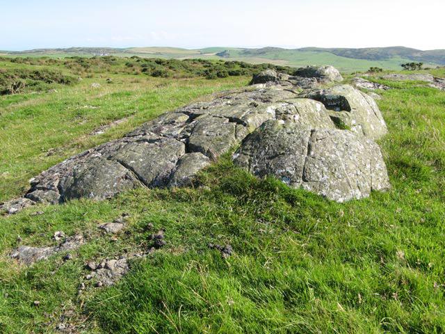 Photo could not load
NX1036 : Whaleback outcrop
Jonathan Wilkins
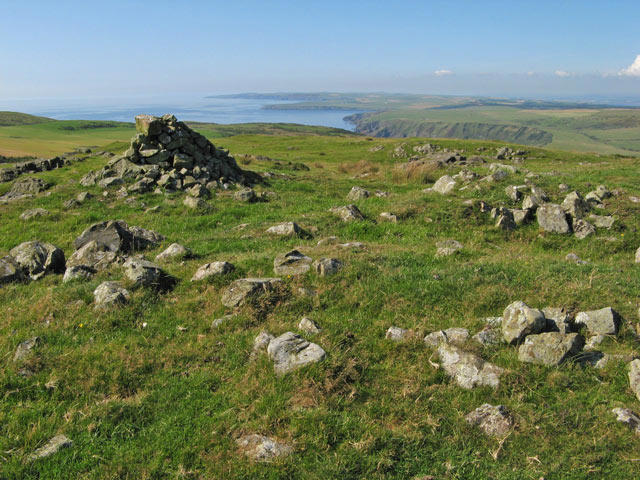 Photo could not load
NX1036 : Cairn Fell
Jonathan Wilkins
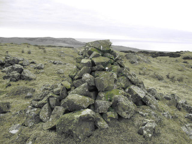 Photo could not load
NX1036 : Cairn Fell
Rude Health
Hill facts and local notes
Classifications
Elevation
164m
539 ft
Prominence
147m
Coordinates
54.6844, -4.9438
NX103361
OS Map
82
Explorer: 309S
At the Summit
The summit is marked by a large, stone cairn that offers a reassuring sight for weary hikers. A small trig point can also be found, providing excellent photo opportunities.
Terrain & Geology
Cairn Fell is predominantly composed of Old Red Sandstone, characterized by its reddish hue and sedimentary layers. This unique geological formation offers insights into the region's ancient environments.
Views & Scenery
On a clear day, the views extend to the distant hills of Galloway Forest Park and the Solway Firth, with the craggy outlines of the Lake District further south.
History & Heritage
Name Origin
The name 'Cairn' denotes the traditional stone pile often used as a way marker for travellers in the mountains. 'Fell' is an Old Norse term for mountain.
Historical Significance
Cairn Fell has been a landmark for local shepherds and an essential part of the area's walking culture for centuries.
Getting There & Facilities
Check current local access restrictions, parking rules and transport timetables before travelling. These notes do not confirm public access to the summit.
Parking
Parking is available at the start of Forest Road, approximately 2 km from the trailhead. Spaces are limited, so arrive early to avoid disappointment.
Public Transport
The nearest bus service operates from Langholm, roughly 15 km away, with limited schedules.
Nearby Facilities
While there are no facilities directly on the mountain, Langholm has several cafes and shops to stock up on supplies or enjoy a hearty meal after your hike.
Safety Information
Known Hazards
- Beware of sudden weather changes, particularly in winter. The terrain can become slippery and boggy after rainfall, so sturdy footwear is essential.
General Safety Tips
- Check weather conditions before setting out
- Carry appropriate clothing and equipment
- Let someone know your planned route
- Take a map, compass, and GPS device
- Carry emergency supplies: food, water, first aid kit, torch
Hills
Some common questions about the hills answered
Are there group walks up Cairn Fell?
Many walkers use Walkmates to join or organise walks with others. You can check for group walks around Cairn Fell through the maps
Are there other walkers around Cairn Fell?
Activity varies by location and time, but Walkmates lets you see whether others have shared walks or shown interest in this area. Find other people through the walking friends search walking friends for Cairn Fell search or of course create your own walk for Cairn Fell
Can I organise a walk to Cairn Fell?
Yes. If there aren’t any walks listed already, you can create a walk and make it available for others to join.
If you're signed up to Walkmates, you can create a walk to Cairn Fell.
How do I find a walk up this hill?
There are often multiple ways to walk this hill, depending on experience and route preference. Walkmates helps you explore walks and routes that others have shared.
Can I suggest a new route up Cairn Fell?
Yes. You can suggest or create routes to share with others. Walkmates focuses on the social side of walking, so routes are used to help people organise walks and explore areas together, rather than as detailed navigation tools or route libraries.
Other uses really appreciate knowledgeable walkers sharing their routes. Share your favourite route to Cairn Fell here
The is an error or something incorrect about this hill. How do I let you know?
We always strive to keep the information on Walkmates as accurate as possible. If you find an error, please let us know through the contact form and we'll aim to correct it as quickly as possible
Community Discussion
Comments
Location
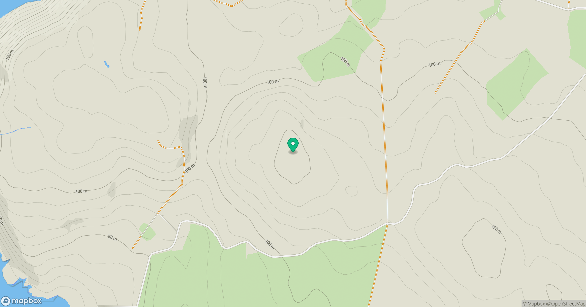
Grid reference: NX103361
View on OpenStreetMapOpens a map in a new tab, centred on the hill.
Hills within 30 km
Straight-line distance, not a walking route or confirmation of access.
No comments yet. Be the first.