

Artfield Fell
Good walks are even better shared.
Overview
Artfield Fell: A Hidden Gem in Galloway
Overview
Artfield Fell, perched at 646 meters, is a Marilyn that offers both a challenge and a breathtaking experience for hikers. Nestled in Galloway Forest Park, it boasts magnificent views and an intriguing geological history.
Geology
The landscape is heavily influenced by granite formations, shaped by the relentless advance and retreat of glaciers. The rock features make it a prime spot for geology enthusiasts—keep your eyes peeled for glacial striations!
Hiking Routes
One of the most popular routes is the West Glen Route. This moderate trail spans approximately 5.5 km and usually takes around 2.5 hours. It begins from the West Glen trailhead, leading you through a mixture of grassy pathways and rocky outcrops. Just remember: pace yourself before you pace others!
Summit Features
At the summit, you’ll encounter a charming stone cairn, perfect for your obligatory summit selfies. The views from here? Absolutely worth the climb—though it helps if you remember to wear proper hiking boots instead of your flashy trainers!
Terrain and Views
The terrain is predominantly grassy with rocky sections; it’s a mix of soothing green and challenging rock.
From the summit, the panorama extends to the shimmering waters of Luce Bay and the rolling hills of Galloway, with the Isle of Man potentially making an appearance on clear days. Autumn is particularly beautiful, with the foliage casting a delightful hue over the landscape.
Hazards
As with many hikes, there are hazards to be mindful of. Loose rocks can be tricky, so keep an eye on where you’re stepping. And remember, your darling weather app might not always align with reality up here!
Nearby Summits
Adventurers may also consider climbing nearby heights such as Mullwharchar (786 meters) and Shillford Hill (605 meters) to make a full day out of it.
Access
Nearest Parking: You can park at a small area near the West Glen trailhead, accommodating about 5-6 cars. Arrive early to claim your spot!
Public Transport: Connectivity can be a bit sparse; the most reliable service is from Newton Stewart. Check bus times before you set off!
Facilities
On the mountain itself, you’ll find no facilities. Pack your munchies and maybe some tea to keep spirits high! The nearest café awaits you in Newton Stewart once you descend.
History
Artfield's name hints at its heritage, with Gaelic origins linking to 'height' and 'field.' It has become a popular haunt for locals and hikers alike, who seem to have discovered this treasure well before social media made it 'Instagrammable.'
In closing, whether you’re a seasoned hiker or just looking for a bit of adventure, Artfield Fell promises a memorable outing in the embrace of Galloway's natural beauty. Who knows, you might just fall in love with one of Galloway's best-kept secrets!
Explore routes near Artfield Fell
Public walks starting within 80 km of this hill. Nearby does not mean a route reaches the summit; check its map and access before setting out.
Wood of Cree Waterfalls and Scrubland Circuit
View route
Knockman Wood Cairn and Woodland Trail
View route
Glentrool Water of Trool and Spout Head Trail
View route
Loch Trool: Full Loch and Oak Woodland Circuit
View route
Route planning notes
These notes describe possible approaches, not verified navigable routes or permission to cross land. Check current paths, local access rules and conditions before setting out.
West Glen Route
A scenic trail starting from the West Glen, meandering through lush surroundings before the climb to the summit.
Make a day of it, together
Find someone to share the walk with, or organise a day out along a route you like.
Photo Gallery
View all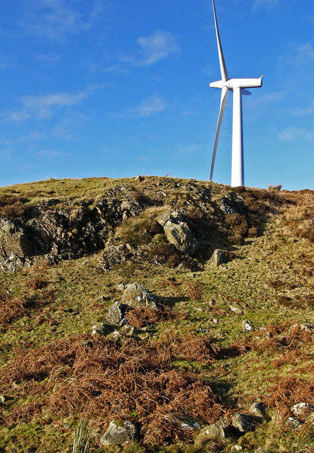 Photo could not load
NX2367 : Artfield Fell - modern turbine, old hut circle
David Baird
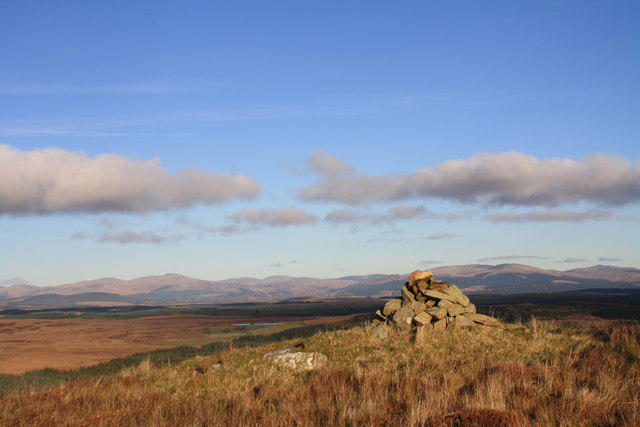 Photo could not load
NX2367 : Artfield Fell summit
Colin Kinnear
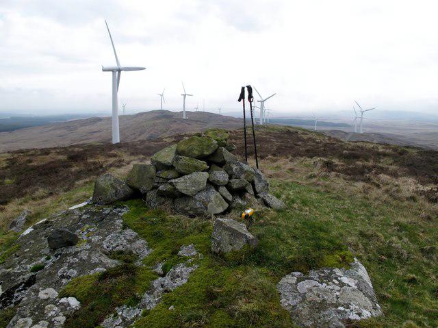 Photo could not load
NX2367 : Artfield Fell
Rude Health
Hill facts and local notes
Classifications
Elevation
272m
892 ft
Prominence
100m
Coordinates
54.9720, -4.7659
NX230676
OS Map
82
Explorer: 310
At the Summit
The summit is graced by a sturdy stone cairn and offers a great spot for picnic admirers. Do mind the epic selfies, though; the view can steal the show!
Terrain & Geology
Artfield Fell is predominantly composed of granite, with interesting features shaped by glacial activity, which gives the terrain a rugged appearance that will keep your heart racing—sometimes literally!
Views & Scenery
From the summit, one can catch a glimpse of the rolling hills of Galloway, the shimmering waters of Luce Bay, and on a clear day, even the Isle of Man peeking at you from over the sea.
History & Heritage
Name Origin
The name 'Artfield' is derived from the Gaelic 'Aird' meaning 'height' and 'field', giving it an earthy charm.
Historical Significance
Artfield Fell has long been a revered spot for local hikers, often considered a 'hidden gem' in the Galloway region.
Getting There & Facilities
Check current local access restrictions, parking rules and transport timetables before travelling. These notes do not confirm public access to the summit.
Parking
There is a small parking area at the West Glen trailhead, suitable for 5-6 cars. Arrive early to nab your spot!
Public Transport
The nearest bus service is available from Newton Stewart, with infrequent service to nearby villages, so plan accordingly.
Nearby Facilities
There are no facilities on the mountain itself—bring your own snacks and perhaps a cheeky thermos of tea. The nearest café is in Newton Stewart.
Safety Information
Known Hazards
- Be cautious of loose rocks and unpredictable weather. Don't rely on your 'weather app' in the hills; it may have a mind of its own!
General Safety Tips
- Check weather conditions before setting out
- Carry appropriate clothing and equipment
- Let someone know your planned route
- Take a map, compass, and GPS device
- Carry emergency supplies: food, water, first aid kit, torch
Hills
Some common questions about the hills answered
Are there group walks up Artfield Fell?
Many walkers use Walkmates to join or organise walks with others. You can check for group walks around Artfield Fell through the maps
Are there other walkers around Artfield Fell?
Activity varies by location and time, but Walkmates lets you see whether others have shared walks or shown interest in this area. Find other people through the walking friends search walking friends for Artfield Fell search or of course create your own walk for Artfield Fell
Can I organise a walk to Artfield Fell?
Yes. If there aren’t any walks listed already, you can create a walk and make it available for others to join.
If you're signed up to Walkmates, you can create a walk to Artfield Fell.
How do I find a walk up this hill?
There are often multiple ways to walk this hill, depending on experience and route preference. Walkmates helps you explore walks and routes that others have shared.
Can I suggest a new route up Artfield Fell?
Yes. You can suggest or create routes to share with others. Walkmates focuses on the social side of walking, so routes are used to help people organise walks and explore areas together, rather than as detailed navigation tools or route libraries.
Other uses really appreciate knowledgeable walkers sharing their routes. Share your favourite route to Artfield Fell here
The is an error or something incorrect about this hill. How do I let you know?
We always strive to keep the information on Walkmates as accurate as possible. If you find an error, please let us know through the contact form and we'll aim to correct it as quickly as possible
Community Discussion
Comments
Location
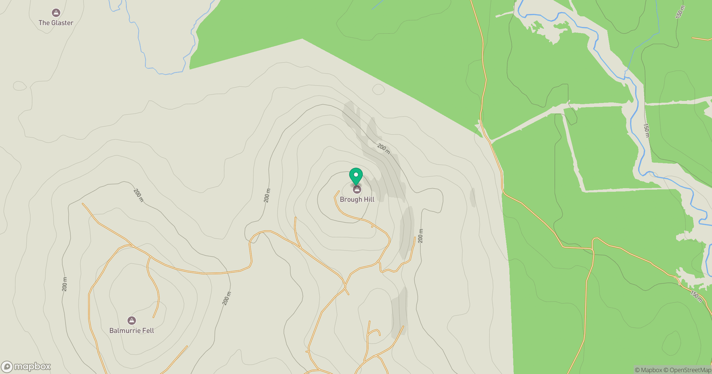
Grid reference: NX230676
View on OpenStreetMapOpens a map in a new tab, centred on the hill.
Hills within 30 km
Straight-line distance, not a walking route or confirmation of access.
No comments yet. Be the first.