

Cairnsmore of Fleet
Good walks are even better shared.
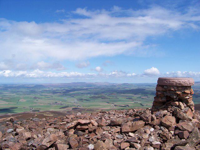
NX5067 : Cairnsmore of Fleet summit cairn and air crash memorial
Jim Barton Photo source
Overview
Cairnsmore of Fleet
Cairnsmore of Fleet stands proudly at 711 meters, a Marilyn that offers a rewarding hike for outdoor enthusiasts. Nestled in the Southern Uplands, this mountain serves as a magnificent vantage point, presenting hikers with some of the most breathtaking scenery in Scotland.
Geology
The geological composition of Cairnsmore of Fleet is quite intriguing, made up primarily of volcanic rock formed during the Palaeozoic era. The rugged terrain showcases the natural beauty created by millennia of geological activity, with andesite and tuff being prominent materials. Not only does this make for an interesting hike, but it’s a geological wonderland for anyone keen to learn more about the Earth’s history.
Routes
One of the most popular routes is the ‘Cairnsmore of Fleet via the Forest Track’. Starting from the car park, this route meanders through a picturesque forest, gently rising to the summit. At approximately 6.5 km round trip, it is perfect for families and those looking to enjoy the outdoors without tackling too steep a climb. The trail is easy to follow, making it a great option for both novice hikers and seasoned adventurers alike.
Summit Features
Upon reaching the summit, you’ll be greeted by a substantial rocky outcrop adorned with a classic cairn and a trig point. This is not only a fantastic photo opportunity, but a place to catch your breath and relish the stunning panoramic views that stretch far and wide across the Southern Uplands and beyond.
Terrain
The terrain on your way up is mainly grassy with rocky sections closer to the summit. This diverse landscape adds interest to your hike, so do be sure to wear sturdy footwear to navigate any trickier spots.
Views
The views from Cairnsmore of Fleet are simply spectacular. Galloway Forest Park spreads out majestically below, with the Solway Firth glistening in the distance. On particularly clear days, the peaks of the Lake District loom in the horizon, providing a fitting backdrop to your triumph. Late spring and early autumn are the best times to soak up these sights, as the weather tends to cooperate, and the natural colours blossom.
Hazards
Like any mountain, Cairnsmore of Fleet does come with its risks. The weather can change quickly, and the mix of grassy and rocky terrain can be slippery when wet. Ensure you’re prepared and come equipped with weather-appropriate gear.
Access
For those driving to the mountain, the nearest car park is located at NX494664, just a short walk from the starting point of your hike. Public transport options are limited, with buses from Newton Stewart being the main link to the area. So, if you’re planning a visit, it’s wise to check the bus schedules. Newton Stewart, about 10 km away, is the nearest town where you can find cafes, shops, and essential facilities.
History
The name ‘Cairnsmore’, or ‘Càrn Mòr’ in Gaelic, translates to ‘big cairn’, aptly describing the numerous stone structures that dot the landscape. Historically significant, this area has been inhabited for thousands of years, and the summit served as a strategic lookout for early settlers.
So lace up those hiking boots, grab your walking stick, and make your way to Cairnsmore of Fleet for a fantastic day out in the great Scottish outdoors!
Explore routes near Cairnsmore of Fleet
Walks starting near this hill. Open a route to check its map, distance and full itinerary.
Kirroughtree Little Bruntis Lochs and Woodland Trail
View route
Knockman Wood Cairn and Woodland Trail
View route
Wood of Cree Waterfalls and Scrubland Circuit
View route
Loch Trool: Full Loch and Oak Woodland Circuit
View route
Route planning notes
These notes describe possible approaches. Check a route's map and access information when planning your walk.
Cairnsmore of Fleet via the Forest Track
This route starts from the forest track leading from the car park, weaving through forestry plantations before ascending to the summit. It's a popular choice for its relatively gentle gradient.
Make a day of it, together
Find someone to share the walk with, or organise a day out along a route you like.
Photo Gallery
View all Photo could not load
NX5067 : Cairnsmore of Fleet summit cairn and air crash memorial
Jim Barton
 Photo could not load
NX5067 : Memorial on the Cairnsmore of Fleet
Andy Farrington
 Photo could not load
NX5067 : Cairnsmore Summit Path
Andy Farrington
 Photo could not load
NX5067 : Cairnsmore of Fleet
Andy Farrington
 Photo could not load
NX5067 : Cairnsmore of Fleet
Andy Farrington
 Photo could not load
NX5067 : Stone Shelter and Trig Point
Andy Farrington
 Photo could not load
NX5067 : Cairn on Cairnsmore of Fleet
Andy Farrington
 Photo could not load
NX5067 : Cairnsmore of Fleet
Andy Farrington
 Photo could not load
NX5067 : Cairnsmore of Fleet
Andy Farrington

NX5067 : Stone Shelter
Andy Farrington
Hill facts and local notes
Classifications
Elevation
711m
2,333 ft
Prominence
522m
Coordinates
54.9755, -4.3433
NX501670
OS Map
83
Explorer: 319
At the Summit
The summit features a large rocky outcrop with a classic cairn and a trig point, ideal for those all-important summit selfies.
Terrain & Geology
Cairnsmore of Fleet is primarily composed of volcanic rock, including andesite and tuff, which formed during the early Palaeozoic era. The rugged terrain and unique geological features make it a fascinating site for both geologists and hikers.
Views & Scenery
From the summit, you can see the stunning views of the Galloway Forest Park, the Solway Firth, and on a clear day, the peaks of the Lake District in the distance.
History & Heritage
Name Origin
The name 'Cairnsmore' derives from the Gaelic 'Càrn Mòr', meaning 'big cairn', likely alluding to the numerous stone monuments found throughout the area.
Historical Significance
Historically, this area has been inhabited since prehistoric times, and the summit is believed to have served as a lookout point for early settlers.
Getting There & Facilities
Parking
There is a car park located at NX494664, with parking capacity for several vehicles. From here, the forest track begins.
Public Transport
Public transport connections are limited; however, buses from Newton Stewart serve the surrounding area. It's advisable to check local timetables ahead of your visit.
Nearby Facilities
Newton Stewart has various facilities, including cafes, shops, and public toilets that can cater to your needs before or after your hike.
Safety Information
Known Hazards
- Be aware of sudden weather changes, as they can be quite dramatic in this region. The terrain can be uneven and slippery in wet conditions; sturdy footwear is recommended.
General Safety Tips
- Check weather conditions before setting out
- Carry appropriate clothing and equipment
- Let someone know your planned route
- Take a map, compass, and GPS device
- Carry emergency supplies: food, water, first aid kit, torch
Hills
Some common questions about the hills answered
Are there group walks up Cairnsmore of Fleet?
Many walkers use Walkmates to join or organise walks with others. You can check for group walks around Cairnsmore of Fleet through the maps
Are there other walkers around Cairnsmore of Fleet?
Activity varies by location and time, but Walkmates lets you see whether others have shared walks or shown interest in this area. Find other people through the walking friends search walking friends for Cairnsmore of Fleet search or of course create your own walk for Cairnsmore of Fleet
Can I organise a walk to Cairnsmore of Fleet?
Yes. If there aren’t any walks listed already, you can create a walk and make it available for others to join.
If you're signed up to Walkmates, you can create a walk to Cairnsmore of Fleet.
How do I find a walk up this hill?
There are often multiple ways to walk this hill, depending on experience and route preference. Walkmates helps you explore walks and routes that others have shared.
Can I suggest a new route up Cairnsmore of Fleet?
Yes. You can suggest or create routes to share with others. Walkmates focuses on the social side of walking, so routes are used to help people organise walks and explore areas together, rather than as detailed navigation tools or route libraries.
Other uses really appreciate knowledgeable walkers sharing their routes. Share your favourite route to Cairnsmore of Fleet here
The is an error or something incorrect about this hill. How do I let you know?
We always strive to keep the information on Walkmates as accurate as possible. If you find an error, please let us know through the contact form and we'll aim to correct it as quickly as possible
Community Discussion
Comments
Location
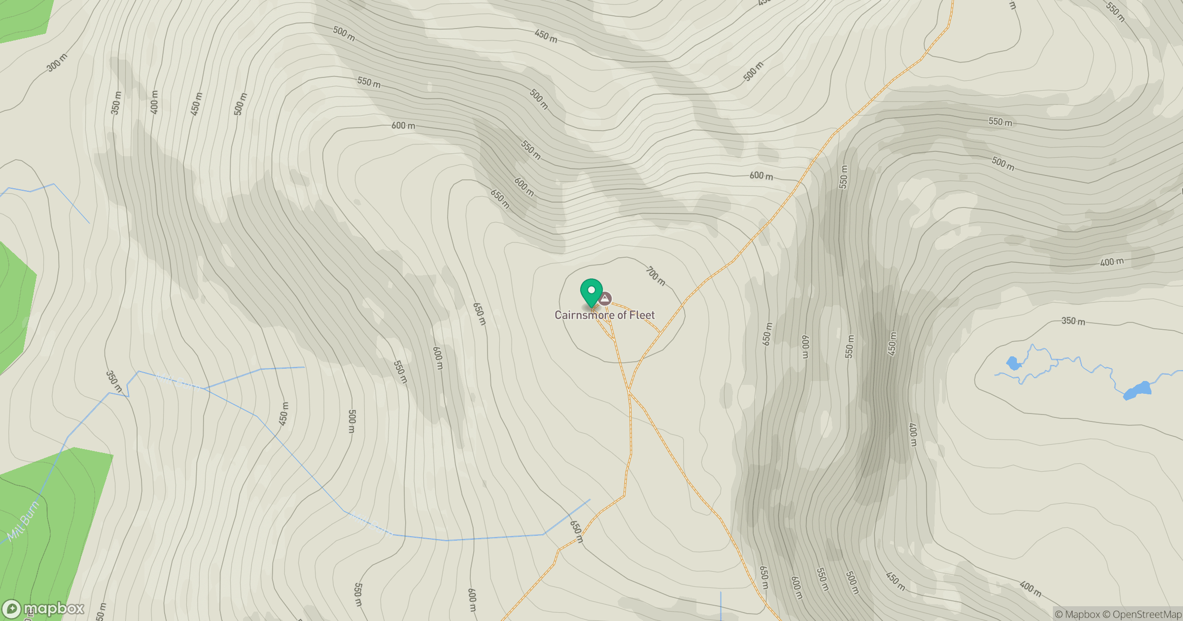
Grid reference: NX501670
View on OpenStreetMapOpens a map in a new tab, centred on the hill.
No comments yet. Be the first.