

Middle Hope
Good walks are even better shared.
ST3266 : A sheltered pebble beach on Swallow Cliff
David Smith Photo source
Overview
Middle Hope
Middle Hope is a delightful Marilyn that beckons hikers of all abilities to its summit. Standing at a modest elevation of 109 meters, it may not test your endurance like some of the more prominent peaks, but its charm lies in the panoramic views and serene trails.
Geology
This region is rich in geological history, dominated by Lias limestone, which boasts an array of marine fossils. As you traverse the paths, keep an eye out for unique rock formations that tell the story of the earth over millions of years.
Accessibility and Parking
Finding your way to Middle Hope is as easy as pie. The closest car park can be found just off the main road near Sand Bay, making it convenient for a day trip. If you prefer leaving the car behind, hop on a train to Weston-Super-Mare and catch a bus that will drop you near the foot of this compact hill.
The Hike
The recommended route is an easy 2 km journey starting from the eastern side of Weston-Super-Mare. A well-trodden path leads comfortably to the summit, which can be achieved in roughly an hour. Ideal for families or those wishing to stretch their legs without too much fuss!
Summit Features
Once at the top, you'll be greeted by a charming grassy mound topped with a small stone cairn. If you’ve made it to this point, don’t forget to snap a quick selfie with the sweeping views of the Bristol Channel in the background.
The Views
Ah, the views! From the summit of Middle Hope, it’s hard not to be captivated by the sight of the Bristol Channel stretching far and wide, with the Welsh coastline visible in the distance. On a clear day, you might even glimpse the timeless Mendip Hills rising majestically away in the background. The best time for a visit? Spring and early summer are splendid as the landscape bursts into life.
Hazards
While the hike is classified as easy, watch your step, especially after a rain shower—things can get a bit slick, and no one wants an unplanned slip down the grassy inclines!
Local Facilities
In Weston-Super-Mare, you're never far from a good cuppa or a slice of cake. No major facilities directly on Middle Hope itself, but you’ll find plenty of amenities in town, including cafes, restaurants, and public toilets—but maybe bring your own snacks for the trail!
Nearby Summits
Feeling adventurous? Nearby, you can explore Warren Hill or even stretch your legs over to Cheddar Gorge if you’re up for a bit more of a challenge!
Conclusion
Middle Hope is a hidden gem that provides an excellent opportunity for a jaunt with friends or family while escaping the hustle and bustle of everyday life. Whether you're a seasoned hiker or just looking for a gentle stroll, this little hill has something for everyone. Just remember—leave no trace and take only memories (and photos, of course).
Explore routes near Middle Hope
Walks starting near this hill. Open a route to check its map, distance and full itinerary.
Weston-super-Mare Walk with Men Walking & Talking
View route
Yatton to Sandford Strawberry Line and Cider Orchards
View route
Cheddar River Yeo and Stubbingham Drove Circuit
View route
Cardiff: Hailey Park to Blackweir Bridge on the Taff Trail
View route
Route planning notes
These notes describe possible approaches. Check a route's map and access information when planning your walk.
East of Weston-Super-Mare Route
A straightforward ascent from the eastern side, offering a well-defined path that allows for easy navigation to the summit.
Make a day of it, together
Find someone to share the walk with, or organise a day out along a route you like.
Photo Gallery
View all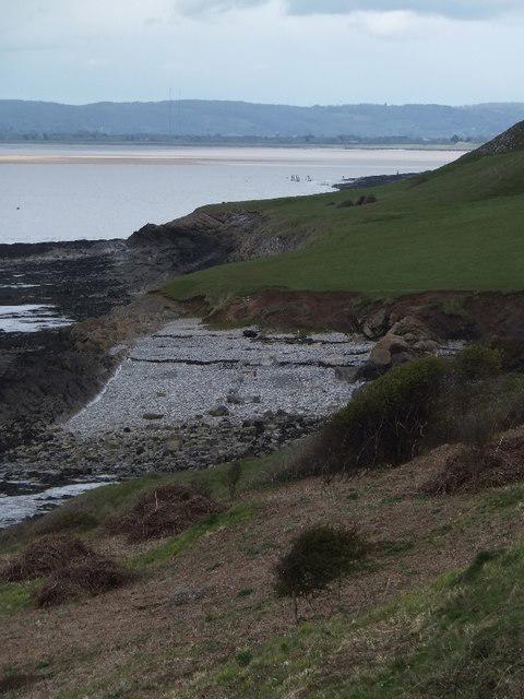 Photo could not load
ST3266 : A sheltered pebble beach on Swallow Cliff
David Smith
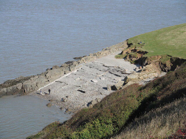 Photo could not load
ST3266 : Natural shoreline on Middle Hope
Neil Owen
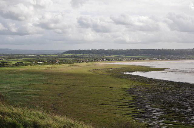 Photo could not load
ST3266 : North Somerset : Sand Bay
Lewis Clarke
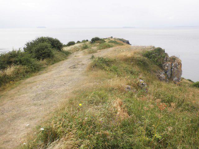 Photo could not load
ST3266 : Promontory, above Sand Bay
Roger Cornfoot
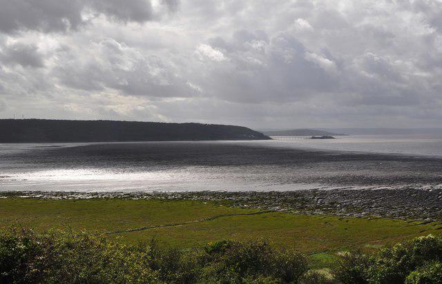 Photo could not load
ST3266 : North Somerset : Sand Bay
Lewis Clarke
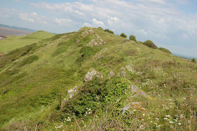 Photo could not load
ST3266 : Ridge near Sand Point
Trevor Harris
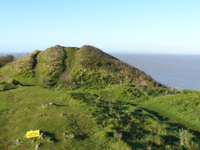 Photo could not load
ST3266 : A scrub covered mound before being cleared
Paul Harvey
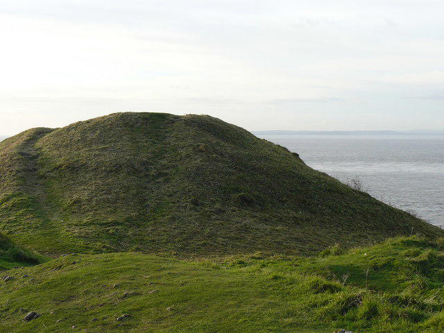 Photo could not load
ST3266 : Area cleared of scrub by National Trust volunteers
Paul Harvey
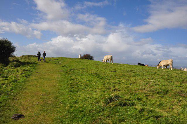 Photo could not load
ST3266 : North Somerset : Middle Hope & Footpath
Lewis Clarke
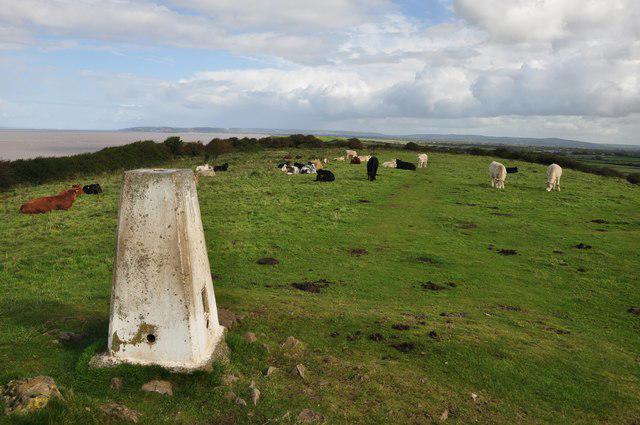
ST3266 : North Somerset : Middle Hope Trig Point
Lewis Clarke
Hill facts and local notes
Classifications
Elevation
48m
157 ft
Prominence
39m
Coordinates
51.3893, -2.9696
ST326660
OS Map
171 182
Explorer: 153
At the Summit
The summit includes a prominent grassy mound with a small stone cairn—a perfect spot for a selfie to show off your hiking prowess.
Terrain & Geology
The area predominantly features Lias limestone, known for its marine fossils, with plenty of interesting rock formations giving insight into the region's geological history.
Views & Scenery
From the summit, admire stunning views of the Bristol Channel, the coastline stretching towards Wales, and the backdrop of the Mendip Hills.
History & Heritage
Name Origin
The name 'Middle Hope' reflects its positioning along the coastline—'hope' meaning a bay or inlet.
Historical Significance
Historically, Middle Hope has been an important lookout point and was used for observation purposes during various maritime conflicts.
Getting There & Facilities
Parking
There is a small car park at the base of Middle Hope, situated near the village of Sand Bay, providing easy access to the trail.
Public Transport
Weston-Super-Mare railway station is the nearest train station, with local buses available to Sand Bay.
Nearby Facilities
There are several cafes and public toilets in Weston-Super-Mare, and some basic services closer to Sand Bay.
Safety Information
Known Hazards
- The terrain can be slippery after rain, and care should be taken around any steep edges.
General Safety Tips
- Check weather conditions before setting out
- Carry appropriate clothing and equipment
- Let someone know your planned route
- Take a map, compass, and GPS device
- Carry emergency supplies: food, water, first aid kit, torch
Hills
Some common questions about the hills answered
Are there group walks up Middle Hope?
Many walkers use Walkmates to join or organise walks with others. You can check for group walks around Middle Hope through the maps
Are there other walkers around Middle Hope?
Activity varies by location and time, but Walkmates lets you see whether others have shared walks or shown interest in this area. Find other people through the walking friends search walking friends for Middle Hope search or of course create your own walk for Middle Hope
Can I organise a walk to Middle Hope?
Yes. If there aren’t any walks listed already, you can create a walk and make it available for others to join.
If you're signed up to Walkmates, you can create a walk to Middle Hope.
How do I find a walk up this hill?
There are often multiple ways to walk this hill, depending on experience and route preference. Walkmates helps you explore walks and routes that others have shared.
Can I suggest a new route up Middle Hope?
Yes. You can suggest or create routes to share with others. Walkmates focuses on the social side of walking, so routes are used to help people organise walks and explore areas together, rather than as detailed navigation tools or route libraries.
Other uses really appreciate knowledgeable walkers sharing their routes. Share your favourite route to Middle Hope here
The is an error or something incorrect about this hill. How do I let you know?
We always strive to keep the information on Walkmates as accurate as possible. If you find an error, please let us know through the contact form and we'll aim to correct it as quickly as possible
Community Discussion
Comments
Location
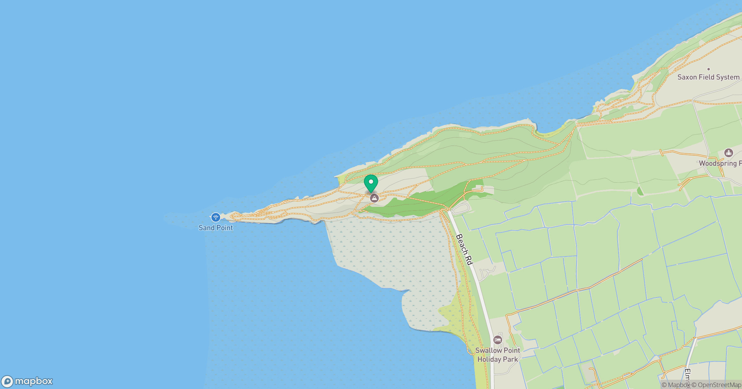
Grid reference: ST326660
View on OpenStreetMapOpens a map in a new tab, centred on the hill.


No comments yet. Be the first.