

Worlebury Hill
Good walks are even better shared.
ST3262 : A change of scenery
Neil Owen Photo source
Overview
Worlebury Hill
Worlebury Hill, standing at a modest 90 meters, may not be the tallest peak in the land, but its strategic position and panoramic views make it a lovely outing for walkers and nature lovers alike.
Geology
This hill is dominated by limestone, with rocky paths that might challenge the unprepared, but the scenery is worth the effort. The plant life here is varied, offering a tapestry of greens and pastels during the blooming seasons.
The Routes
The Worlebury Hill Circular Walk is the standout route for hikers. With a distance of approximately 5 km and a completion time of around 2 hours, it's classified as moderate,
perfect for those who enjoy a bit of a workout without having to scale vertical walls. You'll be greeted by a mix of woodland trails and open stretches offering some delightful views.
Facilities
After conquering the hill, why not treat yourself? Weston-super-Mare is nearby, with an array of cafés, restaurants, and even some ice cream parlours for a well-deserved post-hike treat. Public toilets are also readily available near the seafront for a quick freshen-up.
Access
Getting to Worlebury Hill is straightforward. The nearest parking can be found at the Worlebury Woods car park, located just off Worlebury Hill Road.
Public transport options are plentiful, with buses connecting from Weston-super-Mare and stopping nearby.
Historical Significance
The name 'Worlebury' comes from Old English, translating to 'Wulf's fortification.' This hill has seen human activity for thousands of years, with remnants of Iron Age structures still visible today, adding a layer of intrigue to your hike.
Views
The summit offers spectacular views over the Bristol Channel and distant peaks like Brean Down. Don’t forget your camera, as the vistas are especially stunning in spring when the wildflowers bloom.
Summary
Worlebury Hill may not be towering, but it serves up a delightful slice of Somerset’s scenic beauty. Whether it’s your first foray into hiking or you’re a seasoned pro, there's enough here to keep everyone entertained. Enjoy the great outdoors, and remember, a very good adventure is one where you find a delightful café at the end!
Explore routes near Worlebury Hill
Walks starting near this hill. Open a route to check its map, distance and full itinerary.
Weston-super-Mare Walk with Men Walking & Talking
View route
Yatton to Sandford Strawberry Line and Cider Orchards
View route
Cheddar River Yeo and Stubbingham Drove Circuit
View route
Three Priddy Droves: Pelting, Dursdon and East Water circuit
View route
Route planning notes
These notes describe possible approaches. Check a route's map and access information when planning your walk.
Worlebury Hill Circular Walk
A scenic loop starting from the beach that ascends through woodlands before reaching the summit, offering panoramic views of the Bristol Channel.
Make a day of it, together
Find someone to share the walk with, or organise a day out along a route you like.
Photo Gallery
View all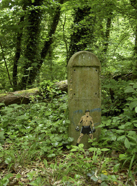 Photo could not load
ST3262 : A change of scenery
Neil Owen
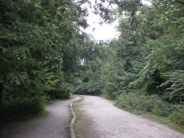 Photo could not load
ST3262 : Highest point on Worlebury Hill
Roger Cornfoot
Hill facts and local notes
Classifications
Elevation
109m
358 ft
Prominence
104m
Coordinates
51.3591, -2.9665
ST328626
OS Map
182
Explorer: 153
At the Summit
The summit is marked by a stone trig point and surrounded by beautiful views over Weston-super-Mare and the coastline. It's a perfect picnic spot, just keep your sandwich secure from marauding seagulls!
Terrain & Geology
Worlebury Hill is primarily composed of limestone, presenting a rugged terrain interspersed with areas of soft grass and wildflowers, typical of the Mendip Hills.
Views & Scenery
From the summit, you can see the Bristol Channel, the Welsh coastline, and the iconic Brean Down.
History & Heritage
Name Origin
The name 'Worlebury' is thought to derive from the old English for 'Wulf's fortification,' hinting at its historical significance as a strategic point.
Historical Significance
The hill has been a site of habitation since the Iron Age, featuring ancient earthworks that speak volumes of its rich history.
Getting There & Facilities
Parking
There is parking available at Worlebury Woods car park, off Worlebury Hill Road, which is a short walk from the trailhead.
Public Transport
Frequent bus services connect Weston-super-Mare to surrounding areas, with the nearest stop just a 20-minute walk from the hill.
Nearby Facilities
There are several cafés and restaurants in Weston-super-Mare, as well as public toilets located near the seafront.
Safety Information
Known Hazards
- Watch out for loose stones on the paths and the occasional mud puddle after rain. Also, be wary of wildlife—generally friendly, but some deer might be standoffish!
General Safety Tips
- Check weather conditions before setting out
- Carry appropriate clothing and equipment
- Let someone know your planned route
- Take a map, compass, and GPS device
- Carry emergency supplies: food, water, first aid kit, torch
Hills
Some common questions about the hills answered
Are there group walks up Worlebury Hill?
Many walkers use Walkmates to join or organise walks with others. You can check for group walks around Worlebury Hill through the maps
Are there other walkers around Worlebury Hill?
Activity varies by location and time, but Walkmates lets you see whether others have shared walks or shown interest in this area. Find other people through the walking friends search walking friends for Worlebury Hill search or of course create your own walk for Worlebury Hill
Can I organise a walk to Worlebury Hill?
Yes. If there aren’t any walks listed already, you can create a walk and make it available for others to join.
If you're signed up to Walkmates, you can create a walk to Worlebury Hill.
How do I find a walk up this hill?
There are often multiple ways to walk this hill, depending on experience and route preference. Walkmates helps you explore walks and routes that others have shared.
Can I suggest a new route up Worlebury Hill?
Yes. You can suggest or create routes to share with others. Walkmates focuses on the social side of walking, so routes are used to help people organise walks and explore areas together, rather than as detailed navigation tools or route libraries.
Other uses really appreciate knowledgeable walkers sharing their routes. Share your favourite route to Worlebury Hill here
The is an error or something incorrect about this hill. How do I let you know?
We always strive to keep the information on Walkmates as accurate as possible. If you find an error, please let us know through the contact form and we'll aim to correct it as quickly as possible
Community Discussion
Comments
Location
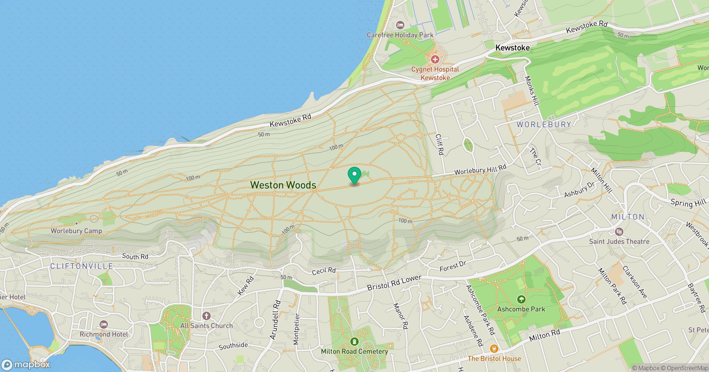
Grid reference: ST328626
View on OpenStreetMapOpens a map in a new tab, centred on the hill.


No comments yet. Be the first.